File:The twin skerries of Sgeir Gallan, Isle of Lewis - geograph.org.uk - 1463518.jpg
Jump to navigation
Jump to search
No higher resolution available.
The_twin_skerries_of_Sgeir_Gallan,_Isle_of_Lewis_-_geograph.org.uk_-_1463518.jpg (640 × 427 pixels, file size: 66 KB, MIME type: image/jpeg)
Captions
Captions
Add a one-line explanation of what this file represents
Summary[edit]
| Description |
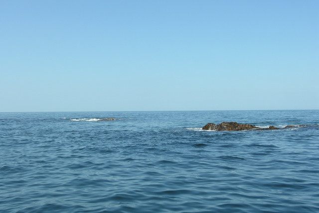
English: The twin skerries of Sgeir Gallan, Isle of Lewis This is all that shows of Sgeir Gallan, two underwater peaks of Lewisian Gneiss. The skerries lie about 600 metres, North-west of Gallan Head. The sea conditions shown are unusually benign and it's rarely possible to get this close. The skerries appear to be swept with unpredictably strong tides as, despite using the Admiralty Tidal Stream Atlas for the West Coast of Scotland to calculate slack water, a two knot tidal stream was encountered underwater. |
| Date | |
| Source | From geograph.org.uk |
| Author | George Brown |
| Attribution (required by the license) | George Brown / The twin skerries of Sgeir Gallan, Isle of Lewis / |
| Camera location | | View this and other nearby images on: OpenStreetMap |
|---|
_heading:337.00&language=en)
| Object location | | View this and other nearby images on: OpenStreetMap |
|---|
_heading:337.00&language=en)
Licensing[edit]

|
This image was taken from the Geograph project collection. See this photograph's page on the Geograph website for the photographer's contact details. The copyright on this image is owned by George Brown and is licensed for reuse under the Creative Commons Attribution-ShareAlike 2.0 license.
|
This file is licensed under the Creative Commons Attribution-Share Alike 2.0 Generic license.
Attribution: George Brown
- You are free:
- to share – to copy, distribute and transmit the work
- to remix – to adapt the work
- Under the following conditions:
- attribution – You must give appropriate credit, provide a link to the license, and indicate if changes were made. You may do so in any reasonable manner, but not in any way that suggests the licensor endorses you or your use.
- share alike – If you remix, transform, or build upon the material, you must distribute your contributions under the same or compatible license as the original.
File history
Click on a date/time to view the file as it appeared at that time.
| Date/Time | Thumbnail | Dimensions | User | Comment | |
|---|---|---|---|---|---|
| current | 09:55, 2 March 2011 | | 640 × 427 (66 KB) | GeographBot (talk | contribs) | == {{int:filedesc}} == {{Information |description={{en|1=The twin skerries of Sgeir Gallan, Isle of Lewis This is all that shows of Sgeir Gallan, two underwater peaks of Lewisian Gneiss. The skerries lie about 600 metres, North-west of Gallan Head. The se |
You cannot overwrite this file.
File usage on Commons
There are no pages that use this file.