File:The Earth seen from Apollo 17.tiff

Original file (3,720 × 3,796 pixels, file size: 40.4 MB, MIME type: image/tiff)
Captions
Captions
| Description |
Čeština: Země z Apola 17.
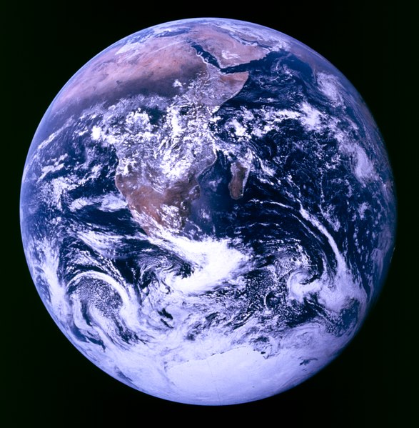
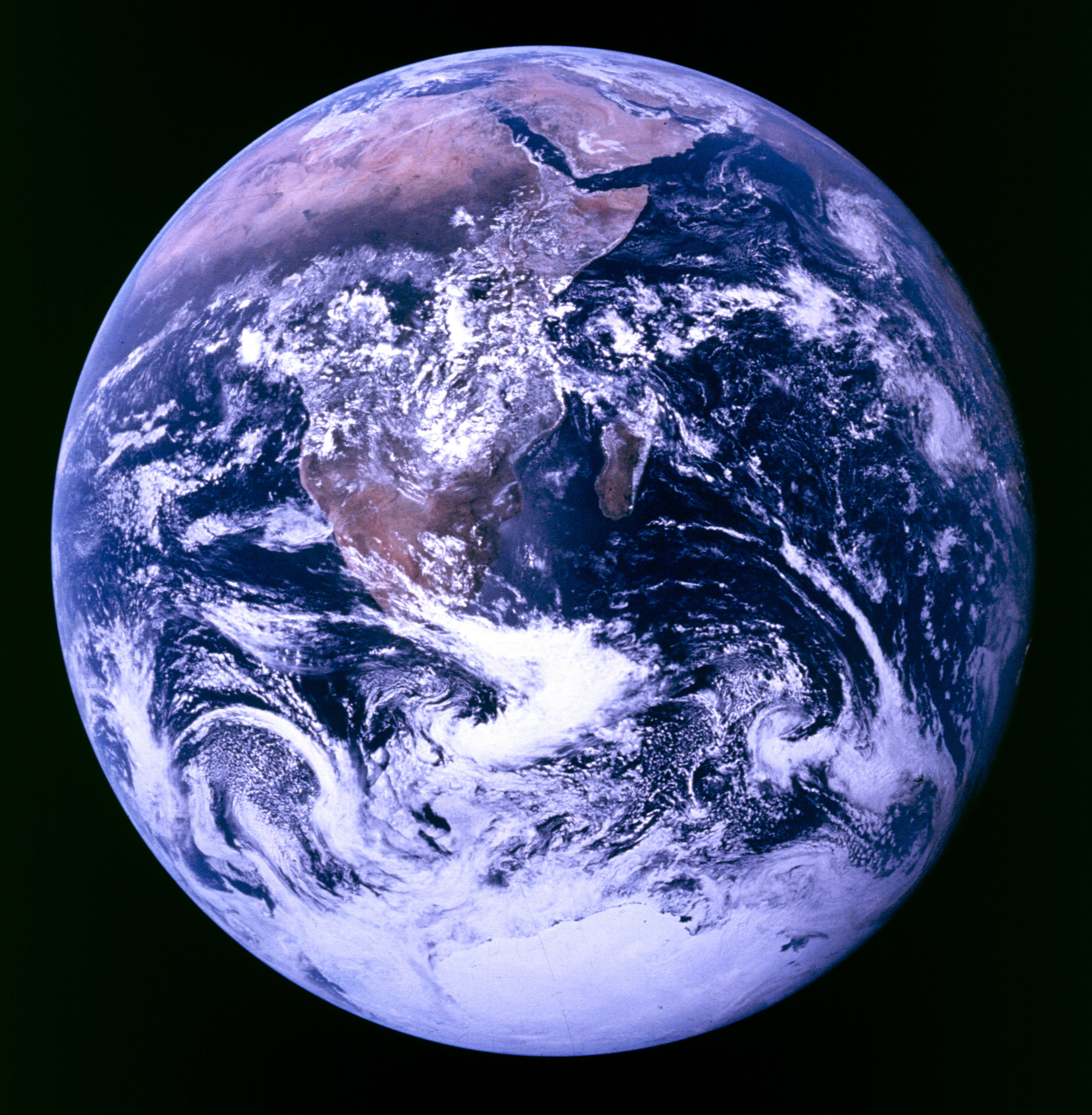
English: The Blue Marble: This photo is of Africa, Antarctica, and the Arabian Peninsula as taken en route to the Moon by one of the crew of Apollo 17 (Eugene Cernan, Harrison Schmitt or Ron Evans) on December 7, 1972. The flight marked the last time that humans left low Earth orbit and the first and only time a geologist, in Harrison Schmitt, travelled to the moon.
Español: La Tierra vista desde el Apolo 17. |
|||||
| Date | ||||||
| Source |
apollo17_earth.tiff as contained by ftp://nssdcftp.gsfc.nasa.gov/photo_gallery/hi-res/planetary/earth/apollo17_earth.tiff.gz
|
|||||
| Author |
|
|||||
| Permission (Reusing this file) |
|
|||||
| Other versions |
Derivative works of this file: |


Other information from NASA about this image:
| “ | Earth - Apollo 17
Full Earth showing Africa and Antarctica
Location & Time Information |
” |
File history
Click on a date/time to view the file as it appeared at that time.
| Date/Time | Thumbnail | Dimensions | User | Comment | |
|---|---|---|---|---|---|
| current | 14:57, 17 October 2010 |  | 3,720 × 3,796 (40.4 MB) | Jeff G. (talk | contribs) | {{Information |Description = {{cs|Země z Apola 17.}} {{en|''The Blue Marble'': This photo is of Africa, Antarctica, and the Arabian Peninsula as taken en route to the Moon by one of the crew of Apollo 17 ([[w:Eug |
You cannot overwrite this file.
File usage on Commons
There are no pages that use this file.