File:Plan de la Bataille de St. Antoine Donnée le 5 Juillet 1652 - Stanford Libraries.jpg
Jump to navigation
Jump to search

Size of this preview: 800 × 571 pixels. Other resolutions: 320 × 228 pixels | 640 × 456 pixels | 1,024 × 730 pixels | 1,280 × 913 pixels | 2,560 × 1,826 pixels | 9,014 × 6,429 pixels.
Original file (9,014 × 6,429 pixels, file size: 19.13 MB, MIME type: image/jpeg)
Captions
Captions
Add a one-line explanation of what this file represents
Summary[edit]
| Title |
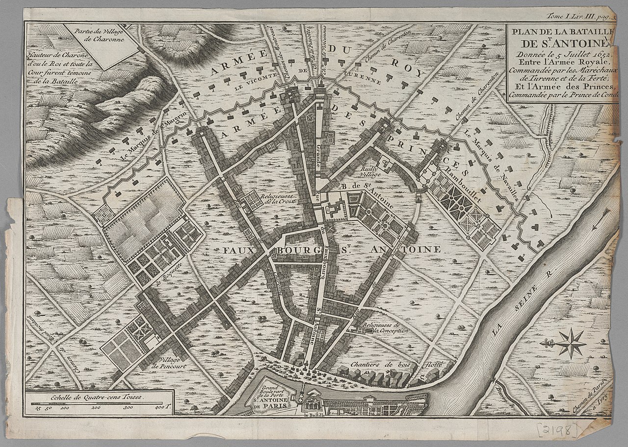
Plan de la Bataille de St. Antoine Donnée le 5 Juillet 1652 ... |
| Date | between 1600 and 1699 |
| Source | Stanford Libraries |
| Creator |
Antoine Coquart |
| Geotemporal data | |
| Date depicted | |
| Georeferencing | If inappropriate please set warp_status = skip to hide. |
| Bibliographic data | |
| Publisher |
Paris? : [publisher not identified] , between 1600 and 1699. |
| Archival data | |
| Collection | Stanford Libraries |
| Dimensions | 245 x 35 cm |
| Medium | 1 map : black and white |
| Notes |
Shows St. Antoine , Paris. Period: 17th century. Collector's note: Orientation: East at top; Watermark; Tome I Liv III Page 3. |
Licensing[edit]
|
This work is in the public domain in its country of origin and other countries and areas where the copyright term is the author's life plus 100 years or fewer. | |
| This file has been identified as being free of known restrictions under copyright law, including all related and neighboring rights. | |
File history
Click on a date/time to view the file as it appeared at that time.
| Date/Time | Thumbnail | Dimensions | User | Comment | |
|---|---|---|---|---|---|
| current | 18:18, 14 July 2020 | | 9,014 × 6,429 (19.13 MB) | Paris 16 (talk | contribs) | Uploaded own work with UploadWizard |
You cannot overwrite this file.
File usage on Commons
There are no pages that use this file.