Category:Maps of Paris from the Stanford Libraries
Jump to navigation
Jump to search
Media in category "Maps of Paris from the Stanford Libraries"
The following 200 files are in this category, out of 220 total.
(previous page) (next page)-
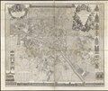
 Atlas des anciens plans de Paris, 1880 - Paris en 1728 - Stanford Libraries.jpg 21,200 × 17,766; 85.87 MB
-
 Atlas des anciens plans de Paris, 1880 - Paris en 1728 - Stanford Libraries.tiff 21,200 × 17,766; 359.22 MB
-
 Atlas des anciens plans de Paris, 1880 - Paris en 1775 - Stanford Libraries.jpg 21,263 × 16,000; 72.08 MB
-
 Atlas des anciens plans de Paris, 1880 - Paris en 1775 - Stanford Libraries.tif 21,263 × 16,000; 324.48 MB
-
 Atlas des anciens plans de Paris, 1880 - Paris en 1798 - Stanford Libraries.jpg 29,386 × 23,200; 101.44 MB
-
 Atlas des anciens plans de Paris, 1880 - Paris en 1798 - Stanford Libraries.tif 29,386 × 23,200; 650.2 MB
-
 Bois de Vincennes, nouvelles dispositions du Bois de Vincennes, 1861 - Stanford Libraries.jpg 14,120 × 10,146; 20.03 MB
-
 Bois de Vincennes, nouvelles dispositions du Bois de Vincennes, 1861 - Stanford Libraries.tif 14,120 × 10,146; 136.63 MB
-
 Carte des environs de Paris avec les tramways de pénétration, 1925 - Stanford Libraries.jpg 17,296 × 13,357; 69.42 MB
-
 Carte du département de la Seine by Dépôt de la guerre, 1839 - Stanford Libraries.jpg 21,737 × 16,665; 110.89 MB
-
 Carte du département de la Seine by Dépôt de la guerre, 1839 - Stanford Libraries.tif 21,737 × 16,665; 345.49 MB
-
 Carte détaillée des environs de Paris, 1816 - Stanford Libraries.jpg 7,375 × 6,003; 14.97 MB
-
 Carte routiere des environs de Paris, 1839 - Stanford Libraries.jpg 14,152 × 9,528; 23.03 MB
-
 Carte routière des environs de Paris... by Basset Paul-André, ca. 1815 - Stanford Libraries.jpg 17,154 × 12,292; 55.76 MB
-
 Carte routière des environs de Paris... by Basset Paul-André, ca. 1815 - Stanford Libraries.tif 17,154 × 12,292; 201.12 MB
-
 Carte statistique des égouts - Nord-est, 1861 - Stanford Libraries.jpg 16,339 × 13,091; 25.76 MB
-
 Carte statistique des égouts - Nord-est, 1861 - Stanford Libraries.tif 16,339 × 13,091; 204.01 MB
-
 Carte statistique des égouts - Nord-ouest, 1861 - Stanford Libraries.jpg 15,759 × 13,211; 24.62 MB
-
 Carte statistique des égouts - Nord-ouest, 1861 - Stanford Libraries.tif 15,759 × 13,211; 198.55 MB
-
 Carte statistique des égouts - Sud-est, 1861 - Stanford Libraries.jpg 16,437 × 12,459; 24.24 MB
-
 Carte statistique des égouts - Sud-est, 1861 - Stanford Libraries.tif 16,437 × 12,459; 195.3 MB
-
 Carte statistique des égouts - Sud-ouest, 1861 - Stanford Libraries.jpg 15,933 × 12,359; 21.12 MB
-
 Carte statistique des égouts - Sud-ouest, 1861 - Stanford Libraries.tif 15,933 × 12,359; 187.8 MB
-
 Carte statistique des égouts, 1861 - Stanford Libraries.jpg 30,880 × 24,130; 224.47 MB
-
 Carte statistique des égouts, 1861 - Stanford Libraries.tif 30,880 × 24,130; 2.08 GB
-
 Carte topographique des environs de Paris, 1856 - Stanford Libraries.jpg 15,418 × 10,771; 31.69 MB
-
 Carte topographique des environs de Paris, 1856 - Stanford Libraries.tif 15,418 × 10,771; 158.38 MB
-
 Carte-Campbell - Nouveau plan de Paris et banlieue, 1916 - Stanford Libraries.jpg 14,947 × 10,039; 44.78 MB
-
 Carte-Campbell - Nouveau plan de Paris et banlieue, 1916 - Stanford Libraries.tif 14,947 × 10,039; 143.34 MB
-
 Département de la Seine - environs de Paris by Alexis Donnet, 1841 - Stanford Libraries.jpg 12,129 × 9,193; 16.6 MB
-
 Département de la Seine - environs de Paris by Alexis Donnet, 1841 - Stanford Libraries.tif 12,129 × 9,193; 106.36 MB
-
 Département de la Seine by Dépôt de la guerre, 1878 - Stanford Libraries.jpg 12,007 × 9,607; 21.05 MB
-
 Département de la Seine by Dépôt de la guerre, 1878 - Stanford Libraries.tif 12,007 × 9,607; 110.01 MB
-
 Environs de Paris by A. Buhlmann - Stanford Libraries.jpg 14,567 × 12,549; 32.25 MB
-
 Environs de Paris by A. Buhlmann - Stanford Libraries.tif 14,567 × 12,549; 174.36 MB
-
 Environs de Paris by Gilles Robert de Vaugondy, 1753 - Stanford Libraries.jpg 10,040 × 8,072; 12.38 MB
-
 Environs de Paris by Gilles Robert de Vaugondy, 1753 - Stanford Libraries.tif 10,040 × 8,072; 77.32 MB
-
 Galignani's plan of Paris and environs drawn by Achin - Stanford Libraries.jpg 9,736 × 7,048; 15.22 MB
-
 Itinéraire des omnibus dans Paris by J. Migeon, 1856 - Stanford Libraries.jpg 4,485 × 3,727; 2.9 MB
-
 Itinéraire des omnibus dans Paris by J. Migeon, 1856 - Stanford Libraries.tif 4,485 × 3,727; 15.97 MB
-
 La banlieue de Paris by Nicolas de Fer, 1717 - Stanford Libraries.jpg 9,745 × 7,607; 18.82 MB
-
 La banlieue de Paris by Nicolas de Fer, 1717 - Stanford Libraries.tif 9,745 × 7,607; 70.72 MB
-
 La nobilissima et grande città di Parigi by Matteo Florimi, 1600 - Stanford Libraries.jpg 14,245 × 11,035; 41.64 MB
-
 Le Paris de Napoleon III by Erhard, 1867 - Stanford Libraries.jpg 13,189 × 9,547; 20.61 MB
-
 Le Paris de Napoleon III by Erhard, 1867 - Stanford Libraries.tif 13,189 × 9,547; 120.11 MB
-
 Le Paris de Napoleon III, 1870 - Stanford Libraries - Original.jpg 21,967 × 16,679; 119.7 MB
-
 Le Paris de Napoleon III, 1870 - Stanford Libraries.jpg 21,967 × 16,679; 148.5 MB
-

-

-
 Le plan de Paris, ses Faubourgs et ses environs by Guillaume de L'Isle - Stanford Libraries.jpg 13,336 × 9,832; 27.89 MB
-

-
 Le plan de Paris, ses faubourgs et ses environs by Guillaume de L'Isle, 1730 - Stanford Libraries.tif 12,165 × 9,067; 105.22 MB
-
 Le plan de Paris, ses faubourgs et ses environs by Nicolas de Fer, 1717 - Stanford Libraries.jpg 12,324 × 8,752; 49.26 MB
-
-

-
 Lutetia Parisiorum vulgo Paris by Jan Jansson, 1682 - Stanford Libraries.jpg 8,343 × 6,865; 10.96 MB
-
 Lutetia Parisiorum vulgo Paris by Jan Jansson, 1682 - Stanford Libraries.tif 8,343 × 6,865; 54.65 MB
-
 Lvtetia - vulgari nomine Paris by Braun and Hogenberg, 1574 - Stanford Libraries.jpg 13,082 × 9,943; 40.97 MB
-
 Map of Paris by Corps d'etat major, 1901 - Stanford Libraries.jpg 13,387 × 9,056; 40.53 MB
-
 Map of Paris by Corps d'etat major, 1901 - Stanford Libraries.tif 13,387 × 9,056; 115.64 MB
-
 Map of Paris, ca. 1855 - Stanford Libraries.jpg 6,915 × 8,135; 8.55 MB
-
 Map of Paris, ca. 1855 - Stanford Libraries.tif 6,915 × 8,135; 53.67 MB
-

-

-
 Nouveau Paris fortifié 1860 by Lallemand, 1859 - Stanford Libraries.jpg 21,712 × 15,450; 103.86 MB
-

-

-
 Nouveau plan de Paris by L. Poulmaire & Garnier frères, 1909 - Stanford Libraries.jpg 18,426 × 13,737; 67.99 MB
-
 Nouveau plan de Paris by Louis Brion de la Tour, 1784 - Stanford Libraries.jpg 12,827 × 9,037; 22.45 MB
-
 Nouveau plan de Paris by Louis Brion de la Tour, 1784 - Stanford Libraries.tif 12,827 × 9,037; 110.57 MB
-
 Nouveau plan de Paris divise en 20 Arrondissements by Auguste Logerot - Stanford Libraries.jpg 17,664 × 11,560; 34.85 MB
-
 Nouveau plan de paris divise en 20 arrondissements by Ch. Smith, 1865 - Stanford Libraries.jpg 26,287 × 17,914; 122.3 MB
-
 Nouveau plan de Paris en 20 arrondissements by J. Migeon, 1866 - Stanford Libraries.jpg 9,672 × 7,680; 10.1 MB
-
 Nouveau plan de Paris et des communes de la banlieue by A. Vuillemin - Stanford Libraries - Original.jpg 22,798 × 17,266; 103.85 MB
-
 Nouveau plan de Paris et des communes de la banlieue by A. Vuillemin - Stanford Libraries.jpg 22,798 × 17,266; 129.33 MB
-
 Nouveau plan de Paris fortifié, 1847 - Stanford Libraries.jpg 14,792 × 9,640; 26.93 MB
-
 Nouveau plan de Paris fortifié, 1851 - Stanford Libraries.jpg 14,680 × 9,688; 64.82 MB
-
 Nouveau plan de Paris monumental by L. Guilmin, 1920 - Stanford Libraries.jpg 11,319 × 8,367; 16.86 MB
-
 Nouveau plan de Paris monumental by L. Guilmin, 1920 - Stanford Libraries.tif 11,319 × 8,367; 90.35 MB
-
 Nouveau plan de Paris, 1891 - Stanford Libraries.jpg 13,092 × 9,548; 26.19 MB
-
 Nouveau plan de Paris, 1891 - Stanford Libraries.tif 13,092 × 9,548; 119.24 MB
-
-
 Nouveau plan des environs de Paris d'après les nouvelles observations... 1787 - Stanford Libraries.tif 12,472 × 8,412; 100.08 MB
-
 Nouveau plan illustré de la ville de Paris by Alexandre Vuillemin, 1860 - Stanford Libraries.jpg 17,303 × 13,603; 42.92 MB
-
 Nouveau plan illustré de la ville de Paris by Alexandre Vuillemin, 1860 - Stanford Libraries.tif 17,303 × 13,603; 224.5 MB
-
 Nouveau plan routier de la ville & faubourgs de Paris, ca. 1800 - Stanford Libraries.jpg 16,917 × 10,379; 32.02 MB
-
 Nouveau plan routier de la ville & faubourgs de Paris, ca. 1800 - Stanford Libraries.tif 16,917 × 10,379; 167.45 MB
-
 Nouveau plan routier de la ville de Paris, 1829 - Stanford Libraries.jpg 15,850 × 11,952; 75.9 MB
-
 Nouveau plan routier de la ville de Paris, 1833 - Stanford Libraries.jpg 12,730 × 8,787; 18.07 MB
-
 Nouveau plan routier de la ville de Paris, 1833 - Stanford Libraries.tif 12,730 × 8,787; 106.7 MB
-

-

-

-

-

-
 Nouveau plan routier de la ville et faubourgs de Paris, ca. 1810-1812 - Stanford Libraries.tiff 5,337 × 4,116; 20.98 MB
-
 Nouveau plan routier de la ville et fauxbourgs de Paris, 1787 - Stanford Libraries 2.jpg 12,480 × 8,662; 22.85 MB
-
 Nouveau plan routier de la ville et fauxbourgs de Paris, 1787 - Stanford Libraries.jpg 12,390 × 8,651; 20.52 MB
-
 Nouveau plan routier de la ville et fauxbourgs de Paris, 1787 - Stanford Libraries.tif 12,390 × 8,651; 102.25 MB
-
-
 Outline map of Paris, France by John W. Boughton, 1900 - Stanford Libraries.jpg 6,267 × 4,355; 5.68 MB
-
 Outline map of Paris, France by John W. Boughton, 1900 - Stanford Libraries.tiff 6,267 × 4,355; 26.05 MB
-
 Parigi by Filippo Pigafetta, 1591 - Stanford Libraries.jpg 14,101 × 10,412; 44.9 MB
-
 Paris and its vicinity by Hydrographic Office, ca. 1870 - Stanford Libraries.jpg 6,890 × 6,301; 5.32 MB
-
 Paris and its vicinity by Hydrographic Office, ca. 1870 - Stanford Libraries.tif 6,890 × 6,301; 41.43 MB
-
 Paris by Geographical Section, General Staff, War Office, 1944 - Stanford Libraries.jpg 16,003 × 13,310; 34.3 MB
-
 Paris by Geographical Section, General Staff, War Office, 1944 - Stanford Libraries.tif 16,003 × 13,310; 203.13 MB
-
 Paris chemins de fer métropolitain et nord-sud by A. Taride, 1922 - Stanford Libraries.jpg 20,200 × 15,800; 79.08 MB
-
 Paris chemins de fer métropolitain et nord-sud by A. Taride, 1922 - Stanford Libraries.tif 20,200 × 15,800; 304.41 MB
-

-
 Paris nouveau, 1855 by Alexandre Vuillemin - Stanford Libraries.jpg 13,977 × 10,828; 40.07 MB
-
 Paris nouveau, 1855 by Alexandre Vuillemin - Stanford Libraries.tif 13,977 × 10,828; 144.36 MB
-
 Paris, 1867 by Justin Lallier - Stanford Libraries.jpg 10,729 × 8,465; 17 MB
-
 Paris, 1867 by Justin Lallier - Stanford Libraries.tif 10,729 × 8,465; 86.64 MB
-
 Paris, divisé en 12 arrondissemens et 48 quartiers by A. Toussaint, 1841 - Stanford Libraries.jpg 17,789 × 11,759; 37.07 MB
-
 Paris, divisé en 12 arrondissemens et 48 quartiers by A. Toussaint, 1841 - Stanford Libraries.tif 17,789 × 11,759; 199.52 MB
-
 Partie du plan général de Paris by Pierre Patte - Stanford Libraries.jpg 7,398 × 5,625; 8.34 MB
-
 Partie du plan général de Paris by Pierre Patte - Stanford Libraries.tif 7,398 × 5,625; 39.71 MB
-
 Plan commode de Paris avec les lignes d'omnibus et tramways, ca. 1891 - Stanford Libraries.jpg 8,928 × 7,004; 10.77 MB
-
 Plan commode de Paris avec les lignes d'omnibus et tramways, ca. 1891 - Stanford Libraries.tif 8,928 × 7,004; 59.64 MB
-
 Plan commode de Paris métropolitain et nord-sud, 1925 - Stanford Libraries.jpg 17,311 × 13,396; 70.48 MB
-
 Plan de la Bataille de St. Antoine Donnée le 5 Juillet 1652 - Stanford Libraries.jpg 9,014 × 6,429; 19.13 MB
-
 Plan de la ville de Paris en 1789, 1887 - Stanford Libraries.jpg 15,836 × 12,589; 71.31 MB
-
 Plan de la ville de Paris en 1789, 1887 - Stanford Libraries.tif 15,836 × 12,589; 190.15 MB
-

-

-
 Plan de la ville de Paris, divisé en 12 arrondissemens, et 48 quartiers, 1823 - Stanford Libraries.jpg 16,282 × 10,215; 34.47 MB
-
 Plan de la ville de Paris, divisé en 12 arrondissemens, et 48 quartiers, 1823 - Stanford Libraries.tif 16,282 × 10,215; 158.62 MB
-
 Plan de la ville et des faubourgs de Paris by Robert de Vaugondy, 1766 - Stanford Libraries.jpg 13,399 × 9,003; 25.5 MB
-
 Plan de la ville et des faubourgs de Paris by Robert de Vaugondy, 1766 - Stanford Libraries.tif 13,399 × 9,003; 115.07 MB
-

-
 Plan de la ville et faubourg de Paris by L. F. Deharme, 1788 - Stanford Libraries.jpg 15,808 × 10,096; 38.27 MB
-
 Plan de la ville et faubourg de Paris, divisé en ses 48 sections, 1790 - Stanford Libraries.jpg 15,355 × 9,902; 31.93 MB
-
 Plan de la ville et faubourg de Paris, divisé en ses 48 sections, 1790 - Stanford Libraries.tif 15,355 × 9,902; 145.03 MB
-
 Plan de la ville et faubourg de Paris, divisé en ses 48 sections, 1791 - Stanford Libraries.jpg 15,552 × 10,040; 30.15 MB
-
 Plan de la ville et faubourg de Paris, divisé en ses 48 sections, 1791 - Stanford Libraries.tif 15,552 × 10,040; 148.94 MB
-

-
 Plan de l’exposition universelle de 1900 (side 1) by Maxime Mabyre - Stanford Libraries.jpg 9,056 × 6,989; 10.36 MB
-
 Plan de l’exposition universelle de 1900 (side 1) by Maxime Mabyre - Stanford Libraries.tif 9,056 × 6,989; 60.39 MB
-
 Plan de l’exposition universelle de 1900 (side 2) by Maxime Mabyre - Stanford Libraries.jpg 9,154 × 6,792; 9.86 MB
-
 Plan de l’exposition universelle de 1900 (side 2) by Maxime Mabyre - Stanford Libraries.tif 9,154 × 6,792; 59.32 MB
-
 Plan de Paris - nouveau système, méthode Zugenbuhler, 1858 - Stanford Libraries.jpg 13,682 × 9,154; 25.43 MB
-
 Plan de Paris - nouveau système, méthode Zugenbuhler, 1858 - Stanford Libraries.tif 13,682 × 9,154; 119.47 MB
-
 Plan de Paris - superieur et complet by Lallemand, 1894 - Stanford Libraries - Original.jpg 22,287 × 15,997; 107.43 MB
-
 Plan de Paris - superieur et complet by Lallemand, 1894 - Stanford Libraries.jpg 22,287 × 15,997; 135.35 MB
-
 Plan de Paris actuel, 1879 by J. Gaultier - Stanford Libraries.jpg 12,206 × 9,745; 20.88 MB
-
 Plan de Paris actuel, 1879 by J. Gaultier - Stanford Libraries.tif 12,206 × 9,745; 113.46 MB
-
 Plan de Paris by Alexandre Vuillemin, 1889 - Stanford Libraries.jpg 13,690 × 10,947; 24.23 MB
-
 Plan de Paris by Alexandre Vuillemin, 1889 - Stanford Libraries.tif 13,690 × 10,947; 142.92 MB
-
 Plan de Paris divisé en seize quartiers, Jean de Lagrive, ca. 1744 - Stanford Libraries.jpg 14,086 × 9,654; 46.02 MB
-
 Plan de Paris divisé en seize quartiers, Jean de Lagrive, ca. 1744 - Stanford Libraries.tif 14,086 × 9,654; 129.69 MB
-
 Plan de Paris et ses fortifications by Maillard & Toussaint, 1846 - Stanford Libraries.jpg 16,321 × 11,246; 35.55 MB
-
 Plan de Paris et ses fortifications by Maillard & Toussaint, 1846 - Stanford Libraries.tif 16,321 × 11,246; 175.05 MB
-
 Plan de Paris et son enceinte by Ch. Dyonnet, 1852 - Stanford Libraries - Original.jpg 26,746 × 18,405; 149.84 MB
-
 Plan de Paris et son enceinte by Ch. Dyonnet, 1852 - Stanford Libraries.jpg 26,746 × 18,405; 190.77 MB
-
 Plan de Paris Métropolitain by A. Leconte - Stanford Libraries.jpg 11,940 × 9,313; 32.31 MB
-
 Plan de Paris sous Charles VII by Aristide Michel Perrot, 1837 - Stanford Libraries.jpg 8,000 × 5,408; 5.28 MB
-
 Plan de Paris, divisé en 12 arrondissements by Dyonnet, 1838 - Stanford Libraries.jpg 13,485 × 9,155; 22.54 MB
-
 Plan de Paris, divisé en 12 arrondissements by Dyonnet, 1838 - Stanford Libraries.tif 13,485 × 9,155; 117.76 MB
-

-
 Plan des ligne d'autobus de Paris by A. Leconte - Stanford Libraries.jpg 11,908 × 9,212; 29.67 MB
-
 Plan des nouvelles dispositions du Bois de Boulogne, 1862 - Stanford Libraries.jpg 16,800 × 11,910; 25.75 MB
-
 Plan des nouvelles dispositions du Bois de Boulogne, 1862 - Stanford Libraries.tif 16,800 × 11,910; 190.84 MB
-
 Plan du Bois de Boulogne et ses environs, ca. 1865 - Stanford Libraries.jpg 7,481 × 10,040; 13.59 MB
-
 Plan du Bois de Boulogne et ses environs, ca. 1865 - Stanford Libraries.tif 7,481 × 10,040; 71.66 MB
-
 Plan général du Palais et du parc de l'Exposition universelle de 1867 - Stanford Libraries.jpg 10,925 × 5,019; 7.95 MB
-
 Plan général du Palais et du parc de l'Exposition universelle de 1867 - Stanford Libraries.tif 10,925 × 5,019; 52.32 MB
-
 Plan géométral de Paris et de ses agrandissments by Andriveau-Goujon, 1865 - Stanford Libraries.jpg 24,435 × 16,326; 62.62 MB
-
 Plan géométral de Paris et de ses agrandissments by Andriveau-Goujon, 1865 - Stanford Libraries.tif 24,435 × 16,326; 380.45 MB
-
 Plan géométral de Paris et de ses fauxbourgs, 1797 - Stanford Libraries.jpg 15,235 × 10,294; 34.12 MB
-
 Plan géométral de Paris et de ses fauxbourgs, 1797 - Stanford Libraries.tif 15,235 × 10,294; 149.59 MB
-
 Plan géométral de Paris à l'échelle de 0.001 pour 10 mètres - Stanford Libraries.jpg 24,540 × 16,440; 66.03 MB
-
 Plan géométral de Paris à l'échelle de 0.001 pour 10 mètres - Stanford Libraries.tif 24,540 × 16,440; 384.75 MB
-

-
 Plan of the fortifications of Paris by Ranfft, 1857 - Stanford Libraries.jpg 15,848 × 11,221; 30.28 MB
-
 Plan of the fortifications of Paris by Ranfft, 1857 - Stanford Libraries.tif 15,848 × 11,221; 169.62 MB
-
 Plan relatif au programe décrété le 30 Juin 1793 par la Convention Nationale - Stanford Libraries.jpg 17,353 × 11,193; 20.24 MB
-
 Plan relatif au programe décrété le 30 Juin 1793 par la Convention Nationale - Stanford Libraries.tif 17,353 × 11,193; 185.26 MB
-
 Plan routier de la ville de Paris by Charles Picquet, 1814 - Stanford Libraries.jpg 21,928 × 12,979; 58.07 MB
-
 Plan routier de la ville de Paris by Charles Picquet, 1814 - Stanford Libraries.tif 21,928 × 12,979; 271.44 MB
-

-
 Plan routier de la ville de Paris et de ses faubourgs by Charles Picquet, 1809 - Stanford Libraries.jpg 21,817 × 12,880; 59.03 MB
-
 Plan routier de la ville de Paris et de ses faubourgs by Charles Picquet, 1809 - Stanford Libraries.tif 21,817 × 12,880; 268.01 MB
-
 Plan routier de la ville de Paris, divisé en douze arrondissemens, 1828 - Stanford Libraries.jpg 9,450 × 6,595; 12.02 MB
-
 Plan routier de la ville de Paris, divisé en douze arrondissemens, 1828 - Stanford Libraries.tif 9,450 × 6,595; 59.46 MB
-
 Plan routier de la ville et faubourg de Paris, 1778 by Jean Lattré - Stanford Libraries.jpg 12,229 × 8,548; 21.56 MB
-
 Plan routier de la ville et faubourg de Paris, 1778 by Jean Lattré - Stanford Libraries.tif 12,229 × 8,548; 99.72 MB
-
 Plan routier de la ville et faubourg de Paris, 1802 - Stanford Libraries.jpg 12,903 × 8,874; 24.75 MB
-
 Plan routier de la ville et faubourg de Paris, 1802 - Stanford Libraries.tif 12,903 × 8,874; 109.2 MB
-
 Plan routier de la ville et faubourg de Paris, 1806 - Stanford Libraries.jpg 13,663 × 9,145; 26.25 MB
-
 Plan routier de la ville et faubourg de Paris, 1806 - Stanford Libraries.tif 13,663 × 9,145; 119.16 MB
-
 Plan routier de la ville et fauxbourgs de Paris, 1813 - Stanford Libraries.jpg 13,098 × 8,872; 24.79 MB
-
 Plan routier de la ville et fauxbourgs de Paris, 1813 - Stanford Libraries.tif 13,098 × 8,872; 110.85 MB
-
 Plan routier de la ville et fauxbourgs de Paris, 1827 - Stanford Libraries.jpg 13,163 × 9,105; 21.49 MB
-
 Plan routier de la ville et fauxbourgs de Paris, 1827 - Stanford Libraries.tif 13,163 × 9,105; 114.32 MB
-
 Plan statistique - Nord-est by Emmery, 1861 - Stanford Libraries.jpg 18,675 × 13,614; 32.48 MB
-
 Plan statistique - Nord-est by Emmery, 1861 - Stanford Libraries.tiff 18,675 × 13,614; 242.47 MB
-
 Plan statistique - Nord-ouest by Emmery, 1861 - Stanford Libraries.jpg 18,661 × 13,563; 30.27 MB
-
 Plan statistique - Nord-ouest by Emmery, 1861 - Stanford Libraries.tiff 18,661 × 13,563; 241.38 MB
-
 Plan statistique - Sud-est by Emmery, 1861 - Stanford Libraries.jpg 18,770 × 13,700; 31.66 MB


_by_Maxime_Mabyre_-_Stanford_Libraries.jpg)
_by_Maxime_Mabyre_-_Stanford_Libraries.jpg)


