File:New Hampshire map.png
Jump to navigation
Jump to search
Size of this preview: 322 × 598 pixels. Other resolutions: 129 × 240 pixels | 430 × 799 pixels.
Original file (430 × 799 pixels, file size: 675 KB, MIME type: image/png)
Captions
Captions
Add a one-line explanation of what this file represents
Summary[edit]
| Description |
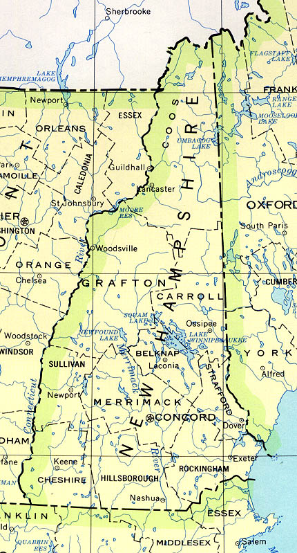
English: County boundaries and names, county seats, rivers. Original scale 1:2,500,000. |
| Date | limited update 1990 |
| Source | [1] |
| Author | U.S. Geological Survey |
Licensing[edit]
This image is in the public domain in the United States because it only contains materials that originally came from the United States Geological Survey, an agency of the United States Department of the Interior. For more information, see the official USGS copyright policy.
|
Original upload log[edit]
The original description page was here. All following user names refer to en.wikipedia.
- 2004-12-22 00:43 Neutrality 430×799× (691655 bytes) County boundaries and names, county seats, rivers. Original scale 1:2,500,000 U.S. Geological Survey, 1972 limited update 1990 [http://www.lib.utexas.edu/maps/new_hampshire.html] {{PD-USGov-Interior-USGS}}
File history
Click on a date/time to view the file as it appeared at that time.
| Date/Time | Thumbnail | Dimensions | User | Comment | |
|---|---|---|---|---|---|
| current | 03:52, 18 June 2011 | | 430 × 799 (675 KB) | File Upload Bot (Magnus Manske) (talk | contribs) | {{BotMoveToCommons|en.wikipedia|year={{subst:CURRENTYEAR}}|month={{subst:CURRENTMONTHNAME}}|day={{subst:CURRENTDAY}}}} {{Information |Description={{en|County boundaries and names, county seats, rivers. Original scale 1:2,500,000 U.S. Geological Survey, |
You cannot overwrite this file.
File usage on Commons
There are no pages that use this file.
File usage on other wikis
The following other wikis use this file:
- Usage on en.wikipedia.org