File:Mont-royal-tunnel.png
Jump to navigation
Jump to search

Size of this preview: 800 × 520 pixels. Other resolutions: 320 × 208 pixels | 640 × 416 pixels | 1,024 × 665 pixels | 1,280 × 832 pixels | 2,602 × 1,691 pixels.
Original file (2,602 × 1,691 pixels, file size: 941 KB, MIME type: image/png)
Captions
Captions
Add a one-line explanation of what this file represents
Summary[edit]
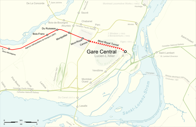
| Description | Karte des Tunnels durch den Mont Royal in Montreal, Kanada |
| Date | |
| Source |
Map was created by using
|
| Author |
|
| Permission (Reusing this file) |
Map data (c) OpenStreetMap (and) contributors, CC-BY-SA |
Licensing[edit]
I, the copyright holder of this work, hereby publish it under the following license:
This file is licensed under the Creative Commons Attribution 3.0 Unported license.
- You are free:
- to share – to copy, distribute and transmit the work
- to remix – to adapt the work
- Under the following conditions:
- attribution – You must give appropriate credit, provide a link to the license, and indicate if changes were made. You may do so in any reasonable manner, but not in any way that suggests the licensor endorses you or your use.
| This work is licensed under the Open Database License (summary). |
File history
Click on a date/time to view the file as it appeared at that time.
| Date/Time | Thumbnail | Dimensions | User | Comment | |
|---|---|---|---|---|---|
| current | 07:36, 17 June 2016 | | 2,602 × 1,691 (941 KB) | Pechristener (talk | contribs) | == {{int:filedesc}} == {{Information |Description=Karte des Tunnels durch den Mont Royal in Montreal, Kanada |Source=Map was created by using * [http://www.openstreetmap.org/ Open Street Map] Data |Date=2016-06-17 |Author= * rendering with Overpass Tu... |
You cannot overwrite this file.
File usage on Commons
The following 5 pages use this file:
File usage on other wikis
The following other wikis use this file:
- Usage on de.wikipedia.org
- Usage on www.wikidata.org