Category:Maps of Montreal
Jump to navigation
Jump to search
Wikimedia category | |||||
| Upload media | |||||
| Instance of | |||||
|---|---|---|---|---|---|
| Category combines topics | |||||
| Montreal | |||||
largest city in Quebec, Canada    .jpg)     | |||||
| Spoken text audio | |||||
| Pronunciation audio | |||||
| Instance of |
| ||||
| Part of |
| ||||
| Named after | |||||
| Location | |||||
| Located in or next to body of water | |||||
| Visitor center |
| ||||
| Legislative body |
| ||||
| Head of government |
| ||||
| Founded by | |||||
| Inception |
| ||||
| Population |
| ||||
| Area |
| ||||
| Elevation above sea level |
| ||||
| Replaces |
| ||||
| Different from | |||||
| official website | |||||
 | |||||
Subcategories
This category has the following 7 subcategories, out of 7 total.
Media in category "Maps of Montreal"
The following 124 files are in this category, out of 124 total.
-
 01-Election mun Montreal 1970 résultats 02.svg 792 × 612; 91 KB
-
 Agglomeration Montreal.PNG 1,613 × 1,388; 437 KB
-
 Ahuntsic-Cartierville location diagram.PNG 643 × 533; 8 KB
-
 Alma (division sénatoriale).png 1,063 × 743; 291 KB
-
 Archipel d Hochelaga.png 505 × 488; 257 KB
-
 Archipel Hochelaga.PNG 1,063 × 743; 43 KB
-
 ArrondissementsQuartiersMontreal 200802.svg 4,320 × 2,016; 11.7 MB
-
 ArrondissementsQuartiersMontreal.svg 4,232 × 2,425; 2.14 MB
-
 Autoroutes Montréal.svg 1,161 × 1,005; 488 KB
-
 Bois des Caryers.png 836 × 537; 402 KB
-
 Brasserie Atkin's, Montréal, Canada, octobre 1890.jpg 3,343 × 2,075; 1.1 MB
-
 Bunkr location.png 695 × 911; 123 KB
-
 Canada with Montreal.png 2,000 × 1,728; 158 KB
-
 Canadian Cities - DPLA - a9cadde2681da78b7b0f329c08ed6471.jpg 15,604 × 11,513; 20.74 MB
-
 Canal Saint-Gabriel.jpg 1,024 × 682; 440 KB
-
 Canopée Montréal 2015.jpg 2,139 × 1,597; 738 KB
-
 Carte - Ile des Soeurs.png 3,216 × 4,152; 6.47 MB
-
 Carte des districts municipaux de Montréal (1994).svg 792 × 612; 248 KB
-
 Carte des îlots de chaleur et de fraîcheur dans Rosemont–La Petite-Patrie.png 1,164 × 1,013; 4.5 MB
-
 Carte localisation Montréal - Ahuntsic-Cartierville.svg 1,563 × 999; 172 KB
-
 Carte localisation Montréal - Anjou.svg 1,563 × 999; 172 KB
-
 Carte localisation Montréal - Côte-des-Neiges–Notre-Dame-de-Grâce.svg 1,563 × 999; 172 KB
-
 Carte localisation Montréal - L'Île-Bizard–Sainte-Geneviève.svg 1,563 × 999; 172 KB
-
 Carte localisation Montréal - Lachine.svg 1,563 × 999; 172 KB
-
 Carte localisation Montréal - LaSalle.svg 1,563 × 999; 172 KB
-
 Carte localisation Montréal - Le Plateau-Mont-Royal.svg 1,563 × 999; 172 KB
-
 Carte localisation Montréal - Le Sud-Ouest.svg 1,563 × 999; 172 KB
-
 Carte localisation Montréal - Mercier–Hochelaga-Maisonneuve.svg 1,563 × 999; 172 KB
-
 Carte localisation Montréal - Montréal-Nord.svg 1,563 × 999; 172 KB
-
 Carte localisation Montréal - Outremont.svg 1,563 × 999; 172 KB
-
 Carte localisation Montréal - Pierrefonds-Roxboro.svg 1,563 × 999; 172 KB
-
 Carte localisation Montréal - Rivière-des-Prairies–Pointe-aux-Trembles.svg 1,563 × 999; 172 KB
-
 Carte localisation Montréal - Rosemont-La Petite-Patrie.svg 1,563 × 999; 172 KB
-
 Carte localisation Montréal - Saint-Laurent.svg 1,563 × 999; 172 KB
-
 Carte localisation Montréal - Saint-Léonard.svg 1,563 × 999; 172 KB
-
 Carte localisation Montréal - Verdun.svg 1,563 × 999; 172 KB
-
 Carte localisation Montréal - Ville-Marie.svg 1,563 × 999; 172 KB
-
 Carte localisation Montréal - Villeray–Saint-Michel–Parc-Extension.svg 1,563 × 999; 172 KB
-
 Carte Montréal Arrondissements.svg 1,563 × 999; 97 KB
-
 CarteD'Outremont.png 1,206 × 1,442; 567 KB
-
 CDNtract anglais.svg 1,204 × 777; 931 KB
-
 CDNtract arabe.svg 1,204 × 777; 922 KB
-
 CDNtract espagnol.svg 1,204 × 777; 926 KB
-
 CDNtract francais.svg 1,204 × 777; 931 KB
-
 CDNtract tagalog.svg 1,204 × 777; 925 KB
-
 CDNtract-density.svg 1,204 × 777; 875 KB
-
 Central montreal map.png 800 × 500; 20 KB
-
 Central montreal map.svg 1,000 × 625; 17 KB
-
 City of Montreal. LOC 2015591065.jpg 7,079 × 5,628; 5.31 MB
-
 City of Montreal. LOC 2015591065.tif 7,079 × 5,628; 113.99 MB
-
 CMM - Montréal.svg 1,969 × 1,512; 220 KB
-
 Concordia campus map-2.png 855 × 1,158; 250 KB
-
 Concordia campus map.svg 855 × 1,158; 5.49 MB
-
 Cotedesneiges census tract.jpg 1,250 × 814; 251 KB
-
 COVID-19 Outbreak Cases in Montreal (Density).svg 1,563 × 999; 53 KB
-
 COVID-19 Outbreak Cases in Montreal (per 100,000).svg 1,563 × 999; 55 KB
-
 Côte-des-Neiges Stations de Metro.svg 1,224 × 797; 1.64 MB
-
 Dawson-shooting-map.svg 514 × 356; 33 KB
-
 Dist elect2008 mun verdun.jpg 330 × 261; 49 KB
-
 Faible revenu - Montréal.svg 1,159 × 815; 655 KB
-
 Fortifications et terrier de la ville de Montreal.png 5,553 × 1,529; 12.12 MB
-
 Grand Montreal.png 1,044 × 1,282; 331 KB
-
 Hallowell-Weredale.png 768 × 798; 485 KB
-
 Ile de Montreal.PNG 1,063 × 743; 39 KB
-
 Ilenotredame.png 584 × 532; 5 KB
-
 Ilestehelene.png 584 × 532; 5 KB
-
 Illustrated map of the REM de l'Est.png 4,950 × 3,526; 579 KB
-
 Income 2011 10 28 14 18 20.0.svg 1,563 × 999; 276 KB
-
 LA2-NSRW-3-0273.jpg 1,867 × 2,799; 1.11 MB
-
 Lachine canal.png 643 × 533; 17 KB
-
 Le Plateau Montréal location diagram.png 609 × 528; 17 KB
-
 LocationMontréal.png 419 × 483; 11 KB
-
 Mont-royal-tunnel.png 2,602 × 1,691; 941 KB
-
 Montreal (administrative region) location map.png 841 × 697; 165 KB
-
 Montreal Agglomeration.PNG 1,613 × 1,388; 437 KB
-
 Montreal au Quebec.png 418 × 480; 18 KB
-
 Montreal et Laval.PNG 1,063 × 743; 43 KB
-
 Montreal GareCentrale NouvelleLigneThornton.gif 1,000 × 466; 61 KB
-
 Montreal Greater Evolution.jpg 878 × 770; 96 KB
-

-
 Montreal printable tourist attractions map.jpg 2,105 × 1,488; 816 KB
-
 Montreal reseau trains banlieue.svg 2,138 × 1,688; 1.55 MB
-
 Montreal-arrondissements-beige.png 3,038 × 2,283; 2.53 MB
-
 Montreal-localisation-mag-greek.jpg 1,575 × 1,226; 336 KB
-
 MontrealQC.jpg 504 × 477; 63 KB
-
 Montréal (39th Parl).png 423 × 514; 14 KB
-
 Montréal - Secteurs statistique 2011 - Langue Maison.svg 1,188 × 846; 506 KB
-
 Montréal - Secteurs Statitiques 2006 - Langue Maternelle.svg 1,563 × 999; 359 KB
-
 Montréal 1879. LHôtel Ottawa et le Secteur du Square Victoria. (6931985319).jpg 3,511 × 1,890; 2.05 MB
-
 Montréal 1881. Secteur des rues Érié, Craig et ave. Colborne. (6671606645).jpg 3,648 × 2,736; 4.56 MB
-
 Montréal Métro.PNG 800 × 559; 117 KB
-
 Montréal-blank.png 841 × 697; 186 KB
-
 Panorama Montreal 1906.jpg 6,160 × 1,040; 2.17 MB
-
 Parish of St Laurent Atlas of the city and island of Montreal 1879.png 1,740 × 992; 3.45 MB
-
 Plan ancien de Saint-Henri.jpg 1,600 × 1,059; 545 KB
-
 Plan d une partie de l isle de Montreal leve en 1778 par Mre Peladau.png 3,290 × 2,750; 20.73 MB
-
 Plan des terrains du gouvernement provincial au canal Lachine.jpg 2,876 × 1,220; 869 KB
-
 Plan d’expropriation du Faubourg à m’lasse secteur de Radio-Canada.jpg 7,174 × 2,500; 5.02 MB
-

-
 Plan of a Proposed Canal from above the Lachine Rapids to Montreal.jpg 10,603 × 4,015; 4.78 MB
-

-
 Plan of the Town of Westmount - 1908.jpg 2,024 × 2,700; 1.32 MB
-
 Plan of Ville Emard, April 1910.jpg 5,836 × 4,013; 3.21 MB
-
 Pointe-Nord - ile des Soeurs.png 3,210 × 1,800; 1.91 MB
-
 Pointe-Sud - Ile des Soeurs.png 1,878 × 1,273; 942 KB
-
 Portland-montreal.JPG 647 × 389; 51 KB
-

-
 Reseau de tramways a Montreal en 1924.jpg 2,000 × 1,085; 1.47 MB
-
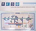 RESO - La ville souterraine de Montréal.jpg 1,783 × 1,535; 358 KB
-
 Rivieres de Montreal vers 1700.png 1,500 × 953; 106 KB
-
 Royal Arthur School Montreal Map Location 1890.jpg 1,313 × 1,100; 376 KB
-
 Région métropolitaine de Montréal (2011).png 2,880 × 2,160; 283 KB
-
 Région métropolitaine de Montréal-blank.svg 1,667 × 1,511; 302 KB
-
 Réseau express vélo de Montréal - Axes 1 à 5.png 4,226 × 2,200; 194 KB
-
 Secteur Bridge-Bonaventure.png 800 × 1,400; 1.08 MB
-
 Sewers and Water Mains for The Wartime Housing.png 931 × 701; 435 KB
-
 Tmr.png 643 × 533; 7 KB
-
 Triangle du parc Angrignon.png 500 × 400; 68 KB
-
 UCM.png 348 × 308; 20 KB
-
 West island fr.PNG 643 × 533; 63 KB
-
 West island.png 643 × 533; 88 KB
-
 Wikivoyage Montreal district map.png 1,591 × 1,199; 452 KB
-
 Wikivoyage Montreal district map.svg 744 × 1,052; 681 KB
-
 Île de Montréal.png 800 × 559; 119 KB


.png)


.svg)


.svg)
.svg)


_location_map.png)


.png)


.jpg)
.jpg)


.png)


