File:Mcas-yuma AC 22 May 1994.jpg
Jump to navigation
Jump to search
No higher resolution available.
Mcas-yuma_AC_22_May_1994.jpg (648 × 540 pixels, file size: 118 KB, MIME type: image/jpeg)
Captions
Captions
Add a one-line explanation of what this file represents
Summary[edit]
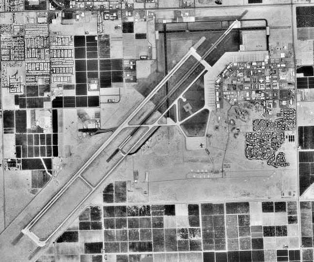
| Description | Aerial image of Marine Corps Air Station Yuma, Arizona |
| Date | |
| Source | USGS The National Map, via MSR Maps (formerly TerraServer-USA) |
| Author | United States Geological Survey (USGS) |
| Permission (Reusing this file) |
Public domain |
Licensing[edit]
This image is in the public domain in the United States because it only contains materials that originally came from the United States Geological Survey, an agency of the United States Department of the Interior. For more information, see the official USGS copyright policy.
|
File history
Click on a date/time to view the file as it appeared at that time.
| Date/Time | Thumbnail | Dimensions | User | Comment | |
|---|---|---|---|---|---|
| current | 00:00, 17 April 2008 | | 648 × 540 (118 KB) | Bwmoll3 (talk | contribs) | {{Information |Description=Marine Corps Air Station Yuma AZ |Source=US Geological Survey via terraserver http://terraserver-usa.com/map.aspx?t=1&s=13&lon=-114.599975028464&lat=32.6455738517048&w=800&h=800&opt=0&f=&fs=8&fc=ffffff99&lp=---+None+--- |Date=22 |
You cannot overwrite this file.
File usage on Commons
There are no pages that use this file.