File:Luxembourg T1 2020 map-lb.svg
Jump to navigation
Jump to search

Size of this PNG preview of this SVG file: 634 × 600 pixels. Other resolutions: 254 × 240 pixels | 508 × 480 pixels | 812 × 768 pixels | 1,083 × 1,024 pixels | 2,165 × 2,048 pixels | 1,052 × 995 pixels.
Original file (SVG file, nominally 1,052 × 995 pixels, file size: 3.06 MB)
Captions
Captions
Add a one-line explanation of what this file represents
Summary[edit]
| Description |
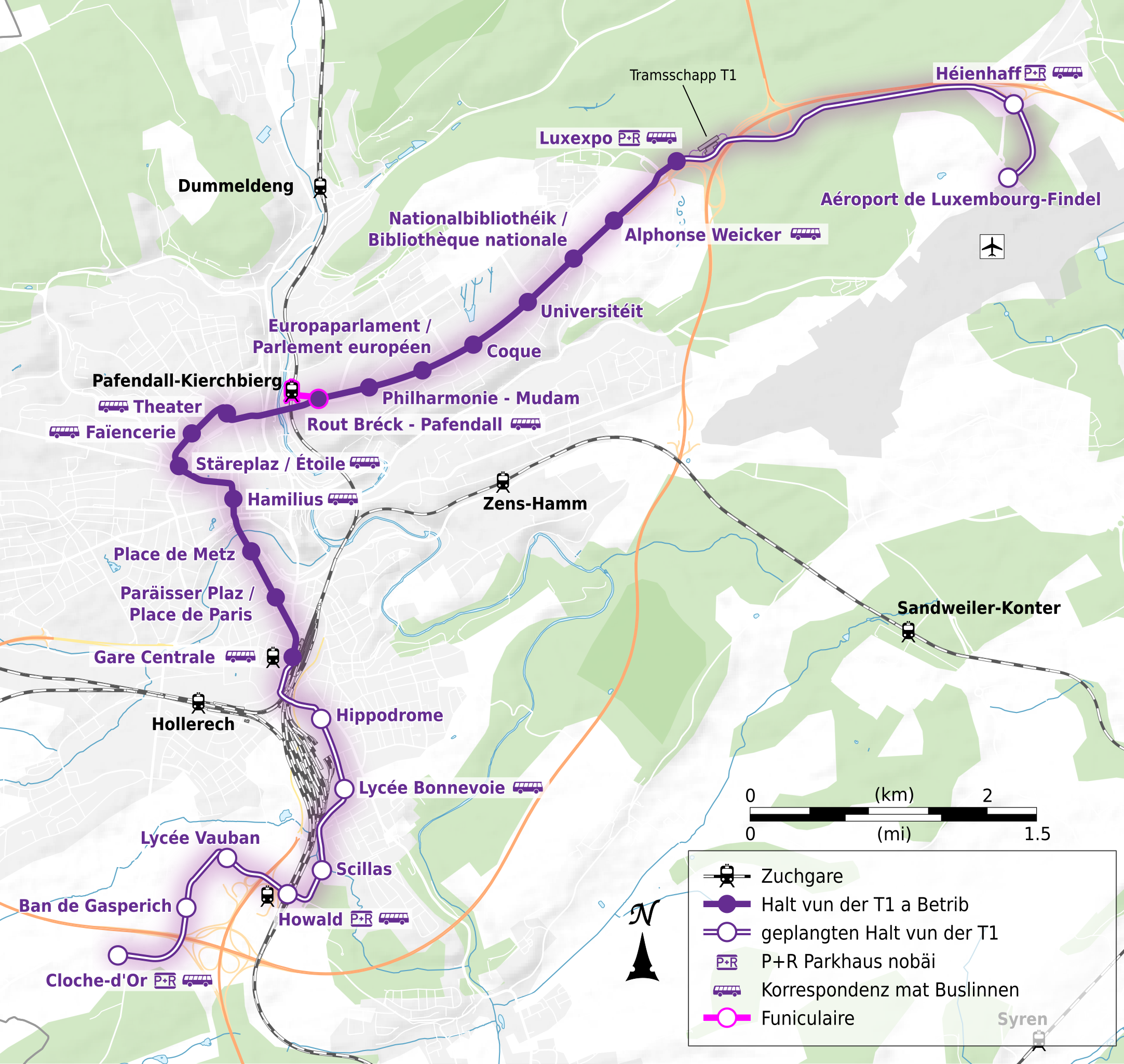
Français : Carte en français de la ligne de tramway T1 de la ville de Luxembourg après le prolongement de 2020. |
| Date | |
| Source |
Own work from:
|
| Author | Flappiefh |
Licensing[edit]
This file is licensed under the Creative Commons Attribution-Share Alike 4.0 International license.
- You are free:
- to share – to copy, distribute and transmit the work
- to remix – to adapt the work
- Under the following conditions:
- attribution – You must give appropriate credit, provide a link to the license, and indicate if changes were made. You may do so in any reasonable manner, but not in any way that suggests the licensor endorses you or your use.
- share alike – If you remix, transform, or build upon the material, you must distribute your contributions under the same or compatible license as the original.
File history
Click on a date/time to view the file as it appeared at that time.
| Date/Time | Thumbnail | Dimensions | User | Comment | |
|---|---|---|---|---|---|
| current | 21:50, 8 April 2023 | | 1,052 × 995 (3.06 MB) | Flappiefh (talk | contribs) | Uploaded a work by Flappiefh from {{own}} from: *[http://openstreetmap.org OpenStreetMap] ; *NASA Shuttle Radar Topography Mission (SRTM3 v.2) (public domain) ; *[https://data.public.lu/fr/datasets/bd-l-carto250/ BDL-CARTO-250]. with UploadWizard |
You cannot overwrite this file.
File usage on Commons
The following 3 pages use this file: