File:Karte Innerdeutsche Grenze.svg
Jump to navigation
Jump to search

Size of this PNG preview of this SVG file: 506 × 599 pixels. Other resolutions: 203 × 240 pixels | 405 × 480 pixels | 648 × 768 pixels | 865 × 1,024 pixels | 1,729 × 2,048 pixels | 1,075 × 1,273 pixels.
Original file (SVG file, nominally 1,075 × 1,273 pixels, file size: 333 KB)
Captions
Captions
Add a one-line explanation of what this file represents
| Description |
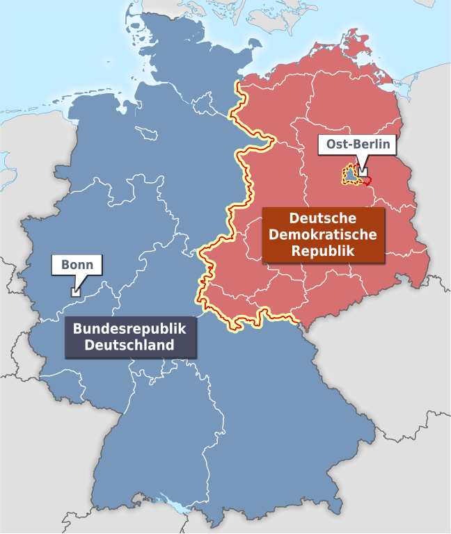
Deutsch: Karte der Innerdeutschen Grenze mit DDR und BRD (und Berlin). Zusätzlich sind die Grenzen der Bundesländer der BRD und Bezirke der DDR eingezeichneten. |
| Date | |
| Source |
Own work |
| Author | Alexrk2 |
| Other versions | PNG version |
This file is licensed under the Creative Commons Attribution-Share Alike 3.0 Unported license.
- You are free:
- to share – to copy, distribute and transmit the work
- to remix – to adapt the work
- Under the following conditions:
- attribution – You must give appropriate credit, provide a link to the license, and indicate if changes were made. You may do so in any reasonable manner, but not in any way that suggests the licensor endorses you or your use.
- share alike – If you remix, transform, or build upon the material, you must distribute your contributions under the same or compatible license as the original.
File history
Click on a date/time to view the file as it appeared at that time.
| Date/Time | Thumbnail | Dimensions | User | Comment | |
|---|---|---|---|---|---|
| current | 16:35, 13 March 2011 | | 1,075 × 1,273 (333 KB) | Alexrk2 (talk | contribs) | SVG Renderer Bugs |
| 16:32, 13 March 2011 |  | 1,075 × 1,273 (334 KB) | Alexrk2 (talk | contribs) | SVG Renderer Bugs | |
| 16:30, 13 March 2011 |  | 1,075 × 1,273 (331 KB) | Alexrk2 (talk | contribs) | neu erstellt - Grenzen zw. 1957 und 1990 (in voriger Version fälschlicherweise mit heutigem Stand) | |
| 20:35, 7 November 2009 |  | 592 × 801 (170 KB) | JFR~commonswiki (talk | contribs) | {{Information |Description={{de|Karte der Innerdeutschen Grenze mit DDR und BRD (und Berlin). Zusätzlich sind die Grenzen der Bundesländer eingezeichneten.}} |Source=*[[:File:Karte_Bundesrepublik_Deutschla |
You cannot overwrite this file.
File usage on Commons
The following page uses this file:
File usage on other wikis
The following other wikis use this file:
- Usage on de.wikipedia.org
- Usage on eo.wikipedia.org
- Usage on it.wikipedia.org