File:Golfe de gascogne-bay of biscay-fr.svg
Jump to navigation
Jump to search

Size of this PNG preview of this SVG file: 594 × 599 pixels. Other resolutions: 238 × 240 pixels | 476 × 480 pixels | 761 × 768 pixels | 1,015 × 1,024 pixels | 2,030 × 2,048 pixels | 680 × 686 pixels.
Original file (SVG file, nominally 680 × 686 pixels, file size: 105 KB)
Captions
Captions
Add a one-line explanation of what this file represents
Summary[edit]
| Description |
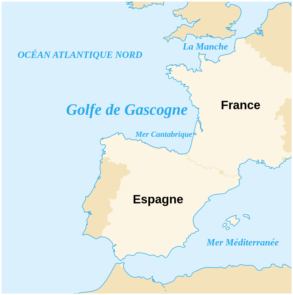
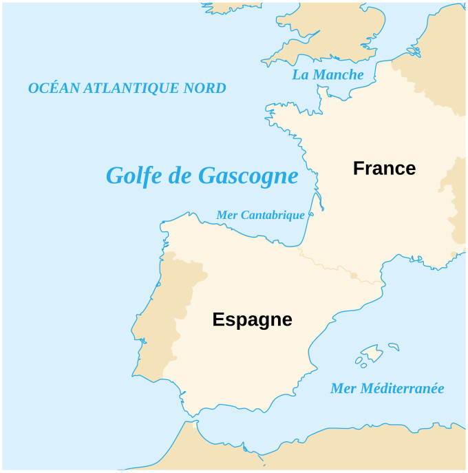
English: The Bay of Biscay.
Euskara: Bizkaiko golkoa.
Français : Le Golfe de Gascogne.
Italiano: Il Golfo di Biscaglia. |
| Date | |
| Source | own work based on fr:Image:Bizkaiko_Golkoa.jpg and derivating from Image:Blank_map_of_Europe.svg |
| Author | Emmanuel Boutet |
| Permission (Reusing this file) |
Creative Commons CC-BY-SA-2.5 |
| Other versions |
|


Licensing[edit]
This file is licensed under the Creative Commons Attribution-Share Alike 2.5 Generic license.
- You are free:
- to share – to copy, distribute and transmit the work
- to remix – to adapt the work
- Under the following conditions:
- attribution – You must give appropriate credit, provide a link to the license, and indicate if changes were made. You may do so in any reasonable manner, but not in any way that suggests the licensor endorses you or your use.
- share alike – If you remix, transform, or build upon the material, you must distribute your contributions under the same or compatible license as the original.
This W3C-unspecified vector image was created with Inkscape .
File history
Click on a date/time to view the file as it appeared at that time.
| Date/Time | Thumbnail | Dimensions | User | Comment | |
|---|---|---|---|---|---|
| current | 15:11, 8 January 2023 | | 680 × 686 (105 KB) | DankJae (talk | contribs) | Reverted to version as of 14:53, 6 March 2007 (UTC) Should've been separate file |
| 15:10, 8 January 2023 |  | 680 × 686 (110 KB) | DankJae (talk | contribs) | File uploaded using svgtranslate tool (https://svgtranslate.toolforge.org/). Added translation for en. | |
| 14:53, 6 March 2007 |  | 680 × 686 (105 KB) | Emmanuel.boutet (talk | contribs) |
You cannot overwrite this file.
File usage on Commons
The following 5 pages use this file:
File usage on other wikis
The following other wikis use this file:
- Usage on af.wikipedia.org
- Usage on fr.wikipedia.org
- Usage on gl.wikipedia.org
- Usage on ia.wikipedia.org
- Usage on ko.wikipedia.org
- Usage on sv.wikipedia.org
- Usage on www.wikidata.org