File:Georgia river basins.png
Jump to navigation
Jump to search
Size of this preview: 583 × 600 pixels. Other resolutions: 233 × 240 pixels | 466 × 480 pixels | 689 × 709 pixels.
Original file (689 × 709 pixels, file size: 23 KB, MIME type: image/png)
Captions
Captions
Add a one-line explanation of what this file represents
Summary[edit]
| Description |
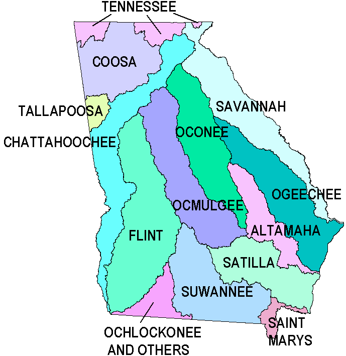
English: Map showing all river basins in Georgia. |
| Source |
|
| Author |
Licensing[edit]
This image is in the public domain in the United States because it only contains materials that originally came from the United States Geological Survey, an agency of the United States Department of the Interior. For more information, see the official USGS copyright policy.
|
Original upload log[edit]
The original description page was here. All following user names refer to en.wikipedia.
- 2006-10-23 17:18 Tlmclain 689×709×8 (23903 bytes) Map showing all river basins in [[Georgia (U.S. State)|Georgia]]. Source: [http://csat.er.usgs.gov/ga_epd/index.html USGS] {{PD-USGov-Interior-USGS}}
File history
Click on a date/time to view the file as it appeared at that time.
| Date/Time | Thumbnail | Dimensions | User | Comment | |
|---|---|---|---|---|---|
| current | 07:20, 5 July 2008 | | 689 × 709 (23 KB) | File Upload Bot (Magnus Manske) (talk | contribs) | {{BotMoveToCommons|en.wikipedia}} {{Information |Description={{en|Map showing all river basins in Georgia. Source: [http://csat.er.usgs.gov/ga_epd/index.html USGS] en:Category:Rivers of Georgia (U.S. state)}} |Source= |
You cannot overwrite this file.
File usage on Commons
There are no pages that use this file.
File usage on other wikis
The following other wikis use this file:
- Usage on bg.wikipedia.org
- Usage on en.wikipedia.org
- Usage on en.wikibooks.org
- Usage on es.wikipedia.org
- Usage on fr.wikipedia.org
- Usage on ur.wikipedia.org