File:False Bay Landsat map.jpg
Jump to navigation
Jump to search

Size of this preview: 800 × 600 pixels. Other resolutions: 320 × 240 pixels | 640 × 480 pixels | 1,024 × 768 pixels.
Original file (1,024 × 768 pixels, file size: 495 KB, MIME type: image/jpeg)
Captions
Captions
Add a one-line explanation of what this file represents
Summary[edit]
| Description |
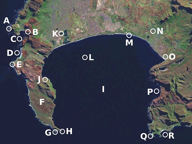
Português: A Baía Falsa é a maior baía verdadeira da África do Sul, com uma superfície de 1.000 km2. English: False Bay, Western Cape is the biggest true bay in South Africa, with a surface of 1,000 km2.
|
| Date | Map created on 08 April 2006; satellite image date unknown |
| Source | Landsat image from NASA World Wind |
| Author | Júlio Reis |
Licensing[edit]
This file is licensed under the Creative Commons Attribution-Share Alike 3.0 Unported license.
- You are free:
- to share – to copy, distribute and transmit the work
- to remix – to adapt the work
- Under the following conditions:
- attribution – You must give appropriate credit, provide a link to the license, and indicate if changes were made. You may do so in any reasonable manner, but not in any way that suggests the licensor endorses you or your use.
- share alike – If you remix, transform, or build upon the material, you must distribute your contributions under the same or compatible license as the original.
File history
Click on a date/time to view the file as it appeared at that time.
| Date/Time | Thumbnail | Dimensions | User | Comment | |
|---|---|---|---|---|---|
| current | 09:23, 8 April 2006 | | 1,024 × 768 (495 KB) | Tintazul (talk | contribs) | {{Tintazul|Description: False Bay}}Category:Cape of Good Hope |
You cannot overwrite this file.
File usage on Commons
The following page uses this file:
File usage on other wikis
The following other wikis use this file:
- Usage on ar.wikipedia.org
- Usage on ceb.wikipedia.org
- Usage on pt.wikipedia.org
- Usage on www.wikidata.org
- Usage on zh.wikipedia.org