File:Disputed Border in the East.jpg
Jump to navigation
Jump to search
Size of this preview: 744 × 599 pixels. Other resolutions: 298 × 240 pixels | 596 × 480 pixels | 953 × 768 pixels | 1,271 × 1,024 pixels | 2,542 × 2,048 pixels | 3,813 × 3,072 pixels.
Original file (3,813 × 3,072 pixels, file size: 3.21 MB, MIME type: image/jpeg)
Captions
Captions
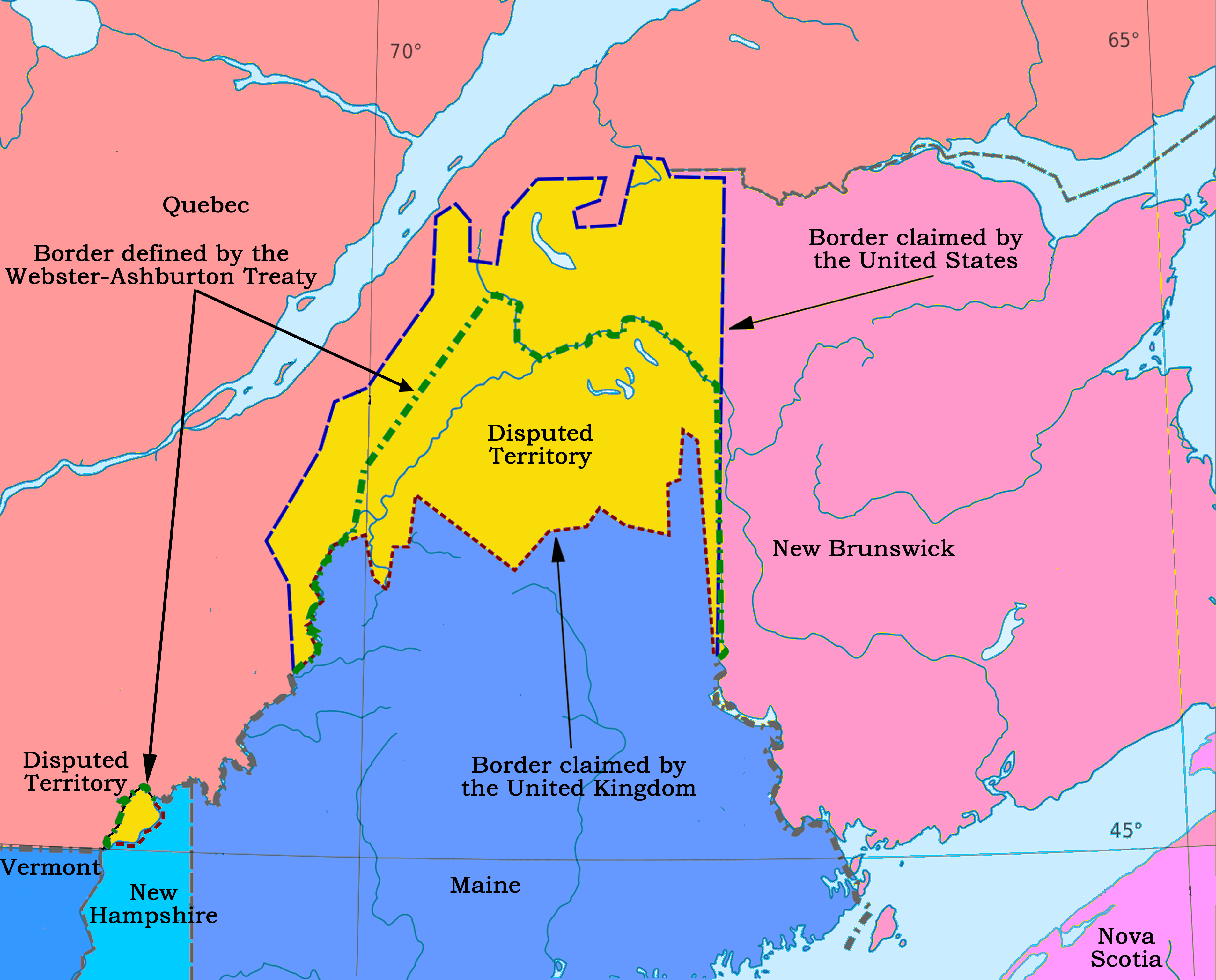
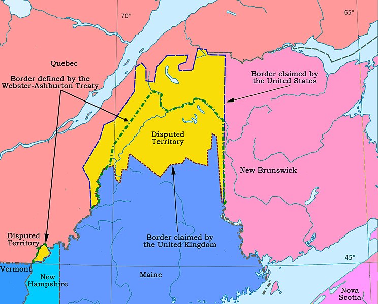
Eastern disputed areas on the Canada-United States boundary. Dispute settled in 1842.
Summary[edit]
| Description |
English: At the end of the American Revolution the boundary between the United States and Canada was defined in the peace treaty. It was discovered later that there were several ambiguities in the definition, due to inaccurate knowledge of the geography. This map shows the disputed area in the east. |
| Date | |
| Source | Own work |
| Author | Nwbeeson |
Licensing[edit]
I, the copyright holder of this work, hereby publish it under the following license:
This file is licensed under the Creative Commons Attribution-Share Alike 4.0 International license.
- You are free:
- to share – to copy, distribute and transmit the work
- to remix – to adapt the work
- Under the following conditions:
- attribution – You must give appropriate credit, provide a link to the license, and indicate if changes were made. You may do so in any reasonable manner, but not in any way that suggests the licensor endorses you or your use.
- share alike – If you remix, transform, or build upon the material, you must distribute your contributions under the same or compatible license as the original.
File history
Click on a date/time to view the file as it appeared at that time.
| Date/Time | Thumbnail | Dimensions | User | Comment | |
|---|---|---|---|---|---|
| current | 05:45, 20 January 2021 | | 3,813 × 3,072 (3.21 MB) | Nwbeeson (talk | contribs) | Uploaded own work with UploadWizard |
You cannot overwrite this file.
File usage on Commons
There are no pages that use this file.
File usage on other wikis
The following other wikis use this file:
- Usage on en.wikipedia.org
- Usage on fr.wikipedia.org
- Usage on pl.wikipedia.org
- Usage on simple.wikipedia.org
- Usage on zh.wikipedia.org