Category:Maps of borders of the United States
Jump to navigation
Jump to search
Countries of the Americas: Argentina · Barbados · Belize · Bolivia · Brazil · Canada · Chile · Colombia · Costa Rica · Dominican Republic · Ecuador · El Salvador · Guatemala · Guyana · Haiti · Honduras · Jamaica · Mexico · Nicaragua · Panama · Paraguay · Peru · Suriname · Trinidad and Tobago · United States of America · Uruguay · Venezuela
Subcategories
This category has the following 2 subcategories, out of 2 total.
M
- Maps of Dixon Entrance (11 F)
Media in category "Maps of borders of the United States"
The following 53 files are in this category, out of 53 total.
-
 1903 Alaska boundary dispute.png 538 × 538; 16 KB
-
 1926 Canada-Alaska 1903 boundary-map.jpg 448 × 432; 55 KB
-
 1926 Canada-Alaska 1903 boundary-map.png 429 × 418; 433 KB
-
 45th parallel US Canada.svg 250 × 250; 32 KB
-
 49th parallel US Canada border.svg 650 × 350; 48 KB
-
 Adams onis map-fr.png 3,029 × 2,476; 711 KB
-
 Adams onis map.png 800 × 654; 226 KB
-
 Adams-Onís treaty map-en.svg 626 × 478; 684 KB
-
 Adams-Onís treaty map-es.svg 626 × 478; 684 KB
-
 Adams-Onís treaty map-it.svg 626 × 478; 683 KB
-
 Alaska boundary dispute.jpg 1,184 × 1,096; 438 KB
-
 Border Region.png 809 × 623; 369 KB
-
 Caribbean maritime boundaries map zh.svg 3,561 × 2,221; 2.87 MB
-
 Caribbean maritime boundaries map.svg 3,561 × 2,221; 2.78 MB
-
 Caribbean maritime boundaries map mk.svg 3,561 × 2,221; 5.52 MB
-
 Mapa das Caraíbas (fronteiras marítimas).svg 3,561 × 2,221; 2.86 MB
-
 Mapa del Caribe (límites marinos).svg 5,340 × 3,660; 3.02 MB
-
 Mapa del Mar Caribe (límites marinos)-fr.svg 3,587 × 2,221; 1.91 MB
-
 Mapa del Mar Caribe (límites marinos).svg 3,587 × 2,221; 1.98 MB
-
 Disputed Border in the East.jpg 3,813 × 3,072; 3.21 MB
-
 Elm Point.png 600 × 400; 419 KB
-
 GAO-05-435 Figure 10.gif 409 × 530; 28 KB
-
 GAO-05-435 Figure 14.gif 616 × 443; 25 KB
-
 GAO-05-435 Figure 17.gif 411 × 487; 18 KB
-
 GAO-05-435 Figure 22.gif 410 × 568; 23 KB
-
 GAO-09-824 Figure 3.gif 1,019 × 629; 73 KB
-
 Great Lakes and St. Lawrence Seaway map 1959.png 2,627 × 1,583; 3.63 MB
-
 Intrborderstates.jpg 882 × 576; 108 KB
-
 Karte Adams-Onís-Vertrag.png 800 × 654; 130 KB
-
 Límites marítimos de Venezuela.png 732 × 558; 22 KB
-
 Marine boundary US - Cuba.jpg 1,038 × 1,192; 127 KB
-
 Masscolony.png 1,239 × 1,000; 618 KB
-
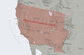 Mexican Cession.png 2,328 × 1,541; 2.81 MB
-
 Mexico-United States border.svg 990 × 627; 1.15 MB
-
 Mexico-US border counties.png 1,513 × 983; 183 KB
-
 Northwest-Angle,-MN.png 428 × 355; 17 KB
-
 NorthwesternPointLakeoftheWoods.svg 372 × 524; 15 KB
-
 Oregoncountry.png 1,000 × 1,019; 1.25 MB
-
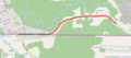 Rue canusa full length marked.png 1,472 × 651; 561 KB
-
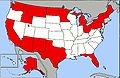
 US International Border States.svg 928 × 588; 85 KB
-
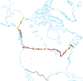
 US-Canada border counties.png 1,513 × 983; 179 KB
-
 US-Canada-Border-Provinces.svg 429 × 420; 380 KB
-
 US-Canada-Border-States.svg 429 × 420; 384 KB
-
 US-Mexico barrier map.png 2,000 × 957; 2.57 MB
-
 US-Mexico-border-BG.jpg 800 × 599; 118 KB
-
 US-Russia border map.jpg 686 × 892; 123 KB
-
 USA-Border-States.svg 688 × 279; 8.72 MB
-
 USA-Extreme-Points.svg 430 × 278; 6.35 MB
-
 USBP Interior Checkpoints FY2020.png 2,249 × 1,782; 946 KB
-
 Webster-Ashburton treaty map-en.svg 730 × 583; 109 KB
-
 Webster-Ashburton treaty map-es.svg 730 × 583; 112 KB
-
 Webster-Ashburton treaty map-fr.svg 730 × 588; 204 KB
-


.svg)
.svg)
-fr.svg)
.svg)


