File:Blue Grass Airport, USGS 1m Ortho, annotated.jpg
Jump to navigation
Jump to search

Size of this preview: 553 × 599 pixels. Other resolutions: 221 × 240 pixels | 443 × 480 pixels | 709 × 768 pixels | 945 × 1,024 pixels | 1,890 × 2,048 pixels | 3,600 × 3,900 pixels.
Original file (3,600 × 3,900 pixels, file size: 2.98 MB, MIME type: image/jpeg)
Captions
Captions
Add a one-line explanation of what this file represents
| Description |
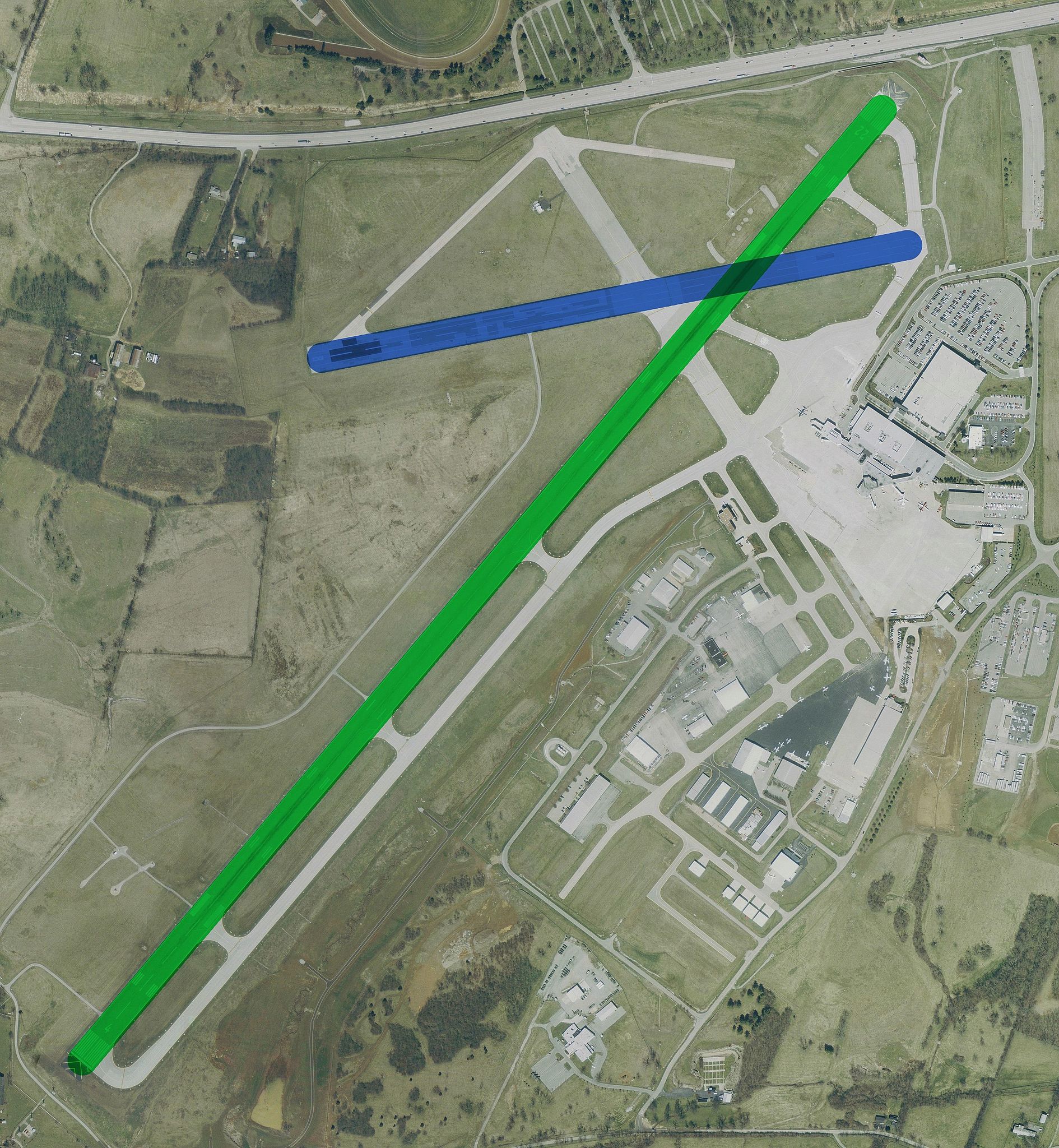
USGS urban ortho of Blue Grass Airport, Kentucky, USA. Overlayed with runway information. Runway 4/22 Runway 8/26 |
|||
| Date | April 2, 2002 | |||
| Source | NASA World Wind | |||
| Author | Runway data overlayed by Wangi on top of PD original. | |||
| Permission (Reusing this file) |
|
|||
| Other versions | Image:KLEX Blue Grass Airport.jpg |
File history
Click on a date/time to view the file as it appeared at that time.
| Date/Time | Thumbnail | Dimensions | User | Comment | |
|---|---|---|---|---|---|
| current | 12:32, 31 August 2006 | | 3,600 × 3,900 (2.98 MB) | Wangi (talk | contribs) | Reverted to earlier revision |
| 06:00, 31 August 2006 |  | 600 × 600 (70 KB) | Towpilot (talk | contribs) | Reverted to earlier revision | |
| 17:00, 30 August 2006 |  | 3,600 × 3,900 (2.98 MB) | Wangi (talk | contribs) | reduce size! | |
| 16:37, 30 August 2006 |  | 7,200 × 7,800 (7.37 MB) | Wangi (talk | contribs) | more jpeg compression | |
| 16:28, 30 August 2006 |  | 7,200 × 7,800 (10.75 MB) | Wangi (talk | contribs) | urban ortho, no runway numbers | |
| 12:22, 30 August 2006 |  | 600 × 600 (70 KB) | Mets501 (talk | contribs) | remove leading zeros from diagram | |
| 16:50, 27 August 2006 |  | 600 × 600 (244 KB) | Wangi (talk | contribs) | removing white border | |
| 16:45, 27 August 2006 |  | 1,043 × 868 (218 KB) | Wangi (talk | contribs) | {{Information |Description=USGS 1m ortho of w:Blue Grass Airport, Kentucky, USA. Overlayed with runway information. |Source=NASA World Wind |Date= |Author=Runway data overlayed by User:Wangi ontop of PD original. |Permission={{USGS}} |
You cannot overwrite this file.
File usage on Commons
There are no pages that use this file.
File usage on other wikis
The following other wikis use this file:
- Usage on en.wikipedia.org
- Usage on en.wikinews.org
- Usage on nl.wikipedia.org
- Usage on www.wikidata.org