File:Arkansas Grand Prairie map.pdf
Jump to navigation
Jump to search

Size of this JPG preview of this PDF file: 463 × 599 pixels. Other resolutions: 185 × 240 pixels | 371 × 480 pixels | 593 × 768 pixels | 1,275 × 1,650 pixels.
Original file (1,275 × 1,650 pixels, file size: 203 KB, MIME type: application/pdf)
Captions
Captions
Add a one-line explanation of what this file represents
Summary[edit]
| Description |
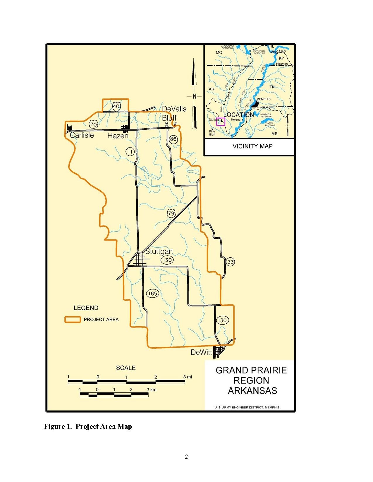
English: Map of the Grand Prairie as defined for the purposes of the Grand Prairie Irrigation Project currently underway by the USACE |
| Date | |
| Source | http://www.mvm.usace.army.mil/Portals/51/docs/missions/projects/Grand%20Prairie%20Area%20Demonstration%20Project/Final%202004%20EA.pdf |
| Author | US Army Corps of Engineers |
Licensing[edit]
This image or file is a work of a U.S. Army Corps of Engineers soldier or employee, taken or made as part of that person's official duties. As a work of the U.S. federal government, the image is in the public domain.
|
File history
Click on a date/time to view the file as it appeared at that time.
| Date/Time | Thumbnail | Dimensions | User | Comment | |
|---|---|---|---|---|---|
| current | 22:22, 8 November 2014 |  | 1,275 × 1,650 (203 KB) | Brandonrush (talk | contribs) | User created page with UploadWizard |
You cannot overwrite this file.
File usage on Commons
There are no pages that use this file.
File usage on other wikis
The following other wikis use this file:
- Usage on en.wikipedia.org