File:Aquifer.svg
Jump to navigation
Jump to search

Size of this PNG preview of this SVG file: 617 × 600 pixels. Other resolutions: 247 × 240 pixels | 494 × 480 pixels | 790 × 768 pixels | 1,053 × 1,024 pixels | 2,107 × 2,048 pixels | 720 × 700 pixels.
Original file (SVG file, nominally 720 × 700 pixels, file size: 61 KB)
Captions
Captions
Add a one-line explanation of what this file represents
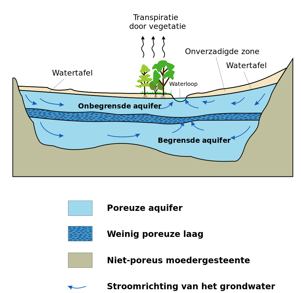
| Description | Aquifer (vectorized) | |||
| Date | ||||
| Source | Schematic aquifer xsection usgs cir1186.png | |||
| Author | Hans Hillewaert | |||
| Permission (Reusing this file) |
I, the copyright holder of this work, hereby publish it under the following license: This file is licensed under the Creative Commons Attribution-Share Alike 3.0 Unported license.
| |||
| Other licenses | More (4100+) and new images on : High resolution files on request. . |
|||
| Attribution (required by the license) | © Hans Hillewaert / | |||
| Other versions |
[]
|
|||
| Other licenses | More (4100+) and new images on : High resolution files on request. . |
|||
| Attribution (required by the license) | © Hans Hillewaert / | |||
| SVG development | This diagram was created with CorelDRAW. This diagram uses embedded text that can be easily translated using a text editor. |


File history
Click on a date/time to view the file as it appeared at that time.
| Date/Time | Thumbnail | Dimensions | User | Comment | |
|---|---|---|---|---|---|
| current | 12:51, 22 June 2006 | | 720 × 700 (61 KB) | Lycaon (talk | contribs) | |
| 12:40, 22 June 2006 |  | 700 × 700 (62 KB) | Lycaon (talk | contribs) | ||
| 08:58, 22 June 2006 |  | 800 × 900 (100 KB) | Lycaon (talk | contribs) | {{Information |Description=Aquifer (vectorized) |Source=en:Image:Schematic aquifer xsection usgs cir1186.png |Date=22-06-2006 |Author=Hans Hillewaert (Lycaon) |Permission=see below |other_versions=[[:en:Image:Schematic aquifer xsectio |
You cannot overwrite this file.
File usage on Commons
The following 23 pages use this file:
- User:Biopics/Images
- File:Aquifer-ar.jpg
- File:Aquifer-kn.svg
- File:Aquifer-pa.svg
- File:Aquifer.svg
- File:Aquifer as.svg
- File:Aquifer bn.svg
- File:Aquifer da.svg
- File:Aquifer de.svg
- File:Aquifer en.svg
- File:Aquifer es.svg
- File:Aquifer hi.svg
- File:Aquifer id.svg
- File:Aquifer it.svg
- File:Aquifer ne.svg
- File:Aquifer nv.svg
- File:Aquifer ro.svg
- File:Aquifer te.svg
- File:Aquifer tr.svg
- File:SchematicAquiferXsection gl.svg
- File:Schematic aquifer xsection usgs cir1186.png
- Template:Other versions/Aquifer
- Template talk:Convert to international
File usage on other wikis
The following other wikis use this file:
- Usage on da.wikipedia.org
- Usage on nl.wikipedia.org