File:19 August 2018 Lombok earthquake intensity map.png
Jump to navigation
Jump to search
Size of this preview: 514 × 600 pixels. Other resolutions: 206 × 240 pixels | 411 × 480 pixels | 658 × 768 pixels | 877 × 1,024 pixels | 1,700 × 1,984 pixels.
Original file (1,700 × 1,984 pixels, file size: 221 KB, MIME type: image/png)
Captions
Captions
Add a one-line explanation of what this file represents
Summary[edit]
| Description |
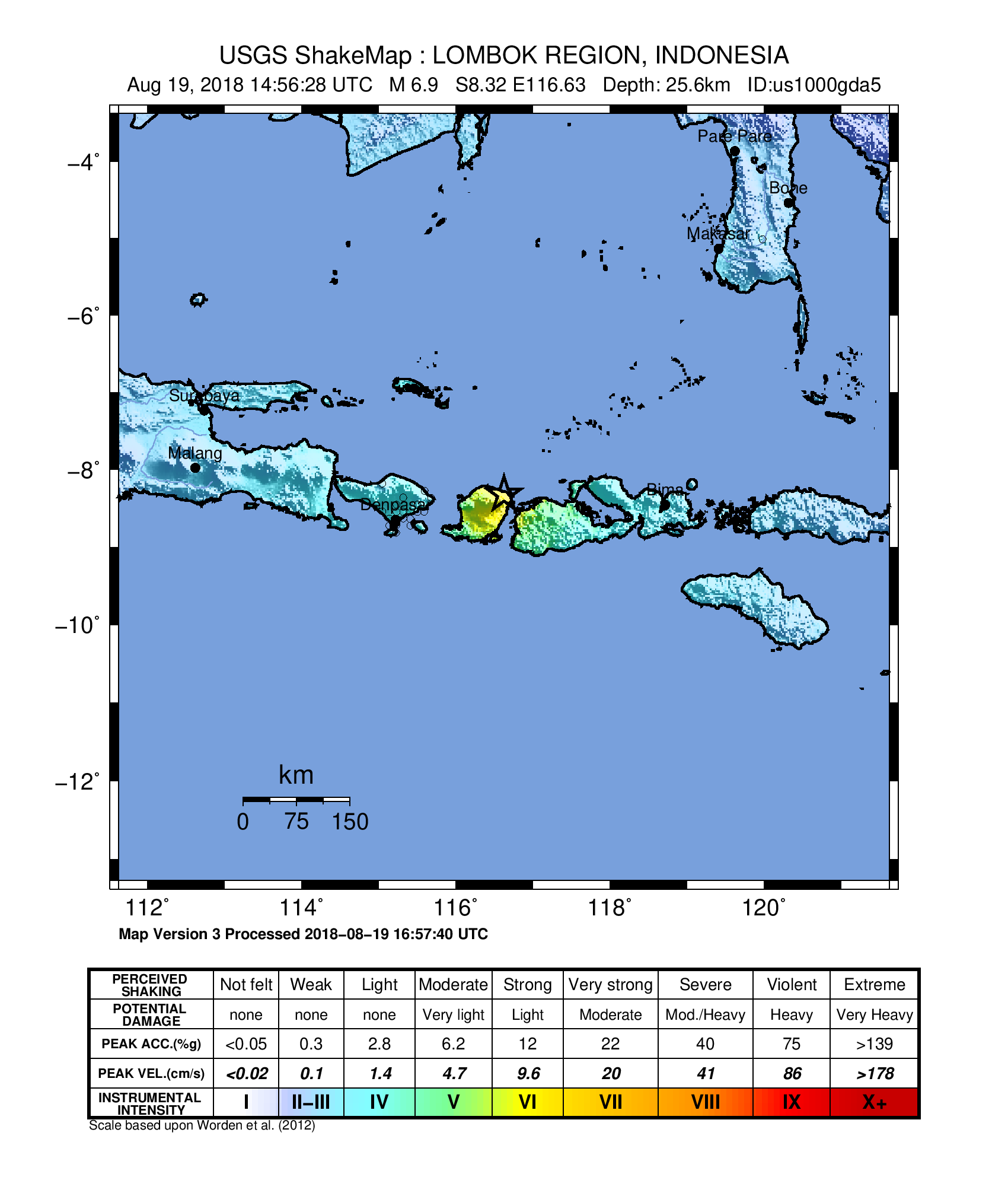
English: ShakeMap from the USGS for the 19 August 2018 Lombok earthquake in Indonesia |
| Date | |
| Source | https://earthquake.usgs.gov/earthquakes/eventpage/us1000gda5#shakemap |
| Author | USGS |
Licensing[edit]
This image is in the public domain in the United States because it only contains materials that originally came from the United States Geological Survey, an agency of the United States Department of the Interior. For more information, see the official USGS copyright policy.
|
File history
Click on a date/time to view the file as it appeared at that time.
| Date/Time | Thumbnail | Dimensions | User | Comment | |
|---|---|---|---|---|---|
| current | 04:10, 21 August 2018 | | 1,700 × 1,984 (221 KB) | Tinh1000000 (talk | contribs) | User created page with UploadWizard |
You cannot overwrite this file.
File usage on Commons
The following 2 pages use this file:
File usage on other wikis
The following other wikis use this file:
- Usage on ar.wikipedia.org
- Usage on en.wikipedia.org
- Usage on fr.wikipedia.org
- Usage on ms.wikipedia.org
- Usage on www.wikidata.org
- Usage on zh.wikipedia.org