File:1817 Map of Mississippi and Alabama.jpeg
Jump to navigation
Jump to search
Size of this preview: 688 × 599 pixels. Other resolutions: 276 × 240 pixels | 551 × 480 pixels | 882 × 768 pixels | 1,176 × 1,024 pixels | 2,351 × 2,048 pixels | 4,000 × 3,484 pixels.
Original file (4,000 × 3,484 pixels, file size: 1.26 MB, MIME type: image/jpeg)
Captions
Captions
Add a one-line explanation of what this file represents
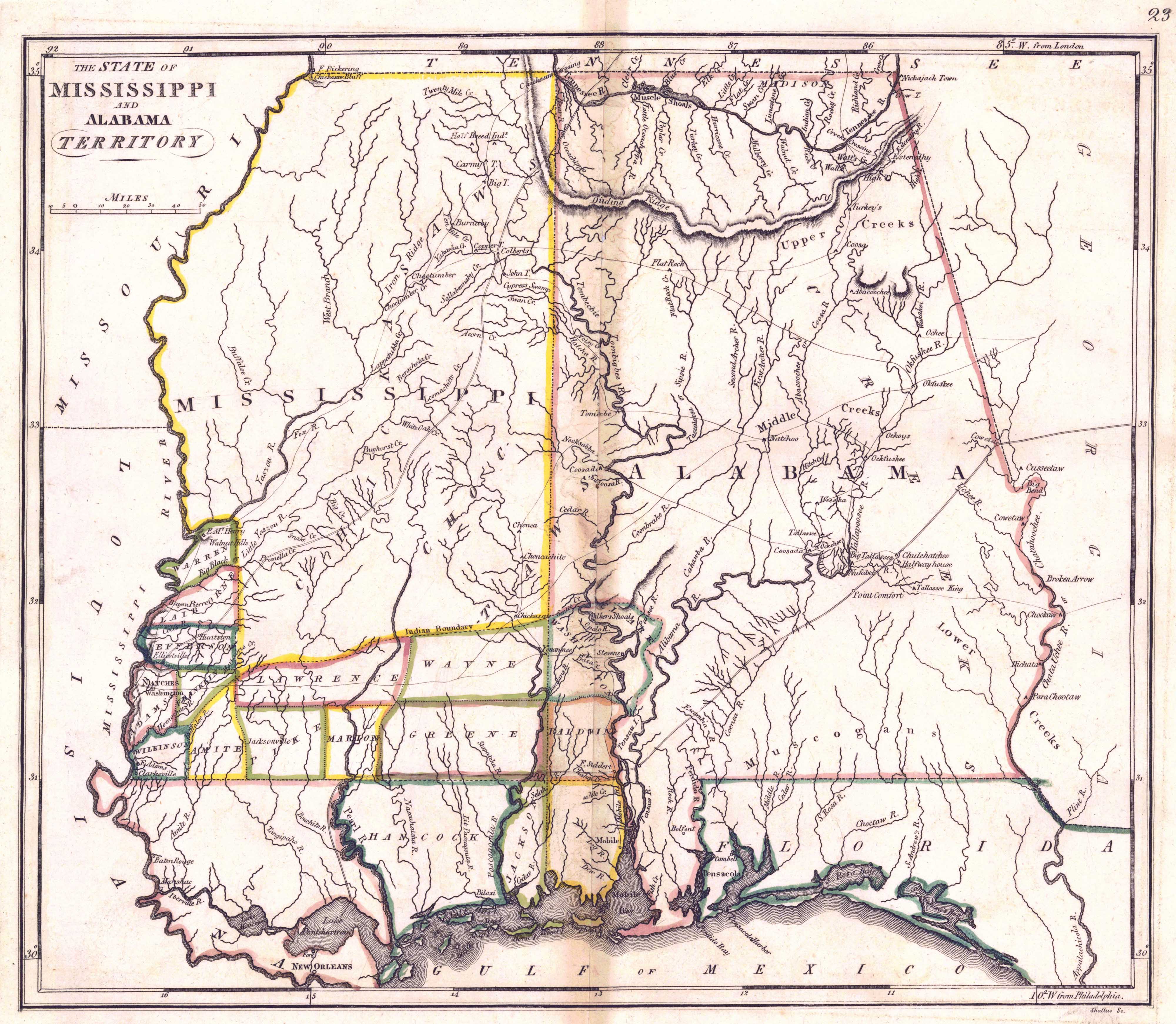
| Description | "The State of Mississippi and Alabama Territory". Showing early counties of Mississippi and Alabama | ||||
| Date | |||||
| Source | Historical Maps of Alabama collection, University of Alabama Department of Geography | ||||
| Author | Francis Shallus; Puiblisher: M. Carey and Son, Philadelphia | ||||
| Permission (Reusing this file) |
|
||||
File history
Click on a date/time to view the file as it appeared at that time.
| Date/Time | Thumbnail | Dimensions | User | Comment | |
|---|---|---|---|---|---|
| current | 21:57, 29 June 2009 | | 4,000 × 3,484 (1.26 MB) | Spyder Monkey (talk | contribs) | {{Information |Description="The State of Mississippi and Alabama Territory". Showing early counties of Mississippi and Alabama |Source=[http://alabamamaps.ua.edu/historicalmaps/alabama/before1825.html Historical Maps of Alabama collection], University of |
You cannot overwrite this file.
File usage on Commons
There are no pages that use this file.
File usage on other wikis
The following other wikis use this file:
- Usage on en.wikipedia.org
- Usage on he.wikipedia.org
- Usage on ru.wikipedia.org