Category:1810s maps of Alabama
Jump to navigation
Jump to search
States of the United States: Alabama · Arizona · Arkansas · California · Delaware · Florida · Georgia · Illinois · Indiana · Iowa · Kentucky · Louisiana · Maine · Maryland · Massachusetts · Michigan · Mississippi · Missouri · New Hampshire · New Jersey · New Mexico · New York · North Carolina · Ohio · Oregon · Pennsylvania · Rhode Island · South Carolina · Tennessee · Texas · Virginia – Washington, D.C.
Puerto Rico
Puerto Rico
Media in category "1810s maps of Alabama"
The following 13 files are in this category, out of 13 total.
-
 1815m4.jpg 1,689 × 1,442; 147 KB
-
 1817 Map of Mississippi and Alabama.jpeg 4,000 × 3,484; 1.26 MB
-
 1818 southeast Alabama townships.jpeg 6,145 × 3,557; 1.25 MB
-
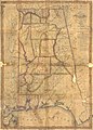 Alabama counties 1818.jpeg 1,887 × 2,633; 998 KB
-
 Battle of Burnt Corn.jpg 2,988 × 5,312; 4.14 MB
-
 Battle of Horseshoe Bend.jpg 2,988 × 5,312; 4.92 MB
-
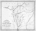
 Creek Country 1812-1814.jpg 806 × 667; 151 KB
-
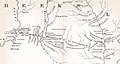
 Creek war 1813-14.jpg 354 × 478; 46 KB
-
 Fort Hampton map.jpg 1,295 × 953; 209 KB
-
 Fort Hull map.jpg 1,384 × 735; 153 KB
-
 Fort Stoddert.jpg 693 × 578; 56 KB
-
 Mobile 1815.jpg 1,846 × 1,461; 418 KB
-
 Plan of bend and breast works of Tohopeka, the battle of the 27th March 1814. LOC 2007629222.tif 5,045 × 4,093; 59.08 MB


