Commons:Wiki Loves Monuments in Switzerland/Bern/K-O
Jump to navigation
Jump to search
Kallnach
| Location | Upload | Photo | Object | Cat. | Coordinates | KGS-Nr | |
|---|---|---|---|---|---|---|---|
| Kallnach | 
|
r. Kirche | B | 47°01′05″N 7°14′11″E / 47.018054075°N 7.236412505°E | 968 | ||
Kandergrund
| Location | Upload | Photo | Object | Cat. | Coordinates | KGS-Nr | |
|---|---|---|---|---|---|---|---|
| Kandergrund | 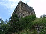
|
Felsenburg | B | 46°31′55″N 7°40′24″E / 46.531894°N 7.673257°E | 969 | ||
Kandersteg
| Location | Upload | Photo | Object | Cat. | Coordinates | KGS-Nr | |
|---|---|---|---|---|---|---|---|
| Kandersteg | 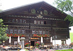
|
Gasthof Ruedihaus | A | 46°29′15″N 7°40′02″E / 46.487513888°N 7.667294444°E | 972 | ||
Kehrsatz
| Location | Upload | Photo | Object | Cat. | Coordinates | KGS-Nr | |
|---|---|---|---|---|---|---|---|
| Kehrsatz | 
|
Campagne Blumenhof | B | 46°54′34″N 7°28′12″E / 46.909389°N 7.4699°E | 974 | ||
| Kehrsatz | 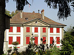
|
Landgut Lohn | A | 46°54′31″N 7°28′29″E / 46.908611111°N 7.474722222°E | 973 | ||
| Kehrsatz | 
|
Schloss Kehrsatz | B | 46°54′35″N 7°28′20″E / 46.909667°N 7.472346°E | 975 | ||
Kiesen
| Location | Upload | Photo | Object | Cat. | Coordinates | KGS-Nr | |
|---|---|---|---|---|---|---|---|
| Kiesen | 
|
Schloss Kiesen | A | 46°49′16″N 7°35′10″E / 46.821121°N 7.586114°E | 976 | ||
| Kiesen | [[File:|150x150px|Schlossgut]] | Schlossgut | A | 46°49′16″N 7°35′10″E / 46.821122222°N 7.586113888°E | 9781 | ||
Kirchberg
| Location | Upload | Photo | Object | Cat. | Coordinates | KGS-Nr | |
|---|---|---|---|---|---|---|---|
| Kirchberg | 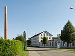
|
Areal Textilindustrie Elsässer | B | 47°04′45″N 7°35′27″E / 47.079165103°N 7.590719107°E | 977 | ||
| Kirchberg | 
|
Bütikofen | ISOS | 47°04′49″N 7°37′04″E / 47.0802°N 7.6179°E | |||
| Kirchberg | 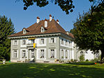
|
Campagne Kleehof | A | 47°05′36″N 7°34′44″E / 47.093297222°N 7.578986111°E | 978 | ||
| Kirchberg | 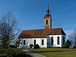
|
reformierte Kirche und Pfarrhaus | B | 47°05′01″N 7°35′08″E / 47.083669529°N 7.585464275°E | 979 | ||
| Kirchberg | 
|
Tannenheim | B | 47°05′11″N 7°35′04″E / 47.086459437°N 7.584352461°E | 980 | ||
Kirchenfeld-Schosshalde
| Location | Upload | Photo | Object | Cat. | Coordinates | KGS-Nr | |
|---|---|---|---|---|---|---|---|
| Kirchenfeld-Schosshalde | 
|
Heil- und Pflegeanstalt Waldau | B | 46°57′54″N 7°28′57″E / 46.96494°N 7.48244°E | 8998 | ||
| Kirchenfeld-Schosshalde | 
|
Landsitz Baumgarten | B | 46°57′11″N 7°27′52″E / 46.953176738°N 7.464381021°E | 704 | ||
Kirchenthurnen
| Location | Upload | Photo | Object | Cat. | Coordinates | KGS-Nr | |
|---|---|---|---|---|---|---|---|
| Kirchenthurnen | 
|
Reformierte Kirche | B | 46°49′28″N 7°30′06″E / 46.824367°N 7.501736°E | 981 | ||
Kirchlindach
| Location | Upload | Photo | Object | Cat. | Coordinates | KGS-Nr | |
|---|---|---|---|---|---|---|---|
| Kirchlindach | 
|
Halenbrücke | A | 46°58′17″N 7°25′06″E / 46.97127°N 7.41843°E | 10504 | ||
| Kirchlindach | 
|
Halenbrücke | A | 46°58′17″N 7°25′06″E / 46.97127°N 7.41843°E | 693 | ||
| Kirchlindach | 
|
Neubrügg | A | 46°58′25″N 7°25′41″E / 46.97373°N 7.42814°E | 10503 | ||
| Kirchlindach | 
|
Neubrügg | A | 46°58′25″N 7°25′41″E / 46.97373°N 7.42814°E | 638 | ||
| Kirchlindach | 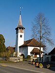
|
reformierte Kirche | B | 46°59′59″N 7°24′51″E / 46.999632°N 7.41428°E | 983 | ||
| Kirchlindach | 
|
Schlösschen Heimehus mit Speicher | B | 46°59′58″N 7°24′45″E / 46.99952862°N 7.412424°E | 984 | ||
| Kirchlindach | 
|
Siedlung Halen | A+ISOS | 46°58′21″N 7°24′47″E / 46.97263611°N 7.413125°E | 985 | ||
Köniz
Konolfingen
| Location | Upload | Photo | Object | Cat. | Coordinates | KGS-Nr | |
|---|---|---|---|---|---|---|---|
| Konolfingen | 
|
Landsitz Ursellen | B | 46°52′39″N 7°36′01″E / 46.877613112°N 7.600316699°E | 997 | ||
| Konolfingen | 
|
Schloss Hünigen | B | 46°52′22″N 7°37′22″E / 46.872763888°N 7.622802777°E | 998 | ||
Koppigen
| Location | Upload | Photo | Object | Cat. | Coordinates | KGS-Nr | |
|---|---|---|---|---|---|---|---|
| Koppigen | 
|
Ehemaliger Bären mit Nebenbauten im Weiler St. Niklaus | A | 47°07′50″N 7°36′49″E / 47.130444444°N 7.613641666°E | 9224 | ||
| Koppigen | 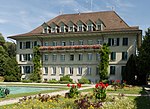
|
Kantonale Gartenbauschule Oeschberg | B | 47°07′38″N 7°36′44″E / 47.127231°N 7.612259°E | 10469 | ||
| Koppigen | 
|
Oeschberg, Dienstbotenheim Nr. 56 (ehemaliger Gasthof Sonne) | B | 47°07′41″N 7°36′35″E / 47.127981°N 7.609836°E | 999 | ||
| Koppigen | 
|
reformierte Kirche | B | 47°08′02″N 7°36′12″E / 47.134017°N 7.603199°E | 1000 | ||
| Koppigen | 
|
St. Niklaus, Kornhaus | B | 47°07′51″N 7°36′48″E / 47.130764°N 7.613272°E | 1002 | ||
Krauchthal
| Location | Upload | Photo | Object | Cat. | Coordinates | KGS-Nr | |
|---|---|---|---|---|---|---|---|
| Krauchthal | 
|
Kloster Hettiswil | B | 47°01′54″N 7°33′17″E / 47.031532524°N 7.554668148°E | 1004 | ||
| Krauchthal | 
|
Lindental, Felsenwohnungen Fluehüsli | B | 46°59′57″N 7°33′10″E / 46.999241542°N 7.552889418°E | 1006 | ||
| Krauchthal | 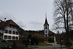
|
r. Kirche und Pfarrhaus | B | 47°00′32″N 7°34′07″E / 47.008921761°N 7.568532665°E | 1007 | ||
| Krauchthal | 
|
Schloss Thorberg | B | 47°00′09″N 7°33′53″E / 47.002557529°N 7.564598927°E | 1008 | ||
La Ferrière
| Location | Upload | Photo | Object | Cat. | Coordinates | KGS-Nr | |
|---|---|---|---|---|---|---|---|
| La Ferrière | 
|
Maison Gagnebin, Le Pavillon | A | 47°08′35″N 6°53′35″E / 47.142972222°N 6.893102777°E | 9526 | ||
La Heutte
| Location | Upload | Photo | Object | Cat. | Coordinates | KGS-Nr | |
|---|---|---|---|---|---|---|---|
| La Heutte | 
|
Le Van, verrerie médiévale / mittelalterliche Glashütte | A | 47°11′53″N 7°13′00″E / 47.198047222°N 7.216669444°E | 9571 | ||
La Neuveville
| Location | Upload | Photo | Object | Cat. | Coordinates | KGS-Nr | |
|---|---|---|---|---|---|---|---|
| La Neuveville | 
|
Blanche Église réformée | A | 47°03′52″N 7°05′50″E / 47.064361111°N 7.097102777°E | 1105 | ||
| La Neuveville | 
|
Burg Schlossberg (La Neuveville) | B | 47°03′59″N 7°05′03″E / 47.066307°N 7.084216°E | 1106 | ||
| La Neuveville | 
|
Chavannes | ISOS | 47°05′N 7°07′E / 47.08°N 7.12°E | |||
| La Neuveville | 
|
Fontaines des Bannerets | A | 47°03′48″N 7°05′33″E / 47.063411111°N 7.092472222°E | 1104 | ||
| La Neuveville | 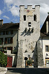
|
Fortifications de la ville (Tour de rive, Tour rouge, Tour carré, Tours Wyss et Jaggi, Tour Hildebrandt, Tours Baillif et Jaggi II, Porte) | A | 47°03′45″N 7°05′32″E / 47.062604°N 7.092259°E | 9916 | ||
| La Neuveville | 
|
Hof Ligerz | A | 47°05′00″N 7°08′01″E / 47.083375°N 7.13366°E | 1107 | ||
| La Neuveville | 
|
Hôtel de Gléresse | B | 47°03′51″N 7°05′33″E / 47.06426°N 7.092525°E | 1108 | ||
| La Neuveville | 
|
Hôtel de Ville | A | 47°03′50″N 7°05′34″E / 47.063755555°N 7.092905555°E | 1109 | ||
| La Neuveville | 
|
Kunsthistorisches Museum (La Neuveville) | B | 47°03′50″N 7°05′35″E / 47.06376°N 7.09299°E | 8741 | ||
| La Neuveville | 
|
La Neuveville | ISOS | 47°03′55″N 7°05′40″E / 47.065277777°N 7.094444444°E | |||
| La Neuveville | 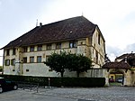
|
Maison de Berne | A | 47°03′44″N 7°05′35″E / 47.062119444°N 7.092955555°E | 1111 | ||
| La Neuveville | 
|
Maison des Dragons | A | 47°03′46″N 7°05′35″E / 47.062775°N 7.093083333°E | 1110 | ||
| La Neuveville | 
|
Schafis, Kirchbergerhaus | B | 47°04′55″N 7°07′46″E / 47.082041°N 7.129506°E | 1114 | ||
| La Neuveville | 
|
Usine Ehrismann-Schinz | B | 47°03′50″N 7°05′33″E / 47.0639°N 7.092422°E | 1118 | ||
Langenthal
| Location | Upload | Photo | Object | Cat. | Coordinates | KGS-Nr | |
|---|---|---|---|---|---|---|---|
| Langenthal | 
|
Chlyrot | ISOS | 47°12′02″N 7°50′49″E / 47.20068°N 7.84697°E | |||
| Langenthal | 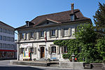
|
Ehemaliges Amthaus (Museum) | B | 47°12′46″N 7°47′17″E / 47.212804502°N 7.788051844°E | 1010 | ||
| Langenthal | 
|
Gasthof Bären | B | 47°12′44″N 7°47′23″E / 47.212287025°N 7.789632473°E | 9225 | ||
| Langenthal | 
|
Kaufhaus | A | 47°12′44″N 7°47′21″E / 47.2122°N 7.78925°E | 1011 | ||
| Langenthal | 
|
Langenthal | ISOS | 47°12′55″N 7°47′20″E / 47.215277777°N 7.788888888°E | |||
| Langenthal | 
|
Mühle | A | 47°12′53″N 7°47′32″E / 47.21462°N 7.7923°E | 1009 | ||
| Langenthal | 
|
Unterhard, Gräber / Siedlungsareal verschiedener Epochen | A | 47°13′49″N 7°47′09″E / 47.230302777°N 7.785922222°E | 9572 | ||
Langnau im Emmental
| Location | Upload | Photo | Object | Cat. | Coordinates | KGS-Nr | |
|---|---|---|---|---|---|---|---|
| Langnau im Emmental | 
|
Bauernhof Dürsrüti | A | 46°56′58″N 7°46′05″E / 46.949427777°N 7.768158333°E | 1015 | ||
| Langnau im Emmental | 
|
Chüechlihaus | A | 46°56′34″N 7°47′05″E / 46.9428°N 7.78472°E | 1012 | ||
| Langnau im Emmental | 
|
Ehemalige BZ-Druckerei | B | 46°56′26″N 7°47′05″E / 46.940667792°N 7.784707853°E | 1014 | ||
| Langnau im Emmental | 
|
Gasthof Bären | B | 46°56′33″N 7°47′03″E / 46.942378257°N 7.784259176°E | 1016 | ||
| Langnau im Emmental | 
|
Gedeckte Moosbrücke (versetzt) über die Ilfis | B | 46°56′17″N 7°47′56″E / 46.938060483°N 7.798888093°E | 1017 | ||
| Langnau im Emmental | 
|
Langnau im Emmental | ISOS | 46°56′36″N 7°47′07″E / 46.943333333°N 7.785277777°E | |||
| Langnau im Emmental | 
|
Reformierte Kirche Langnau im Emmental | A | 46°56′30″N 7°47′06″E / 46.941794444°N 7.785013888°E | 1018 | ||
| Langnau im Emmental | 
|
Stiftung Hans Ulrich Schwaar | B | 46°56′27″N 7°47′22″E / 46.940923694°N 7.789306383°E | 8613 | ||
Lauenen
| Location | Upload | Photo | Object | Cat. | Coordinates | KGS-Nr | |
|---|---|---|---|---|---|---|---|
| Lauenen | 
|
Ehemaliges Bauernhaus mit Mühle | A | 46°25′28″N 7°19′21″E / 46.424444444°N 7.322536111°E | 1021 | ||
| Lauenen | 
|
Jägerhaus, auf der Schüpfe Nr. 514 | B | 46°24′59″N 7°19′47″E / 46.416295266°N 7.329706355°E | 1020 | ||
| Lauenen | 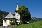
|
reformierte Kirche | B | 46°25′29″N 7°19′16″E / 46.424697408°N 7.321038231°E | 1022 | ||
Laupen
| Location | Upload | Photo | Object | Cat. | Coordinates | KGS-Nr | |
|---|---|---|---|---|---|---|---|
| Laupen | 
|
Freienhof | B | 46°54′09″N 7°14′27″E / 46.90256°N 7.24072°E | 1025 | ||
| Laupen | 
|
Laupen | ISOS | 46°54′00″N 7°13′59″E / 46.9°N 7.233055555°E | |||
| Laupen | 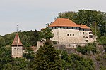
|
Schloss Laupen | A | 46°54′08″N 7°14′30″E / 46.902194444°N 7.241555555°E | 1023 | ||
| Laupen | 
|
Stadtbefestigung | B | 46°54′10″N 7°14′21″E / 46.902784°N 7.239144°E | 9917 | ||
Lauperswil
| Location | Upload | Photo | Object | Cat. | Coordinates | KGS-Nr | |
|---|---|---|---|---|---|---|---|
| Lauperswil | 
|
Herrenbauernhaus | A | 46°58′13″N 7°44′20″E / 46.970377777°N 7.738827777°E | 1027 | ||
| Lauperswil | 
|
Kirche | A | 46°57′59″N 7°44′29″E / 46.966252777°N 7.741455555°E | 1026 | ||
| Lauperswil | 
|
Längenbach | ISOS | 46°57′05″N 7°44′36″E / 46.9515°N 7.74331°E | |||
| Lauperswil | 
|
Witebach, Haus Grunder, Nr. 597 | B | 46°57′30″N 7°44′13″E / 46.958207777°N 7.736932243°E | 1028 | ||
| Lauperswil | 
|
Witenbach | ISOS | 46°57′30″N 7°44′16″E / 46.95829°N 7.73773°E | |||
Lauterbrunnen
| Location | Upload | Photo | Object | Cat. | Coordinates | KGS-Nr | |
|---|---|---|---|---|---|---|---|
| Lauterbrunnen | 
|
Gimmelwald | ISOS | 46°32′46″N 7°53′32″E / 46.546111111°N 7.892222222°E | |||
| Lauterbrunnen | 
|
Hallenbad Wengen | B | 9264 | |||
| Lauterbrunnen | 
|
Kirche | B | 46°35′33″N 7°54′30″E / 46.592636032°N 7.908407536°E | 1030 | ||
| Lauterbrunnen | 
|
Kleine Scheidegg | ISOS | 46°35′05″N 7°57′41″E / 46.584722222°N 7.961388888°E | |||
| Lauterbrunnen | 
|
Kraftwerk BOB | B | 46°36′16″N 7°54′24″E / 46.604562546°N 7.906683854°E | 1031 | ||
| Lauterbrunnen | 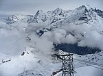
|
Luftseilbahn Stechelberg - Schilthorn | A | 46°35′25″N 7°53′43″E / 46.590348°N 7.895336°E | 9918 | ||
| Lauterbrunnen | 
|
Mürren, Anglikanische Kirche | B | 46°33′40″N 7°53′43″E / 46.561204483°N 7.895287547°E | 1032 | ||
| Lauterbrunnen | 
|
Schwimm- und Sonnenbad Wengen | B | 46°36′23″N 7°55′31″E / 46.606329257°N 7.925298729°E | 9919 | ||
| Lauterbrunnen | 
|
Trachsellauenen, mittelalterlich /neuzeitlicher Silberbergbau | A | 46°31′26″N 7°54′05″E / 46.523755555°N 7.901291666°E | 9573 | ||
Leissigen
| Location | Upload | Photo | Object | Cat. | Coordinates | KGS-Nr | |
|---|---|---|---|---|---|---|---|
| Leissigen | 
|
r. Kirche mit Pfarrhaus | B | 46°39′18″N 7°46′22″E / 46.654914666°N 7.772818439°E | 1033 | ||
Leuzigen
| Location | Upload | Photo | Object | Cat. | Coordinates | KGS-Nr | |
|---|---|---|---|---|---|---|---|
| Leuzigen | 
|
Leuzigen | ISOS | 47°10′34″N 7°27′35″E / 47.176111111°N 7.459722222°E | |||
| Leuzigen | 
|
r. Kirche | B | 47°10′28″N 7°27′09″E / 47.174521247°N 7.452483192°E | 1035 | ||
Ligerz
| Location | Upload | Photo | Object | Cat. | Coordinates | KGS-Nr | |
|---|---|---|---|---|---|---|---|
| Ligerz | 
|
Aarberghaus | A | 47°05′06″N 7°08′12″E / 47.084908333°N 7.136597222°E | 9204 | ||
| Ligerz | 
|
Bipschal | ISOS | 47°05′15″N 7°08′40″E / 47.08751°N 7.14439°E | |||
| Ligerz | 
|
Gaberelhaus Nr. 53 | A | 47°05′07″N 7°08′14″E / 47.085208333°N 7.137319444°E | 1038 | ||
| Ligerz | 
|
Kirche | A | 47°05′09″N 7°08′08″E / 47.085869444°N 7.135430555°E | 1037 | ||
| Ligerz | Ligerz | Ligerz | ISOS | 47°05′00″N 7°08′00″E / 47.083333333°N 7.133333333°E | |||
| Ligerz | 
|
Rebbaumuseum am Bielersee / Musée de la vigne au lac de Bienne | B | 47°05′00″N 7°08′01″E / 47.083383731°N 7.133633203°E | 10652 | ||
Limpach
| Location | Upload | Photo | Object | Cat. | Coordinates | KGS-Nr | |
|---|---|---|---|---|---|---|---|
| Limpach | 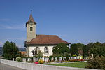
|
Reformierte Kirche Limpach | A | 47°06′24″N 7°29′40″E / 47.106727777°N 7.494363888°E | 1040 | ||
Lotzwil
| Location | Upload | Photo | Object | Cat. | Coordinates | KGS-Nr | |
|---|---|---|---|---|---|---|---|
| Lotzwil | 
|
Bauernhaus Ingold-Hof | A | 47°11′24″N 7°47′29″E / 47.19005°N 7.791452777°E | 9205 | ||
| Lotzwil | 
|
Pfarrhaus | A | 47°11′27″N 7°47′22″E / 47.190794444°N 7.789452777°E | 1041 | ||
Lüscherz
| Location | Upload | Photo | Object | Cat. | Coordinates | KGS-Nr | |
|---|---|---|---|---|---|---|---|
| Lüscherz | 
|
Schaltenrain / Grossholz, hallstattzeitliche Grabhügelgruppe | A | 47°01′45″N 7°08′18″E / 47.029216666°N 7.138302777°E | 9574 | ||
Lützelflüh
| Location | Upload | Photo | Object | Cat. | Coordinates | KGS-Nr | |
|---|---|---|---|---|---|---|---|
| Lützelflüh | 
|
Brandis, Gutshof Eimattscheuer Nr. 633, Kornhaus, Knochenstampfe und Speicher | B | 47°00′46″N 7°40′32″E / 47.012817°N 7.675621°E | 1042 | ||
| Lützelflüh | 
|
Ehemalige Mühle (Kulturmühle) | A | 47°00′18″N 7°41′40″E / 47.005002777°N 7.694402777°E | 1045 | ||
| Lützelflüh | 
|
Erdwerk Schmidslehn | B | 46°58′01″N 7°39′35″E / 46.96692°N 7.65963°E | 1043 | ||
| Lützelflüh | 
|
Gedeckte Gohlhausbrücke über die Emme (versetzt) | B | 47°00′04″N 7°41′32″E / 47.00106°N 7.69227°E | 1044 | ||
| Lützelflüh | 
|
Lützelflüh | ISOS | 47°00′33″N 7°41′21″E / 47.0091°N 7.6892°E | |||
| Lützelflüh | 
|
Pfarrhaus | A | 47°00′32″N 7°41′14″E / 47.008766666°N 7.687333333°E | 1046 | ||
| Lützelflüh | 
|
Ranflüh | ISOS | 46°59′21″N 7°44′28″E / 46.98911°N 7.74098°E | |||
| Lützelflüh | 
|
Waldhaus | ISOS | 46°57′05″N 7°44′36″E / 46.9515°N 7.74331°E | |||
Lyss
| Location | Upload | Photo | Object | Cat. | Coordinates | KGS-Nr | |
|---|---|---|---|---|---|---|---|
| Lyss | 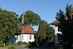
|
Alte r. Kirche | B | 47°04′13″N 7°18′26″E / 47.070194425°N 7.30724252°E | 1050 | ||
Lyssach
| Location | Upload | Photo | Object | Cat. | Coordinates | KGS-Nr | |
|---|---|---|---|---|---|---|---|
| Lyssach | 
|
Lyssach | ISOS | 47°03′52″N 7°34′46″E / 47.064444444°N 7.579444444°E | |||
Madiswil
| Location | Upload | Photo | Object | Cat. | Coordinates | KGS-Nr | |
|---|---|---|---|---|---|---|---|
| Madiswil | 
|
r. Kirche und Pfarrhaus | B | 47°10′03″N 7°47′58″E / 47.167390434°N 7.79936244°E | 1052 | ||
| Madiswil | 
|
Steinerne Bogenbrücke über die Langeten | B | 47°09′49″N 7°47′14″E / 47.163559673°N 7.787335166°E | 1053 | ||
| Madiswil | 
|
Wallanlage «Hunze» | B | 47°08′39″N 7°48′06″E / 47.144176408°N 7.801579212°E | 986 | ||
Matten bei Interlaken
| Location | Upload | Photo | Object | Cat. | Coordinates | KGS-Nr | |
|---|---|---|---|---|---|---|---|
| Matten bei Interlaken | 
|
Galgenhubel | B | 46°40′44″N 7°51′19″E / 46.678887113°N 7.855243144°E | 9920 | ||
| Matten bei Interlaken | 
|
Hotel Mattenhof | B | 46°40′46″N 7°51′51″E / 46.679349238°N 7.864069384°E | 1054 | ||
| Matten bei Interlaken | 
|
Mattenwirtshaus Hirschen | B | 46°40′54″N 7°51′44″E / 46.681694869°N 7.86225797°E | 1055 | ||
Mattenhof
| Location | Upload | Photo | Object | Cat. | Coordinates | KGS-Nr | |
|---|---|---|---|---|---|---|---|
| Mattenhof | 
|
Brunnenpumphaus | B | 46°56′47″N 7°25′37″E / 46.94638°N 7.42684°E | 675 | ||
Mattenhof-Weissenbühl
| Location | Upload | Photo | Object | Cat. | Coordinates | KGS-Nr | |
|---|---|---|---|---|---|---|---|
| Mattenhof-Weissenbühl | 
|
Brunnenpumphaus | B | 46°56′47″N 7°25′37″E / 46.94638°N 7.42684°E | 675 | ||
| Mattenhof-Weissenbühl | 
|
Florabrunnen | B | 46°56′34″N 7°26′14″E / 46.94283°N 7.43727°E | 732 | ||
Mattstetten
| Location | Upload | Photo | Object | Cat. | Coordinates | KGS-Nr | |
|---|---|---|---|---|---|---|---|
| Mattstetten | 
|
Dorfbrunnen | A | 47°01′48″N 7°30′49″E / 47.030044444°N 7.513611111°E | 9493 | ||
Meienried
| Location | Upload | Photo | Object | Cat. | Coordinates | KGS-Nr | |
|---|---|---|---|---|---|---|---|
| Meienried | 
|
Meienried | ISOS | 47°08′24″N 7°20′25″E / 47.14°N 7.340277777°E | |||
Meikirch
| Location | Upload | Photo | Object | Cat. | Coordinates | KGS-Nr | |
|---|---|---|---|---|---|---|---|
| Meikirch | 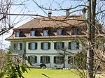
|
Grächwil, Landsitz | B | 47°01′02″N 7°22′35″E / 47.017361069°N 7.376290877°E | 1056 | ||
| Meikirch | 
|
r. Kirche und Pfarrhaus | B | 47°00′33″N 7°21′45″E / 47.009302137°N 7.362624061°E | 1058 | ||
Meiringen
| Location | Upload | Photo | Object | Cat. | Coordinates | KGS-Nr | |
|---|---|---|---|---|---|---|---|
| Meiringen | 
|
Bahnhof Meiringen | B | 46°43′39″N 8°11′03″E / 46.727363759°N 8.184239329°E | 1060 | ||
| Meiringen | 
|
Brünigen | ISOS | 46°45′13″N 8°08′56″E / 46.7536°N 8.1489°E | |||
| Meiringen | 
|
Burgruine Resti | B | 46°43′36″N 8°11′46″E / 46.72679919°N 8.19620149°E | 1061 | ||
| Meiringen | 
|
Englische Kapelle | B | 46°43′37″N 8°11′14″E / 46.726906°N 8.187354°E | 1062 | ||
| Meiringen | 
|
Hotel Sauvage | A | 46°43′36″N 8°11′16″E / 46.726544444°N 8.187822222°E | 9050 | ||
| Meiringen | 
|
Isenbolgen, Bauernhaus Nr. 915 | B | 46°43′50″N 8°10′46″E / 46.730454462°N 8.179310632°E | 1063 | ||
| Meiringen | 
|
Meiringen | ISOS | 46°43′42″N 8°11′10″E / 46.728333333°N 8.186111111°E | |||
| Meiringen | 
|
Museum der Talschaft Hasli | B | 46°43′45″N 8°11′21″E / 46.729174792°N 8.189301238°E | 1064 | ||
| Meiringen | 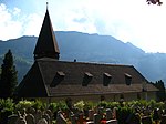
|
Sankt Michaelskirche | A | 46°43′46″N 8°11′21″E / 46.729577°N 8.189171°E | 1059 | ||
Melchnau
| Location | Upload | Photo | Object | Cat. | Coordinates | KGS-Nr | |
|---|---|---|---|---|---|---|---|
| Melchnau | 
|
Burgruine Grünenberg | B | 47°10′44″N 7°51′29″E / 47.178974661°N 7.858146665°E | 1066 | ||
| Melchnau | 
|
Käserstock | A | 47°10′55″N 7°51′05″E / 47.182005555°N 7.851361111°E | 9207 | ||
| Melchnau | 
|
reformierte Kirche, Pfarrhaus und Speicher | B | 47°10′45″N 7°51′19″E / 47.179300231°N 7.855180836°E | 1067 | ||
| Melchnau | 
|
Salzmann-Haus Nr. 59 im Oberdorf, mit Stöckli | B | 47°10′43″N 7°51′20″E / 47.178579706°N 7.855439092°E | 1068 | ||
| Melchnau | 
|
Stock des Birlihofs | A | 47°10′48″N 7°50′28″E / 47.179877777°N 7.841013888°E | 9206 | ||
Monbijou
| Location | Upload | Photo | Object | Cat. | Coordinates | KGS-Nr | |
|---|---|---|---|---|---|---|---|
| Monbijou | 
|
Florabrunnen | B | 46°56′34″N 7°26′14″E / 46.94283°N 7.43727°E | 732 | ||
Monible
| Location | Upload | Photo | Object | Cat. | Coordinates | KGS-Nr | |
|---|---|---|---|---|---|---|---|
| Monible | 
|
Forêts du Beucle, mine de fer médiévale | A | 47°16′11″N 7°12′05″E / 47.269705555°N 7.201438888°E | 9576 | ||
Moosseedorf
| Location | Upload | Photo | Object | Cat. | Coordinates | KGS-Nr | |
|---|---|---|---|---|---|---|---|
| Moosseedorf | 
|
Moosbühl, paläolithische Freilandstation | A | 47°00′50″N 7°29′25″E / 47.013991666°N 7.490388888°E | 1069 | ||
| Moosseedorf | 
|
Reformierte Kirche Moosseedorf | B | 47°01′03″N 7°28′56″E / 47.01755001°N 7.482233008°E | 1070 | ||
Mörigen
| Location | Upload | Photo | Object | Cat. | Coordinates | KGS-Nr | |
|---|---|---|---|---|---|---|---|
| Mörigen | 
|
Strandboden, bronzezeitliche Ufersiedlung | B | 47°05′09″N 7°12′10″E / 47.085768865°N 7.202903891°E | 1071 | ||
Moutier
| Location | Upload | Photo | Object | Cat. | Coordinates | KGS-Nr | |
|---|---|---|---|---|---|---|---|
| Moutier | 
|
Collège | B | 47°16′45″N 7°22′28″E / 47.279201°N 7.374332°E | 1074 | ||
| Moutier | 
|
Collégiale St-Germain avec archives paroissiales | B | 47°16′50″N 7°22′20″E / 47.280504°N 7.37215°E | 1075 | ||
| Moutier | 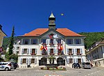
|
Hôtel de Ville et place | B | 47°16′46″N 7°22′12″E / 47.279423°N 7.370116°E | 1076 | ||
| Moutier | 
|
Jurassisches Kunstmuseum | B | 47°16′52″N 7°22′42″E / 47.28113°N 7.37841°E | 9458 | ||
| Moutier | 
|
Kapelle von Chalières | A | 47°16′25″N 7°21′41″E / 47.273617°N 7.361268°E | 1072 | ||
| Moutier | 
|
Moutier | ISOS | 47°16′49″N 7°22′15″E / 47.280277777°N 7.370833333°E | |||
| Moutier | 
|
Musée jurassien des beaux-arts | B | 47°16′52″N 7°22′42″E / 47.281074°N 7.378295°E | 1077 | ||
| Moutier | 
|
Museum des Drehautomaten und für Geschichte | B | 47°16′15″N 7°21′46″E / 47.270784°N 7.362897°E | 10653 | ||
| Moutier | 
|
Usine Pétermann SA | B | 47°16′52″N 7°23′12″E / 47.281051°N 7.386754°E | 1078 | ||
| Moutier | 
|
Vieille usine Tornos SA | B | 47°16′15″N 7°21′49″E / 47.27092°N 7.363571°E | 1079 | ||
Mühleberg
| Location | Upload | Photo | Object | Cat. | Coordinates | KGS-Nr | |
|---|---|---|---|---|---|---|---|
| Mühleberg | 
|
Gümmenen, gedeckte Holzbrücke über die Saane | B | 46°56′40″N 7°14′37″E / 46.944350342°N 7.243520662°E | 1082 | ||
| Mühleberg | 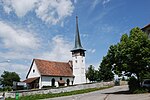
|
reformierte Kirche und Pfarrhaus | B | 46°57′15″N 7°15′43″E / 46.954050307°N 7.26194281°E | 1084 | ||
Mühledorf
| Location | Upload | Photo | Object | Cat. | Coordinates | KGS-Nr | |
|---|---|---|---|---|---|---|---|
| Mühledorf | 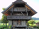
|
Speicher | A | 46°49′32″N 7°32′13″E / 46.825455555°N 7.536980555°E | 9208 | ||
Münchenbuchsee
| Location | Upload | Photo | Object | Cat. | Coordinates | KGS-Nr | |
|---|---|---|---|---|---|---|---|
| Münchenbuchsee | 
|
Badeanstalt Hofwil | A | 47°01′20″N 7°27′57″E / 47.022238888°N 7.465877777°E | 9497 | ||
| Münchenbuchsee | 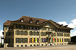
|
Hofwil | A+ISOS | 47°01′13″N 7°27′45″E / 47.020277777°N 7.4625°E | 1088 | ||
| Münchenbuchsee | 
|
Johanniterkommende Münchenbuchsee | B | 47°01′18″N 7°26′54″E / 47.021633°N 7.448297°E | 1085 | ||
| Münchenbuchsee | 
|
reformierte Kirche | B | 47°01′18″N 7°26′57″E / 47.021771°N 7.449138°E | 1086 | ||
| Münchenbuchsee | 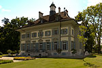
|
Schloss Hofwil (mit Park, Nebenbauten und Pavillon) | A | 47°01′16″N 7°27′40″E / 47.021033333°N 7.461036111°E | 10548 | ||
| Münchenbuchsee | 
|
Schloss Münchenbuchsee | B | 47°01′19″N 7°26′54″E / 47.022003°N 7.448368°E | 1087 | ||
Münchenwiler
| Location | Upload | Photo | Object | Cat. | Coordinates | KGS-Nr | |
|---|---|---|---|---|---|---|---|
| Münchenwiler | 
|
Münchenwiler | ISOS | 46°54′47″N 7°07′31″E / 46.913055555°N 7.125277777°E | |||
| Münchenwiler | 
|
Schloss Münchenwiler | A | 46°54′44″N 7°07′37″E / 46.912222222°N 7.126944444°E | 1089 | ||
Münsingen
| Location | Upload | Photo | Object | Cat. | Coordinates | KGS-Nr | |
|---|---|---|---|---|---|---|---|
| Münsingen | 
|
Alte Oele | B | 46°52′31″N 7°34′42″E / 46.875258081°N 7.57846869°E | 1091 | ||
| Münsingen | 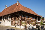
|
Gasthof Bären | B | 46°52′43″N 7°33′41″E / 46.878650809°N 7.56148896°E | 1092 | ||
| Münsingen | 
|
Pfarrhaus | A | 46°52′44″N 7°33′36″E / 46.878894444°N 7.559930555°E | 1093 | ||
| Münsingen | 
|
Produktions- und Verwaltungsanlage USM | A | 46°51′58″N 7°33′55″E / 46.866005555°N 7.565397222°E | 9038 | ||
| Münsingen | 
|
Psychiatriezentrum Münsingen | A+ISOS | 46°52′52″N 7°33′08″E / 46.8811°N 7.55222°E | 10556 | ||
| Münsingen | 
|
Rossboden, römischer Gutshof | B | 46°52′40″N 7°33′36″E / 46.877707908°N 7.559978203°E | 1094 | ||
| Münsingen | 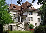
|
Schloss Münsingen | B | 46°52′32″N 7°33′36″E / 46.875454°N 7.560106°E | 1095 | ||
| Münsingen | 
|
Schwand, Landsitz Schwandstock | B | 46°53′19″N 7°33′32″E / 46.888593553°N 7.558756219°E | 1096 | ||
Muri bei Bern
| Location | Upload | Photo | Object | Cat. | Coordinates | KGS-Nr | |
|---|---|---|---|---|---|---|---|
| Muri bei Bern | 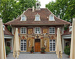
|
Hofgut Gümlingen | A | 46°56′01″N 7°30′44″E / 46.933742°N 7.512123°E | 1097 | ||
| Muri bei Bern | 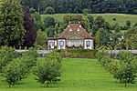
|
Schloss Gümligen | A | 46°56′05″N 7°30′55″E / 46.934722222°N 7.515277777°E | 1098 | ||
| Muri bei Bern | 
|
Villa Mettlen | B | 46°55′43″N 7°28′56″E / 46.928497047°N 7.48222752°E | 1101 | ||
Murten
| Location | Upload | Photo | Object | Cat. | Coordinates | KGS-Nr | |
|---|---|---|---|---|---|---|---|
| Murten | 
|
Stadtarchiv Murten | B | 46°55′43″N 7°06′59″E / 46.92871°N 7.11632°E | 8862 | ||
Neuenegg
| Location | Upload | Photo | Object | Cat. | Coordinates | KGS-Nr | |
|---|---|---|---|---|---|---|---|
| Neuenegg | 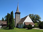
|
r. Kirche und Pfarrhaus | B | 46°53′50″N 7°17′55″E / 46.897115674°N 7.298546612°E | 1102 | ||
Nidau
| Location | Upload | Photo | Object | Cat. | Coordinates | KGS-Nr | |
|---|---|---|---|---|---|---|---|
| Nidau | 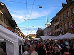
|
Nidau | ISOS | 47°07′32″N 7°14′25″E / 47.125555555°N 7.240277777°E | |||
| Nidau | 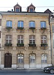
|
Rathaus | A | 47°07′32″N 7°14′25″E / 47.125647222°N 7.240163888°E | 8982 | ||
| Nidau | 
|
Schloss Nidau | A | 47°07′40″N 7°14′24″E / 47.127777777°N 7.24°E | 1119 | ||
| Nidau | 
|
Strandbad Biel | A | 47°07′47″N 7°14′08″E / 47.129838888°N 7.235613888°E | 9034 | ||
| Nidau | 
|
Südwestturm der ehemaligen Stadtbefestigung | B | 47°07′27″N 7°14′19″E / 47.124200568°N 7.238646094°E | 1121 | ||
Niederbipp
| Location | Upload | Photo | Object | Cat. | Coordinates | KGS-Nr | |
|---|---|---|---|---|---|---|---|
| Niederbipp | 
|
r. Kirche mit Pfarrhaus | B | 47°15′54″N 7°41′36″E / 47.264873°N 7.693259°E | 1122 | ||
Niedermuhlern
| Location | Upload | Photo | Object | Cat. | Coordinates | KGS-Nr | |
|---|---|---|---|---|---|---|---|
| Niedermuhlern | 
|
Falebach, Hofgruppe Schmutz | B | 46°51′35″N 7°28′39″E / 46.859729748°N 7.477451397°E | 1124 | ||
| Niedermuhlern | 
|
Obermuhlern, Bachmühle | B | 46°52′01″N 7°27′02″E / 46.867022°N 7.450635°E | 1125 | ||
Niederösch
| Location | Upload | Photo | Object | Cat. | Coordinates | KGS-Nr | |
|---|---|---|---|---|---|---|---|
| Niederösch | 
|
Gehöft | A | 47°07′07″N 7°36′40″E / 47.118486111°N 7.610980555°E | 9209 | ||
Nods
| Location | Upload | Photo | Object | Cat. | Coordinates | KGS-Nr | |
|---|---|---|---|---|---|---|---|
| Nods | 
|
Cure réformée | B | 47°06′47″N 7°04′55″E / 47.112937°N 7.082026°E | 1128 | ||
| Nods | 
|
Nods BE | ISOS | 47°06′55″N 7°04′55″E / 47.115277777°N 7.081944444°E | |||
Oberbalm
| Location | Upload | Photo | Object | Cat. | Coordinates | KGS-Nr | |
|---|---|---|---|---|---|---|---|
| Oberbalm | 
|
Bauernhaus, Stöckli 203 | A | 46°51′30″N 7°24′19″E / 46.858425°N 7.405236111°E | 9231 | ||
| Oberbalm | 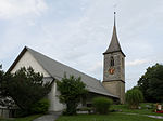
|
reformierte Kirche mit Pfarrhaus und Ofenhaus | B | 46°52′22″N 7°24′16″E / 46.872909038°N 7.404530201°E | 1129 | ||
| Oberbalm | 
|
Speicher | A | 46°52′29″N 7°25′26″E / 46.874755555°N 7.423986111°E | 9210 | ||
| Oberbalm | 
|
Speicher, Oberbalmstrasse 209 | A | 46°52′25″N 7°24′05″E / 46.873519444°N 7.401330555°E | 9232 | ||
Oberbipp
| Location | Upload | Photo | Object | Cat. | Coordinates | KGS-Nr | |
|---|---|---|---|---|---|---|---|
| Oberbipp | 
|
Oberbipp | ISOS | 47°15′41″N 7°39′33″E / 47.261388888°N 7.659166666°E | |||
| Oberbipp | 
|
Reformierte Kirche | B | 47°15′47″N 7°39′35″E / 47.263086°N 7.65967°E | 1131 | ||
| Oberbipp | 
|
Schloss Bipp | B | 47°15′49″N 7°39′06″E / 47.263507209°N 7.651692871°E | 1132 | ||
Oberburg
| Location | Upload | Photo | Object | Cat. | Coordinates | KGS-Nr | |
|---|---|---|---|---|---|---|---|
| Oberburg | 
|
Brittenwald | ISOS | 47°00′34″N 7°36′18″E / 47.00941°N 7.60494°E | |||
| Oberburg | 
|
reformierte Kirche mit Pfarrhaus und Umgebung | B | 47°02′22″N 7°37′14″E / 47.039497887°N 7.620541242°E | 1133 | ||
| Oberburg | 
|
Rohrmoos | ISOS | 47°02′57″N 7°36′14″E / 47.0491°N 7.6038°E | |||
| Oberburg | 
|
Sammlung Historisches Armeematerial (vgl. auch Thun/BE und Dübendorf/ZH) | A | 47°02′34″N 7°38′10″E / 47.042662°N 7.636015°E | 11717 | ||
| Oberburg | 
|
Staldenhof | A | 47°01′44″N 7°37′30″E / 47.028763888°N 7.625044444°E | 9769 | ||
Oberdiessbach
| Location | Upload | Photo | Object | Cat. | Coordinates | KGS-Nr | |
|---|---|---|---|---|---|---|---|
| Oberdiessbach | 
|
Altes Schloss | B | 46°50′21″N 7°37′33″E / 46.839209089°N 7.625960063°E | 1135 | ||
| Oberdiessbach | Familienkapelle von Wattenwyl | Familienkapelle von Wattenwyl | A | 46°50′25″N 7°37′09″E / 46.840205555°N 7.619280555°E | 1137 | ||
| Oberdiessbach | Landsitz Diessenhof | Landsitz Diessenhof | A | 46°50′07″N 7°37′20″E / 46.835236111°N 7.622161111°E | 1136 | ||
| Oberdiessbach | 
|
Neues Schloss Oberdiessbach | A | 46°50′21″N 7°37′33″E / 46.839166666°N 7.625833333°E | 9502 | ||
| Oberdiessbach | 
|
Oberdiessbach | ISOS | 46°50′22″N 7°37′09″E / 46.839444444°N 7.619166666°E | |||
Oberhofen
| Location | Upload | Photo | Object | Cat. | Coordinates | KGS-Nr | |
|---|---|---|---|---|---|---|---|
| Oberhofen | 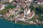
|
Schloss Oberhofen | A | 46°43′47″N 7°40′07″E / 46.729722222°N 7.668611111°E | 1138 | ||
Oberhofen am Thunersee
| Location | Upload | Photo | Object | Cat. | Coordinates | KGS-Nr | |
|---|---|---|---|---|---|---|---|
| Oberhofen am Thunersee | 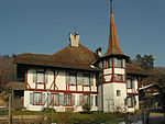
|
Klösterli | B | 46°43′50″N 7°40′21″E / 46.73045763°N 7.672615007°E | 1139 | ||
| Oberhofen am Thunersee | 
|
Oberhofen am Thunersee | ISOS | 46°43′47″N 7°40′09″E / 46.7298°N 7.66914°E | |||
| Oberhofen am Thunersee | 
|
reformierte Kirche mit Pfarrhaus in Hilterfingen | B | 46°44′02″N 7°39′43″E / 46.733807459°N 7.66190093°E | 1140 | ||
| Oberhofen am Thunersee | 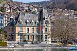
|
Schlössli Simeon | B | 46°43′52″N 7°40′03″E / 46.731007832°N 7.66744963°E | 1141 | ||
| Oberhofen am Thunersee | 
|
Wichterheer-Gut | A | 46°43′43″N 7°40′18″E / 46.728477777°N 7.671769444°E | 1142 | ||
Oberried am Brienzersee
| Location | Upload | Photo | Object | Cat. | Coordinates | KGS-Nr | |
|---|---|---|---|---|---|---|---|
| Oberried am Brienzersee | 
|
Bauernhaus Platzi 83 | A | 46°44′13″N 7°57′40″E / 46.736983333°N 7.961227777°E | 9235 | ||
Oberwil bei Büren
| Location | Upload | Photo | Object | Cat. | Coordinates | KGS-Nr | |
|---|---|---|---|---|---|---|---|
| Oberwil bei Büren | 
|
Oberwil bei Büren | ISOS | 47°07′49″N 7°24′25″E / 47.130277777°N 7.406944444°E | |||
| Oberwil bei Büren | 
|
reformierte Kirche und Pfarrhaus, freistehender Glockenstuhl | B | 47°07′42″N 7°24′16″E / 47.128282642°N 7.404366453°E | 1146 | ||
Oberwil im Simmental
| Location | Upload | Photo | Object | Cat. | Coordinates | KGS-Nr | |
|---|---|---|---|---|---|---|---|
| Oberwil im Simmental | 
|
Oberwil im Simmental | ISOS | 46°38′59″N 7°26′00″E / 46.649722222°N 7.433333333°E | |||
| Oberwil im Simmental | 
|
Pfaffenried | ISOS | 46°38′42″N 7°25′11″E / 46.6451°N 7.4198°E | |||
| Oberwil im Simmental | 
|
reformierte Kirche mit Pfarrhaus | B | 46°39′26″N 7°25′57″E / 46.657293695°N 7.432494551°E | 1149 | ||
| Oberwil im Simmental | 
|
Schnurrenloch, altsteinzeitliche Wohnhöhle | B | 46°40′09″N 7°27′13″E / 46.669257039°N 7.453532303°E | 1147 | ||
| Oberwil im Simmental | 
|
Vennerhaus | A | 46°39′38″N 7°27′11″E / 46.66053°N 7.45303°E | 9236 | ||
Ochlenberg
| Location | Upload | Photo | Object | Cat. | Coordinates | KGS-Nr | |
|---|---|---|---|---|---|---|---|
| Ochlenberg | 
|
Wäckerschwend | ISOS | 47°07′31″N 7°43′45″E / 47.1252°N 7.7291°E | |||
Orpund
| Location | Upload | Photo | Object | Cat. | Coordinates | KGS-Nr | |
|---|---|---|---|---|---|---|---|
| Orpund | 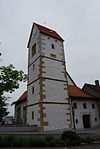
|
Gottstatt, ehem. Prämonstratenserabtei (Baugruppe) | B | 47°08′13″N 7°18′48″E / 47.13706084°N 7.313208028°E | 1150 | ||
Orvin
| Location | Upload | Photo | Object | Cat. | Coordinates | KGS-Nr | |
|---|---|---|---|---|---|---|---|
| Orvin | 
|
Orvin | ISOS | 47°09′38″N 7°12′50″E / 47.160555555°N 7.213888888°E | |||
| Orvin | 
|
Taubenlochschlucht | ISOS | 47°09′28″N 7°15′53″E / 47.1578°N 7.26472°E | |||
| Orvin | 
|
Temple | B | 47°09′33″N 7°12′58″E / 47.15915°N 7.216228°E | 1151 | ||
Ostermundigen
| Location | Upload | Photo | Object | Cat. | Coordinates | KGS-Nr | |
|---|---|---|---|---|---|---|---|
| Ostermundigen | 
|
Landsitz Rothus | B | 46°58′02″N 7°29′35″E / 46.967217059°N 7.49309917°E | 1153 | ||
| Ostermundigen | 
|
Rörswil, Landsitz mit Park | B | 46°57′57″N 7°30′07″E / 46.965773349°N 7.501835785°E | 1154 | ||
| Ostermundigen | 
|
Sandsteintunnel | B | 46°56′56″N 7°29′35″E / 46.94899°N 7.493°E | 1155 | ||
| Ostermundigen | 
|
Worblental | ISOS | 46°57′22″N 7°32′16″E / 46.9561°N 7.53782°E | |||


