Name
ID
Place
District
Coordinates
Image
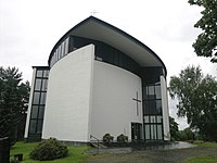
Aurejärvi Church (church building )
3984
. . Ylöjärvi
62°02′30″N 23°26′53″E / 62.04153706°N 23.44802605°E / 62.04153706; 23.44802605 62°02′30″N 23°26′53″E / 62.0415374°N 23.4480797°E / 62.0415374; 23.4480797
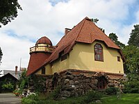
Emil Danielssonin erämaa-ateljee (artist's home
1967
. Pirunvuori . Sastamala
61°23′55″N 23°02′37″E / 61.398497127°N 23.043642945°E / 61.398497127; 23.043642945
Eskolan ja Tervamäen kylät (ryhmäkylä
4638
. . Sastamala
61°30′24″N 22°54′17″E / 61.506804598°N 22.904621956°E / 61.506804598; 22.904621956 Upload an image of this heritage site
F.E. Sillanpään kodit (cultural landscape
1932
. . Hämeenkyrö
Upload an image of this heritage site
Forestry field station in Hyytiälä (research station
1003
. . Juupajoki
61°50′49″N 24°17′03″E / 61.8469428°N 24.28423082°E / 61.8469428; 24.28423082
Hatanpää Manor (manor environment building
1243
1 Hatanpään puukuja Tampere
61°29′00″N 23°45′03″E / 61.483333°N 23.750833°E / 61.483333; 23.750833 61°29′00″N 23°45′03″E / 61.4833396153°N 23.7508708933°E / 61.4833396153; 23.7508708933
Haveri mine (mine
1457
. . Ylöjärvi
61°42′36″N 23°14′47″E / 61.71°N 23.246389°E / 61.71; 23.246389
Herttualan kylä (village
4027
. . Hämeenkyrö
61°35′45″N 23°09′08″E / 61.595926204°N 23.152319221°E / 61.595926204; 23.152319221 Upload an image of this heritage site
Hervanta Central Axis (urban landscape building complex
1248
. . Tampere
61°27′02″N 23°50′58″E / 61.45052778°N 23.84955556°E / 61.45052778; 23.84955556
Hämeenkankaan- ja Kyrönkankaantie (historic road
4050
. . Ylöjärvi Ikaalinen Hämeenkyrö Sastamala
Upload an image of this heritage site
Hämeenpuisto (street park
4502
. . Tampere
61°29′52″N 23°45′07″E / 61.49783333°N 23.75183333°E / 61.49783333; 23.75183333
Ikaalisten vanhan kauppalan alue ja Ikaalisten kirkonseutu (landscape of religious buildings
4076
. . Ikaalinen
Upload an image of this heritage site
Iso-Röyhiön kylä (village
4028
. . Ikaalinen
61°46′43″N 23°12′41″E / 61.77858911°N 23.211259522°E / 61.77858911; 23.211259522 Upload an image of this heritage site
Kalela (house museum home studio )
1961
. . Ruovesi
61°57′56″N 24°08′51″E / 61.965416666667°N 24.1475°E / 61.965416666667; 24.1475
Kalevan kirkko ja kaupunginosa (urban landscape )
1253
. . Tampere
Upload an image of this heritage site
Kalevankangas cemetery (cemetery )
1452
. Kalevanharju Tampere
61°29′36″N 23°47′42″E / 61.493333°N 23.795°E / 61.493333; 23.795
Kallenaution kestikievari (Gästgiveri )
1950
. . Juupajoki
61°50′03″N 24°16′56″E / 61.834167°N 24.282189°E / 61.834167; 24.282189
Kaltsilan, Uudenkylän ja Vanhankylän viljelymaisema (agricultural environment
4085
. . Sastamala
Upload an image of this heritage site
Kangasala observation towers (cultural landscape
1952
. . Kangasala
Upload an image of this heritage site
Kangasalan kirkko, kartanot ja suurtilat (manor environment
1951
. . Kangasala
Upload an image of this heritage site
Karkku (urban area in Finland
4084
. . Sastamala
61°26′45″N 23°02′42″E / 61.44583333°N 23.045°E / 61.44583333; 23.045
Kauniaisten ja Kuljun kartanot (manor environment
3994
. . Nokia
Upload an image of this heritage site
Killinkosken tehdasyhdyskunta (industrial heritage site
5096
. . Virrat
62°24′17″N 23°53′29″E / 62.404688703°N 23.89136641°E / 62.404688703; 23.89136641 Upload an image of this heritage site
Kokemäenjoen voimalaitokset (industrial heritage site
1969
. . Sastamala
Upload an image of this heritage site
Korkeakosken tehdasyhdyskunta (industrial heritage site
1888
. . Juupajoki
Kovero (agricultural environment torp )
4079
. . Ikaalinen
61°54′51″N 23°22′59″E / 61.91404°N 23.38307°E / 61.91404; 23.38307
Kuhmoisten kirkonmäki (landscape of religious buildings
209
. . Kuhmoinen
Upload an image of this heritage site
Kuhmoisten sahan lahti (industrial heritage site
320
. . Kuhmoinen
61°33′41″N 25°11′18″E / 61.561263785°N 25.188467342°E / 61.561263785; 25.188467342 Upload an image of this heritage site
Kurun kirkonmäki (landscape of religious buildings
4637
. . Ylöjärvi
Upload an image of this heritage site
Kyröskosken tehdasyhdyskunta (industrial heritage site
1887
. . Hämeenkyrö
Upload an image of this heritage site
Kyröskosken tehdasyhtiö (factory )
1887
. . Hämeenkyrö
61°39′57″N 23°11′21″E / 61.66583333333333°N 23.189166666666665°E / 61.66583333333333; 23.189166666666665 Upload an image of this heritage site
Lappi (district of Tampere
1247
. . Tampere
61°30′32″N 23°46′40″E / 61.508938384925194°N 23.777781483633973°E / 61.508938384925194; 23.777781483633973
Laukko Manor (manor estate
3988
. . Vesilahti
61°19′54″N 23°30′48″E / 61.33166667°N 23.51333333°E / 61.33166667; 23.51333333
Lempäälä railway station (railway station station building
4180
. . Lempäälä
61°18′48″N 23°45′15″E / 61.31331671°N 23.75423919°E / 61.31331671; 23.75423919
Lielahti railway station (railway station )
4219
. Lielahti Tampere
61°30′35″N 23°40′46″E / 61.509638888889°N 23.679471944444°E / 61.509638888889; 23.679471944444
Lyly railway station (railway station )
4179
. . Juupajoki
61°53′08″N 24°28′44″E / 61.88563333333333°N 24.478883333333332°E / 61.88563333333333; 24.478883333333332
Lähteenmäen torppa (agricultural environment
4049
. . Sastamala
Upload an image of this heritage site
Längelmäen kirkonkylä (village with a church
4473
. Längelmäki Orivesi
Upload an image of this heritage site
Mänttä factories and community (industrial landscape
1889
. . Mänttä-Vilppula
Nokian teollisuuslaitokset (industrial heritage site
1890
. . Nokia
Upload an image of this heritage site
Nuutajärven lasitehtaan alue (industrial heritage site
1891
. . Urjala
Upload an image of this heritage site
Näsijärven reitin kanavat (water traffic site
5019
. . Ruovesi Virrat
Upload an image of this heritage site
Onnistaipale (village
4016
. . Orivesi
61°42′26″N 24°19′18″E / 61.707257102°N 24.321658911°E / 61.707257102; 24.321658911 Upload an image of this heritage site
Orivesi Church (church building )
1957
. . Orivesi
61°40′25″N 24°21′28″E / 61.673666666667°N 24.357861111111°E / 61.673666666667; 24.357861111111 61°40′25″N 24°21′28″E / 61.67369409°N 24.35785715°E / 61.67369409; 24.35785715 61°40′25″N 24°21′28″E / 61.673682°N 24.3578792°E / 61.673682; 24.3578792
Orivesi railway station (railway station rail yard station located on surface junction station
4182
. Orivesi station area Orivesi
61°39′01″N 24°22′07″E / 61.650278°N 24.368611°E / 61.650278; 24.368611
Pappila (village with a church
285
. . Hämeenkyrö
Upload an image of this heritage site
Paysage de l'église de Sastamala (landscape of religious buildings
1966
. . Sastamala
Upload an image of this heritage site
Pekkala manor (manor estate
139
. . Ruovesi
61°54′27″N 24°03′55″E / 61.9075°N 24.06527778°E / 61.9075; 24.06527778 Upload an image of this heritage site
Peräkunnantie (museum road )
4074
. . Ruovesi
61°58′23″N 24°03′20″E / 61.97305556°N 24.05555556°E / 61.97305556; 24.05555556 Upload an image of this heritage site
Pispalanrinne (urban landscape )
1246
. Pispala Tampere
Upload an image of this heritage site
Pitkäniemi hospital (hospital psychiatric hospital
1955
. . Nokia
61°28′43″N 23°34′45″E / 61.47858°N 23.57903°E / 61.47858; 23.57903
Pohjaslahti Church (church building )
4642
. Pohjaslahti village Mänttä-Vilppula
62°09′53″N 24°08′29″E / 62.164721944444445°N 24.14138888888889°E / 62.164721944444445; 24.14138888888889 62°09′53″N 24°08′29″E / 62.16475721°N 24.14146591°E / 62.16475721; 24.14146591 62°09′53″N 24°08′29″E / 62.1647852°N 24.1414748°E / 62.1647852; 24.1414748
Punkalaitumen keskustan kylämaisema (cultural landscape
1988
. . Punkalaidun
Upload an image of this heritage site
Puutikkala (village
4080
. . Pälkäne
61°17′21″N 24°41′31″E / 61.289219516°N 24.691879073°E / 61.289219516; 24.691879073 Upload an image of this heritage site
Pyynikinrinne (district of Tampere
1245
. . Tampere
61°29′51″N 23°44′30″E / 61.4975°N 23.741667°E / 61.4975; 23.741667
Pyynikki observation tower (observation tower
2218
. Pyynikki Tampere
61°29′47″N 23°43′55″E / 61.496333333333°N 23.732°E / 61.496333333333; 23.732
Päijälän raittikylä (village
210
. . Kuhmoinen
61°34′21″N 25°10′36″E / 61.57244901°N 25.176740401°E / 61.57244901; 25.176740401 Upload an image of this heritage site
Pälkäneen pitäjänkeskus (village
360
. . Pälkäne
Upload an image of this heritage site
Raiskion torppa (torp )
4004
. . Pälkäne
Upload an image of this heritage site
Ristaniemen yksinäistalo (cultural landscape
4078
. . Ylöjärvi
Upload an image of this heritage site
Ruovesi village (village with a church urban area in Finland
1963
. . Ruovesi
61°59′04″N 24°04′08″E / 61.98449°N 24.06881°E / 61.98449; 24.06881 Upload an image of this heritage site
Salokunta Church (church building )
5167
. . Sastamala
61°22′32″N 23°06′36″E / 61.3754635°N 23.1099431°E / 61.3754635; 23.1099431
Sarkolan ja Vahalahden kyläkeskukset (rural environment
4082
. . Nokia
Upload an image of this heritage site
Siuronmäki ja rautatieasema (railway environment
1956
. Siuro Nokia
Upload an image of this heritage site
Soinin kylä (village
4222
. . Virrat
62°23′09″N 23°51′09″E / 62.385899512°N 23.852400722°E / 62.385899512; 23.852400722 Upload an image of this heritage site
Sääksjärvi railway station (railway station )
4181
. Sääksjärvi Lempäälä
61°25′30″N 23°45′04″E / 61.42492046°N 23.75124607°E / 61.42492046; 23.75124607
Sääksmäki historique (cultural landscape
2271
. Sääksmäki Valkeakoski
Tammerkoski (neighborhood district of Tampere
5020
. Tampere urban area Tampere
61°29′53″N 23°45′33″E / 61.498°N 23.7593°E / 61.498; 23.7593
Tampella factory area (industrial landscape
5021
. . Tampere Tampella
Tampere Cathedral (Lutheran cathedral cathedral building church building )
1251
5 Tuomiokirkonkatu . Juhannuskylä Tampere
61°30′09″N 23°46′11″E / 61.50250611°N 23.76979899°E / 61.50250611; 23.76979899
Tampere General Hospital (hospital )
1005
. . Tampere
61°29′36″N 23°47′02″E / 61.493431°N 23.783924°E / 61.493431; 23.783924
Tampere Stadium (association football venue pitch
1242
. Ratina Tampere
61°29′33″N 23°45′51″E / 61.4925°N 23.764167°E / 61.4925; 23.764167
Tampereen linja-autoasema ympäristöineen (bus station
3966
. . Tampere
Upload an image of this heritage site
Tampereen rautatieasema ja veturitallit (railway environment
2197
. . Tampere
Upload an image of this heritage site
Teiskolan kulttuurimaisema (village
1249
. Teisko Tampere
Upload an image of this heritage site
Tunkelon Isotalo (cultural landscape
4081
. . Orivesi
61°43′04″N 24°44′30″E / 61.717905801°N 24.741733826°E / 61.717905801; 24.741733826 Upload an image of this heritage site
Tyrvää Church (church building )
2273
. . Sastamala
61°20′30″N 22°54′30″E / 61.3417°N 22.9083°E / 61.3417; 22.9083 61°20′39″N 22°54′16″E / 61.34403642°N 22.90442442°E / 61.34403642; 22.90442442 61°20′39″N 22°54′16″E / 61.3440393°N 22.9043951°E / 61.3440393; 22.9043951
Tyrvään vanhan kirkon maisema (landscape of religious buildings
1965
. Tyrvää Kalliala Sastamala
61°21′18″N 22°56′26″E / 61.355075°N 22.940483°E / 61.355075; 22.940483
Urjalan kirkonmäki (landscape of religious buildings
4846
. . Urjala
Upload an image of this heritage site
Valkeakosken tehtaat ja yhdyskunta (industrial heritage site
1892
. . Valkeakoski
Upload an image of this heritage site
Vammala Railway Station (railway station rail yard
4184
. . Sastamala
61°20′57″N 22°53′15″E / 61.3492°N 22.8875°E / 61.3492; 22.8875
Vatiala cemetery chapel (cemetery chapel
1451
. Vatiala cemetery . Kangasala
61°28′29″N 23°58′07″E / 61.47458605°N 23.96854393888889°E / 61.47458605; 23.96854393888889
Vihavuoden mylly- ja sahayhdyskunta (industrial heritage site
4702
. . Pälkäne
61°16′35″N 24°39′57″E / 61.276274°N 24.665937°E / 61.276274; 24.665937 Upload an image of this heritage site
Viiala Church (church building )
5166
. . Akaa
61°12′47″N 23°45′48″E / 61.21302042°N 23.76331433°E / 61.21302042; 23.76331433
Viinikka-Nekalan pientaloalue (residential area )
1244
. . Tampere
Upload an image of this heritage site
Vilppula prison (prison )
400
. . Mänttä-Vilppula
62°02′19″N 24°26′54″E / 62.03869444°N 24.44838889°E / 62.03869444; 24.44838889 Upload an image of this heritage site
Vilppulan ja Kolhon rautatieasemat (railway environment
1968
. . Mänttä-Vilppula
Upload an image of this heritage site
Visavuori (house studio museum artist's home
1964
. Tarttila Valkeakoski
61°10′30″N 24°01′15″E / 61.175°N 24.020833333333°E / 61.175; 24.020833333333 61°10′31″N 24°01′13″E / 61.175209°N 24.020413°E / 61.175209; 24.020413
museum bridge ()
4845
. . Kihniö Tampere


