Category:Yoxford
Jump to navigation
Jump to search
English: Yoxford is a village in the east of Suffolk, England close to the Heritage Coast, Minsmere Reserve (RSPB), Aldeburgh and Southwold. Some 94 miles from London and 25 miles north of Ipswich, Yoxford is surrounded by the parkland of three country houses in an area known as the “Garden of Suffolk”. The village derives its name from a ford of the River Yox where oxen could pass. It runs near the village. The junction of the A12 trunk road and the A1120 is in the village.
village in Suffolk, UK _St_Peter%27s_Church_-_geograph.org.uk_-_68616.jpg) | |||||
| Upload media | |||||
| Instance of | |||||
|---|---|---|---|---|---|
| Location |
| ||||
 | |||||
Subcategories
This category has the following 12 subcategories, out of 12 total.
B
- Blois Arms, Yoxford (2 F)
C
- Cockfield Hall, Yoxford (12 F)
D
- Danbrook Bridge (3 F)
F
- Freedom Works, Yoxford (2 F)
G
- The Griffin, Yoxford (11 F)
H
- Haven House, Yoxford (2 F)
K
- King's Head, Yoxford (10 F)
M
- Methodist Chapel, Yoxford (4 F)
- Milestone House, Yoxford (3 F)
P
S
V
- Yoxford Village Sign (4 F)
Media in category "Yoxford"
The following 200 files are in this category, out of 326 total.
(previous page) (next page)-
 A1120 High Street, Yoxford - geograph.org.uk - 4281754.jpg 3,072 × 2,304; 1.62 MB
-
 A1120 Little Street, Yoxford - geograph.org.uk - 2301637.jpg 3,072 × 2,304; 1.33 MB
-
 A1120 Yoxford Road, Hemp Green - geograph.org.uk - 4283540.jpg 3,072 × 2,304; 1.9 MB
-
 A1120 Yoxford Road, Yoxford - geograph.org.uk - 5753328.jpg 4,608 × 3,072; 1.84 MB
-
 A1120 Yoxford Road, Yoxford - geograph.org.uk - 5753336.jpg 4,608 × 3,072; 1.85 MB
-
 A1120 Yoxford Road, Yoxford - geograph.org.uk - 5753707.jpg 4,608 × 3,072; 1.79 MB
-

-

-
 A12 Brook Street - geograph.org.uk - 2301541.jpg 3,072 × 2,304; 1.52 MB
-
 A12 Brook Street - geograph.org.uk - 2301545.jpg 3,072 × 2,304; 1.33 MB
-
 A12 Main Rd Darsham and The Stn Postbox no IP17 4607 - geograph.org.uk - 1405149.jpg 3,072 × 2,304; 1.62 MB
-
 A12 Main Road , Yoxford - geograph.org.uk - 3376279.jpg 3,072 × 2,304; 1.37 MB
-
 A12 Main Road - geograph.org.uk - 2018672.jpg 3,072 × 2,304; 1.29 MB
-
 A12 Main Road - geograph.org.uk - 2021605.jpg 3,072 × 2,304; 1.65 MB
-
 A12 Main Road Bridge - geograph.org.uk - 3376208.jpg 3,072 × 2,304; 1.39 MB
-
 A12 Main Road Bridge - geograph.org.uk - 3376253.jpg 3,072 × 2,304; 1.39 MB
-
 A12 Main Road, Kelsae - geograph.org.uk - 2010663.jpg 3,072 × 2,304; 1.24 MB
-
 A12 Main Road, Yoxford - geograph.org.uk - 2297911.jpg 3,072 × 2,304; 1.45 MB
-
 A12 Main Road, Yoxford - geograph.org.uk - 4606401.jpg 3,072 × 2,304; 1.67 MB
-
 A12 Main Road, Yoxford - geograph.org.uk - 4606405.jpg 3,072 × 2,304; 2.02 MB
-
 A12 Station Road, Yoxford - geograph.org.uk - 3376294.jpg 3,072 × 2,304; 1.34 MB
-
 A12 Station Road, Yoxford - geograph.org.uk - 3379779.jpg 3,072 × 2,304; 1.43 MB
-
 A12 Station Road, Yoxford - geograph.org.uk - 5852836.jpg 4,608 × 3,072; 1.81 MB
-
 A12 towards Blythburgh - geograph.org.uk - 5158175.jpg 640 × 480; 94 KB
-
 A12 towards Yoxford - geograph.org.uk - 5157912.jpg 640 × 480; 59 KB
-
 A12, Layby north of Yoxford - geograph.org.uk - 3864907.jpg 640 × 480; 301 KB
-
 Airburst, explosion over the fireworks factory at Darsham - geograph.org.uk - 6364119.jpg 4,608 × 3,072; 5.83 MB
-
 Along The Yellow Line - geograph.org.uk - 4516294.jpg 1,024 × 768; 316 KB
-
 B1122 Middleton Road - geograph.org.uk - 2018980.jpg 3,072 × 2,304; 1.4 MB
-
 B1122 Middleton Road - geograph.org.uk - 2301547.jpg 2,304 × 3,072; 1.51 MB
-
 B1122 Middleton Road, Yoxford - geograph.org.uk - 1202840.jpg 3,072 × 2,304; 1.46 MB
-
 Border Bus on the A1120, Yoxford - geograph.org.uk - 5158169.jpg 640 × 480; 86 KB
-
 Bridge on footpath to Martins Farm - geograph.org.uk - 2301598.jpg 2,304 × 3,072; 1.62 MB
-
 Children's Play ^ Picnic Area in Mulberry Park - geograph.org.uk - 4281236.jpg 3,072 × 2,304; 2.05 MB
-
 Church Room, Yoxford - geograph.org.uk - 4466528.jpg 2,304 × 3,072; 3.51 MB
-
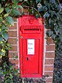
 Close up, George VI postbox, Yoxford - geograph.org.uk - 5158409.jpg 1,500 × 2,049; 558 KB
-
 Cottage at Darsham - geograph.org.uk - 1977211.jpg 640 × 480; 66 KB
-

-
 Cottages in Yoxford - geograph.org.uk - 2604619.jpg 640 × 461; 165 KB
-
 Cottages on Main Road (A12), Yoxford - geograph.org.uk - 5158152.jpg 640 × 426; 55 KB
-
 Cricket Training Net Supports - geograph.org.uk - 2299421.jpg 3,072 × 2,304; 1.59 MB
-
 Crossing Point - geograph.org.uk - 4589465.jpg 1,024 × 768; 172 KB
-
 Cullicott Close, Yoxford - geograph.org.uk - 2018683.jpg 3,072 × 2,304; 1.28 MB
-
 Cut Mark Yoxford No 3 Suffolk House Archway - geograph.org.uk - 5561155.jpg 3,457 × 3,361; 3.49 MB
-
 Drum House, Yoxford - geograph.org.uk - 1982455.jpg 640 × 480; 80 KB
-
 East Wood - geograph.org.uk - 2299296.jpg 3,072 × 2,304; 1.45 MB
-
 Entering Martin's Farm - geograph.org.uk - 4516288.jpg 1,024 × 768; 238 KB
-
 Entering Sibton on the A1120 Yoxford Road - geograph.org.uk - 5753903.jpg 4,608 × 3,072; 2.05 MB
-
 Entering Yoxford - geograph.org.uk - 5158154.jpg 640 × 480; 82 KB
-
 Entering Yoxford on the A12 Main Road - geograph.org.uk - 4281758.jpg 2,950 × 2,113; 2.51 MB
-
 Entering Yoxford on the A12 Main Road - geograph.org.uk - 4281761.jpg 2,841 × 2,134; 2.16 MB
-
 Entering Yoxford on the B1122 Middleton Road - geograph.org.uk - 4283511.jpg 2,872 × 2,158; 2.23 MB
-

-
 Entrance to Martin's Farm - geograph.org.uk - 2197435.jpg 700 × 525; 136 KB
-
 Entrance to Park Cottage - geograph.org.uk - 3450392.jpg 1,536 × 2,048; 678 KB
-
 Entrance to Yoxford Antiques Centre ^ Flying Goose Cafe - geograph.org.uk - 4283610.jpg 3,011 × 2,262; 2.66 MB
-
 Farm buildings at Brick Kiln Farm - geograph.org.uk - 6418783.jpg 800 × 533; 136 KB
-
 Farm track near Rookery Farm - geograph.org.uk - 5158147.jpg 640 × 480; 65 KB
-
 Farm track off B1122 Middleton Road - geograph.org.uk - 2018970.jpg 3,072 × 2,304; 1.32 MB
-
 Farm track off the A12 Main Road - geograph.org.uk - 2018621.jpg 3,072 × 2,304; 1.31 MB
-
 Farmland near Cockfield Hall - geograph.org.uk - 5158172.jpg 640 × 480; 105 KB
-
 Farmland off Sibton Road - geograph.org.uk - 5614276.jpg 4,608 × 3,072; 1.95 MB
-
 Farmland off Weavers Marsh Lane - geograph.org.uk - 5614312.jpg 4,608 × 3,072; 1.8 MB
-
 Farmland, Yoxford - geograph.org.uk - 5158158.jpg 640 × 480; 69 KB
-
 Field off Main Road (A12) - geograph.org.uk - 5157913.jpg 640 × 480; 68 KB
-
 Fields next to the A12 Main Road - geograph.org.uk - 2018665.jpg 3,072 × 2,304; 1.27 MB
-
 Fields off the A12 Main Road - geograph.org.uk - 3376244.jpg 3,072 × 2,304; 1.29 MB
-
 Fields off the A12 Main Road - geograph.org.uk - 3376290.jpg 3,072 × 2,304; 1.23 MB
-
 Fields off the entrance to Park Cottage - geograph.org.uk - 3450383.jpg 1,536 × 2,048; 507 KB
-
 Fields off the entrance to Park Cottage - geograph.org.uk - 3450386.jpg 1,536 × 2,048; 479 KB
-
 Flying Goose Cafe sign - geograph.org.uk - 4283564.jpg 3,072 × 2,304; 1.82 MB
-
 Follow The Yellow Path - geograph.org.uk - 4516292.jpg 768 × 1,024; 324 KB
-
 Footbridge on footpath to the A1120 Yoxford Road - geograph.org.uk - 2299236.jpg 2,304 × 3,072; 1.56 MB
-
 Footbridge on the footpath to Martin's Farm - geograph.org.uk - 2301488.jpg 2,304 × 3,072; 1.61 MB
-

-
 Footpath Off Willow Marsh Lane - geograph.org.uk - 4516307.jpg 1,024 × 768; 308 KB
-
 Footpath Sign And Bridge - geograph.org.uk - 4383791.jpg 1,024 × 768; 261 KB
-
 Footpath Sign And Dog Waste Bin - geograph.org.uk - 4383771.jpg 1,024 × 768; 231 KB
-
 Footpath Through Field - geograph.org.uk - 4516263.jpg 1,024 × 768; 345 KB
-
 Footpath to A1120 Yoxford Road ^ Green Road - geograph.org.uk - 2299254.jpg 3,072 × 2,304; 1.69 MB
-
 Footpath to Bunkers Hill Farm - geograph.org.uk - 2298639.jpg 3,072 × 2,304; 1.66 MB
-
 Footpath to Bunkers Hill Farm - geograph.org.uk - 2298641.jpg 3,072 × 2,304; 1.69 MB
-
 Footpath to Bunkers Hill Farm - geograph.org.uk - 2298643.jpg 3,072 × 2,304; 1.65 MB
-
 Footpath to Littlemoor Road ^ North Green - geograph.org.uk - 2298201.jpg 3,072 × 2,304; 1.52 MB
-
 Footpath to Martin's Farm - geograph.org.uk - 2301485.jpg 2,304 × 3,072; 1.45 MB
-
 Footpath to Martins Farm - geograph.org.uk - 2301562.jpg 3,072 × 2,304; 1.67 MB
-
 Footpath to Martins Farm - geograph.org.uk - 2301566.jpg 3,072 × 2,304; 1.67 MB
-
 Footpath to Martins Farm - geograph.org.uk - 2301587.jpg 3,072 × 2,304; 1.37 MB
-
 Footpath to Martins Farm - geograph.org.uk - 2301742.jpg 3,072 × 2,304; 1.67 MB
-
 Footpath to Oak Tree Farm ^ A1120 Yoxford Road - geograph.org.uk - 2299199.jpg 3,072 × 2,304; 1.61 MB
-
 Footpath to Oak Tree Farm ^ A1120 Yoxford Road - geograph.org.uk - 2299218.jpg 3,072 × 2,304; 1.48 MB
-
 Footpath to Oak Tree Farm ^ Stickland Manor Hill - geograph.org.uk - 2300243.jpg 3,072 × 2,304; 1.38 MB
-
 Footpath to Oak Tree Farm ^ Stickland Manor Hill - geograph.org.uk - 2300259.jpg 2,640 × 1,980; 1.78 MB
-
 Footpath to Old High Road - geograph.org.uk - 2299424.jpg 2,304 × 3,072; 1.55 MB
-
 Footpath to Park Cottage ^ A1120 Yoxford Road - geograph.org.uk - 2299212.jpg 3,072 × 2,304; 1.5 MB
-
 Footpath to Park Cottage ^ A1120 Yoxford Road - geograph.org.uk - 2299234.jpg 2,304 × 3,072; 1.45 MB
-
 Footpath to Sibton Road near Danbrook Bridge - geograph.org.uk - 2298717.jpg 3,072 × 2,304; 1.44 MB
-
 Footpath to South Manor Farm - geograph.org.uk - 2298427.jpg 3,072 × 2,304; 1.63 MB
-
 Footpath to South Manor Farm - geograph.org.uk - 2298430.jpg 3,072 × 2,304; 1.6 MB
-
 Footpath to Stickland Manor Hill ^ A12 Main Road - geograph.org.uk - 2299340.jpg 2,304 × 3,072; 1.65 MB
-
 Footpath to Stickland Manor Hill ^ A12 Main Road - geograph.org.uk - 2299355.jpg 2,304 × 3,072; 1.62 MB
-
 Footpath to Strickand Manor Hill ^ entrance to Park Cottage - geograph.org.uk - 2136245.jpg 3,072 × 2,304; 1.52 MB
-
 Footpath to Strickland Manor Hill - geograph.org.uk - 2299443.jpg 2,304 × 3,072; 1.34 MB
-
 Footpath to Strickland Manor Hill - geograph.org.uk - 2300274.jpg 1,980 × 2,640; 1.36 MB
-
 Footpath to Strickland Manor Hill - geograph.org.uk - 3450004.jpg 1,536 × 2,048; 534 KB
-
 Footpath to Strickland Manor Hill - geograph.org.uk - 3735775.jpg 3,072 × 2,304; 1.76 MB
-

-
 Footpath to the A1120 High Street - geograph.org.uk - 2301583.jpg 2,304 × 3,072; 1.64 MB
-

-

-
 Footpath to the A1120 Yoxford Road - geograph.org.uk - 2299228.jpg 3,072 × 2,304; 1.59 MB
-

-

-

-

-

-
 Footpath to the A12 Main Road ^ Old High Road - geograph.org.uk - 2299284.jpg 3,072 × 2,304; 1.51 MB
-
 Footpath to the A12 Main Road ^ Old High Road - geograph.org.uk - 2299285.jpg 3,072 × 2,304; 1.5 MB
-
 Footpath to The Lane, Yoxford - geograph.org.uk - 2298662.jpg 3,072 × 2,304; 1.5 MB
-
 Footpath to The Lane, Yoxford - geograph.org.uk - 2298665.jpg 3,072 × 2,304; 1.63 MB
-
 Footpath to Woodhill Farm ^ entrance to Hall Farm - geograph.org.uk - 2301627.jpg 3,072 × 2,304; 1.55 MB
-
 Footpath to Woodhill Farm ^ entrance to Hall Farm - geograph.org.uk - 2301630.jpg 3,072 × 2,304; 1.61 MB
-
 Footpath to Woodhill Farm ^ Entrance to Hall Farm - geograph.org.uk - 2301635.jpg 3,072 × 2,304; 1.54 MB
-
 Footpath to Woodhill Farm ^ Yoxford Cemetery - geograph.org.uk - 2298634.jpg 3,072 × 2,304; 1.29 MB
-
 Footpath ^ entrance of Park Cottage - geograph.org.uk - 3735780.jpg 3,072 × 2,304; 1.83 MB
-
 Former part of Middleton Road and junction with the A12 - geograph.org.uk - 1202837.jpg 3,072 × 2,304; 1.63 MB
-
 Gables, Cockfield Hall, Yoxford - geograph.org.uk - 2895766.jpg 1,024 × 705; 147 KB
-
 Gated Entrance to Public Footpath - geograph.org.uk - 1247722.jpg 640 × 480; 129 KB
-
 Gatehouse to Cockfield Hall - 2301572.jpg 3,072 × 2,304; 1.52 MB
-
 Gatehouse, Yoxford High Street - geograph.org.uk - 1107202.jpg 640 × 368; 110 KB
-
 Gates of Mulberry Park - geograph.org.uk - 4281231.jpg 2,304 × 3,072; 1.87 MB
-
 George V Postbox, Yoxford PO - geograph.org.uk - 1405236.jpg 2,304 × 3,072; 1.71 MB
-
 George V Postbox, Yoxford PO - geograph.org.uk - 1405239.jpg 2,304 × 3,072; 1.59 MB
-
 George VI postbox and phonebox, Yoxford - geograph.org.uk - 5158405.jpg 3,648 × 2,736; 2.28 MB
-
 George VI Postbox Bank Corner Yoxford - geograph.org.uk - 1448059.jpg 2,304 × 3,072; 2.09 MB
-
 Grove Farm - geograph.org.uk - 4383758.jpg 1,024 × 768; 243 KB
-
 Hair Salon and Antiques shop, Yoxford - geograph.org.uk - 2604622.jpg 640 × 480; 187 KB
-
 High Street Yoxford - geograph.org.uk - 6222349.jpg 1,886 × 1,228; 1.05 MB
-
 High Street Yoxford - geograph.org.uk - 6354527.jpg 1,824 × 1,114; 1 MB
-
 High Street, Yoxford (2) - geograph.org.uk - 2896905.jpg 1,600 × 1,030; 423 KB
-
 High Street, Yoxford - geograph.org.uk - 2281657.jpg 640 × 480; 68 KB
-
 High Street, Yoxford - geograph.org.uk - 2896904.jpg 1,600 × 937; 290 KB
-
 High Street, Yoxford - geograph.org.uk - 4667763.jpg 1,600 × 1,064; 324 KB
-
 Hog Hill Lane, Yoxford - geograph.org.uk - 2299299.jpg 3,072 × 2,304; 1.31 MB
-
 Hollytree Farm from across the field - geograph.org.uk - 2197398.jpg 700 × 525; 169 KB
-
 Hope House, Yoxford (geograph 6960069).jpg 4,032 × 3,024; 3.04 MB
-
 Horner's shop, Yoxfield - geograph.org.uk - 2604636.jpg 640 × 480; 72 KB
-
 Horners Store, Yoxford - geograph.org.uk - 2896901.jpg 1,024 × 911; 212 KB
-
 Horners Village Shop - geograph.org.uk - 1081634.jpg 3,072 × 2,304; 1.42 MB
-
 Horners Village Shop - geograph.org.uk - 1081638.jpg 3,072 × 2,304; 1.38 MB
-

-
 Layby on the A12 Main Road - geograph.org.uk - 3376246.jpg 3,072 × 2,304; 1.52 MB
-
 Level Crossing - geograph.org.uk - 4589552.jpg 1,024 × 768; 256 KB
-
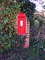
 Little Street Victorian Postbox - geograph.org.uk - 2298727.jpg 2,640 × 1,980; 1.26 MB
-
 Little Street Victorian Postbox - geograph.org.uk - 2298728.jpg 1,980 × 2,640; 1.82 MB
-
 Little Street Victorian Postbox - geograph.org.uk - 2298729.jpg 2,640 × 1,980; 1.88 MB
-
 Little Street Victorian Postbox - geograph.org.uk - 2300204.jpg 2,304 × 3,072; 1.55 MB
-

-
 Looking South - geograph.org.uk - 4589467.jpg 1,024 × 768; 338 KB
-
 Looking towards Deadman's Corner - geograph.org.uk - 3735784.jpg 3,072 × 2,304; 1.86 MB
-
 Looking West - geograph.org.uk - 4383762.jpg 1,024 × 768; 317 KB
-

-
 Love Lane footpath to North Green - geograph.org.uk - 2301529.jpg 3,072 × 2,304; 1.69 MB
-
 Loves Lane footpath to North Green - geograph.org.uk - 2301531.jpg 2,304 × 3,072; 1.65 MB
-
 Main Road (A12) - geograph.org.uk - 5158150.jpg 640 × 480; 71 KB
-
 Main Road, Darsham - geograph.org.uk - 5378418.jpg 2,304 × 1,728; 809 KB
-
 Manor House or supermarket^ - geograph.org.uk - 1107200.jpg 640 × 366; 79 KB
-
 Map of Yoxford - geograph.org.uk - 2301740.jpg 2,304 × 3,072; 1.39 MB
-
 Memorial cemetery gates at Yoxford - geograph.org.uk - 4371134.jpg 1,024 × 768; 508 KB
-
 Middleton Crossing - geograph.org.uk - 178254.jpg 640 × 480; 83 KB
-
 Middleton Crossing - geograph.org.uk - 233390.jpg 1,600 × 1,200; 404 KB
-
 Middleton level crossing equipment room - geograph.org.uk - 4283497.jpg 2,304 × 3,072; 1.96 MB
-
 Middleton Road (B1122) - geograph.org.uk - 4786508.jpg 640 × 435; 61 KB
-

-
 Minor Road - geograph.org.uk - 4383784.jpg 1,024 × 768; 239 KB
-
 Minsmere River - geograph.org.uk - 3376225.jpg 2,304 × 3,072; 1.46 MB
-
 Minsmere River - geograph.org.uk - 3376237.jpg 2,304 × 3,072; 1.66 MB
-
 Mulberry Park, Yoxford - geograph.org.uk - 4281228.jpg 3,072 × 2,304; 6.58 MB
-
 Next To Yoxford Wood - geograph.org.uk - 4516286.jpg 1,024 × 768; 239 KB
-
 Old High Road, Yoxford - geograph.org.uk - 2299431.jpg 3,072 × 2,304; 1.48 MB
-
 Old roadsign at Yoxford - geograph.org.uk - 2299446.jpg 2,304 × 3,072; 1.59 MB
-
 Ornate Ironwork on footbridge - geograph.org.uk - 2301599.jpg 3,072 × 2,304; 1.68 MB
-
 Parking on the drive by High Street Yoxford - geograph.org.uk - 6238948.jpg 1,896 × 1,244; 1.62 MB
-
 Plaque on the cemetery gates at Yoxford - geograph.org.uk - 4371137.jpg 1,024 × 768; 479 KB
-
 Plum Bush off the A12 Main Road - geograph.org.uk - 4606371.jpg 3,072 × 2,304; 2.05 MB
-
 Plum Bush off the A12 Main Road - geograph.org.uk - 4606376.jpg 2,304 × 3,072; 3.42 MB
-
 Plum Fruit off the A12 Main Road - geograph.org.uk - 4606383.jpg 2,304 × 3,072; 2.27 MB
-
 Plum Fruit off the A12 Main Road - geograph.org.uk - 4606392.jpg 2,304 × 3,072; 2.08 MB
-
 Rail tracks as seen from Middleton Crossing - geograph.org.uk - 3330152.jpg 3,264 × 2,448; 1.84 MB
-
 River Yox - geograph.org.uk - 2301611.jpg 2,304 × 3,072; 1.68 MB
-
 River Yox - geograph.org.uk - 2301613.jpg 2,304 × 3,072; 1.5 MB
-
 Road Junction - geograph.org.uk - 4383778.jpg 1,024 × 768; 303 KB
-
 Roadsign on the A1120 Yoxford Road - geograph.org.uk - 4283539.jpg 2,304 × 3,072; 1.95 MB
-
 Roadsign on the A12 Main Road - geograph.org.uk - 3376221.jpg 3,029 × 2,276; 1.98 MB
-
 Roadsigns on the A12 Brook Street - geograph.org.uk - 4863746.jpg 2,304 × 3,072; 3.52 MB
-
 Roadsigns on the A12 Brook Street - geograph.org.uk - 4863754.jpg 3,007 × 2,253; 3.63 MB
-
 Roadsigns on the A12 Main Road - geograph.org.uk - 3376280.jpg 2,304 × 3,072; 1.57 MB
-
 Roadsigns on the A12 Station Road - geograph.org.uk - 5853947.jpg 2,618 × 3,942; 5.06 MB
-
 Roadsigns on Westleton Road - geograph.org.uk - 5852878.jpg 4,608 × 3,072; 1.84 MB
-
 Satis House sign - geograph.org.uk - 3376262.jpg 2,304 × 3,072; 1.44 MB


,_Yoxford_-_geograph.org.uk_-_5158152.jpg)


_-_geograph.org.uk_-_5157913.jpg)


_-_geograph.org.uk_-_2896905.jpg)


.jpg)


,_Yoxford_-_geograph.org.uk_-_5158165.jpg)


_-_geograph.org.uk_-_5158150.jpg)


_-_geograph.org.uk_-_4786508.jpg)


