Category:Wood Walton
Jump to navigation
Jump to search
village in Cambridgeshire, United Kingdom  | |||||
| Upload media | |||||
| Instance of | |||||
|---|---|---|---|---|---|
| Location | Huntingdonshire, Cambridgeshire, East of England, England | ||||
 | |||||
English: Wood Walton – in Huntingdonshire (now part of Cambridgeshire), England – is a village near Abbots Ripton south west of Ramsey.
Subcategories
This category has the following 3 subcategories, out of 3 total.
Media in category "Wood Walton"
The following 200 files are in this category, out of 243 total.
(previous page) (next page)-
 "... and the barman says 'Why the long face^'" - geograph.org.uk - 2654414.jpg 1,024 × 768; 312 KB
-
 "Hurry up, it's my turn" - geograph.org.uk - 2654382.jpg 1,024 × 768; 330 KB
-
 A distant Woodwalton Hill - geograph.org.uk - 1705156.jpg 3,648 × 2,736; 2.1 MB
-
 A large pond with reeds near Higney wood - geograph.org.uk - 1706872.jpg 3,648 × 2,736; 2.1 MB
-
 A rare hedge - geograph.org.uk - 389696.jpg 640 × 480; 72 KB
-
 A view towards Poles bridge - geograph.org.uk - 1706781.jpg 3,648 × 2,736; 2.13 MB
-
 Across fields to Wood Walton Church - geograph.org.uk - 3911870.jpg 1,200 × 911; 1.41 MB
-
 Across the fields to the old school house - geograph.org.uk - 1705205.jpg 3,648 × 2,736; 2.08 MB
-
 Agreserves - Manor Farm near Wood Walton - geograph.org.uk - 1243428.jpg 640 × 480; 106 KB
-
 An old fire appliance at Higney Grange - geograph.org.uk - 1706877.jpg 3,648 × 2,736; 2.12 MB
-
 B1090 beside Monk's Wood - geograph.org.uk - 2999720.jpg 640 × 480; 56 KB
-
 B1090 past Monk's Wood - geograph.org.uk - 391105.jpg 640 × 480; 136 KB
-
 B1090 south towards Walton Hill - geograph.org.uk - 391098.jpg 640 × 480; 55 KB
-
 B1090 towards Abbots Ripton - geograph.org.uk - 2999705.jpg 640 × 480; 47 KB
-
 Bank and reeds - Great Raveley Drain - geograph.org.uk - 3582593.jpg 4,320 × 3,240; 6.03 MB
-
 Barn Owl at Middle Farm - geograph.org.uk - 3384793.jpg 1,600 × 1,140; 428 KB
-
 Base of the old windmill by Monks Lode - geograph.org.uk - 1706903.jpg 3,648 × 2,736; 2.23 MB
-
 Beville, Wood Walton - geograph.org.uk - 5858509.jpg 1,600 × 1,200; 363 KB
-
 Big Holt spinney - geograph.org.uk - 1707616.jpg 3,648 × 2,736; 2.16 MB
-
 Bog Oak - geograph.org.uk - 1707007.jpg 3,648 × 2,736; 2.1 MB
-
 Bouncy footpath bridge - geograph.org.uk - 1705116.jpg 3,648 × 2,736; 2.16 MB
-
 Brick Mere - geograph.org.uk - 4057490.jpg 1,600 × 1,067; 721 KB
-
 Bridge over the Great Raveley Drain - geograph.org.uk - 2654449.jpg 1,024 × 768; 255 KB
-
 Bridge Street towards Woodwalton - geograph.org.uk - 2999717.jpg 640 × 480; 44 KB
-
 Bridge to Higney Grange - geograph.org.uk - 3697332.jpg 4,320 × 3,240; 5.64 MB
-
 Bridleway to Raveley Road - geograph.org.uk - 5858535.jpg 1,600 × 1,279; 571 KB
-
 Bridleway towards Little Raveley - geograph.org.uk - 4122610.jpg 640 × 480; 117 KB
-
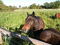
 Can I be bothered to charge^ - geograph.org.uk - 2655126.jpg 1,024 × 768; 297 KB
-
 Church access track - geograph.org.uk - 1705265.jpg 3,648 × 2,736; 2.17 MB
-
 Church End near Wood Walton - geograph.org.uk - 3472357.jpg 4,320 × 3,240; 5.68 MB
-
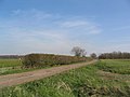
 Crop field off Raveley Road - geograph.org.uk - 4122603.jpg 640 × 480; 71 KB
-
 Cross on The Green in Wood Walton - geograph.org.uk - 3472233.jpg 4,320 × 3,240; 5.66 MB
-
 Cross on The Green, Wood Walton - geograph.org.uk - 4122538.jpg 640 × 480; 77 KB
-
 Cut area, Woodwalton Fen - geograph.org.uk - 4361129.jpg 1,600 × 1,200; 674 KB
-
 Digger working on a fenland drain - geograph.org.uk - 2513185.jpg 1,024 × 768; 110 KB
-
 Ditch alongside Double Bank Lane - geograph.org.uk - 3096748.jpg 4,000 × 3,000; 4.02 MB
-
 Ditch alongside Double Bank Lane - geograph.org.uk - 3096762.jpg 4,000 × 3,000; 4.36 MB
-
 Ditch in Woodwalton Fen - geograph.org.uk - 3384664.jpg 1,600 × 1,067; 934 KB
-
 Ditch in Woodwalton Fen - geograph.org.uk - 3384727.jpg 1,600 × 1,067; 1.03 MB
-
 Ditch in Woodwalton Fen - geograph.org.uk - 4361012.jpg 1,600 × 1,200; 712 KB
-
 Ditch in Woodwalton Fen - geograph.org.uk - 5861307.jpg 1,600 × 1,200; 523 KB
-
 Ditch on Middle Farm - geograph.org.uk - 3384788.jpg 1,600 × 1,067; 709 KB
-
 Ditch to Speed The Plough Farm - geograph.org.uk - 4057492.jpg 1,600 × 1,067; 742 KB
-
 Ditch towards Darlows Farm - geograph.org.uk - 4057517.jpg 1,600 × 1,067; 707 KB
-
 Ditch towards Woodwalton Fen - geograph.org.uk - 5858446.jpg 1,600 × 1,200; 592 KB
-
 Double Bank Lane - geograph.org.uk - 1705166.jpg 3,648 × 2,736; 2.16 MB
-
 Double Bank Lane - geograph.org.uk - 3000096.jpg 640 × 480; 45 KB
-
 Double Bank Lane - geograph.org.uk - 3697143.jpg 4,320 × 3,240; 5.54 MB
-
 Drain from Finlay's Bridge - geograph.org.uk - 5858561.jpg 1,600 × 1,200; 501 KB
-
 Dwellings at Moat Farm - geograph.org.uk - 5858462.jpg 1,600 × 1,200; 341 KB
-
 Edge of the Great Fen - geograph.org.uk - 3384760.jpg 1,600 × 1,067; 714 KB
-

-
 Entering Wood Walton - geograph.org.uk - 391074.jpg 640 × 480; 62 KB
-
 Entrance to Five Arches Pit Nature Reserve - geograph.org.uk - 3697518.jpg 4,320 × 3,240; 5.99 MB
-
 Farm track near Monk's Wood - geograph.org.uk - 2999719.jpg 640 × 480; 86 KB
-
 Farm track, Walton Hill - geograph.org.uk - 2999462.jpg 640 × 480; 70 KB
-
 Farmland near Church End - geograph.org.uk - 2997985.jpg 800 × 521; 72 KB
-
 Farmland near Church End - geograph.org.uk - 4203599.jpg 640 × 268; 25 KB
-
 Farmland off the B1090 - geograph.org.uk - 2999737.jpg 640 × 480; 53 KB
-

-
 Farmland, Walton Hill - geograph.org.uk - 2999534.jpg 640 × 480; 48 KB
-
 Farmland, Walton Hill - geograph.org.uk - 2999699.jpg 640 × 480; 54 KB
-
 Fen drain embankment - geograph.org.uk - 1243416.jpg 640 × 480; 85 KB
-
 Field near Keeler Farm - geograph.org.uk - 4122615.jpg 640 × 480; 52 KB
-
 Fields, a winding lane and the East Coast Main Line - geograph.org.uk - 3911854.jpg 1,200 × 877; 1.13 MB
-
 Five Arch Bridge at Church End, Wood Walton - geograph.org.uk - 3699458.jpg 4,320 × 3,240; 5.82 MB
-
 Five Arch Bridge, Church End, Wood Walton - geograph.org.uk - 3699438.jpg 4,320 × 3,240; 5.58 MB
-
 Five Arches Bridge - geograph.org.uk - 1240280.jpg 640 × 480; 125 KB
-
 Five arches bridge looking west - geograph.org.uk - 1240338.jpg 640 × 480; 93 KB
-
 Five Arches Pit walk - geograph.org.uk - 1243403.jpg 640 × 480; 149 KB
-
 Flat farmland - geograph.org.uk - 4203597.jpg 640 × 335; 33 KB
-
 Flush Bracket Bench Mark, Wood Walton - geograph.org.uk - 1243479.jpg 640 × 480; 147 KB
-
 Footpath along a track to Hill Farm - geograph.org.uk - 3472229.jpg 4,320 × 3,240; 5.49 MB
-
 Footpath by Riddy Wood - geograph.org.uk - 5858527.jpg 1,600 × 1,200; 607 KB
-
 Footpath from Moat Farm - geograph.org.uk - 5858475.jpg 1,600 × 1,200; 495 KB
-
 Footpath from Riddy Wood - geograph.org.uk - 5858202.jpg 1,600 × 1,200; 586 KB
-
 Footpath from Riddy Wood - geograph.org.uk - 5858443.jpg 1,600 × 1,200; 509 KB
-
 Footpath from Riddy Wood - geograph.org.uk - 5858549.jpg 1,600 × 1,200; 575 KB
-
 Footpath from Wood Walton - geograph.org.uk - 5858520.jpg 1,600 × 1,200; 460 KB
-
 Footpath here somewhere - geograph.org.uk - 5858503.jpg 1,600 × 1,200; 634 KB
-
 Footpath stile - geograph.org.uk - 1705798.jpg 3,648 × 2,736; 2.19 MB
-
 Footpath to Moat Farm - geograph.org.uk - 5858449.jpg 1,600 × 1,200; 462 KB
-
 Footpath to Riddy Wood - geograph.org.uk - 5858522.jpg 1,600 × 1,200; 441 KB
-
 Footpath to Speechly's Farm - geograph.org.uk - 4057488.jpg 1,600 × 1,067; 490 KB
-
 Footpath to Wood Walton - geograph.org.uk - 5858498.jpg 1,600 × 1,200; 562 KB
-
 Footpath, stile and rabbit fencing - geograph.org.uk - 1706397.jpg 3,648 × 2,736; 2.22 MB
-
 Gathering in the straw - geograph.org.uk - 3096759.jpg 4,000 × 3,000; 3.92 MB
-
 Gathering in the straw - geograph.org.uk - 3096768.jpg 4,000 × 3,000; 4.17 MB
-
 Gordon's Mere - geograph.org.uk - 792946.jpg 640 × 480; 76 KB
-
 Gordon's Mere, Woodwalton Fen - geograph.org.uk - 3384708.jpg 1,600 × 1,067; 629 KB
-
 Gordon's Mere, Woodwalton Fen - geograph.org.uk - 3384712.jpg 1,600 × 1,067; 501 KB
-
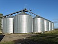 Grain Silos at Manor Farm - geograph.org.uk - 1706973.jpg 2,920 × 2,190; 2.54 MB
-
 Grazed area in Woodwalton Fen - geograph.org.uk - 5861297.jpg 1,600 × 1,200; 490 KB
-
 Great Fen Project - geograph.org.uk - 4057478.jpg 1,600 × 1,067; 725 KB
-
 Great Fen Project - geograph.org.uk - 4057480.jpg 1,600 × 1,067; 610 KB
-
 Great Fen Project - geograph.org.uk - 5861353.jpg 1,600 × 1,200; 383 KB
-
 Great Fen Project, Darlows Farm - geograph.org.uk - 4057483.jpg 1,600 × 1,067; 684 KB
-
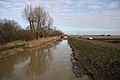 Great Raveley Drain - geograph.org.uk - 3384647.jpg 1,600 × 1,067; 540 KB
-
 Great Raveley Drain - geograph.org.uk - 4361108.jpg 1,600 × 1,200; 856 KB
-
 Great Raveley Drain - geograph.org.uk - 4361113.jpg 1,600 × 1,200; 444 KB
-
 Great Raveley Drain - geograph.org.uk - 5861290.jpg 1,600 × 1,200; 604 KB
-
 Great Raveley Drain and Woodwalton Fen - geograph.org.uk - 3582527.jpg 4,320 × 3,240; 6.17 MB
-
 Great Raveley Drain at Jackson's Bridge - geograph.org.uk - 3582409.jpg 4,320 × 3,240; 5.72 MB
-
 Green lane Bridge - geograph.org.uk - 1705175.jpg 3,648 × 2,736; 2.18 MB
-
 Green Lane Bridge near Wood Walton - geograph.org.uk - 3472345.jpg 4,320 × 3,240; 5.5 MB
-
 Green Lane north of Wood Walton - geograph.org.uk - 3472348.jpg 4,320 × 3,240; 5.99 MB
-
 Hazard by the church yard - geograph.org.uk - 1705370.jpg 3,648 × 2,736; 2.17 MB
-
 Higney Grange - geograph.org.uk - 2371589.jpg 640 × 471; 35 KB
-
 Higney Grange cottage - geograph.org.uk - 1706431.jpg 3,648 × 2,736; 2.07 MB
-
 Higney Grange Cottages, from the railway - geograph.org.uk - 4716717.jpg 1,600 × 630; 136 KB
-
 Higney Grange, from the railway - geograph.org.uk - 4576498.jpg 1,600 × 827; 166 KB
-
 Horses at Darlow's Farm - geograph.org.uk - 844769.jpg 640 × 457; 171 KB
-
 Jackson's Bridge and Great Raveley Drain - geograph.org.uk - 3582431.jpg 4,320 × 3,240; 5.91 MB
-
 Large pond near Big Holt spinney - geograph.org.uk - 1707612.jpg 3,648 × 2,736; 2.26 MB
-
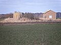
 Lodge Farm - geograph.org.uk - 4122625.jpg 640 × 392; 44 KB
-
 Looking across New Dyke towards Holme Fen - geograph.org.uk - 4057508.jpg 1,600 × 1,067; 494 KB
-
 Looking down Walton Hill - geograph.org.uk - 3096797.jpg 4,000 × 3,000; 4.08 MB
-
 Mature farm building - geograph.org.uk - 1706758.jpg 3,648 × 2,736; 2.11 MB
-
 Middle Farm, 2013 - geograph.org.uk - 3384744.jpg 1,600 × 1,067; 674 KB
-
 Middle Farm, Great Fen project - geograph.org.uk - 3384763.jpg 1,600 × 1,067; 729 KB
-
 Middle level Catchwater Drain - geograph.org.uk - 1707015.jpg 3,397 × 2,548; 3.4 MB
-
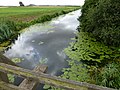
 Middle Level Catchwater Drain - geograph.org.uk - 389766.jpg 640 × 480; 63 KB
-
 Middle Level Catchwater Drain - geograph.org.uk - 5858197.jpg 1,600 × 1,200; 443 KB
-
 Middle Level Catchwater Drain - geograph.org.uk - 5858201.jpg 1,600 × 1,200; 506 KB
-
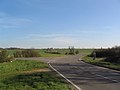
 Minor road west of Walton Hill junction - geograph.org.uk - 5589314.jpg 1,024 × 768; 100 KB
-
 Monks Lode near the Abbey Field - geograph.org.uk - 3697479.jpg 4,320 × 3,240; 5.73 MB
-
 Monks wood viewed from Walton hill - geograph.org.uk - 1430109.jpg 640 × 480; 98 KB
-
 Near Keeler Farm, Wood Walton - geograph.org.uk - 3472219.jpg 4,320 × 3,240; 5.75 MB
-
 Nest, near Wood Walton church - geograph.org.uk - 3618807.jpg 1,600 × 1,064; 444 KB
-
 New Dyke - geograph.org.uk - 4057499.jpg 1,600 × 1,067; 708 KB
-
 New Road - geograph.org.uk - 4122540.jpg 640 × 480; 86 KB
-
 North Hide, Woodwalton Fen - geograph.org.uk - 4361122.jpg 1,600 × 1,200; 964 KB
-
 Oak trees beside New road - geograph.org.uk - 1705191.jpg 3,648 × 2,736; 2.13 MB
-
 Oak trees in Autumn - geograph.org.uk - 3697306.jpg 4,320 × 3,240; 5.34 MB
-
 Old gate leading into West Wood - geograph.org.uk - 3096777.jpg 4,000 × 3,000; 4.25 MB
-
 Open area, Woodwalton Fen - geograph.org.uk - 3384720.jpg 1,600 × 1,067; 723 KB
-
 Ordnance Survey Cut Mark - geograph.org.uk - 4139534.jpg 2,560 × 1,536; 1.64 MB
-
 Ordnance Survey Flush Bracket S9285 - geograph.org.uk - 4139508.jpg 1,536 × 2,560; 1.78 MB
-
 Path in Woodwalton Fen - geograph.org.uk - 3384676.jpg 1,600 × 1,067; 693 KB
-
 Path in Woodwalton Fen - geograph.org.uk - 3384684.jpg 1,600 × 1,067; 752 KB
-
 Path in Woodwalton Fen - geograph.org.uk - 4361125.jpg 1,600 × 1,200; 1.3 MB
-
 Path in Woodwalton Fen - geograph.org.uk - 5860481.jpg 1,600 × 1,200; 541 KB
-
 Path in Woodwalton Fen - geograph.org.uk - 5861326.jpg 1,600 × 1,200; 500 KB
-
 Path in Woodwalton Fen - geograph.org.uk - 5861338.jpg 1,166 × 1,600; 583 KB
-
 Path to Charterhouse Farm - geograph.org.uk - 4057521.jpg 1,600 × 1,067; 432 KB
-
 Path to Darlow's Farm - geograph.org.uk - 3384783.jpg 1,600 × 1,067; 639 KB
-
 Path to Darlow's Farm - geograph.org.uk - 3384790.jpg 1,600 × 1,067; 638 KB
-
 Permissive path across Woodwalton Fen - geograph.org.uk - 4057551.jpg 1,600 × 1,067; 741 KB
-
 Pond in Woodwalton Fen - geograph.org.uk - 5861313.jpg 1,600 × 1,200; 634 KB
-
 Possibly the lowest highland cattle in Britain - geograph.org.uk - 2655122.jpg 1,024 × 768; 355 KB
-
 Quiet place, lets dump some rubbish - geograph.org.uk - 1240223.jpg 640 × 480; 117 KB
-
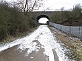
 Railway arch in Wood Walton - geograph.org.uk - 3472243.jpg 4,320 × 3,240; 5.63 MB
-
 Railway bridge - geograph.org.uk - 1243465.jpg 640 × 480; 95 KB
-

-

-
 Raveley Road - geograph.org.uk - 4122605.jpg 640 × 480; 69 KB
-
 Raveley Road - geograph.org.uk - 4122613.jpg 640 × 480; 74 KB
-
 Raveley Road - geograph.org.uk - 4122622.jpg 640 × 480; 54 KB
-
 Raveley Road - geograph.org.uk - 5858536.jpg 1,600 × 1,200; 343 KB
-
 Raveley Road entering Wood Walton - geograph.org.uk - 5858505.jpg 1,600 × 1,262; 387 KB
-
 Red House Farm - geograph.org.uk - 2933302.jpg 1,600 × 1,023; 209 KB
-
 Reedbed at Woodwalton Fen - geograph.org.uk - 4057562.jpg 1,600 × 1,067; 637 KB
-
 Reeds at the Five Arches nature reserve - geograph.org.uk - 1706404.jpg 3,648 × 2,736; 2.19 MB
-
 Reservoir near Five Arch Bridge - Church End - geograph.org.uk - 3697464.jpg 4,320 × 3,240; 6.1 MB
-
 Riddy lane towards Riddy wood - geograph.org.uk - 1243451.jpg 640 × 480; 96 KB
-
 Rothschild Bungalow, Woodwalton Fen - geograph.org.uk - 3384671.jpg 1,600 × 1,067; 1.15 MB
-
 Rothschild Way, Woodwalton Fen - geograph.org.uk - 5860477.jpg 1,600 × 1,200; 561 KB
-
 Rothschild's Mere, Woodwalton Fen - geograph.org.uk - 3384704.jpg 1,600 × 1,067; 598 KB
-
 Sheep at Middle Farm - geograph.org.uk - 3384780.jpg 1,600 × 1,067; 737 KB
-
 Sheep on Woodwalton Fen - geograph.org.uk - 4057542.jpg 1,600 × 1,067; 657 KB
-
 Sluice gates - geograph.org.uk - 1707663.jpg 3,648 × 2,736; 2.2 MB
-

-
 Speechly's Farm Pumping Station - geograph.org.uk - 4057502.jpg 1,600 × 1,049; 707 KB
-
 St Andrew's Church at Wood Walton - geograph.org.uk - 3472351.jpg 4,320 × 3,240; 5.61 MB
-
 St Andrew's Church, Wood Walton - geograph.org.uk - 2371605.jpg 640 × 430; 29 KB
-
 St Andrew's Church, Wood Walton - geograph.org.uk - 2400689.jpg 911 × 807; 195 KB
-
 St Andrew's, Wood Walton - geograph.org.uk - 3405324.jpg 4,306 × 3,220; 2.47 MB
-
 St Andrew's, Wood Walton - geograph.org.uk - 3617384.jpg 1,600 × 1,064; 497 KB
-
 St Andrew's, Wood Walton - geograph.org.uk - 3617387.jpg 1,600 × 1,064; 548 KB
-
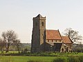 St. Andrew's Church, Wood Walton - geograph.org.uk - 2354495.jpg 550 × 412; 63 KB
-

-
 Substation, Wood Walton - geograph.org.uk - 5858516.jpg 1,600 × 1,200; 386 KB
-
 Telecom mast and fly tipped material - geograph.org.uk - 1240192.jpg 480 × 640; 82 KB
-
 The bank of Great Raveley Drain - geograph.org.uk - 3582586.jpg 4,320 × 3,240; 6.01 MB
-
 The eastern aspect of Green Lane bridge - geograph.org.uk - 1705182.jpg 3,648 × 2,736; 2.26 MB
-
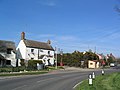 The Elephant and Castle, Wood Walton - geograph.org.uk - 391068.jpg 640 × 480; 66 KB
-
 The Elephant and Castle, Wood Walton - geograph.org.uk - 4122541.jpg 640 × 480; 62 KB
-
 The north eastern corner of Woodwalton Fen - geograph.org.uk - 3582534.jpg 4,320 × 3,240; 5.92 MB
-
 The view from the top of Walton Hill - geograph.org.uk - 3096802.jpg 4,000 × 3,000; 3.77 MB
-
 The view from Walton Hill - geograph.org.uk - 3096807.jpg 4,000 × 3,000; 4.45 MB
-
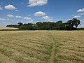
 Three oaks in an arable field - geograph.org.uk - 1705126.jpg 640 × 480; 94 KB
-
 Timber stack - geograph.org.uk - 1244484.jpg 640 × 480; 63 KB
-
 Track alongside West Wood - geograph.org.uk - 3096782.jpg 4,000 × 3,000; 4.34 MB
-
 Track to Castlehill Farm - geograph.org.uk - 1707032.jpg 3,648 × 2,736; 2.14 MB
-
 Track to Higney Grange - geograph.org.uk - 1706440.jpg 3,648 × 2,736; 1.98 MB
-
 Track to Keeler Farm - geograph.org.uk - 4122619.jpg 640 × 480; 72 KB
-
 Track towards Monks Wood - geograph.org.uk - 3096788.jpg 4,000 × 3,000; 4.05 MB
-
 Truck mounted crane - geograph.org.uk - 1708304.jpg 3,648 × 2,736; 2.06 MB
-
 Twisting lane from Church End to Wood Walton village - geograph.org.uk - 3618803.jpg 1,600 × 1,064; 498 KB
-
 Two oak trees beside an arable field - geograph.org.uk - 1705140.jpg 3,648 × 2,736; 2.08 MB


