Category:Wisconsin in the 1850s
Jump to navigation
Jump to search
States of the United States: Alabama · Alaska · Arizona · Arkansas · California · Colorado · Connecticut · Delaware · Florida · Georgia · Hawaii · Illinois · Indiana · Iowa · Kansas · Kentucky · Louisiana · Maine · Maryland · Massachusetts · Michigan · Minnesota · Mississippi · Missouri · Montana · Nebraska · Nevada · New Hampshire · New Jersey · New Mexico · New York · North Carolina · North Dakota · Ohio · Oklahoma · Oregon · Pennsylvania · Rhode Island · South Carolina · South Dakota · Tennessee · Texas · Utah · Vermont · Virginia · Washington · West Virginia · Wisconsin · Wyoming – Washington, D.C.
Puerto Rico · United States Virgin Islands
Puerto Rico · United States Virgin Islands
Wikimedia category | |||||
| Upload media | |||||
| Instance of | |||||
|---|---|---|---|---|---|
| Category combines topics | |||||
| Follows | |||||
| Followed by | |||||
| Wisconsin | |||||
state of the United States of America      | |||||
| Pronunciation audio | |||||
| Instance of | |||||
| Part of | |||||
| Named after | |||||
| Location |
| ||||
| Located in or next to body of water | |||||
| Capital | |||||
| Legislative body | |||||
| Executive body | |||||
| Highest judicial authority | |||||
| Anthem |
| ||||
| Head of government |
| ||||
| Inception |
| ||||
| Highest point | |||||
| Population |
| ||||
| Area |
| ||||
| Elevation above sea level |
| ||||
| Maximum temperature record |
| ||||
| Minimum temperature record |
| ||||
| official website | |||||
 | |||||
Subcategories
This category has the following 12 subcategories, out of 12 total.
*
- 1850s maps of Wisconsin (16 F)
Media in category "Wisconsin in the 1850s"
The following 39 files are in this category, out of 39 total.
-

-
 1849 WI Cong 01.svg 245 × 262; 26 KB
-
 1849 WI Cong 02.svg 245 × 262; 26 KB
-
 1849 WI Cong 03.svg 245 × 262; 26 KB
-
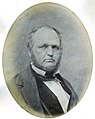 Byron Kilbourn photo.jpg 478 × 600; 40 KB
-
 Carl Schurz- 1900-04-01 Potter Correspondence.pdf 1,275 × 1,650, 7 pages; 700 KB
-
 John Penn Arndt.png 471 × 600; 255 KB
-
 Le Tour du monde-03-p268.jpg 832 × 630; 166 KB
-
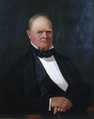
 Lewis Ludington.jpg 467 × 445; 18 KB
-
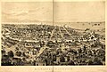
 Madison 1855.jpg 1,619 × 947; 335 KB
-
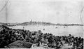
 Milwaukee 1858.jpg 12,496 × 8,432; 22.37 MB
-
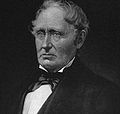
 Nelson Dewey c.1850s.png 500 × 600; 253 KB
-
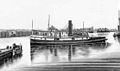 NiagaraSteamer.jpg 716 × 421; 24 KB
-
 Randall Wilcox.png 473 × 600; 318 KB
-

-
 Samuel Hale Jr.jpg 482 × 600; 20 KB
-
 WI Assembly 1858.svg 360 × 185; 6 KB
-
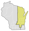
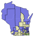
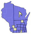
 WI Assembly Partisan Map 1850.svg 245 × 262; 55 KB
-
 WI Assembly Partisan Map 1851.svg 245 × 262; 55 KB
-
 WI Assembly Partisan Map 1852.svg 245 × 262; 56 KB
-
 WI Assembly Partisan Map 1853.svg 245 × 262; 62 KB
-
 WI Assembly Partisan Map 1854.svg 245 × 262; 63 KB
-
 WI Assembly Partisan Map 1855.svg 245 × 262; 62 KB
-
 WI Assembly Partisan Map 1856.svg 245 × 262; 62 KB
-
 WI Assembly Partisan Map 1857.svg 245 × 262; 67 KB
-
 WI Assembly Partisan Map 1858.svg 245 × 262; 68 KB
-
 WI Assembly Partisan Map 1859.svg 245 × 262; 68 KB
-
 WI Senate 1858.svg 360 × 185; 3 KB
-
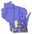
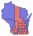
 WI Senate Partisan Map 1850.svg 245 × 262; 38 KB
-
 WI Senate Partisan Map 1851.svg 245 × 262; 39 KB
-
 WI Senate Partisan Map 1852.svg 245 × 262; 39 KB
-
 WI Senate Partisan Map 1853.svg 245 × 262; 41 KB
-
 WI Senate Partisan Map 1854.svg 245 × 262; 42 KB
-
 WI Senate Partisan Map 1855.svg 245 × 262; 41 KB
-
 WI Senate Partisan Map 1856.svg 245 × 262; 41 KB
-
 WI Senate Partisan Map 1857.svg 245 × 262; 41 KB
-
 WI Senate Partisan Map 1858.svg 245 × 262; 42 KB
-
 WI Senate Partisan Map 1859.svg 245 × 262; 42 KB
-
 Wisconsin State Capitol 1855.jpg 568 × 414; 191 KB


_(14565094197).jpg)


