Category:Wisbech
Jump to navigation
Jump to search
market town, inland port and civil parish in the Fens of Cambridgeshire, England  | |||||
| Upload media | |||||
| Instance of | |||||
|---|---|---|---|---|---|
| Location | Fenland, Cambridgeshire, East of England, England | ||||
| Population |
| ||||
| Area |
| ||||
 | |||||
Deutsch: Wisbech ist eine kleine Markt- und Hafenstadt in der englischen Grafschaft Cambridgeshire im Osten Mittelenglands (East Anglia), nahe der Küste der Meeresbucht The Wash. Sie zählt 21.010 Einwohner (Stand: 2006) und gehört zum Distrikt Fenland. Sie wird von dem Fluss Nene durchflossen, der durch die starken Gezeiten bedingt ausgeprägte Hoch- und Tiefwasser aufweist.
English: Wisbech (, second syllable as 'beach') is a market town and inland port with a population of about 20,000 in the Fenland area of Cambridgeshire. The tidal River Nene runs through the centre of the town and is spanned by two bridges. The name is believed to mean on the back of the (River) Ouse, with Ouse being a common Celtic word relating to 'water'.
Français : Wisbech est une commune de Grande-Bretagne, situé dans le comté du Cambridgeshire en Angleterre.
Polski: Wisbech - miasto w Wielkiej Brytanii, w Anglii, w regionie East of England, w hrabstwie Cambridgeshire. W 2001 roku miejscowość to zamieszkiwało 20 200 osób.
Română: Wisbech (pronunţat ) este un oraş în comitatul Cambridgeshire, regiunea East, Anglia. Oraşul se află în districtul Fenland.
Simple English: Wisbech is a town in Cambridgeshire, England, UK. It is not far from the border with Norfolk.
Subcategories
This category has the following 7 subcategories, out of 7 total.
Media in category "Wisbech"
The following 200 files are in this category, out of 1,121 total.
(previous page) (next page)-
 "NEW BELL INN" - Ghost sign in Hill Street, Wisbech - geograph.org.uk - 4749808.jpg 4,320 × 3,240; 5.3 MB
-

-

-
 1925 building with modern shop-fronts - geograph.org.uk - 3607639.jpg 2,504 × 1,822; 653 KB
-
 24-26 Old Market, Wisbech - geograph.org.uk - 5748271.jpg 4,871 × 3,248; 6.2 MB
-
 25 04 2020 Social distancing at the supermarket in Wisbech, Cambs, UK.jpg 2,922 × 1,857; 777 KB
-
 3 and 4 Nene Quay, Wisbech - geograph.org.uk - 5747279.jpg 5,184 × 3,456; 5.92 MB
-
 8 and 9 Old Market, Wisbech - geograph.org.uk - 5748214.jpg 3,456 × 5,184; 7.33 MB
-
 A 215-year-old wall - geograph.org.uk - 3610088.jpg 2,548 × 1,884; 1.53 MB
-
 A colourful corner of the Old Market, Wisbech - geograph.org.uk - 1984103.jpg 2,848 × 2,136; 2.96 MB
-
 A layer of mud on the port road in Wisbech - geograph.org.uk - 3773229.jpg 4,320 × 3,240; 5.32 MB
-
 A site that has seen better days. - geograph.org.uk - 5786810.jpg 3,024 × 4,032; 3.22 MB
-
 A view from the balcony at the rear of Wisbech Castle - geograph.org.uk - 5901426.jpg 3,005 × 4,032; 5.81 MB
-
 A willow tree on Panswell Lane - geograph.org.uk - 1538690.jpg 640 × 480; 80 KB
-
 A Wisbech window display - geograph.org.uk - 3714363.jpg 826 × 1,024; 1.21 MB
-
 A1101 Churchill Road looking north - geograph.org.uk - 3641612.jpg 640 × 481; 57 KB
-
 A1101 Leverington Road - geograph.org.uk - 3641678.jpg 640 × 481; 67 KB
-
 A1101 southbound - geograph.org.uk - 5586284.jpg 640 × 480; 54 KB
-
 A47 at Broad Drove - geograph.org.uk - 1818002.jpg 640 × 480; 78 KB
-
 A47 South Brink towards Wisbech - geograph.org.uk - 5679388.jpg 640 × 428; 114 KB
-
 A47 South Brink towards Wisbech - geograph.org.uk - 5679390.jpg 640 × 428; 95 KB
-
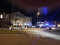
 Ambulance on the Wisbech by-pass (A47) - geograph.org.uk - 1984194.jpg 2,848 × 2,136; 2.98 MB
-
 An old barn with character - geograph.org.uk - 1538676.jpg 640 × 480; 72 KB
-
 Angel in the General Cemetery, Wisbech - geograph.org.uk - 5764524.jpg 2,702 × 3,913; 3.76 MB
-
 Angles Theatre Alexandra Road Wisbech - geograph.org.uk - 5746664.jpg 5,184 × 3,456; 6.74 MB
-

-
 Antiques sale at Clifford Cross Auction Hall, Wisbech - geograph.org.uk - 5450708.jpg 4,032 × 3,024; 2.59 MB
-
 Archway in Exchange Square - geograph.org.uk - 4988448.jpg 1,113 × 1,500; 207 KB
-
 Astral House and Bodgers, Lynn Road, Wisbech - geograph.org.uk - 4738380.jpg 4,320 × 3,240; 5.43 MB
-
 Astroturf pitches on The Peckover Estate in Wisbech - geograph.org.uk - 6026193.jpg 4,032 × 3,024; 3.78 MB
-
 At the start of the track - geograph.org.uk - 1537928.jpg 640 × 480; 100 KB
-

-
 Autumn in the park. - geograph.org.uk - 1025357.jpg 640 × 480; 72 KB
-
-
 Awdry House. - geograph.org.uk - 3442461.jpg 800 × 600; 105 KB
-
 B198 South Brink, Wisbech - geograph.org.uk - 5679399.jpg 640 × 428; 105 KB
-
 Baltika, parduotuvė Visbiče.JPG 3,264 × 2,448; 1.43 MB
-
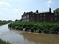
 Bank of The River Nene near Wisbech - geograph.org.uk - 1505221.jpg 640 × 480; 114 KB
-
 Banks, Corn Hill, Wisbech (geograph 6846311).jpg 1,024 × 768; 162 KB
-
 Barclays Bank, 12 Old Market, Wisbech - geograph.org.uk - 5747383.jpg 4,758 × 3,172; 5.37 MB
-
 Barton Road - geograph.org.uk - 1818013.jpg 640 × 480; 134 KB
-
 Barton Road at Mile Tree Lane - geograph.org.uk - 1817988.jpg 640 × 480; 229 KB
-
 Barton Road heading east - geograph.org.uk - 3983857.jpg 640 × 480; 119 KB
-
 Barton Road heading west - geograph.org.uk - 3984046.jpg 640 × 480; 74 KB
-
 Barton Road near Gadds Lane - geograph.org.uk - 1818010.jpg 640 × 480; 196 KB
-
 Bath Road, Wisbech - geograph.org.uk - 4103106.jpg 640 × 402; 54 KB
-
 Beach garden - Wisbech in Bloom 2018 - geograph.org.uk - 5832251.jpg 4,032 × 3,024; 4.5 MB
-
 Bedroom, Peckover House, Wisbech, Cambridgeshire - geograph.org.uk - 3721974.jpg 683 × 1,024; 677 KB
-
 Bedroom, Peckover House, Wisbech, Cambridgeshire - geograph.org.uk - 3721977.jpg 683 × 1,024; 564 KB
-
 Bend in the Nene - geograph.org.uk - 3019356.jpg 3,872 × 2,592; 3.42 MB
-
 Bevis Lane - geograph.org.uk - 1817946.jpg 640 × 480; 141 KB
-
 Bevis Lane - geograph.org.uk - 3984830.jpg 640 × 480; 71 KB
-
 Big CAT in The Fens - geograph.org.uk - 3157287.jpg 4,320 × 3,240; 5.62 MB
-
 Blackfriars Road, Wisbech - geograph.org.uk - 4109180.jpg 640 × 640; 111 KB
-
-
 Boathouse and Yacht Harbour in Wisbech - geograph.org.uk - 3773420.jpg 4,320 × 3,240; 5.52 MB
-
 Boathouse. - geograph.org.uk - 2617616.jpg 800 × 600; 119 KB
-
 Boats on the rising tide, Wisbech Yacht Harbour - geograph.org.uk - 3773394.jpg 4,320 × 3,240; 5.4 MB
-
 Boats on the River Nene in Wisbech - geograph.org.uk - 3773242.jpg 4,320 × 3,240; 5.45 MB
-
 Bodgers in Wisbech - geograph.org.uk - 4738404.jpg 4,320 × 3,240; 5.44 MB
-
 Boots at Wisbeach - panoramio.jpg 4,320 × 3,240; 2.7 MB
-
 Boundary Stone - geograph.org.uk - 3398530.jpg 800 × 700; 450 KB
-

-
 Bridge WIG 2319 - geograph.org.uk - 3378134.jpg 900 × 612; 225 KB
-
 Britannia Café, Wisbech - geograph.org.uk - 4109181.jpg 640 × 640; 124 KB
-
 Broad Drove - geograph.org.uk - 1817997.jpg 640 × 480; 246 KB
-
 Broad Drove Crossing - geograph.org.uk - 3504055.jpg 800 × 600; 160 KB
-
 Budgens on Freedom Bridge, Wisbech - geograph.org.uk - 3773358.jpg 4,320 × 3,240; 5.32 MB
-
 Building near hospital in Wisbech - geograph.org.uk - 4941045.jpg 4,320 × 3,240; 5.78 MB
-

-
 Bullard ^ Sons Ltd advert - Corn Exchange, Wisbech - geograph.org.uk - 4778695.jpg 3,240 × 4,320; 4.93 MB
-

-

-
 Car park, Horsefair Shopping Centre, Wisbech - geograph.org.uk - 5292904.jpg 3,776 × 2,520; 4.09 MB
-
 Car sales on Panswell Lane - geograph.org.uk - 3983852.jpg 640 × 480; 70 KB
-
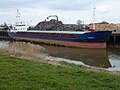 Cargo boat on The River Nene in Wisbech Docks - geograph.org.uk - 4874433.jpg 4,320 × 3,240; 5.4 MB
-
 Castellated building on North Brink, Wisbech - geograph.org.uk - 6156018.jpg 3,456 × 2,592; 3.91 MB
-
 Castle Square in Wisbech - geograph.org.uk - 4990870.jpg 1,500 × 1,115; 216 KB
-
 Castle Square, Wisbech - geograph.org.uk - 3606985.jpg 2,534 × 1,711; 956 KB
-
 Cemetery Chapel, Wisbech (geograph 6833807).jpg 1,024 × 768; 147 KB
-
 Cemetery Chapel, Wisbech - geograph.org.uk - 4103100.jpg 640 × 380; 59 KB
-
 Cemetery gates, Walsoken, Wisbech - geograph.org.uk - 4841948.jpg 4,320 × 2,817; 5.58 MB
-
 Centenary Gardens - geograph.org.uk - 3421462.jpg 800 × 600; 206 KB
-
 Chapel Road car park, Wisbech - geograph.org.uk - 5292688.jpg 3,776 × 2,520; 3.9 MB
-
 Chapel Road, Wisbech - geograph.org.uk - 1855522.jpg 2,848 × 2,136; 2.89 MB
-
 Chapel Road, Wisbech - geograph.org.uk - 3610083.jpg 2,592 × 1,944; 1.25 MB
-
 Cheerful face overlooking North Brink - geograph.org.uk - 6156001.jpg 3,456 × 2,592; 3.75 MB
-
 Cherry picker at North Cambs Hospital, Wisbech - geograph.org.uk - 4801596.jpg 4,248 × 3,142; 3.79 MB
-
 Children's playground - geograph.org.uk - 4103102.jpg 640 × 402; 54 KB
-
 Church garden, Wisbech - geograph.org.uk - 3607060.jpg 2,592 × 1,944; 1.32 MB
-
 Church Mews, Wisbech - geograph.org.uk - 4118874.jpg 640 × 640; 138 KB
-

-
 Church Terrace, Wisbech - geograph.org.uk - 4122587.jpg 640 × 426; 74 KB
-
 Churchill Road at Wisbech boundary - geograph.org.uk - 3641599.jpg 640 × 482; 64 KB
-
 Closed flood gate at the Port of Wisbech - geograph.org.uk - 3773235.jpg 4,320 × 3,240; 5.15 MB
-
 Closed flood gates at North End, Wisbech - geograph.org.uk - 3773414.jpg 4,320 × 3,240; 5.5 MB
-
 Cold frames in Peckover House - geograph.org.uk - 4988483.jpg 1,500 × 1,125; 324 KB
-

-
 Coming Along Nicely - geograph.org.uk - 3635365.jpg 640 × 360; 51 KB
-
 Constantine House before the fire - geograph.org.uk - 3602420.jpg 2,592 × 1,944; 1.27 MB
-
 Constantine House, Wisbech.jpg 4,000 × 3,000; 2.02 MB
-
 Construction of Tesco store and cinema, Wisbech - geograph.org.uk - 3753226.jpg 4,320 × 3,240; 5.23 MB
-
 Construction work at Peckover School in Wisbech - geograph.org.uk - 6171879.jpg 4,032 × 3,024; 4.22 MB
-
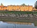
 Contrasting architectural styles on North Brink, Wisbech - geograph.org.uk - 4778555.jpg 4,320 × 3,240; 5.44 MB
-
 Corner Shop, Wisbech - geograph.org.uk - 4103312.jpg 426 × 640; 89 KB
-
 Corporation Quay - geograph.org.uk - 6302101.jpg 4,032 × 2,268; 3.73 MB
-
 Cox's Lane meets North Brink - geograph.org.uk - 1818027.jpg 640 × 480; 204 KB
-

-
 Cricket at Harecroft Road, Wisbech - A drive to square leg - geograph.org.uk - 6163363.jpg 4,032 × 3,024; 1.98 MB
-
 Cricket at Harecroft Road, Wisbech - Looking for a lost ball - geograph.org.uk - 6163375.jpg 4,032 × 3,024; 1.34 MB
-
 Cricket match at Harecroft Road, Wisbech - geograph.org.uk - 6163368.jpg 4,032 × 3,024; 2.57 MB
-
 Cricket pavilion, Wisbech - geograph.org.uk - 3982913.jpg 640 × 480; 62 KB
-
 Cromwell Retail Park in Wisbech - geograph.org.uk - 4979825.jpg 1,500 × 1,105; 134 KB
-
 Cromwell Road (B198) - geograph.org.uk - 3982666.jpg 640 × 480; 63 KB
-
 Cromwell Road (B198) - geograph.org.uk - 3982895.jpg 640 × 480; 67 KB
-
 Cromwell Road, Wisbech - geograph.org.uk - 5679391.jpg 640 × 428; 117 KB
-
 Cromwell Road, Wisbech - geograph.org.uk - 5679394.jpg 640 × 428; 88 KB
-
 Cromwell Road, Wisbech - geograph.org.uk - 5679397.jpg 640 × 428; 81 KB
-
 Crooked Bank Byway - geograph.org.uk - 3421514.jpg 800 × 600; 306 KB
-
 Crooked Bank level crossing, Wisbech - geograph.org.uk - 2927091.jpg 4,320 × 3,240; 5.75 MB
-
 Crooked Bank near Wisbech - geograph.org.uk - 2927108.jpg 4,320 × 3,240; 5.73 MB
-
 Crop field and woodland - geograph.org.uk - 3983823.jpg 640 × 480; 89 KB
-
 Crop field east of Wisbech St Mary - geograph.org.uk - 3983859.jpg 640 × 480; 90 KB
-
 Crop field, Whitehouse Farm - geograph.org.uk - 3982640.jpg 640 × 480; 90 KB
-
 Croquet lawn, Peckover House - geograph.org.uk - 3610108.jpg 2,592 × 1,944; 1.28 MB
-
-
 Crows on a stubble field - geograph.org.uk - 1538662.jpg 640 × 480; 77 KB
-
 Culvert Under The A47 - geograph.org.uk - 2078179.jpg 800 × 600; 159 KB
-

-
 Dandelions on the Bramley Line near Wisbech - geograph.org.uk - 2926757.jpg 4,320 × 3,240; 5.48 MB
-
 Dealers at Wisbech Cattle Market, Cambridgeshire - geograph.org.uk - 4718794.jpg 4,845 × 3,575; 5.2 MB
-
 Debesys Visbičiuje (WISBECH).JPG 3,216 × 4,288; 3.26 MB
-
 Demolition of Bodger's showroom on Lynn Road, Wisbech - geograph.org.uk - 4824329.jpg 4,320 × 3,240; 5.57 MB
-
 Demolition of Bodger's showroom, Lynn Road, Wisbech - geograph.org.uk - 4824334.jpg 4,320 × 3,240; 5.49 MB
-
 Demolition of Tesco in Wisbech - No 2 - geograph.org.uk - 3891063.jpg 4,608 × 3,456; 6.03 MB
-
 Demolition of Tesco in Wisbech - No 3 - geograph.org.uk - 3891107.jpg 4,608 × 3,456; 6.12 MB
-
 Demolition of Tesco in Wisbech - No 4 - geograph.org.uk - 3891116.jpg 4,608 × 3,456; 6.02 MB
-
 Demolition of Tesco in Wisbech - No1 - geograph.org.uk - 3891049.jpg 4,608 × 3,456; 6.12 MB
-
 Derelict buildings, 2009 - geograph.org.uk - 3607589.jpg 2,592 × 1,944; 1.3 MB
-
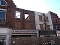
 Derelict shops in Wisbech High Street, Cambridgeshire - geograph.org.uk - 5786790.jpg 4,032 × 3,024; 3.18 MB
-

-
 Dicken's Tavern, 17 Hill Street, Wisbech - geograph.org.uk - 5746992.jpg 5,044 × 3,362; 7.46 MB
-

-

-
 Disused railway - geograph.org.uk - 3982639.jpg 640 × 480; 76 KB
-
 Disused railway track between Wisbech and March - geograph.org.uk - 2926117.jpg 4,320 × 3,240; 5.96 MB
-
 Disused Sluice - geograph.org.uk - 3504042.jpg 800 × 559; 250 KB
-
 Doorway to St Peter's churchyard - geograph.org.uk - 1826780.jpg 480 × 640; 143 KB
-
 Drain and weir near Crooked Bank, Wisbech - geograph.org.uk - 2927939.jpg 4,320 × 3,240; 5.46 MB
-
 Drain by Fenditch Lane - geograph.org.uk - 784995.jpg 2,048 × 3,089; 3.09 MB
-
 Drain near the old railway, Waldersea - geograph.org.uk - 2926863.jpg 4,320 × 3,240; 5.67 MB
-
 Drain off Redmoor Lane near Begdale - geograph.org.uk - 2779859.jpg 4,320 × 3,240; 5.88 MB
-
 Drainage junction, Waldersea near Wisbech - geograph.org.uk - 2928047.jpg 4,320 × 3,240; 5.6 MB
-
 Dry Culvert - geograph.org.uk - 3457352.jpg 800 × 600; 250 KB
-
 Dukes Head, Wisbech - geograph.org.uk - 4122596.jpg 640 × 426; 73 KB
-

-
 Edes' Terrace on South Brink, Wisbech - geograph.org.uk - 5763563.jpg 4,032 × 3,024; 3.32 MB
-
 Elgood's Ales in Wisbech.jpg 3,264 × 2,448; 1.36 MB
-
 Elgood's Ales, Wisbech.jpg 1,632 × 1,224; 521 KB
-
-
 Elgood's brewery, Wisbech - geograph.org.uk - 1504933.jpg 640 × 480; 73 KB
-
 Elgood's Brewrey Tours - geograph.org.uk - 3816284.jpg 640 × 480; 85 KB
-
 Elgoods Brewery - geograph.org.uk - 5479105.jpg 640 × 480; 71 KB
-
 Elgoods-brewery-wisbech.jpg 1,000 × 668; 857 KB
-
 Ely Place, Wisbech - geograph.org.uk - 5185449.jpg 4,320 × 3,240; 3.98 MB
-
-
 Entering Wisbech - geograph.org.uk - 3982674.jpg 640 × 480; 72 KB
-
 Entering Wisbech St Mary - geograph.org.uk - 3984049.jpg 640 × 480; 102 KB
-
 Entrance to Market Place, Wisbech - geograph.org.uk - 1826738.jpg 480 × 640; 88 KB
-
 Etcetera on Bridge Street - geograph.org.uk - 4990862.jpg 1,125 × 1,500; 250 KB
-
 Farm buildings off Redmoor Lane - geograph.org.uk - 1818246.jpg 640 × 480; 193 KB
-
 Farmland off Barton Road - geograph.org.uk - 3983853.jpg 640 × 480; 67 KB
-
 Farmland off Leverington Common - geograph.org.uk - 3983802.jpg 640 × 480; 69 KB
-
 Farmland off Panswell Lane - geograph.org.uk - 3983847.jpg 640 × 480; 75 KB
-
 Fast food restaurant, Wisbech - geograph.org.uk - 3982738.jpg 640 × 480; 80 KB
-
 Fen Shovel - geograph.org.uk - 1051963.jpg 640 × 480; 52 KB
-
 Fens Menswear on Chapel Road - geograph.org.uk - 4979832.jpg 1,125 × 1,500; 178 KB
-
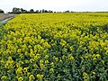 Field of rape on Redmoor Field, Waldersea - geograph.org.uk - 2926877.jpg 4,320 × 3,240; 5.78 MB
-
 Field off Cox's Lane - geograph.org.uk - 1818014.jpg 640 × 480; 194 KB
-
 Fields off Bevis Lane - geograph.org.uk - 1817944.jpg 640 × 480; 176 KB
-
 Fields off Mile Tree Lane - geograph.org.uk - 1817982.jpg 640 × 480; 180 KB
-
 Fine town houses - Queens Road - geograph.org.uk - 5724867.jpg 640 × 480; 88 KB
-
 Fir tree in the centre of Wisbech (Mount Pleasant) cemetery - geograph.org.uk - 5208993.jpg 3,456 × 2,592; 3.96 MB
-
 Fire damaged house in Townshend Road, Wisbech - geograph.org.uk - 5629905.jpg 4,320 × 3,240; 3.07 MB
-
 Flatmoor Field - geograph.org.uk - 3983812.jpg 640 × 480; 53 KB
-
 Flood defence wall - Wisbech in Bloom 2016 - geograph.org.uk - 5053532.jpg 4,320 × 3,240; 5.65 MB
-
 Flood gate on West Parade - geograph.org.uk - 1528535.jpg 640 × 480; 74 KB
-
-

-
 Flowers and the marina - Wisbech in bloom 2018 - geograph.org.uk - 5849064.jpg 4,032 × 3,024; 3.56 MB
-
 Flowers and The River Nene - Wisbech in Bloom 2016 - geograph.org.uk - 5054100.jpg 4,320 × 3,240; 5.59 MB
-
 Flowers on Freedom Bridge - Wisbech in Bloom 2018 - geograph.org.uk - 5849047.jpg 3,024 × 4,032; 2.98 MB
-
 Flowers outside 31 Old Market - Wisbech in Bloom 2016 - geograph.org.uk - 5054088.jpg 3,240 × 3,940; 2.72 MB
-
 Footpath Sign - geograph.org.uk - 2574411.jpg 800 × 600; 240 KB
-
 Footpath through The General Cemetery, Wisbech - geograph.org.uk - 6157911.jpg 4,032 × 3,024; 5.94 MB
-
 Former Boys Grammar School - geograph.org.uk - 1203903.jpg 640 × 480; 47 KB
-
 Former Inn - Public Houses, Inns and Taverns of Wisbech - geograph.org.uk - 5465121.jpg 4,320 × 3,240; 5.51 MB
-
 Former inn and warehouse on Nene Quay, Wisbech - geograph.org.uk - 4765661.jpg 4,196 × 3,068; 4.75 MB
-
 Former Post Office, Wisbech - geograph.org.uk - 3982905.jpg 478 × 640; 62 KB
-
 Former Queen's Hotel, Wisbech-geograph-5267392.jpg 3,792 × 3,084; 5.54 MB


_-_geograph.org.uk_-_1984194.jpg)


.jpg)


_-_geograph.org.uk_-_4751679.jpg)


.jpg)


_-_geograph.org.uk_-_3982666.jpg)
_-_geograph.org.uk_-_3982895.jpg)


.JPG)


_cemetery_-_geograph.org.uk_-_5208993.jpg)


