Category:Wiener Flur
Jump to navigation
Jump to search
 |
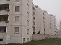
This category shows the Vienna residential building (Gemeindebau) with the ID 1678 (Wiener Flur). (commons, de)
|
| Object location | | View all coordinates using: OpenStreetMap |
|---|
 | |||||
| Upload media | |||||
| Instance of | |||||
|---|---|---|---|---|---|
| Location | |||||
 | |||||
Subcategories
This category has only the following subcategory.
Media in category "Wiener Flur"
The following 14 files are in this category, out of 14 total.
-
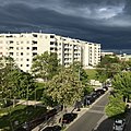 20190521 Wien 2419.jpg 2,647 × 2,647; 3.86 MB
-
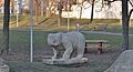 Die Bären 01 by Josef Hladik.jpg 4,928 × 2,684; 6 MB
-
 Die Bären 02 by Josef Hladik.jpg 3,080 × 4,616; 5.73 MB
-
 Nordtor by Peter Braunsteiner.jpg 4,795 × 3,207; 8.49 MB
-
 Sonnenbogen by Robert Stieg.jpg 4,928 × 3,192; 9.29 MB
-
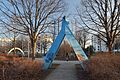
 Tagtraumbrücke by Robert Stieg.jpg 4,623 × 2,984; 6.02 MB
-
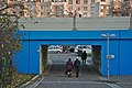 U6 Unterführung Siebenhirten Lemböckgasse.jpg 6,022 × 4,024; 14.57 MB
-
 Wiener Flur 1.jpg 3,264 × 2,448; 2.13 MB
-
 Wiener Flur 2.JPG 1,000 × 750; 180 KB
-
 Wiener Flur 3 - Spar supermarket.jpg 4,466 × 3,051; 5.04 MB
-
 Wiener Flur 4.jpg 4,538 × 3,008; 5.41 MB
-
 Wiener Flur 5.jpg 4,688 × 2,824; 5.66 MB
-
 Wiener Flur 6.jpg 4,455 × 3,135; 6.11 MB
-
 Wiener Flur Kunst am Bau.JPG 1,000 × 667; 261 KB


