Category:Whitton, Powys
Jump to navigation
Jump to search
village and community in Powys, Wales   | |||||
| Upload media | |||||
| Pronunciation audio | |||||
|---|---|---|---|---|---|
| Instance of | |||||
| Location | Powys, Wales | ||||
| Population |
| ||||
| Area |
| ||||
 | |||||
Cymraeg: Pentref ym Mhowys, Cymru, yw Llanddewi yn Hwytyn (Saesneg: Whitton).
Cymraeg: Whitton is a village (and community) in Powys, Wales.
Media in category "Whitton, Powys"
The following 200 files are in this category, out of 426 total.
(previous page) (next page)-
 "Beware of the Deer" sign - geograph.org.uk - 2290980.jpg 640 × 480; 117 KB
-
 A field of oats by Offa's Dyke - geograph.org.uk - 5531946.jpg 6,000 × 4,000; 6.36 MB
-
 A harvested field on Cwm-Whotton Hill - geograph.org.uk - 5531955.jpg 6,000 × 4,000; 7.16 MB
-
 A section of Offa's Dyke, SW of Discoed - geograph.org.uk - 3742481.jpg 1,024 × 768; 230 KB
-
 A trailer-load of bales - geograph.org.uk - 5531920.jpg 5,689 × 3,668; 5.88 MB
-
 A488 at entrance to Gwernaffel - geograph.org.uk - 3134205.jpg 640 × 397; 73 KB
-

-
 Ackhill Baptist Chapel, Dolley Green - geograph.org.uk - 438575.jpg 640 × 480; 81 KB
-
 Ackhill Baptist Church, Dolley Green - geograph.org.uk - 438572.jpg 640 × 480; 53 KB
-
 An Ancient Yew Tree - geograph.org.uk - 4336245.jpg 990 × 1,484; 880 KB
-
 Ancient Yew at Cascob Church - geograph.org.uk - 4336254.jpg 990 × 1,484; 945 KB
-
 And the rain came. Hawthorn Hill - geograph.org.uk - 702998.jpg 640 × 480; 50 KB
-
 Approaching Hawthorn Hill along the Offa's Dyke Path - geograph.org.uk - 6273154.jpg 6,000 × 4,000; 3.52 MB
-

-
 B4355 junction with B4357 - geograph.org.uk - 3730792.jpg 2,913 × 2,004; 752 KB
-
 B4355 Offa's Dyke Path crosses - geograph.org.uk - 3730802.jpg 3,743 × 2,499; 2.42 MB
-
 B4357 at Maes-Treylow - geograph.org.uk - 5898202.jpg 1,024 × 768; 182 KB
-
 B4357 at Whitton Bridge - geograph.org.uk - 5898206.jpg 1,024 × 759; 181 KB
-
 B4357 near Bank Farm - geograph.org.uk - 5898223.jpg 1,024 × 768; 171 KB
-
 B4357 near Daffodil Wood - geograph.org.uk - 5898213.jpg 1,024 × 781; 141 KB
-
 B4357 near The Werns - geograph.org.uk - 5898218.jpg 1,024 × 722; 188 KB
-
 Bales and sheep - geograph.org.uk - 5531913.jpg 6,000 × 4,000; 5.75 MB
-
 Barn at Discoed - geograph.org.uk - 6170630.jpg 3,648 × 2,736; 4.21 MB
-
 Barn at Pilleth Court - geograph.org.uk - 6169713.jpg 3,648 × 2,736; 4.82 MB
-
 Barn at Upper House (Discoed) - geograph.org.uk - 6170590.jpg 3,648 × 2,736; 4 MB
-
 Beggar's Bush crossroads - geograph.org.uk - 605447.jpg 640 × 480; 69 KB
-
 Bole of The Whitton Churchyard Yew - geograph.org.uk - 4359689.jpg 1,484 × 990; 1.03 MB
-
 Bridge End - geograph.org.uk - 509341.jpg 640 × 480; 99 KB
-
 Car Park at St. Mary's Church (Pilleth) - geograph.org.uk - 6168549.jpg 3,648 × 2,736; 5.1 MB
-
 Cascob Churchyard - geograph.org.uk - 4336263.jpg 1,484 × 990; 1.06 MB
-
 Castell Foel Allt - geograph.org.uk - 2489688.jpg 690 × 518; 233 KB
-
 Castell Foel Allt - geograph.org.uk - 5480772.jpg 1,280 × 851; 595 KB
-
 Cattle by the Lugg - geograph.org.uk - 5533916.jpg 6,000 × 4,000; 4.58 MB
-
 Cattle through the gate - geograph.org.uk - 5531899.jpg 6,000 × 4,000; 7.31 MB
-
 Ceiling at St. David's Church (Nave ^ Whitton) - geograph.org.uk - 6169813.jpg 3,648 × 2,056; 2.06 MB
-
 Ceiling at St. Mary's Church (Bell Tower ^ Pilleth) - geograph.org.uk - 6169458.jpg 3,648 × 2,736; 3.13 MB
-
 Ceiling at St. Michael's Church (Nave ^ Cascob) - geograph.org.uk - 6170474.jpg 3,648 × 2,056; 2.35 MB
-
 Ceiling at St. Michael's Church (Nave ^ Discoed) - geograph.org.uk - 6170578.jpg 3,648 × 2,056; 1.89 MB
-
 Church Of St Michael in Discoed - geograph.org.uk - 4373390.jpg 1,574 × 1,050; 1.68 MB
-
 Churchyard at St. David's Church (Whitton) - geograph.org.uk - 6169787.jpg 3,648 × 2,736; 4.84 MB
-
 Churchyard at St. Mary's Church (Pilleth) - geograph.org.uk - 6169676.jpg 3,648 × 2,056; 3.54 MB
-
 Copse in the wind and rain - geograph.org.uk - 703000.jpg 640 × 480; 54 KB
-
 Cottage at Thorn - geograph.org.uk - 2588382.jpg 640 × 480; 77 KB
-
 Cwm Whitton - geograph.org.uk - 509352.jpg 640 × 431; 69 KB
-
 Cwm Whitton - geograph.org.uk - 509360.jpg 640 × 480; 139 KB
-
 Cwmadee between Thorn and Discoed - geograph.org.uk - 4336341.jpg 1,484 × 990; 806 KB
-

-
 Discoed Church and 5,000 year-old Yew tree. - geograph.org.uk - 2444815.jpg 1,280 × 960; 499 KB
-

-
 Earthworks on the hillside - geograph.org.uk - 4336312.jpg 1,484 × 990; 459 KB
-

-
 Ednol - geograph.org.uk - 508112.jpg 640 × 480; 66 KB
-
 Ednol - geograph.org.uk - 508114.jpg 640 × 480; 76 KB
-
 Entrance Gate to St. Mary's Church (Pilleth) - geograph.org.uk - 6168573.jpg 3,648 × 2,736; 4.93 MB
-
 Entrance Gate to St. Mary's Church (Pilleth) - geograph.org.uk - 6169717.jpg 2,736 × 3,648; 4.96 MB
-
 Entrance to Pilleth - geograph.org.uk - 3816187.jpg 640 × 480; 104 KB
-
 Farm buildings at The Hill - geograph.org.uk - 695165.jpg 640 × 480; 84 KB
-
 Farmland and the Cascob Brook at Dyffryn - geograph.org.uk - 4336882.jpg 1,484 × 990; 919 KB
-

-
 Ffynnon Fair - geograph.org.uk - 5450654.jpg 1,071 × 1,600; 666 KB
-
 Fields on Cwm-Whitton Hill - geograph.org.uk - 5531952.jpg 6,000 × 4,000; 4.58 MB
-
 Fields south of Rhos-y-meirch - geograph.org.uk - 5531936.jpg 6,000 × 4,000; 6.1 MB
-
 Floor at St. David's Church (Chancel ^ Whitton) - geograph.org.uk - 6169797.jpg 3,648 × 2,736; 3.09 MB
-

-
 Furrow Hill (Viewed from Discoed) - geograph.org.uk - 6170624.jpg 3,648 × 2,056; 3.55 MB
-
 Furrow Hill from Yew Tree Farm - geograph.org.uk - 4336357.jpg 1,484 × 990; 512 KB
-
 Gate bolt on Gilfach Hill - geograph.org.uk - 6199408.jpg 1,024 × 768; 270 KB
-
 Ger - Near Rhyd y Meirch - geograph.org.uk - 4511475.jpg 640 × 447; 42 KB
-
 Ger Bryn Hengwm . Near Hengwm Hill - geograph.org.uk - 4511515.jpg 640 × 480; 106 KB
-
 Ger Hawthorn Hill - geograph.org.uk - 4511495.jpg 640 × 480; 80 KB
-
 Grazing sheep on Gilfach Hill - geograph.org.uk - 6236369.jpg 1,024 × 768; 831 KB
-
 Gwernaffel Cottages from A488 - geograph.org.uk - 3134173.jpg 640 × 390; 60 KB
-
 Heather moorland - geograph.org.uk - 3050268.jpg 1,024 × 680; 229 KB
-

-
 Hillside above the Lugg valley - geograph.org.uk - 5532193.jpg 6,000 × 4,000; 5.45 MB
-
 Hillside on Furrow Hill - geograph.org.uk - 5532216.jpg 6,000 × 4,000; 4.94 MB
-
 Idyllic lunch spot at Dolley Old Bridge - geograph.org.uk - 2061009.jpg 640 × 480; 143 KB
-

-
 Inside St. David's Church (Bell Tower ^ Whitton) - geograph.org.uk - 6169796.jpg 3,648 × 2,736; 3.08 MB
-
 Inside St. Mary's Church (Bell Tower ^ Pilleth) - geograph.org.uk - 6169449.jpg 3,648 × 2,736; 3.21 MB
-
 Inside St. Mary's Church (Bell Tower ^ Pilleth) - geograph.org.uk - 6169460.jpg 3,648 × 2,736; 3.01 MB
-

-
 Into the Lugg Valley - geograph.org.uk - 450412.jpg 640 × 480; 80 KB
-
 Lane by St. Mary's Church (Pilleth) - geograph.org.uk - 6169677.jpg 3,648 × 2,736; 5.16 MB
-
 Lane crossroads at Thorn - geograph.org.uk - 2588385.jpg 640 × 480; 89 KB
-
 Lane to Thorn at Pen Offa - geograph.org.uk - 2588379.jpg 640 × 480; 66 KB
-

-
 Large property near Whitton - geograph.org.uk - 4019988.jpg 640 × 360; 45 KB
-
 Large property near Whitton - geograph.org.uk - 4019998.jpg 640 × 360; 73 KB
-
 Llan Fawr - geograph.org.uk - 2489724.jpg 690 × 518; 133 KB
-
 Llan-Fawr (Viewed from St. Michael's Church in Cascob) - geograph.org.uk - 6170389.jpg 3,648 × 2,736; 4.83 MB
-
 Llan-fawr - geograph.org.uk - 909879.jpg 640 × 480; 74 KB
-
 Llan-Fawr Hill - geograph.org.uk - 4336291.jpg 1,484 × 990; 519 KB
-

-
 Lords Land, Whitton - geograph.org.uk - 2442033.jpg 800 × 600; 225 KB
-
 Lugg Valley from Pilleth Oaks - geograph.org.uk - 3497578.jpg 640 × 480; 116 KB
-
 Maes Treylow - geograph.org.uk - 5274775.jpg 1,000 × 665; 864 KB
-
 Marker Stone - geograph.org.uk - 315098.jpg 640 × 480; 171 KB
-
 Meander on River Lugg, SW of Dolley Green - geograph.org.uk - 3742470.jpg 1,024 × 768; 219 KB
-
 Memorial stone at Pilleth - geograph.org.uk - 2422767.jpg 640 × 480; 126 KB
-
 Memorials to the Taylor family - geograph.org.uk - 5451021.jpg 1,600 × 1,067; 309 KB
-
 Model of the Old St. Mary's Church (Pilleth) - geograph.org.uk - 6169472.jpg 3,648 × 2,736; 3.22 MB
-
 Monument to John ^ Catherine Price, 1597 - geograph.org.uk - 5450062.jpg 1,067 × 1,600; 302 KB
-
 New chalets at Pen Offa - geograph.org.uk - 438532.jpg 640 × 480; 57 KB
-
 Offa Dyke Path crosses lane, W of Discoed - geograph.org.uk - 3742476.jpg 1,024 × 768; 243 KB
-
 Offa's Dyke - geograph.org.uk - 5532013.jpg 6,000 × 4,000; 5.01 MB
-
 Offa's Dyke approaching Yew Tree Farm - geograph.org.uk - 709414.jpg 639 × 437; 95 KB
-
 Offa's Dyke below Hengwym Hill - geograph.org.uk - 6273184.jpg 6,000 × 4,000; 3.19 MB
-
 Offa's Dyke near Hengwym Hill - geograph.org.uk - 6273179.jpg 6,000 × 4,000; 3.45 MB
-
 Offa's Dyke on Hawthorn Hill - geograph.org.uk - 5532083.jpg 6,000 × 4,000; 5.38 MB
-
 Offa's Dyke Path - geograph.org.uk - 5531244.jpg 6,000 × 4,000; 6.67 MB
-
 Offa's Dyke Path - geograph.org.uk - 703006.jpg 640 × 480; 75 KB
-
 Offa's Dyke Path at Pen Offa - geograph.org.uk - 6265709.jpg 6,000 × 4,000; 3.26 MB
-
 Offa's Dyke Path below Hawthorn Hill - geograph.org.uk - 6273148.jpg 6,000 × 4,000; 2.99 MB
-
 Offa's Dyke Path below Hengwm Hill - geograph.org.uk - 6273175.jpg 6,000 × 4,000; 3.53 MB
-
 Offa's Dyke Path below Hengwm Hill - geograph.org.uk - 6273186.jpg 6,000 × 4,000; 3.42 MB
-

-
 Offa's Dyke Path near Beggar's Bush - geograph.org.uk - 6266335.jpg 6,000 × 4,000; 3.87 MB
-
 Offa's Dyke Path near Discoed - geograph.org.uk - 6266341.jpg 6,000 × 4,000; 4.55 MB
-
 Offa's Dyke Path near Discoed - geograph.org.uk - 6266351.jpg 6,000 × 4,000; 3.29 MB
-
 Offa's Dyke path near Rhos-y-meirch - geograph.org.uk - 315123.jpg 640 × 480; 157 KB
-
 Offa's Dyke Path on Furrow Hill - geograph.org.uk - 6273106.jpg 6,000 × 4,000; 3.72 MB
-
 Offa's Dyke Up hill at Yew Tree Farm Discoed - geograph.org.uk - 4336328.jpg 1,484 × 938; 710 KB
-
 Old Dolley Green Bridge - geograph.org.uk - 4511721.jpg 480 × 640; 140 KB
-

-

-

-

-

-
 On the bridleway across Rhos Hill - geograph.org.uk - 5262676.jpg 2,592 × 1,936; 1.19 MB
-
 Ordnance Survey Cut Mark - geograph.org.uk - 5329274.jpg 640 × 504; 29 KB
-
 Ordnance Survey Cut Mark - geograph.org.uk - 5329278.jpg 640 × 374; 109 KB
-
 Ordnance Survey Cut Mark - geograph.org.uk - 5329280.jpg 640 × 368; 75 KB
-
 Ordnance Survey Cut Mark - geograph.org.uk - 5329281.jpg 640 × 358; 84 KB
-
 Part of Bryn Glas hill above Pilleth - geograph.org.uk - 2494481.jpg 640 × 480; 75 KB
-

-
 Part of Offa's Dyke Path above Discoed - geograph.org.uk - 2061014.jpg 640 × 480; 108 KB
-

-
 Path to St. Michael's Church (Cascob) - geograph.org.uk - 6170371.jpg 3,648 × 2,736; 4.86 MB
-
 Path up to Hawthorn Hill - geograph.org.uk - 5532126.jpg 6,000 × 4,000; 4.53 MB
-
 Pilleth and Whitton Radnorshire - geograph.org.uk - 696232.jpg 640 × 427; 101 KB
-
 Pilleth Church - geograph.org.uk - 2422737.jpg 640 × 480; 124 KB
-
 Pilleth Church - geograph.org.uk - 5480592.jpg 851 × 1,280; 423 KB
-
 Pilleth Church - remains of former building - geograph.org.uk - 5480576.jpg 851 × 1,280; 719 KB
-
 Pilleth Churchyard - geograph.org.uk - 5480500.jpg 1,280 × 851; 673 KB
-
 Pilleth Churchyard - geograph.org.uk - 5480541.jpg 1,280 × 851; 610 KB
-
 Pilleth Court - geograph.org.uk - 6169686.jpg 3,648 × 2,056; 3.63 MB
-
 Pilleth Oaks B^B - geograph.org.uk - 3497585.jpg 640 × 480; 118 KB
-
 Pilleth Oaks B^B - geograph.org.uk - 3497588.jpg 640 × 480; 117 KB
-
 Plaque on the Entrance Gate to St. Mary's Church (Pilleth) - geograph.org.uk - 6168574.jpg 3,648 × 2,736; 4.67 MB
-
 Pond at Pilleth - geograph.org.uk - 5481199.jpg 1,280 × 851; 542 KB
-
 Pond on Hendregenny Farm - geograph.org.uk - 5697582.jpg 1,280 × 720; 718 KB
-
 Radnor Forest from A488 road near Knighton, 1950 - geograph.org.uk - 4228380.jpg 2,393 × 1,479; 1.21 MB
-
 Radnor forest track - geograph.org.uk - 2809261.jpg 4,288 × 3,216; 2.77 MB
-
 Remains of a Stone built sluice at The Pentre - geograph.org.uk - 4336278.jpg 990 × 1,484; 1.01 MB
-
 Rhos-y-Meirch - geograph.org.uk - 509373.jpg 640 × 480; 130 KB
-
 River Lugg at Discoed - geograph.org.uk - 6236368.jpg 1,024 × 768; 904 KB
-
 River Lugg, Pilleth - geograph.org.uk - 5480646.jpg 1,280 × 851; 763 KB
-
 Road through Hanging Wood - geograph.org.uk - 3134200.jpg 640 × 447; 78 KB
-
 Rounded Seat at St. Mary's Church (Pilleth) - geograph.org.uk - 6168581.jpg 3,648 × 2,736; 4.83 MB
-
 Sheep at Discoed - geograph.org.uk - 6170625.jpg 3,648 × 2,056; 3.65 MB
-
 Sheep at Discoed - geograph.org.uk - 6170626.jpg 3,648 × 2,736; 4.86 MB
-
 Sheep at St. Michael's Church (Cascob) - geograph.org.uk - 6170393.jpg 3,648 × 2,736; 4.57 MB
-
 Sheep at St. Michael's Church (Cascob) - geograph.org.uk - 6170403.jpg 3,648 × 2,736; 4.85 MB
-
 Sheep at St. Michael's Church (Cascob) - geograph.org.uk - 6170415.jpg 3,648 × 2,736; 4.44 MB
-
 Sheep at St. Michael's Church (Cascob) - geograph.org.uk - 6170422.jpg 3,648 × 2,736; 5.06 MB
-
 Sheep by the site of the Battle of Bryn Glas-Pilleth - geograph.org.uk - 6169698.jpg 3,648 × 2,736; 4.72 MB
-
 Sheep near Meadow View Farm - geograph.org.uk - 5531239.jpg 6,000 × 4,000; 6.09 MB
-
 Sheep on Gilfach Hill - geograph.org.uk - 5532173.jpg 6,000 × 4,000; 4.68 MB
-
 Sheep on Hawthorn Hill - geograph.org.uk - 5532093.jpg 6,000 × 4,000; 4.84 MB
-
 Sheep on Hengwm Hill - geograph.org.uk - 5532009.jpg 6,000 × 4,000; 5.12 MB
-
 Sheep pasture at Pilleth - geograph.org.uk - 5480789.jpg 1,280 × 851; 412 KB
-
 Sign at St. Mary's Church (Pilleth) - geograph.org.uk - 6168556.jpg 3,648 × 2,736; 4.86 MB
-
 Sign at St. Mary's Church (Pilleth) - geograph.org.uk - 6168568.jpg 3,648 × 2,736; 4.73 MB
-
 Sign at St. Michael's Church (Cascob) - geograph.org.uk - 6170382.jpg 3,648 × 2,736; 4.77 MB
-
 Sign at the Holy Well (Pilleth) - geograph.org.uk - 6169486.jpg 3,648 × 2,736; 4.7 MB
-
 Sign at the Old School (Whitton) - geograph.org.uk - 6169824.jpg 3,648 × 2,736; 4.65 MB
-
 Sign at Upper House (Discoed) - geograph.org.uk - 6170618.jpg 3,648 × 2,736; 5.13 MB
-
 Sign by St. Mary's Church (Pilleth) - geograph.org.uk - 6169658.jpg 3,648 × 2,056; 3.25 MB
-
 Sign for Pilleth Oaks B^B - geograph.org.uk - 3497589.jpg 640 × 480; 115 KB
-
 Sign inside St. Mary's Church (Nave ^ Pilleth) - geograph.org.uk - 6169470.jpg 3,648 × 2,736; 3.2 MB
-
 Smallholding on the edge of Rhos-y-meirch - geograph.org.uk - 5531894.jpg 6,000 × 4,000; 6.32 MB
-
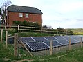 Solar panels at Pilleth Oaks - geograph.org.uk - 3497586.jpg 640 × 480; 114 KB
-
 Squirrel on the lane by St. Mary's Church (Pilleth) - geograph.org.uk - 6169721.jpg 3,648 × 2,736; 4.85 MB
-

-
 St Mary, Pilleth - geograph.org.uk - 2501495.jpg 3,456 × 2,592; 3.73 MB
-
 St Michael and All Angels, Cascob - geograph.org.uk - 3013906.jpg 3,697 × 2,183; 7.13 MB
-
 St Michael and All Angels, Cascob - geograph.org.uk - 3013927.jpg 3,456 × 2,592; 5.45 MB
-

-
 St. David's Church (Altar ^ Whitton) - geograph.org.uk - 6169801.jpg 3,648 × 2,736; 2.72 MB
-
 St. David's Church (Bell Tower ^ Porch ^ Whitton) - geograph.org.uk - 6169791.jpg 3,648 × 2,736; 3.53 MB
-
 St. David's Church (Bell Tower ^ Whitton) - geograph.org.uk - 6169782.jpg 3,648 × 2,736; 3.71 MB
-
 St. David's Church (Bell Tower ^ Whitton) - geograph.org.uk - 6169788.jpg 3,648 × 2,736; 4.15 MB
-
 St. David's Church (Chancel ^ Whitton) - geograph.org.uk - 6169798.jpg 3,648 × 2,736; 3.24 MB
-
 St. David's Church (Font ^ Whitton) - geograph.org.uk - 6169795.jpg 3,648 × 2,736; 3.37 MB
-
 St. David's Church (Lectern ^ Whitton) - geograph.org.uk - 6169811.jpg 3,648 × 2,736; 2.71 MB
-
 St. David's Church (Nave ^ Whitton) - geograph.org.uk - 6169809.jpg 3,648 × 2,736; 2.71 MB
-
 St. David's Church (Organ ^ Whitton) - geograph.org.uk - 6169808.jpg 3,648 × 2,736; 3 MB
-
 St. David's Church (Porch ^ Whitton) - geograph.org.uk - 6169818.jpg 3,648 × 2,736; 4.89 MB
-
 St. David's Church (Pulpit ^ Whitton) - geograph.org.uk - 6169810.jpg 3,648 × 2,736; 3.08 MB


_-_geograph.org.uk_-_6170513.jpg)


_-_geograph.org.uk_-_6170590.jpg)


_-_geograph.org.uk_-_6168549.jpg)


_-_geograph.org.uk_-_6169813.jpg)
_-_geograph.org.uk_-_6169458.jpg)
_-_geograph.org.uk_-_6170474.jpg)
_-_geograph.org.uk_-_6170578.jpg)

_-_geograph.org.uk_-_6169787.jpg)
_-_geograph.org.uk_-_6169676.jpg)


_over_River_Lugg,_SW_of_Dolley_Green_-_geograph.org.uk_-_3742465.jpg)


_-_geograph.org.uk_-_6168573.jpg)
_-_geograph.org.uk_-_6169717.jpg)


_-_geograph.org.uk_-_6169797.jpg)

_-_geograph.org.uk_-_6170624.jpg)


_-_geograph.org.uk_-_6169796.jpg)
_-_geograph.org.uk_-_6169449.jpg)
_-_geograph.org.uk_-_6169460.jpg)


_-_geograph.org.uk_-_6169677.jpg)


_-_geograph.org.uk_-_6170389.jpg)


_-_geograph.org.uk_-_6169472.jpg)


_-_geograph.org.uk_-_6170371.jpg)


_-_geograph.org.uk_-_6168574.jpg)


_-_geograph.org.uk_-_6168581.jpg)


_-_geograph.org.uk_-_6170393.jpg)
_-_geograph.org.uk_-_6170403.jpg)
_-_geograph.org.uk_-_6170415.jpg)
_-_geograph.org.uk_-_6170422.jpg)


_-_geograph.org.uk_-_6168556.jpg)
_-_geograph.org.uk_-_6168568.jpg)
_-_geograph.org.uk_-_6170382.jpg)
_-_geograph.org.uk_-_6169486.jpg)
_-_geograph.org.uk_-_6169824.jpg)
_-_geograph.org.uk_-_6170618.jpg)
_-_geograph.org.uk_-_6169658.jpg)

_-_geograph.org.uk_-_6169470.jpg)


_-_geograph.org.uk_-_6169721.jpg)


_-_geograph.org.uk_-_6169801.jpg)
_-_geograph.org.uk_-_6169791.jpg)
_-_geograph.org.uk_-_6169782.jpg)
_-_geograph.org.uk_-_6169788.jpg)
_-_geograph.org.uk_-_6169798.jpg)
_-_geograph.org.uk_-_6169795.jpg)
_-_geograph.org.uk_-_6169811.jpg)
_-_geograph.org.uk_-_6169809.jpg)
_-_geograph.org.uk_-_6169808.jpg)
_-_geograph.org.uk_-_6169818.jpg)
_-_geograph.org.uk_-_6169810.jpg)