Category:West Lavington, Wiltshire
Jump to navigation
Jump to search
village and civil parish in Wiltshire, UK  | |||||
| Upload media | |||||
| Instance of | |||||
|---|---|---|---|---|---|
| Location | Wiltshire, South West England, England | ||||
| official website | |||||
 | |||||
English: West Lavington is a village and civil parish in Wiltshire, England, on the north edge of Salisbury Plain. The village is on the A360 road between Devizes and Salisbury, about south of Devizes. The parish includes the hamlet of Littleton Panell.
Latina: Lavington Episcopi, vulgo hodie West Lavington, est oppidum comitatus Wiltoniae in Anglia occidentali situm.
Nederlands: West Lavington is een dorp (village) en civil parish in de unitary authority Wiltshire, in het Engelse graafschap Wiltshire. De civil parish telt inwoners.

Subcategories
This category has the following 5 subcategories, out of 5 total.
Media in category "West Lavington, Wiltshire"
The following 200 files are in this category, out of 405 total.
(previous page) (next page)-
 "Alpha" by Thomas Joynes - geograph.org.uk - 4991971.jpg 480 × 640; 375 KB
-
 "Birdsong" by Lucy Lutyens - geograph.org.uk - 4991988.jpg 480 × 640; 336 KB
-
 "Boxing hares" by Henrietta Bud - geograph.org.uk - 4992540.jpg 480 × 640; 433 KB
-
 "Circles of Life" by Jenny Pickford - geograph.org.uk - 4992593.jpg 480 × 640; 442 KB
-
 "Cock Pheasant" by Alison Bowyer - geograph.org.uk - 4992598.jpg 640 × 480; 425 KB
-
 "Cow Parsley" by Simon Hempsell - geograph.org.uk - 4992595.jpg 640 × 480; 428 KB
-
 "Crescent" by Thomas Joynes - geograph.org.uk - 4991986.jpg 480 × 640; 389 KB
-
 "Eclipse" by Chris Wood - geograph.org.uk - 4992548.jpg 480 × 640; 425 KB
-
 "Entwined II" by Lucy Lutyens - geograph.org.uk - 4992602.jpg 480 × 640; 411 KB
-
 "Herd of deer" by Simon Hempsell - geograph.org.uk - 4992586.jpg 640 × 480; 403 KB
-
 "Horse head" by Heather Jansch - geograph.org.uk - 4992536.jpg 480 × 640; 418 KB
-

-
 "Poise" by Thomas Joynes - geograph.org.uk - 4991973.jpg 480 × 640; 352 KB
-
 "Resonance" by Thomas Joynes - geograph.org.uk - 4991975.jpg 480 × 640; 379 KB
-
-
 "Tall hare II" by Lilia Umana-Clarke - geograph.org.uk - 4992576.jpg 480 × 640; 416 KB
-
 "Unfurl" byJenny Pickford - geograph.org.uk - 4992591.jpg 480 × 640; 401 KB
-
 2010 , A360 approaching Gore Cross - geograph.org.uk - 2166429.jpg 1,600 × 1,359; 646 KB
-
 2010 , A360 going south past St. Joan a Gore Farm - geograph.org.uk - 2166435.jpg 1,600 × 1,219; 841 KB
-
 2010 , A360 heading north into West Lavington - geograph.org.uk - 2174016.jpg 1,600 × 1,150; 578 KB
-
 2010 , A360 heading north to West Lavington - geograph.org.uk - 2174029.jpg 1,600 × 1,180; 478 KB
-
 2010 , A360 heading north to West Lavington - geograph.org.uk - 2174049.jpg 1,024 × 683; 328 KB
-
 2010 , A360 heading north toward West Lavington - geograph.org.uk - 2166499.jpg 1,600 × 1,067; 1.16 MB
-
 2010 , A360 heading south to Tilshead - geograph.org.uk - 2174349.jpg 1,600 × 1,173; 501 KB
-
 2010 , A360 leaving West Lavington - geograph.org.uk - 2174004.jpg 1,600 × 1,296; 693 KB
-
 2010 , A360 Looking north toward West Lavington - geograph.org.uk - 2166696.jpg 1,600 × 1,181; 443 KB
-
 2010 , Beech woods seen from the Wessex Ridgeway - geograph.org.uk - 2196504.jpg 4,041 × 2,366; 3.33 MB
-
 2010 , Bottoms up^ - geograph.org.uk - 2092305.jpg 930 × 787; 298 KB
-
 2010 , East from The White Horse Trail and Wessex Ridgeway - geograph.org.uk - 2200180.jpg 3,318 × 2,073; 2.23 MB
-
 2010 , Farm buildings near Gore Cross - geograph.org.uk - 2196480.jpg 4,191 × 2,347; 2.79 MB
-
 2010 , Farm buildings off the A360 - geograph.org.uk - 2165729.jpg 1,600 × 879; 411 KB
-

-
 2010 , First view of the Imber Military Range - geograph.org.uk - 2092476.jpg 1,600 × 753; 221 KB
-
 2010 , From the White Horse Trail near Gore Cross - geograph.org.uk - 2199250.jpg 3,599 × 2,210; 2.33 MB
-
 2010 , Minor road to Gore Cross - geograph.org.uk - 2092484.jpg 800 × 380; 59 KB
-
 2010 , North east on the Wessex Ridgeway footpath - geograph.org.uk - 2199222.jpg 4,700 × 2,562; 4.12 MB
-

-
 2010 , North on West Lavington Down - geograph.org.uk - 2092194.jpg 800 × 344; 59 KB
-

-
 2010 , South east from The White Horse Trail - geograph.org.uk - 2199351.jpg 3,768 × 2,066; 2.47 MB
-
 2010 , Stack of Straw seen from the White Horse Trail - geograph.org.uk - 2196464.jpg 4,145 × 2,653; 4.83 MB
-
 2010 , The White Horse Trail and The Wessex Ridgeway - geograph.org.uk - 2199421.jpg 1,600 × 1,199; 399 KB
-
 2010 , The White Horse Trail approaching Gore Cross - geograph.org.uk - 2199244.jpg 4,126 × 2,262; 3.19 MB
-
 2010 , The White Horse Trail approaching Gore Cross - geograph.org.uk - 2199391.jpg 1,600 × 1,134; 560 KB
-
 2010 , The White Horse Trail leaving Gore Cross - geograph.org.uk - 2199328.jpg 1,600 × 1,038; 338 KB
-
 2010 , Track to the military range - geograph.org.uk - 2174036.jpg 1,600 × 1,115; 641 KB
-

-
 2010 , View from the Wessex Ridgeway Path - geograph.org.uk - 2199228.jpg 4,459 × 2,497; 3.43 MB
-
 2010 , View on West Lavington Down - geograph.org.uk - 2092200.jpg 800 × 369; 60 KB
-

-
 2012 , Field north of the A362 - geograph.org.uk - 3187820.jpg 800 × 515; 102 KB
-

-
 A short walk around Littleton Panell (10) (geograph 7370012).jpg 4,213 × 3,160; 2.33 MB
-
 A short walk around Littleton Panell (12) (geograph 7370020).jpg 4,241 × 3,181; 2.31 MB
-
 A short walk around Littleton Panell (18) (geograph 7370385).jpg 4,320 × 3,240; 2.6 MB
-
 A short walk around Littleton Panell (4) (geograph 7369936).jpg 4,300 × 3,225; 3.44 MB
-
 A short walk around Littleton Panell (5) (geograph 7369938).jpg 4,152 × 3,114; 3.51 MB
-
 A short walk around Littleton Panell (6) (geograph 7369981).jpg 2,658 × 3,544; 1.89 MB
-
 A short walk around Littleton Panell (8) (geograph 7370008).jpg 4,320 × 3,240; 2.97 MB
-
 A360 northbound - geograph.org.uk - 4579240.jpg 640 × 443; 76 KB
-
 A360 passes The Churchill Arms - geograph.org.uk - 3459234.jpg 3,648 × 2,736; 1.38 MB
-
 A360 passes The Robber's Stone - geograph.org.uk - 3459452.jpg 3,601 × 2,542; 1.18 MB
-
 A360 south of Gore Cross - geograph.org.uk - 3459462.jpg 3,594 × 2,667; 2.2 MB
-
 A360 southeast of Cornbury Farm - geograph.org.uk - 3459523.jpg 3,648 × 2,736; 2.38 MB
-
 All Saints Church at West Lavington - geograph.org.uk - 5346607.jpg 3,905 × 2,929; 2.1 MB
-
 All Saints Church, West Lavington - geograph.org.uk - 6062137.jpg 4,000 × 3,000; 4.6 MB
-
 All Saints Church, West Lavington - geograph.org.uk - 6062154.jpg 4,000 × 3,000; 4.77 MB
-
 All Saints Church, West Lavington - geograph.org.uk - 6062158.jpg 4,000 × 3,000; 4.46 MB
-
 All Saints Road, West Lavington (1) - geograph.org.uk - 2580145.jpg 1,024 × 768; 285 KB
-
 All Saints Road, West Lavington (2) - geograph.org.uk - 2580161.jpg 1,024 × 768; 351 KB
-
 All Saints, West Lavington, altar - geograph.org.uk - 5086227.jpg 640 × 480; 55 KB
-
 All Saints, West Lavington, banner - geograph.org.uk - 5086230.jpg 480 × 640; 40 KB
-

-

-
 All Saints, West Lavington, flags - geograph.org.uk - 5086233.jpg 480 × 640; 52 KB
-
 All Saints, West Lavington, font - geograph.org.uk - 5086225.jpg 640 × 480; 41 KB
-

-

-

-

-

-

-

-

-

-

-

-

-

-

-
-

-

-

-
-

-

-
 All Saints, West Lavington, nave - geograph.org.uk - 5086224.jpg 480 × 640; 42 KB
-

-
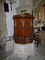 All Saints, West Lavington, pulpit - geograph.org.uk - 5086232.jpg 480 × 640; 54 KB
-

-

-

-

-

-

-

-

-
 An emerald isle set in a golden sea - geograph.org.uk - 1303938.jpg 640 × 477; 131 KB
-
 B3098 leaving Market Lavington - geograph.org.uk - 3389509.jpg 4,320 × 3,240; 5.43 MB
-
 Barley crop, Cornbury Farm, Gore Cross - geograph.org.uk - 452087.jpg 640 × 480; 182 KB
-
 Barns near Gore Cross - geograph.org.uk - 5084719.jpg 640 × 428; 66 KB
-
 Bridge over Church Lane, West Lavington - geograph.org.uk - 2582451.jpg 1,024 × 768; 359 KB
-
 Bridleway leaves the road - geograph.org.uk - 6364643.jpg 3,240 × 4,320; 2.1 MB
-
 Bridleway, New Town - geograph.org.uk - 2000505.jpg 640 × 480; 189 KB
-
 Bridleway, New Town - geograph.org.uk - 2000517.jpg 480 × 640; 205 KB
-
 Bus shelter, Littleton Panell - geograph.org.uk - 5445415.jpg 1,600 × 1,280; 918 KB
-

-
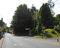
 Church Lane - West Lavington - geograph.org.uk - 2685390.jpg 640 × 430; 425 KB
-
 Church of All Saints, West Lavington - geograph.org.uk - 5679707.jpg 3,776 × 2,520; 2.73 MB
-

-
 Crocuses at All Saints Churchyard, West Lavington - geograph.org.uk - 6062768.jpg 4,000 × 3,000; 4.77 MB
-
 Crocuses at All Saints Churchyard, West Lavington - geograph.org.uk - 6062774.jpg 4,000 × 3,000; 4.78 MB
-
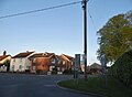 Crossroads in West Lavington - geograph.org.uk - 5763619.jpg 1,990 × 1,458; 1.35 MB
-
 Earthwork, West Lavington Down - geograph.org.uk - 4929043.jpg 4,000 × 3,000; 4.8 MB
-
 Ebenezer Baptist Chapel, West Lavington - geograph.org.uk - 5679565.jpg 3,776 × 2,520; 2.62 MB
-

-
 Entrance to Dauntsey's School - geograph.org.uk - 3459204.jpg 3,648 × 2,736; 2.24 MB
-
 Entrance to military site, Gore Cross - geograph.org.uk - 5084707.jpg 640 × 480; 153 KB
-
 Entrance to the Salisbury Plain Danger Area - geograph.org.uk - 6062780.jpg 4,000 × 3,000; 4.47 MB
-
 Entrance to the Salisbury Plain Danger Area - geograph.org.uk - 6062784.jpg 4,000 × 3,000; 4.61 MB
-
 Entrance to the Salisbury Plain Danger Area - geograph.org.uk - 6062791.jpg 4,000 × 3,000; 4.05 MB
-
 Entrance to West Lavington - geograph.org.uk - 4579256.jpg 640 × 461; 73 KB
-
 Exit to Gore Cross from Imber ranges - geograph.org.uk - 5084580.jpg 640 × 428; 72 KB
-
 Farm buildings north of B3098 - geograph.org.uk - 1236028.jpg 640 × 522; 108 KB
-
 Farmland, Littleton Mill - geograph.org.uk - 5124956.jpg 640 × 492; 47 KB
-
 Footpath, West Lavington - geograph.org.uk - 1999431.jpg 480 × 640; 206 KB
-

-
 Gore Cross, road junction - geograph.org.uk - 5513288.jpg 1,024 × 762; 135 KB
-
 Grazing land, Woodbridge Farm - geograph.org.uk - 4628650.jpg 640 × 426; 39 KB
-

-
 High Street, West Lavington - geograph.org.uk - 5861878.jpg 1,024 × 683; 152 KB
-
 Highland Farm, Gore Cross - geograph.org.uk - 4929025.jpg 4,000 × 3,000; 4.72 MB
-

-
 House at entrance to Littleton Panell mobile home park - geograph.org.uk - 5445412.jpg 1,600 × 1,143; 734 KB
-
 House entrance on High Street, Littleton Panell - geograph.org.uk - 5777676.jpg 1,990 × 1,454; 1.14 MB
-
 House on High Street, Littleton Panell - geograph.org.uk - 5772892.jpg 1,986 × 1,450; 1.32 MB
-
 Houses on High Street, Littleton Panell - geograph.org.uk - 5772884.jpg 1,962 × 1,414; 1.29 MB
-
 Houses on High Street, Littleton Panell - geograph.org.uk - 5772886.jpg 2,014 × 1,490; 1.03 MB
-
 Imber Range Perimeter Path - geograph.org.uk - 1771615.jpg 640 × 270; 34 KB
-
 Imber Range Perimeter Path view - geograph.org.uk - 4153190.jpg 1,600 × 1,067; 740 KB
-

-

-

-

-

-

-

-

-

-

-

-

-

-

-

-
 Interior, All Saints Church - geograph.org.uk - 2000623.jpg 640 × 480; 103 KB
-
-
 Junction of Rutts Lane and the main road - geograph.org.uk - 3593105.jpg 3,648 × 2,736; 4.18 MB
-
 Lavington , West Lavington - geograph.org.uk - 5679552.jpg 3,776 × 2,520; 2.73 MB
-
 Little Cheverell, junction - geograph.org.uk - 5476789.jpg 1,024 × 769; 140 KB
-
 Little Cheverell, red flag - geograph.org.uk - 5476799.jpg 1,024 × 768; 126 KB
-
 Littleton Panell, the post office - geograph.org.uk - 5512664.jpg 640 × 480; 71 KB
-
 Littleton Panell.JPG 2,272 × 1,704; 1.15 MB
-

-
 Looking east along the Perimeter Path - geograph.org.uk - 1316435.jpg 640 × 504; 117 KB
-
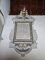
 Memorial to Henry Danvers, All Saints Church, West Lavington - geograph.org.uk - 6062172.jpg 3,000 × 4,000; 4.13 MB
-

-
 Military Road over Littleton Down - geograph.org.uk - 1740150.jpg 640 × 394; 54 KB
-
 Millennium cross at West Lavington - geograph.org.uk - 6062807.jpg 4,000 × 3,000; 4.59 MB
-
 MOD crossing on the A360 - geograph.org.uk - 3594128.jpg 3,648 × 2,736; 3.38 MB
-

-

-

-

-

-
 Monument, All Saints Church - geograph.org.uk - 2000705.jpg 640 × 480; 102 KB
-
 Monument, All Saints Church - geograph.org.uk - 2000855.jpg 480 × 640; 111 KB
-
 Monument, All Saints Church - geograph.org.uk - 2000873.jpg 640 × 481; 125 KB
-
 Monument, All Saints Church - geograph.org.uk - 2001056.jpg 480 × 640; 179 KB
-
 Narrow railway bridge over the A360 - geograph.org.uk - 5861882.jpg 1,024 × 683; 245 KB
-
 North east from White Hill - geograph.org.uk - 1316430.jpg 640 × 505; 154 KB
-
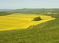
 Oil seed rape near West Lavington - geograph.org.uk - 1380746.jpg 640 × 481; 196 KB
-
 On the Wessex Ridgeway Path, Littleton Down - geograph.org.uk - 2736519.jpg 1,024 × 768; 208 KB
-
 Ordnance Survey Flush Bracket G3882 - geograph.org.uk - 5346581.jpg 4,000 × 3,000; 2.17 MB
-
 Over more water - geograph.org.uk - 6206757.jpg 4,320 × 3,240; 4.15 MB
-
 Over the stile (1) - geograph.org.uk - 6206764.jpg 4,320 × 3,240; 3.68 MB
-
 Parish chest, All Saints Church - geograph.org.uk - 2001012.jpg 640 × 481; 132 KB
-
 Parish church (1) - geograph.org.uk - 6363316.jpg 4,177 × 3,133; 1.92 MB
-
 Parish church (10) (geograph 6363930).jpg 4,111 × 3,083; 2.45 MB


_(geograph_7370012).jpg)
_(geograph_7370020).jpg)
_(geograph_7370385).jpg)
_(geograph_7369936).jpg)
_(geograph_7369938).jpg)
_(geograph_7369981).jpg)
_(geograph_7370008).jpg)


_-_geograph.org.uk_-_2580145.jpg)
_-_geograph.org.uk_-_2580161.jpg)


_-_geograph.org.uk_-_5086191.jpg)
_-_geograph.org.uk_-_5086194.jpg)


_-_geograph.org.uk_-_5086234.jpg)
_-_geograph.org.uk_-_5086236.jpg)
_-_geograph.org.uk_-_5086237.jpg)
_-_geograph.org.uk_-_5086239.jpg)
_-_geograph.org.uk_-_5086241.jpg)
_-_geograph.org.uk_-_5086242.jpg)
_-_geograph.org.uk_-_5086243.jpg)
_-_geograph.org.uk_-_5086245.jpg)
_-_geograph.org.uk_-_5086246.jpg)
_-_geograph.org.uk_-_5086248.jpg)
_-_geograph.org.uk_-_5086251.jpg)
_-_geograph.org.uk_-_5086263.jpg)
_-_geograph.org.uk_-_5086264.jpg)
_-_geograph.org.uk_-_5086278.jpg)
_-_geograph.org.uk_-_5086280.jpg)
_-_geograph.org.uk_-_5086283.jpg)
_-_geograph.org.uk_-_5086284.jpg)
_-_geograph.org.uk_-_5086285.jpg)
_-_geograph.org.uk_-_5086282.jpg)


_-_geograph.org.uk_-_5086213.jpg)
_-_geograph.org.uk_-_5086214.jpg)
_-_geograph.org.uk_-_5086215.jpg)
_-_geograph.org.uk_-_5086218.jpg)
_-_geograph.org.uk_-_5086219.jpg)
_-_geograph.org.uk_-_5086220.jpg)
_-_geograph.org.uk_-_5086223.jpg)
_-_geograph.org.uk_-_5086222.jpg)


,_All_Saints_Churchyard_-_geograph.org.uk_-_2001234.jpg)


_-_geograph.org.uk_-_5086196.jpg)
_-_geograph.org.uk_-_5086197.jpg)
_-_geograph.org.uk_-_5086199.jpg)
_-_geograph.org.uk_-_5086200.jpg)
_-_geograph.org.uk_-_5086201.jpg)
_-_geograph.org.uk_-_5086202.jpg)
_-_geograph.org.uk_-_5086204.jpg)
_-_geograph.org.uk_-_5086206.jpg)
_-_geograph.org.uk_-_5086207.jpg)
_-_geograph.org.uk_-_5086208.jpg)
_-_geograph.org.uk_-_5086210.jpg)
_-_geograph.org.uk_-_5086211.jpg)
_-_geograph.org.uk_-_5086287.jpg)
_-_geograph.org.uk_-_5086288.jpg)

_-_geograph.org.uk_-_5446002.jpg)


_-_geograph.org.uk_-_2685258.jpg)


_-_geograph.org.uk_-_6206764.jpg)

_-_geograph.org.uk_-_6363316.jpg)
_(geograph_6363930).jpg)