Category:Welland, Worcestershire
Jump to navigation
Jump to search
English: Welland is a village and a civil parish in the administrative district of Malvern Hills in the county of Worcestershire, England. It has a combined parish council with Little Malvern. (→Welland, Worcestershire)
Nederlands: Welland is een plaats en civil parish in het bestuurlijke gebied Malvern Hills, in het Engelse graafschap Worcestershire. Welland ligt ongeveel 6 mijl (9,7 km) bij Malvern vandaan. De plaats wordt omgeven door landbouwgrond en maakt deel uit van een regio die als The Malverns bekendstaat. (→Welland (plaats))
Polski: Welland – wieś w Anglii, w hrabstwie Worcestershire, w dystrykcie Malvern Hills. Leży 16 km na południe od miasta Worcester i 162 km na zachód od Londynu. (→Welland (Worcestershire))
Svenska: Welland (Wenlond ix talet, Weneland xii talet, Wentlande och Wenlond xiii talet) är en by och en civil parish i Malvern Hills i Worcestershire i England. Orten har 1 181 invånare (2011). (→Welland, England)

village and civil parish in Worcestershire, United Kingdom  | |||||
| Upload media | |||||
| Instance of | |||||
|---|---|---|---|---|---|
| Location | Malvern Hills, Worcestershire, West Midlands, England | ||||
| Different from | |||||
 | |||||
Subcategories
This category has the following 5 subcategories, out of 5 total.
Media in category "Welland, Worcestershire"
The following 200 files are in this category, out of 513 total.
(previous page) (next page)-
 "Free seats" notice, Welland church - geograph.org.uk - 3654645.jpg 640 × 475; 311 KB
-
 A Claas combine harvester - geograph.org.uk - 5055602.jpg 1,024 × 680; 269 KB
-
 A Conqueror tank at Welland Steam Rally - geograph.org.uk - 5056780.jpg 1,024 × 680; 269 KB
-
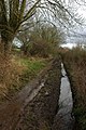 A muddy green lane, Welland - geograph.org.uk - 664417.jpg 426 × 640; 104 KB
-
 A4101 Marlbank Road - geograph.org.uk - 5302633.jpg 4,678 × 2,914; 5.44 MB
-
 A4104 and St James' church spire - geograph.org.uk - 5302627.jpg 4,820 × 3,155; 6.34 MB
-
 A4104 at Drake Street - geograph.org.uk - 3569791.jpg 800 × 451; 207 KB
-
 A4104 entering Welland - geograph.org.uk - 5301435.jpg 4,928 × 3,264; 4.15 MB
-
 A4104 near Marl Bank - geograph.org.uk - 5302643.jpg 4,928 × 3,264; 4.62 MB
-
 An E200 Pay Scraper - geograph.org.uk - 5056132.jpg 800 × 531; 99 KB
-
 An E200 Pay Scraper - geograph.org.uk - 5056138.jpg 1,024 × 680; 283 KB
-
 An early baler at Welland Steam Rally - geograph.org.uk - 5056698.jpg 1,024 × 680; 343 KB
-
 B4208 approaches Danemoor Farm - geograph.org.uk - 3461903.jpg 3,648 × 2,736; 1.29 MB
-
 Badger sett, Brotheridge Green - geograph.org.uk - 1171733.jpg 640 × 427; 368 KB
-
 Barn, Danemoor Farm - geograph.org.uk - 442449.jpg 640 × 293; 146 KB
-
 Berrington's Quarry - geograph.org.uk - 3208489.jpg 2,723 × 1,635; 3.12 MB
-
 Berrington's Quarry, Black Hill, Malvern - geograph.org.uk - 2820743.jpg 4,000 × 2,667; 6.42 MB
-
 Big wheel - geograph.org.uk - 5056902.jpg 680 × 1,024; 303 KB
-
 Black Poplar after pollarding - geograph.org.uk - 2661000.jpg 3,750 × 2,500; 6.8 MB
-
 Black Poplar in mid-October - geograph.org.uk - 3185914.jpg 633 × 640; 441 KB
-
 Black Poplars in September - geograph.org.uk - 3133653.jpg 640 × 427; 273 KB
-
 Blackmore Park Road near Welland - geograph.org.uk - 6257651.jpg 1,920 × 1,280; 987 KB
-
 Bramble flowers, Upper Welland - geograph.org.uk - 893875.jpg 640 × 482; 273 KB
-
 Bramble shoot - geograph.org.uk - 893882.jpg 640 × 466; 241 KB
-
 Bridge over Mere Brook south of Hanley Swan - geograph.org.uk - 4948851.jpg 1,600 × 1,197; 841 KB
-
 Building development at Welland - geograph.org.uk - 4957593.jpg 800 × 600; 149 KB
-
 Building site at Welland - geograph.org.uk - 5116441.jpg 1,024 × 768; 192 KB
-
 Building site at Welland - geograph.org.uk - 5116450.jpg 1,024 × 768; 267 KB
-
 Building site at Welland - geograph.org.uk - 5222037.jpg 800 × 600; 71 KB
-
 Bulldozer at Welland Steam Rally ^1 - geograph.org.uk - 5056672.jpg 680 × 1,024; 250 KB
-
 Bulldozer at Welland Steam Rally ^2 - geograph.org.uk - 5056676.jpg 1,024 × 680; 266 KB
-
 Bulldozer at Welland Steam Rally ^3 - geograph.org.uk - 5056679.jpg 800 × 531; 119 KB
-
 Bus shelter in Welland - geograph.org.uk - 3822295.jpg 1,536 × 767; 663 KB
-
 Bus shelter on road north of Welland - geograph.org.uk - 2688495.jpg 800 × 600; 300 KB
-
 Caterpillar and earthmover - geograph.org.uk - 5056185.jpg 1,024 × 680; 269 KB
-
 Caterpillar and earthmover - geograph.org.uk - 5056191.jpg 1,024 × 680; 259 KB
-
 Cattle Water Trough, Danemoor Farm - geograph.org.uk - 442440.jpg 640 × 427; 268 KB
-
 Chevrolet at Welland Steam Rally - geograph.org.uk - 5058566.jpg 800 × 531; 137 KB
-
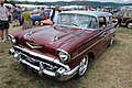 Chevrolet at Welland Steam Rally - geograph.org.uk - 5058567.jpg 1,024 × 680; 325 KB
-
 Chevrolet at Welland Steam Rally - geograph.org.uk - 5058572.jpg 800 × 531; 153 KB
-
 Citroen DS at Welland Steam Rally - geograph.org.uk - 5058363.jpg 1,024 × 680; 286 KB
-
 Cock and Hens, Berry Lodge Farm - geograph.org.uk - 442456.jpg 640 × 443; 314 KB
-
 Coming soon... - geograph.org.uk - 4207228.jpg 800 × 531; 126 KB
-
 Cottage at Tyre Hill - geograph.org.uk - 4866633.jpg 3,339 × 2,676; 1.34 MB
-
 Crop spraying in Little Malvern - geograph.org.uk - 4007700.jpg 640 × 423; 293 KB
-
 Daimler Dart at Welland Steam Rally - geograph.org.uk - 5058492.jpg 800 × 531; 125 KB
-
 Danemoor crossroads - geograph.org.uk - 3179790.jpg 640 × 339; 260 KB
-
 Danemoor Farm - geograph.org.uk - 3822298.jpg 1,536 × 1,152; 1.14 MB
-
 Dawn over Welland - geograph.org.uk - 3144478.jpg 4,279 × 2,632; 5.57 MB
-
 Days Farm, Upper Welland, Malvern - geograph.org.uk - 3932053.jpg 5,184 × 3,456; 7.55 MB
-
 Detail of a traction engine, Welland Steam Rally - geograph.org.uk - 5056737.jpg 680 × 1,024; 196 KB
-
 Diesel shovel - geograph.org.uk - 5056097.jpg 531 × 800; 142 KB
-
 Display of scaled steam traction engines - geograph.org.uk - 5057961.jpg 1,024 × 680; 286 KB
-
 Display of scaled steam traction engines - geograph.org.uk - 5057967.jpg 1,024 × 680; 287 KB
-
 Display of scaled steam traction engines - geograph.org.uk - 5057974.jpg 800 × 531; 114 KB
-
 Drake Street, Welland - geograph.org.uk - 4957533.jpg 800 × 600; 104 KB
-
 Drake Street, Welland - geograph.org.uk - 845021.jpg 640 × 416; 243 KB
-
 Dumped material near the B4208 - geograph.org.uk - 2317421.jpg 3,750 × 2,500; 7.63 MB
-
 E200 Pay Scraper - geograph.org.uk - 5056140.jpg 800 × 531; 112 KB
-
 Early blackberries, Upper Welland - geograph.org.uk - 893871.jpg 640 × 497; 326 KB
-
 Early MG car, Welland Steam Rally - geograph.org.uk - 5058535.jpg 1,024 × 680; 334 KB
-
 Earthmover at Welland Steam Rally - geograph.org.uk - 5056179.jpg 1,024 × 680; 278 KB
-
 Electricity Pylons at Danemoor Cross - geograph.org.uk - 4866620.jpg 3,503 × 2,233; 1.09 MB
-
 Entrance to Harmans Farm - geograph.org.uk - 2217022.jpg 4,272 × 2,848; 4.91 MB
-
 Entrance to Hill Court Farm - geograph.org.uk - 5425042.jpg 1,024 × 768; 303 KB
-
 Fairground carousel - geograph.org.uk - 5056832.jpg 800 × 531; 159 KB
-
 Fairground Carousel ride - geograph.org.uk - 5056827.jpg 1,024 × 680; 282 KB
-
 Farm access ramp - geograph.org.uk - 1171747.jpg 640 × 427; 277 KB
-
 Farmland at Little Welland - geograph.org.uk - 720488.jpg 640 × 426; 60 KB
-
 Farmland on Hook Bank - geograph.org.uk - 5425046.jpg 1,024 × 768; 276 KB
-

-
 Fields near Mayall's Farm - geograph.org.uk - 2212950.jpg 4,172 × 2,294; 5.55 MB
-
 Fields of Little Malvern - geograph.org.uk - 2208859.jpg 4,272 × 2,848; 5.92 MB
-
 Font in Welland church - geograph.org.uk - 6244771.jpg 768 × 1,024; 167 KB
-
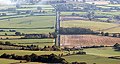
 Football pitches - geograph.org.uk - 838865.jpg 640 × 480; 62 KB
-

-
 Fordson Thames lorries, Welland Steam Rally - geograph.org.uk - 5059823.jpg 1,024 × 680; 222 KB
-
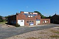 Former Roberts' Garage, Welland - geograph.org.uk - 3048195.jpg 640 × 427; 273 KB
-

-
 Front of a traction engine - geograph.org.uk - 5056752.jpg 800 × 531; 100 KB
-
 Frozen field - geograph.org.uk - 2216998.jpg 4,272 × 2,848; 5.59 MB
-

-
 Gallopers on a carousel - geograph.org.uk - 5056897.jpg 531 × 800; 140 KB
-
 Gents' garage clock, Welland - geograph.org.uk - 3187519.jpg 640 × 582; 311 KB
-
 Gilver's Lane junction - geograph.org.uk - 836065.jpg 640 × 480; 83 KB
-
 Gilvers Lane and footpath signs - geograph.org.uk - 4948870.jpg 1,600 × 1,067; 729 KB
-
 Goat's Beard "Clock" - geograph.org.uk - 2497633.jpg 2,556 × 2,441; 3.95 MB
-
 Goat's Beard - geograph.org.uk - 2497662.jpg 3,103 × 2,213; 3.7 MB
-
 Goat's Beard flower - geograph.org.uk - 2497646.jpg 2,628 × 1,866; 2.62 MB
-
 Grass Snake, Welland Mill - geograph.org.uk - 376245.jpg 640 × 313; 245 KB
-
 Grassy verge with wild orchids - geograph.org.uk - 6145937.jpg 1,600 × 900; 454 KB
-
 Green Lane - geograph.org.uk - 377046.jpg 640 × 427; 304 KB
-
 Green Winged Orchids, Welland - geograph.org.uk - 3968301.jpg 1,600 × 1,010; 1.61 MB
-

-
 Green-winged orchid, Orchis morio, 1 - geograph.org.uk - 6145941.jpg 1,600 × 1,600; 670 KB
-
 Green-winged orchid, Orchis morio, 2 - geograph.org.uk - 6145942.jpg 1,200 × 1,600; 839 KB
-
 Green-winged orchid, Orchis morio, 3 - geograph.org.uk - 6145943.jpg 1,197 × 1,600; 871 KB
-
 Green-winged orchid, Orchis morio, 4 - geograph.org.uk - 6145946.jpg 1,200 × 1,600; 804 KB
-
 Green-winged orchids - geograph.org.uk - 4490599.jpg 800 × 531; 182 KB
-
 Green-winged orchids - geograph.org.uk - 4490602.jpg 800 × 531; 192 KB
-
 Green-winged orchids - geograph.org.uk - 4490610.jpg 531 × 800; 130 KB
-
 Green-winged orchids in Welland - geograph.org.uk - 4957549.jpg 800 × 600; 212 KB
-
 Green-winged orchids in Welland - geograph.org.uk - 4957553.jpg 800 × 600; 197 KB
-
 Green-winged orchids in Welland - geograph.org.uk - 4957564.jpg 800 × 600; 213 KB
-
 Grille of a Fordson Thames lorry - geograph.org.uk - 5059827.jpg 531 × 800; 83 KB
-
 Grille of a Fordson Thames lorry - geograph.org.uk - 5059828.jpg 680 × 1,024; 154 KB
-

-

-
 Hancocks Lane - geograph.org.uk - 2203984.jpg 4,272 × 2,848; 6.44 MB
-
 Hancocks Lane on Christmas Day - geograph.org.uk - 2213522.jpg 4,272 × 2,848; 4.72 MB
-
 Hay bales at Hill Court Farm - geograph.org.uk - 5455493.jpg 1,600 × 1,200; 556 KB
-
 Heading north - geograph.org.uk - 838867.jpg 640 × 480; 70 KB
-
 Heatherlea and Hook Farm - geograph.org.uk - 1171005.jpg 640 × 427; 268 KB
-
 Hedge lichen, Welland - geograph.org.uk - 4291322.jpg 1,600 × 1,112; 1.6 MB
-
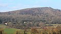
 Herefordshire Beacon on Christmas Day - geograph.org.uk - 2215081.jpg 2,689 × 1,361; 1.99 MB
-
 Hill Court Farm - geograph.org.uk - 6289060.jpg 800 × 533; 163 KB
-
 Hook Bank mobile home park - geograph.org.uk - 1170991.jpg 640 × 427; 280 KB
-
 Hook Bank Mobile Home Park - geograph.org.uk - 2316934.jpg 4,272 × 2,848; 4.7 MB
-
 Hook Farm - geograph.org.uk - 1171047.jpg 640 × 406; 255 KB
-
 Horse grazing - geograph.org.uk - 838910.jpg 640 × 480; 120 KB
-
 Horse pasture in Welland - geograph.org.uk - 2315686.jpg 4,272 × 2,848; 5.59 MB
-
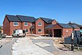
 House building at Welland - geograph.org.uk - 6303598.jpg 1,024 × 768; 221 KB
-
 House building at Welland - geograph.org.uk - 6322549.jpg 1,024 × 683; 201 KB
-
 House building at Welland - geograph.org.uk - 6322554.jpg 1,024 × 683; 186 KB
-
 House building at Welland - geograph.org.uk - 6357068.jpg 1,024 × 768; 228 KB
-
 Houses building at Welland - geograph.org.uk - 6276379.jpg 1,024 × 768; 235 KB
-
 Houses on the Hook link road - geograph.org.uk - 1170968.jpg 640 × 427; 264 KB
-
 Housing development in Welland - geograph.org.uk - 4957528.jpg 800 × 600; 123 KB
-
-
 In Welland village - geograph.org.uk - 6267463.jpg 2,592 × 1,944; 1.84 MB
-
 Joy Ride - geograph.org.uk - 5116570.jpg 640 × 480; 111 KB
-
 Junction for Gilvers Lane - geograph.org.uk - 4948863.jpg 1,600 × 1,104; 683 KB
-
 Kirklands and St Wulstans RC Church - geograph.org.uk - 2786143.jpg 4,000 × 2,245; 6.74 MB
-
 Knopper gall on an oak tree by the A4104 - geograph.org.uk - 3133641.jpg 640 × 415; 191 KB
-
 Land for development in Welland - geograph.org.uk - 4207232.jpg 800 × 531; 133 KB
-
 Land for housing development - geograph.org.uk - 4207229.jpg 800 × 531; 145 KB
-
 Lane at Welland Lodge - geograph.org.uk - 5924529.jpg 1,600 × 903; 571 KB
-
 Lane to Gilver's Lane - geograph.org.uk - 836057.jpg 640 × 480; 88 KB
-
 Lane to Welland Court - geograph.org.uk - 5924541.jpg 1,600 × 901; 940 KB
-
 Little Malvern - geograph.org.uk - 3208470.jpg 640 × 428; 299 KB
-
 Little Malvern Priory - geograph.org.uk - 2203996.jpg 4,272 × 2,848; 3.83 MB
-
 Little Malvern Priory - geograph.org.uk - 2784901.jpg 4,000 × 2,302; 6.64 MB
-
 Little Malvern Priory at Christmas - geograph.org.uk - 2208851.jpg 4,174 × 2,371; 5.25 MB
-
 Little Malvern Priory in the March snow - geograph.org.uk - 3379846.jpg 4,344 × 2,604; 6.76 MB
-
 Low cloud over the Severn Plain - geograph.org.uk - 3178717.jpg 4,516 × 2,644; 4.73 MB
-
 Malvern Hills Children's Zoo - 1 - geograph.org.uk - 1194080.jpg 640 × 417; 125 KB
-
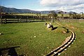 Malvern Hills Children's Zoo - 2 - geograph.org.uk - 1194083.jpg 640 × 425; 116 KB
-
 March snow in Upper Welland - geograph.org.uk - 3380635.jpg 5,184 × 3,456; 6.7 MB
-
 Marl Pit, Bakehouse Orchard, Welland - geograph.org.uk - 510411.jpg 640 × 427; 306 KB
-
 The Marlbank Inn - geograph.org.uk - 427560.jpg 640 × 427; 241 KB
-
 Marlbank Inn - geograph.org.uk - 584235.jpg 640 × 396; 260 KB
-
 Marlbank Road - geograph.org.uk - 754870.jpg 640 × 480; 71 KB
-
 Massey Ferguson tractor - geograph.org.uk - 5055599.jpg 1,024 × 680; 290 KB
-
 Mayall's Coppice on Christmas Day - geograph.org.uk - 3270569.jpg 640 × 401; 192 KB
-
 Mayall's Farm - geograph.org.uk - 2784957.jpg 4,000 × 2,442; 7.04 MB
-
 Meadow near Hook Farm - geograph.org.uk - 1609580.jpg 640 × 480; 130 KB
-
 Merry Christmas in Watery Lane - geograph.org.uk - 2212986.jpg 4,272 × 2,848; 5.44 MB
-
 MGA at Welland Steam Rally - geograph.org.uk - 5058499.jpg 1,024 × 680; 297 KB
-
 Micklefield, Little Welland - geograph.org.uk - 6517.jpg 640 × 479; 101 KB
-
 Midlands Farm - geograph.org.uk - 1170961.jpg 640 × 427; 250 KB
-
 Minimum expenditure - geograph.org.uk - 838892.jpg 640 × 480; 121 KB
-
 Morris Cowley Saloon, Welland Steam Rally - geograph.org.uk - 5058518.jpg 1,024 × 680; 305 KB
-
 Mouse-ear Hawkweed - geograph.org.uk - 2497697.jpg 2,870 × 1,791; 2.71 MB
-
 Muddy paddock - geograph.org.uk - 655076.jpg 640 × 480; 110 KB
-
 Myrtle Cottage, Drake Street, Welland - geograph.org.uk - 2315697.jpg 4,272 × 2,848; 5.47 MB
-
 Myrtle Cottage, Drake Street, Welland - geograph.org.uk - 2316972.jpg 3,633 × 2,421; 4.72 MB
-
 Near the top of Hancocks Lane - geograph.org.uk - 2203871.jpg 4,272 × 2,848; 6.49 MB
-
 New housing development at Welland - geograph.org.uk - 4957525.jpg 800 × 600; 102 KB
-
 Oak tree near Upper Welland - geograph.org.uk - 1155860.jpg 640 × 480; 202 KB
-
 Old letter box, Hook Bank - geograph.org.uk - 1170985.jpg 640 × 427; 298 KB
-
 Old Orchard and Daffodils - geograph.org.uk - 376258.jpg 640 × 427; 242 KB
-

-
 Old Welland Churchyard - geograph.org.uk - 2876872.jpg 640 × 427; 358 KB
-
 Orchard in Welland - geograph.org.uk - 2202651.jpg 4,272 × 2,848; 7.72 MB
-
 Orchids in Welland - geograph.org.uk - 845297.jpg 640 × 444; 326 KB
-
 Ordnance Survey Cut Mark - geograph.org.uk - 4375040.jpg 480 × 640; 121 KB
-
 Pasture in Welland - geograph.org.uk - 2316925.jpg 4,272 × 2,848; 4.77 MB
-
 Pasture in Welland - geograph.org.uk - 2317590.jpg 4,272 × 2,848; 4.85 MB
-
 Pear tree, Welland - geograph.org.uk - 3209885.jpg 2,965 × 2,862; 6.67 MB
-
 Pheasant Inn, Welland - geograph.org.uk - 4957589.jpg 1,024 × 768; 239 KB
-
 Ploughing at Welland Stemn Rally - geograph.org.uk - 5055585.jpg 1,024 × 680; 259 KB
-
 Ploughing demonstration - geograph.org.uk - 5055595.jpg 1,024 × 680; 288 KB
-
 Ploughing demonstration - geograph.org.uk - 5056168.jpg 1,024 × 680; 290 KB
-
 Ploughing demonstration, Welland Steam Rally - geograph.org.uk - 5055573.jpg 1,024 × 680; 286 KB
-
 Ploughing using a steam traction engine - geograph.org.uk - 5055594.jpg 1,024 × 680; 267 KB
-
 Plume of Feathers - 1 - geograph.org.uk - 1135028.jpg 640 × 480; 72 KB
-
 Plume of Feathers - 2 - geograph.org.uk - 1135036.jpg 640 × 480; 98 KB
-
 Poplar trees in Welland - geograph.org.uk - 1077330.jpg 426 × 640; 77 KB
-
 Pylon and power lines, Welland - geograph.org.uk - 451226.jpg 640 × 426; 86 KB
-
 Pylon in Upper Welland - geograph.org.uk - 2438692.jpg 3,772 × 2,847; 5.16 MB
-
 Pylons near Danemoor Cross - geograph.org.uk - 3822297.jpg 1,536 × 767; 745 KB
-
 Red lorry, yellow lorry... - geograph.org.uk - 5059812.jpg 1,024 × 680; 252 KB
-
 Reflections in a door mirror - geograph.org.uk - 5059835.jpg 680 × 1,024; 146 KB
-
 Ridge and Furrow, Welland - geograph.org.uk - 3421664.jpg 5,184 × 3,456; 5.7 MB
-
 Ridge and Furrow, Welland - geograph.org.uk - 845018.jpg 640 × 427; 265 KB
-
 Riley car at Welland Steam Rally - geograph.org.uk - 5058562.jpg 800 × 531; 138 KB
-
 Road side telephone kiosk - geograph.org.uk - 1171279.jpg 640 × 427; 260 KB
-
 Roadside grasses - geograph.org.uk - 868210.jpg 640 × 427; 358 KB
-
 Roadside Nature Reserve - geograph.org.uk - 5455740.jpg 1,600 × 1,200; 615 KB
-
 Rolls Royces at Welland Steam Rally - geograph.org.uk - 5058341.jpg 1,024 × 680; 284 KB


