Category:Waterfoot, Lancashire
Jump to navigation
Jump to search
English: Waterfoot is a small Rossendale mill-town at between Rawtenstall and Bacup in Lancashire where the B6238 from Burnley meets the A681. It is where the River Whitwell meets the River Irwell.
village in Lancashire, England, UK  | |||||
| Upload media | |||||
| Instance of | |||||
|---|---|---|---|---|---|
| Location | Rossendale, Lancashire, North West England, England | ||||
 | |||||
Subcategories
This category has the following 3 subcategories, out of 3 total.
Media in category "Waterfoot, Lancashire"
The following 41 files are in this category, out of 41 total.
-
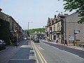
 B6238 Burnley Road East, Waterfoot - geograph.org.uk - 929325.jpg 640 × 480; 85 KB
-
 B6238, Burnley Road East, Waterfoot - geograph.org.uk - 929328.jpg 640 × 480; 93 KB
-
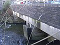 Bacup Road crosses the River Irwell - geograph.org.uk - 1135386.jpg 640 × 480; 91 KB
-
 Bacup Road, Waterfoot - geograph.org.uk - 528831.jpg 640 × 527; 81 KB
-
 Bridge Street, Waterfoot - geograph.org.uk - 970340.jpg 640 × 480; 177 KB
-
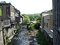 Confluence - geograph.org.uk - 828859.jpg 608 × 456; 180 KB
-
 Cowpe Brook, Hugh Mill - geograph.org.uk - 970344.jpg 640 × 480; 203 KB
-
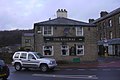
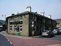
 Duke of Buccleuch, Waterfoot - geograph.org.uk - 828849.jpg 640 × 480; 140 KB
-
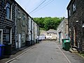
 Duke Street, Waterfoot - geograph.org.uk - 828853.jpg 640 × 480; 173 KB
-
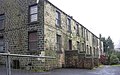
 Formerly Hugh Mill (Woollen) - geograph.org.uk - 970337.jpg 640 × 480; 171 KB
-
 Glen House, Waterfoot - geograph.org.uk - 970386.jpg 640 × 480; 205 KB
-
 Glen Terrace, Waterfoot - geograph.org.uk - 1120670.jpg 640 × 398; 78 KB
-
 Glen Terrace, Waterfoot - geograph.org.uk - 970381.jpg 640 × 480; 181 KB
-
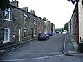
 Houses, Booth Road, Waterfoot - geograph.org.uk - 929322.jpg 640 × 480; 76 KB
-

-
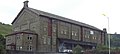 Old Railway Buildings, Waterfoot. - geograph.org.uk - 504941.jpg 640 × 287; 40 KB
-
 Preserve Works, Waterfoot - geograph.org.uk - 1314420.jpg 640 × 480; 79 KB
-
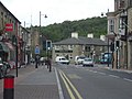
 Road junction - geograph.org.uk - 970333.jpg 640 × 480; 174 KB
-
 Road junction, Waterfoot - geograph.org.uk - 818344.jpg 640 × 480; 230 KB
-

-
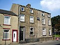
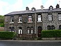 St James's Terrace, Waterfoot - geograph.org.uk - 441594.jpg 640 × 480; 140 KB
-
 Sunday School, Cowpe - geograph.org.uk - 685162.jpg 640 × 480; 184 KB
-
 The former NatWest Bank in Waterfoot - geograph.org.uk - 1706342.jpg 3,872 × 2,592; 3.72 MB
-

-

-
 The Railway - geograph.org.uk - 1120672.jpg 640 × 427; 52 KB
-
 The Railway, Waterfoot - geograph.org.uk - 828842.jpg 640 × 480; 231 KB
-
 Todd Carr Road - geograph.org.uk - 1202265.jpg 640 × 480; 137 KB
-
 Victoria Parade, Waterfoot - geograph.org.uk - 828860.jpg 640 × 480; 213 KB
-
 Victoria Street, Waterfoot - geograph.org.uk - 828855.jpg 640 × 480; 203 KB
-
 Victorian Arcade.jpg 460 × 302; 35 KB
-
 View of Waterfoot from Boarsgreave - geograph.org.uk - 685179.jpg 640 × 480; 155 KB
-
 Waterfoot Centre - geograph.org.uk - 504935.jpg 640 × 480; 81 KB
-
 Waterfoot Social Club - geograph.org.uk - 1314392.jpg 640 × 480; 90 KB
-

-
 Bacup Road, Waterfoot - geograph.org.uk - 818337.jpg 640 × 480; 180 KB
-
 Cowpe Brook, Waterfoot - geograph.org.uk - 442204.jpg 480 × 640; 159 KB
-
 Guest House, Waterfoot. - geograph.org.uk - 504922.jpg 640 × 387; 68 KB
-
 Hugh Mill Bridge, Waterfoot - geograph.org.uk - 442191.jpg 640 × 480; 153 KB
-
 Royal Hotel, Waterfoot. - geograph.org.uk - 504927.jpg 640 × 600; 111 KB
-
 Waterfoot Health Centre - geograph.org.uk - 442187.jpg 640 × 480; 109 KB


_-_geograph.org.uk_-_970337.jpg)


