Category:Utah State Route 8 (1910-1977)
Jump to navigation
Jump to search
former state highway in Utah County, Utah, United States  | |||||
| Upload media | |||||
| Instance of | |||||
|---|---|---|---|---|---|
| Location | Utah County, Utah | ||||
| Transport network | |||||
| Owned by |
| ||||
| Maintained by |
| ||||
| Inception |
| ||||
| Dissolved, abolished or demolished date |
| ||||
| Terminus |
| ||||
 | |||||
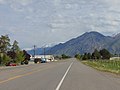
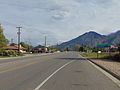
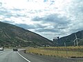
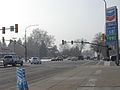
English: Media related to Utah State Route 8 (1910-1977), SR-8, the former state highway designation (legislative overlay) for a section of U.S. Route 89 (US 89) in Utah County, United States, that connected U.S. Route 6 (US 6) at Moark Junction (in what is now eastern Spanish Fork) with State Route 1 (Interstate 15) in Lehi. (Most of this section of US 89 was concurrent with the former routing of U.S. Route 91.)
From 1910 to 1962, SR-8 also included the section of what was later (1926) designated as U.S. Route 6 / U.S. Route 50 (US 6 / US 50) from Moark Junction to the Colorado State line (via Price and Green River). In 1962 the eastern terminus was truncated to the junction with the newly created Interstate 70 (I-70), west of Green River, and the truncated section became part of the newly designated State Route 4. In 1969 the section from Moark Junction to the junction with I-70 was renumbered as part of Utah State Route 27. In 1976, US 50 was rerouted south such that it no longer ran along SR-8. In the next year (1977), the State Route 8 designation was deleted from the state highway system and with the section north of Moark Junction becoming part of the newly created State Route 89, and the entire length of US 6 within the state was designated as State Route 6.
From 1910 to 1962, SR-8 also included the section of what was later (1926) designated as U.S. Route 6 / U.S. Route 50 (US 6 / US 50) from Moark Junction to the Colorado State line (via Price and Green River). In 1962 the eastern terminus was truncated to the junction with the newly created Interstate 70 (I-70), west of Green River, and the truncated section became part of the newly designated State Route 4. In 1969 the section from Moark Junction to the junction with I-70 was renumbered as part of Utah State Route 27. In 1976, US 50 was rerouted south such that it no longer ran along SR-8. In the next year (1977), the State Route 8 designation was deleted from the state highway system and with the section north of Moark Junction becoming part of the newly created State Route 89, and the entire length of US 6 within the state was designated as State Route 6.
Subcategories
This category has the following 2 subcategories, out of 2 total.
M
- Moark Junction (6 F)
Media in category "Utah State Route 8 (1910-1977)"
The following 13 files are in this category, out of 13 total.
-
 East across US-89 at the Northwest Plaza in Provo, Utah, Feb 18.jpg 2,592 × 1,944; 2.33 MB
-
 North along US-89, from 2700 S, in Mapleton, Utah, May 16.jpg 2,592 × 1,944; 2.36 MB
-
 North at US-89 & SR-180 junction, American Fork, Utah, Aug 16.jpg 2,592 × 1,944; 2.4 MB
-
 North toward junction of US-89 and SR-75, Feb 16.jpg 2,816 × 2,112; 2.23 MB
-
 Provo City, Utah cemetery, Feb 17.jpg 2,592 × 1,944; 2.36 MB
-
 South at US-89 & SR 147 (W Maple St) junction, Apr 16.jpg 2,592 × 1,944; 2.36 MB
-
 South at US-89 & SR-147 (W 1600 South) in Mapleton, Utah, Apr 16.jpg 2,592 × 1,944; 2.42 MB
-
 South-southeast along UP tracks at S 2400 East in Utah County, Utah, May 16.jpg 2,592 × 1,944; 2.4 MB
-
 US Highway 6 - Utah - 7688471172.jpg 3,072 × 2,304; 505 KB
-
 US Highway 6 - Utah - 7688471692.jpg 3,072 × 2,304; 565 KB
-
 Utah 8.svg 600 × 600; 11 KB
-
 Utah SR 8.svg 385 × 385; 8 KB
-
 West toward junction of US-89 and SR-77, Feb 16.jpg 2,816 × 2,112; 2.11 MB


_junction,_Apr_16.jpg)
_in_Mapleton,_Utah,_Apr_16.jpg)


