Category:United Kingdom photographs taken on 2010-02-06
Jump to navigation
Jump to search
Countries of Europe: Austria · Belgium · Croatia · Estonia · Finland · France‡ · Germany · Italy · Latvia · Lithuania · Malta · Netherlands‡ · Norway · Poland · Portugal‡ · Romania · Russia‡ · Spain‡ · Sweden · Switzerland · Turkey‡ · Ukraine · United Kingdom
‡: partly located in Europe
‡: partly located in Europe
| ← | 6 February 2010 | → | ||
| ← | February 2010 | → | ||

United Kingdom photographs taken on 6 February 2010.
Image files should be categorized here automatically using {{taken on}} template. Direct categorisation is also possible, if automatic is impossible.
Subcategories
This category has only the following subcategory.
L
Media in category "United Kingdom photographs taken on 2010-02-06"
The following 200 files are in this category, out of 464 total.
(previous page) (next page)-
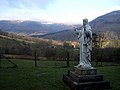 'Our Lady of Llanthony' - geograph.org.uk - 1766407.jpg 800 × 600; 120 KB
-

-

-
-

-

-

-
 A sunset sky over Gwithian beach - geograph.org.uk - 1707379.jpg 640 × 618; 88 KB
-
-

-

-
 A30 westbound near Broadwoodwidger - geograph.org.uk - 1701126.jpg 640 × 426; 75 KB
-
 Above the tunnel - geograph.org.uk - 1708600.jpg 640 × 480; 118 KB
-

-
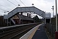
 Adlington railway station, Lancashire, 2010 (geograph 3231008).jpg 800 × 507; 105 KB
-
 Afon Honddu at Capel-y-ffin - geograph.org.uk - 1765149.jpg 800 × 600; 140 KB
-
 Albany Road, Chorlton - panoramio.jpg 3,072 × 2,304; 1.77 MB
-
 All Saints Church - geograph.org.uk - 1705115.jpg 480 × 640; 87 KB
-
 All Saints Churchyard (1) - geograph.org.uk - 1709878.jpg 480 × 640; 73 KB
-
 All Saints Churchyard (2) - geograph.org.uk - 1709886.jpg 640 × 480; 82 KB
-
 All Saints Churchyard (3) - geograph.org.uk - 1709888.jpg 640 × 480; 84 KB
-
 All Saints Churchyard (4) - geograph.org.uk - 1709889.jpg 480 × 640; 57 KB
-
 All Saints Churchyard (5) - geograph.org.uk - 1709896.jpg 640 × 480; 72 KB
-
 All Saints Churchyard (6) - geograph.org.uk - 1709914.jpg 640 × 480; 53 KB
-
 Allt Coire nah-Achlais - geograph.org.uk - 1702112.jpg 640 × 480; 150 KB
-
 An evening stroll on Gwithian beach - geograph.org.uk - 1707363.jpg 640 × 426; 68 KB
-

-

-
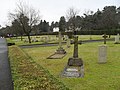
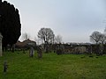
 Annesley Cemetery - geograph.org.uk - 1705094.jpg 640 × 480; 146 KB
-
 Annesley Village - geograph.org.uk - 1708329.jpg 640 × 480; 99 KB
-
 Annesley village artwork - 1 - geograph.org.uk - 1708452.jpg 640 × 480; 118 KB
-
 Annesley village artwork - 2 - geograph.org.uk - 1708496.jpg 640 × 480; 108 KB
-
-

-
 Aqueduct flows towards the River Otter - geograph.org.uk - 1701396.jpg 480 × 640; 132 KB
-
 Arable land at Stocks Farm - geograph.org.uk - 1700613.jpg 1,600 × 1,200; 439 KB
-
 Arable land east of Annesley - geograph.org.uk - 1708550.jpg 640 × 480; 108 KB
-

-

-
 Ascent of Buachaille Etive Beag - geograph.org.uk - 1701177.jpg 640 × 359; 87 KB
-
-

-
 Baptist chapel at Capel-y-ffin - geograph.org.uk - 1765613.jpg 800 × 600; 124 KB
-
 Barn and Baptist chapel - geograph.org.uk - 1765185.jpg 800 × 600; 148 KB
-
 Battersea Park Road - geograph.org.uk - 1703822.jpg 480 × 640; 90 KB
-
 Baynard Close - .5 and 7 - geograph.org.uk - 1732405.jpg 800 × 600; 85 KB
-

-
 Beside a brook south of Broadwoodwidger - geograph.org.uk - 1701129.jpg 640 × 426; 159 KB
-
 Billy Wynt - geograph.org.uk - 1709398.jpg 1,600 × 1,200; 327 KB
-
 Binsted's War Memorial - geograph.org.uk - 1710388.jpg 480 × 640; 55 KB
-
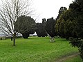
 Blaise Castle Estate - geograph.org.uk - 1705183.jpg 640 × 480; 43 KB
-
 Bollards on the Peddars Way - geograph.org.uk - 1701428.jpg 640 × 480; 200 KB
-
 Boomsbury Square - geograph.org.uk - 1705734.jpg 640 × 427; 100 KB
-
 Bowling green wall - Llantwit Major - geograph.org.uk - 1700124.jpg 1,200 × 900; 1.11 MB
-
 Bredbury Sunset - geograph.org.uk - 1705313.jpg 640 × 622; 108 KB
-

-
 Bridge over the River Trym, decorated - geograph.org.uk - 1705385.jpg 640 × 480; 128 KB
-

-
 Buachaille Etive Beag - geograph.org.uk - 1701864.jpg 480 × 640; 25 KB
-

-

-
 Burlington Arcade - geograph.org.uk - 1705341.jpg 480 × 640; 75 KB
-
 Bus shelter at Oakhanger - geograph.org.uk - 1701812.jpg 640 × 480; 48 KB
-
 Bus shelter on Main Road - geograph.org.uk - 1709823.jpg 640 × 480; 77 KB
-

-
 Calvary at The Monastery - geograph.org.uk - 1765903.jpg 600 × 800; 125 KB
-
 Calvary plaque, and cat - geograph.org.uk - 1765935.jpg 600 × 800; 168 KB
-
 Calvary, close-up - geograph.org.uk - 1765924.jpg 600 × 800; 132 KB
-
 Capel-y-ffin, church entrance - geograph.org.uk - 1764401.jpg 705 × 475; 129 KB
-
 Captains Farm from Streat Lane - geograph.org.uk - 1702251.jpg 1,600 × 1,200; 463 KB
-
 Cardurnock and the Solway - geograph.org.uk - 1703861.jpg 3,872 × 2,592; 2.72 MB
-
 Cardwell Road - geograph.org.uk - 1702477.jpg 640 × 429; 116 KB
-
 Cat outside the café at Headley - geograph.org.uk - 1709904.jpg 480 × 640; 80 KB
-
 Channel Marker, River Lymington - geograph.org.uk - 1702245.jpg 3,872 × 2,592; 4.92 MB
-
 Chapel of rest at Annesley cemetery - geograph.org.uk - 1705089.jpg 640 × 480; 116 KB
-
 Chapel of rest at Annesley cemetery - geograph.org.uk - 1705106.jpg 640 × 480; 172 KB
-

-
 Churt Churchyard (1) - geograph.org.uk - 1708014.jpg 480 × 640; 62 KB
-
 Circular seat at Headley - geograph.org.uk - 1709861.jpg 640 × 480; 103 KB
-
 Circular seat on the green at Oakhanger - geograph.org.uk - 1701796.jpg 480 × 640; 132 KB
-
 Club house of Mid Sussex Golf Club - geograph.org.uk - 1700674.jpg 1,600 × 1,200; 364 KB
-
 Coliseum and Chandos Bar - geograph.org.uk - 1706149.jpg 528 × 640; 75 KB
-

-
 Community Forest Path - geograph.org.uk - 1705197.jpg 640 × 480; 60 KB
-

-
 Cornice on Druim Sgùrr Eilde - geograph.org.uk - 1702135.jpg 640 × 480; 100 KB
-

-
 Crags, Stob Dubh - geograph.org.uk - 1701898.jpg 640 × 359; 21 KB
-
 Curious creature at West Worldham - geograph.org.uk - 1701951.jpg 640 × 480; 140 KB
-

-
 Cycleway and footpath to Newstead - geograph.org.uk - 1705353.jpg 640 × 480; 122 KB
-
 Càrn Alasdair - geograph.org.uk - 1702102.jpg 640 × 480; 144 KB
-
 Darren Lwyd through the window - geograph.org.uk - 1764428.jpg 800 × 600; 122 KB
-
 De Havilland Canada DHC-8-400 (Flybe) 1706620.jpg 1,600 × 1,200; 254 KB
-

-
 Decoration on Bury Street - geograph.org.uk - 1704129.jpg 480 × 640; 70 KB
-
 Derwent Water and Thirlmere - geograph.org.uk - 1703876.jpg 3,872 × 2,592; 2.5 MB
-
 Dining room at Llanthony Priory hotel - geograph.org.uk - 1767747.jpg 800 × 600; 124 KB
-
 Druim Sgùrr Eilde - geograph.org.uk - 1702139.jpg 640 × 480; 83 KB
-

-
 East Grinstead High St - geograph.org.uk - 1701372.jpg 588 × 640; 80 KB
-
 East stand, Kassam Stadium, Oxford United - geograph.org.uk - 1705831.jpg 3,072 × 2,304; 2.36 MB
-
 Bell within St Mary, East Worldham - geograph.org.uk - 1705761.jpg 480 × 640; 66 KB
-
 Eccles bound at Pomona - geograph.org.uk - 1705096.jpg 640 × 456; 106 KB
-

-
 End of the Line - geograph.org.uk - 1701266.jpg 3,872 × 2,592; 3.32 MB
-

-
 Entrance to Lymington Harbour - geograph.org.uk - 1702196.jpg 3,872 × 2,592; 4.23 MB
-

-
 Entrance to The Grange - geograph.org.uk - 1765968.jpg 800 × 600; 131 KB
-

-
 Evening glow over Gwithian beach - geograph.org.uk - 1707365.jpg 640 × 426; 32 KB
-

-
 Evening silhouette of ruin of Duntulm Castle, Isle of Skye.JPG 2,592 × 1,944; 1.53 MB
-

-
-

-
 Farm beside the bridge - geograph.org.uk - 1760819.jpg 800 × 600; 124 KB
-

-

-

-

-
 Fishing platform at Kingsley Pond - geograph.org.uk - 1709828.jpg 640 × 480; 96 KB
-

-

-
-
 Foggy at Another Place.jpg 1,349 × 915; 809 KB
-
 Foggy Day at Another Place.jpg 1,313 × 938; 1.04 MB
-
 Font at St Mary's church - geograph.org.uk - 1765163.jpg 600 × 800; 116 KB
-

-
 Footbridge over The Portway (A4) - geograph.org.uk - 1705308.jpg 640 × 480; 67 KB
-
 Footpath and bridge over the River Trym - geograph.org.uk - 1705371.jpg 640 × 480; 125 KB
-
 Footpath sign at Hartley Mauditt - geograph.org.uk - 1701882.jpg 640 × 480; 58 KB
-
 Foreshore photographer at Godrevy - geograph.org.uk - 1706114.jpg 640 × 422; 75 KB
-
 Former village store - geograph.org.uk - 1705435.jpg 640 × 500; 68 KB
-
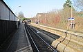
 Fort Matilda railway station - geograph.org.uk - 1702445.jpg 640 × 429; 129 KB
-
 Fruiterer on The Pavement - geograph.org.uk - 1762464.jpg 800 × 600; 154 KB
-
 Fungus, Lagan towpath - geograph.org.uk - 1702394.jpg 564 × 320; 99 KB
-
 Garage on the A287 at Churt - geograph.org.uk - 1707825.jpg 640 × 480; 61 KB
-

-

-

-
 Gateway to Otterton Park - geograph.org.uk - 1701399.jpg 640 × 480; 141 KB
-
 Glen Dee - geograph.org.uk - 1705756.jpg 800 × 600; 111 KB
-

-

-

-
-
 Goldfinch 6 (4335005978).jpg 1,710 × 1,584; 1.23 MB
-
 Goose, St James's Park - geograph.org.uk - 1705533.jpg 464 × 640; 101 KB
-
 Graeme House, Chorlton - panoramio.jpg 3,072 × 2,304; 1.87 MB
-
 Graves at Capel-y-ffin - geograph.org.uk - 1764582.jpg 800 × 600; 139 KB
-
 Gravestone with elegant carving - geograph.org.uk - 1765648.jpg 600 × 800; 154 KB
-
-

-
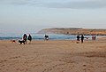
 Group on Godrevy beach at low water - geograph.org.uk - 1707338.jpg 600 × 395; 41 KB
-
-
 Guildford Road-Alton Road crossroads, Fleet - geograph.org.uk - 1705820.jpg 3,072 × 2,304; 4.15 MB
-
 Hartfield Rd, Forest Row - geograph.org.uk - 1701254.jpg 640 × 427; 64 KB
-
 Hay Bluff lost in the mist - geograph.org.uk - 1763992.jpg 800 × 600; 124 KB
-
 Head of the Lairig Eilde - geograph.org.uk - 1701170.jpg 640 × 359; 68 KB
-

-

-
 Headley Church Centre - geograph.org.uk - 1709906.jpg 640 × 480; 51 KB
-
 Headley War Memorial - geograph.org.uk - 1709898.jpg 511 × 640; 84 KB
-
 High Holburn - geograph.org.uk - 1705752.jpg 640 × 427; 84 KB
-
 High Street, Yarmouth - geograph.org.uk - 1706206.jpg 3,872 × 2,592; 4.14 MB
-
 Hurstwood Building - panoramio.jpg 3,648 × 2,736; 1.81 MB
-
 In a monastery garden... - geograph.org.uk - 1767380.jpg 800 × 600; 135 KB
-

-
-
 Ipswich and the Orwell Bridge - geograph.org.uk - 1716129.jpg 3,166 × 2,142; 1.63 MB
-
 Jetski spray 44.jpg 3,000 × 1,997; 2.69 MB
-
-
 Kings Weston Road - geograph.org.uk - 1705206.jpg 640 × 480; 119 KB
-

-
 Rear of Kingsley War Memorial - geograph.org.uk - 1709849.jpg 480 × 640; 120 KB
-

-
-

-

-
 Kingsley Post Office - geograph.org.uk - 1709815.jpg 640 × 480; 59 KB
-
 Kingsley War Memorial - geograph.org.uk - 1709852.jpg 480 × 640; 82 KB
-
 Lairig Gartain - geograph.org.uk - 1701816.jpg 640 × 480; 35 KB
-

-
 Lane traversing Brettenham Heath - geograph.org.uk - 1701409.jpg 640 × 480; 120 KB
-
 Latchmere Passage, Battersea - geograph.org.uk - 1703725.jpg 480 × 640; 101 KB
-
 Leaving Wales - geograph.org.uk - 1762627.jpg 800 × 600; 136 KB
-

-
 Lifebuoy, Bangor - geograph.org.uk - 1706445.jpg 649 × 800; 503 KB
-
 Lifeguard hut near Godrevy beach - geograph.org.uk - 1706117.jpg 640 × 426; 88 KB
-

-
 Llantwit Major RFC club house - geograph.org.uk - 1700186.jpg 1,200 × 789; 904 KB
-

-
-

-
 Looking along the Lindford Road - geograph.org.uk - 1709874.jpg 640 × 480; 83 KB
-

-
 Looking eastwards from Stansted Lane (geograph 1699061).jpg 640 × 480; 61 KB
-


.jpg)


_-_geograph.org.uk_-_1709878.jpg)
_-_geograph.org.uk_-_1709886.jpg)
_-_geograph.org.uk_-_1709888.jpg)
_-_geograph.org.uk_-_1709889.jpg)
_-_geograph.org.uk_-_1709896.jpg)
_-_geograph.org.uk_-_1709914.jpg)


_-_geograph.org.uk_-_1708014.jpg)


_1706620.jpg)


_-_geograph.org.uk_-_1705308.jpg)


_-_geograph.org.uk_-_1707340.jpg)
_-_geograph.org.uk_-_1707342.jpg)
_-_geograph.org.uk_-_1707356.jpg)
.jpg)


.jpg)
