Category:United Kingdom photographs taken on 2009-01-11
Jump to navigation
Jump to search
Countries of Europe: Austria · Belgium · Cyprus‡ · Czech Republic · Estonia · Finland · France‡ · Germany · Hungary · Republic of Ireland · Italy · Lithuania · Netherlands‡ · Poland · Romania · Russia‡ · Slovakia · Spain‡ · Sweden · Switzerland · Turkey‡ · Ukraine · United Kingdom
Specific status: Gibraltar
‡: partly located in Europe
Specific status: Gibraltar
‡: partly located in Europe
| ← | 11 January 2009 | → | ||
| ← | January 2009 | → | ||

United Kingdom photographs taken on 11 January 2009.
Image files should be categorized here automatically using {{taken on}} template. Direct categorisation is also possible, if automatic is impossible.
Subcategories
This category has the following 3 subcategories, out of 3 total.
Media in category "United Kingdom photographs taken on 2009-01-11"
The following 200 files are in this category, out of 792 total.
(previous page) (next page)-
 "Yuk" - geograph.org.uk - 1133552.jpg 480 × 640; 57 KB
-
 10-23 St John's Square - geograph.org.uk - 1120655.jpg 640 × 480; 329 KB
-
 A parliament of rooks - geograph.org.uk - 1116638.jpg 640 × 480; 190 KB
-
 A spring, Dunorlan Park - geograph.org.uk - 1117420.jpg 640 × 430; 131 KB
-
 A wet Glen Roy - geograph.org.uk - 1117506.jpg 640 × 480; 75 KB
-
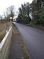
 A1122 around Downham Market - geograph.org.uk - 1142239.jpg 640 × 480; 74 KB
-
 A142 junction - geograph.org.uk - 1141310.jpg 640 × 480; 77 KB
-
 Across the allotments, Birdingbury - geograph.org.uk - 1116274.jpg 640 × 514; 196 KB
-
 Aldi sunrise, Hessle - geograph.org.uk - 1116043.jpg 440 × 640; 184 KB
-
 All that remains of Wigan Pier - geograph.org.uk - 1116167.jpg 640 × 480; 91 KB
-
 Allotments shed, Birdingbury - geograph.org.uk - 1116283.jpg 640 × 498; 107 KB
-
 Allotments, Birdingbury - geograph.org.uk - 1116279.jpg 640 × 468; 90 KB
-
 America Farm - geograph.org.uk - 1137562.jpg 640 × 512; 80 KB
-
 Arable fields east of Whittle Farm - geograph.org.uk - 1115914.jpg 640 × 360; 83 KB
-
 Arable hillside below the Penyard - geograph.org.uk - 1116349.jpg 640 × 454; 105 KB
-
 Archway, East Bank - geograph.org.uk - 1138393.jpg 480 × 640; 94 KB
-
 Arundel Rd - geograph.org.uk - 1117537.jpg 640 × 430; 88 KB
-
 Asparagus crop below the Penyard - geograph.org.uk - 1116388.jpg 640 × 441; 146 KB
-
 Auckland Rd - geograph.org.uk - 1117330.jpg 640 × 430; 65 KB
-
 Aylesford Street Pimlico - geograph.org.uk - 1115243.jpg 640 × 480; 102 KB
-

-

-
 B1049 towards Wilburton - geograph.org.uk - 1140662.jpg 640 × 480; 96 KB
-
 Back road in the Fens - geograph.org.uk - 1141783.jpg 640 × 480; 131 KB
-
 St John the Baptist church, Barham - geograph.org.uk - 1130551.jpg 480 × 640; 193 KB
-

-
 View of St John the Baptist church - geograph.org.uk - 1130549.jpg 640 × 480; 208 KB
-
 Barn south of Leamington Hastings - geograph.org.uk - 1116462.jpg 640 × 474; 84 KB
-
 Barns at Filkins - geograph.org.uk - 1116053.jpg 640 × 427; 57 KB
-
 Barns on Woolage Farm - geograph.org.uk - 1123702.jpg 640 × 480; 159 KB
-
 Baysdale Moor - geograph.org.uk - 1116125.jpg 640 × 480; 106 KB
-
 Beech House, No. 4 Wentworth Street - geograph.org.uk - 1120703.jpg 640 × 480; 423 KB
-
 Bessborough Gardens Pimlico - geograph.org.uk - 1115216.jpg 640 × 480; 92 KB
-
 Bessborough Gardens Pimlico - geograph.org.uk - 1115254.jpg 3,264 × 2,448; 2.33 MB
-
 Bessborough Place Pimlico - geograph.org.uk - 1115168.jpg 640 × 480; 70 KB
-
 Bessborough Place Pimlico - geograph.org.uk - 1115191.jpg 640 × 480; 101 KB
-
 Beulah Lodge Rest Home, Beulah Rd - geograph.org.uk - 1117337.jpg 640 × 430; 71 KB
-
 Birches Barn - geograph.org.uk - 1116358.jpg 640 × 480; 170 KB
-
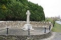 Black Bourton war memorial - geograph.org.uk - 1116076.jpg 640 × 427; 91 KB
-
 Black Drift trackway - geograph.org.uk - 1115715.jpg 480 × 640; 81 KB
-
 Black Rock Station - geograph.org.uk - 1117433.jpg 640 × 480; 92 KB
-
 Blowing in the wind - geograph.org.uk - 1117469.jpg 426 × 640; 69 KB
-
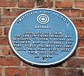 Blue Plaque - John Lee - geograph.org.uk - 1120649.jpg 640 × 584; 400 KB
-
 Boat house, Dunorlan Park - geograph.org.uk - 1117406.jpg 640 × 430; 86 KB
-
 Boat Shed, Dunorlan Park - geograph.org.uk - 1518403.jpg 559 × 640; 70 KB
-
 Boathouse ahead - geograph.org.uk - 1117355.jpg 640 × 426; 62 KB
-
 Boathouse by the river - geograph.org.uk - 1117333.jpg 640 × 426; 73 KB
-
 Bog, Carn Dearg Beag - geograph.org.uk - 1117917.jpg 640 × 480; 77 KB
-
 Boulders Overlooking Grain Intakes - geograph.org.uk - 1116116.jpg 480 × 640; 98 KB
-
 Boulders Overlooking Grain Intakes - geograph.org.uk - 1116119.jpg 640 × 480; 94 KB
-
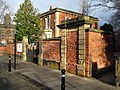 Boundary walls, Sixth Form Centre - geograph.org.uk - 1120715.jpg 640 × 480; 393 KB
-
 Box Wood and Fredville Park - geograph.org.uk - 1117785.jpg 640 × 480; 192 KB
-

-
 Bramshill Park - geograph.org.uk - 1116970.jpg 640 × 518; 101 KB
-
 Brick sheds southwest of Birdingbury - geograph.org.uk - 1116344.jpg 640 × 494; 102 KB
-
 Bridge across Burn of Waterhead - geograph.org.uk - 1115791.jpg 640 × 425; 95 KB
-
 Bridge on Byall Fen - geograph.org.uk - 1141779.jpg 640 × 480; 130 KB
-
 Bridge over ditch - geograph.org.uk - 1141378.jpg 640 × 480; 153 KB
-
 Bridge over fenland ditch - geograph.org.uk - 1142056.jpg 640 × 480; 109 KB
-
 Bridge over Grunty Fen Catchwater Drain - geograph.org.uk - 1141267.jpg 640 × 480; 147 KB
-
-
 Bridge to Annat - geograph.org.uk - 1116202.jpg 640 × 480; 87 KB
-
 Bridge, Achavady - geograph.org.uk - 1117901.jpg 480 × 640; 91 KB
-

-
 Bridleway and Monarchs Way cross roads - geograph.org.uk - 1115799.jpg 640 × 480; 128 KB
-
 Bridleway from Corndon Farm - geograph.org.uk - 1116743.jpg 640 × 480; 90 KB
-
 Bridleway on Linley Hill - geograph.org.uk - 1116729.jpg 640 × 480; 88 KB
-
 Bridleway to Barkhale Wood - geograph.org.uk - 1116015.jpg 640 × 480; 86 KB
-
 Bridleway up Great Down - geograph.org.uk - 1115757.jpg 640 × 480; 59 KB
-
 Bridleway, Leamington Hastings (2) - geograph.org.uk - 1116470.jpg 640 × 447; 118 KB
-
 Bridleway, Leamington Hastings - geograph.org.uk - 1116466.jpg 640 × 445; 112 KB
-
 Brims Hill - geograph.org.uk - 1115249.jpg 640 × 480; 52 KB
-
 Broadmoor Farm - geograph.org.uk - 1115539.jpg 640 × 479; 83 KB
-
 Broadmoor Hospital - geograph.org.uk - 1115545.jpg 640 × 480; 88 KB
-
 Broadmoor Hospital Car Park - geograph.org.uk - 1115594.jpg 640 × 480; 101 KB
-
 Broadstairs Water Tower - geograph.org.uk - 1132134.jpg 640 × 480; 112 KB
-

-
 Brook at Black Bourton - geograph.org.uk - 1116101.jpg 640 × 427; 83 KB
-
 Broom House - geograph.org.uk - 1115865.jpg 640 × 480; 89 KB
-
 Building by the boathouse - geograph.org.uk - 1117381.jpg 640 × 426; 46 KB
-
 Bunkers Hill, Birdingbury - geograph.org.uk - 1116319.jpg 640 × 489; 145 KB
-
 Burley Street, cattle - geograph.org.uk - 1115717.jpg 640 × 480; 89 KB
-
 Burley Street, guide stone - geograph.org.uk - 1116407.jpg 480 × 640; 64 KB
-
 Burley Street, milestone - geograph.org.uk - 1115794.jpg 480 × 640; 59 KB
-
 Burley, Forest Tea House - geograph.org.uk - 1115761.jpg 640 × 480; 93 KB
-
 Burley, guide stone - geograph.org.uk - 1116422.jpg 480 × 640; 97 KB
-
 Burley, milestone - geograph.org.uk - 1115823.jpg 480 × 640; 78 KB
-
 Burley, ponies - geograph.org.uk - 1115745.jpg 640 × 480; 104 KB
-
 Burley, the Burley Inn - geograph.org.uk - 1116442.jpg 640 × 480; 103 KB
-
 Burley, war memorial - geograph.org.uk - 1115844.jpg 480 × 640; 84 KB
-
 Burn crossing, Glen Roy - geograph.org.uk - 1116225.jpg 640 × 480; 104 KB
-
 Burn of Waterhead - geograph.org.uk - 1115795.jpg 429 × 640; 126 KB
-
 Butter Bottom - geograph.org.uk - 1115553.jpg 640 × 480; 59 KB
-
 Byre near Birdingbury - geograph.org.uk - 1116293.jpg 640 × 482; 101 KB
-
 Byway to Elveden - geograph.org.uk - 1116594.jpg 640 × 427; 96 KB
-
 Cafe, Dunorlan Park - geograph.org.uk - 1117395.jpg 640 × 430; 93 KB
-
 Cairn Within the Barmkyn of Keig - geograph.org.uk - 1117119.jpg 640 × 480; 131 KB
-
 Calow - Church - geograph.org.uk - 1115719.jpg 480 × 640; 94 KB
-
 Calow - Post Office - geograph.org.uk - 1115660.jpg 640 × 480; 71 KB
-
 Calow - signage - geograph.org.uk - 1115692.jpg 480 × 640; 98 KB
-
 Calow - Somerset House - geograph.org.uk - 1115728.jpg 640 × 480; 60 KB
-
 Calow - United Reformed Church - geograph.org.uk - 1115669.jpg 640 × 480; 62 KB
-
 Calow - Working Men's Club - geograph.org.uk - 1115679.jpg 640 × 480; 58 KB
-
 Camden Park (2) - geograph.org.uk - 1117496.jpg 640 × 430; 94 KB
-
 Camden Park - geograph.org.uk - 1117488.jpg 640 × 430; 81 KB
-
 CamdenPark.jpeg 640 × 430; 97 KB
-
 Canal Junction Signpost - geograph.org.uk - 1116265.jpg 480 × 640; 97 KB
-
 Car Park, Dunorlan Park - geograph.org.uk - 1117387.jpg 640 × 430; 81 KB
-
 Carn Dearg Beag - geograph.org.uk - 1117235.jpg 640 × 480; 73 KB
-
 Carn Dearg Beag - geograph.org.uk - 1117301.jpg 640 × 480; 79 KB
-
 Castle Vineyard, Black Bourton - geograph.org.uk - 1116118.jpg 640 × 427; 57 KB
-
 Catcliffe Flash - geograph.org.uk - 1115786.jpg 582 × 640; 54 KB
-
 Chantry library - geograph.org.uk - 1115428.jpg 640 × 480; 115 KB
-

-
 Cheglinch Cross - geograph.org.uk - 1115749.jpg 640 × 480; 83 KB
-
 Civil Avition Authority - panoramio.jpg 1,600 × 800; 205 KB
-
 Clarendon Place - geograph.org.uk - 1116941.jpg 448 × 640; 57 KB
-
 Classic lighting, Camden Rd - geograph.org.uk - 1117589.jpg 640 × 430; 82 KB
-
 Clearing, Grain Planting East - geograph.org.uk - 1116128.jpg 640 × 480; 115 KB
-
 Cleopatra's needle - geograph.org.uk - 1121004.jpg 480 × 640; 56 KB
-
 Coastal Erosion - geograph.org.uk - 1116480.jpg 640 × 417; 111 KB
-

-
 Coming into Brize Norton - geograph.org.uk - 1117304.jpg 640 × 427; 40 KB
-
 Concrete Straining Post - geograph.org.uk - 1117371.jpg 640 × 480; 71 KB
-
 Cooting Down from Cooting Lane - geograph.org.uk - 1133561.jpg 640 × 480; 206 KB
-
 Corndon Cottage - geograph.org.uk - 1116749.jpg 640 × 480; 111 KB
-

-
 Cotswold Camping at Wychbold - geograph.org.uk - 1149745.jpg 640 × 480; 69 KB
-
 Cott of Ness - geograph.org.uk - 1116336.jpg 640 × 417; 69 KB
-

-
 Cottages in Filkins - geograph.org.uk - 1116062.jpg 640 × 427; 51 KB
-
 Crew Yard and pasture - geograph.org.uk - 1115989.jpg 640 × 480; 127 KB
-
 Cricket Field Broadmoor - geograph.org.uk - 1116097.jpg 640 × 480; 93 KB
-
 Cricket field, Wilburton - geograph.org.uk - 1141201.jpg 640 × 480; 157 KB
-
 Crop fields below the Penyard - geograph.org.uk - 1116368.jpg 480 × 640; 132 KB
-
 Crossroads and Skip - geograph.org.uk - 1116404.jpg 640 × 480; 312 KB
-
 Blocked off door - geograph.org.uk - 1117258.jpg 640 × 426; 112 KB
-
 Crawl way by the door - geograph.org.uk - 1117299.jpg 426 × 640; 70 KB
-
 Crowthorne Wood - geograph.org.uk - 1115842.jpg 640 × 480; 86 KB
-
 Cupid - geograph.org.uk - 1120066.jpg 640 × 481; 32 KB
-
 Cycles to the right - geograph.org.uk - 1122297.jpg 640 × 480; 96 KB
-
 Cycling along the towpath - geograph.org.uk - 1116182.jpg 640 × 480; 100 KB
-
 Daisybank Development - geograph.org.uk - 1117629.jpg 640 × 425; 83 KB
-
 Deffer Woods Signs - geograph.org.uk - 1115357.jpg 480 × 640; 113 KB
-
 Deffer Woods Summerhouse - geograph.org.uk - 1115377.jpg 640 × 480; 99 KB
-
 Deffer Woods track - geograph.org.uk - 1115381.jpg 640 × 480; 129 KB
-
 Deffer Woods track to summerhouse - geograph.org.uk - 1115368.jpg 480 × 640; 123 KB
-

-
 Denver war memorial - geograph.org.uk - 1142238.jpg 640 × 480; 74 KB
-

-
 Derelict shop and house, Quarry Hill - geograph.org.uk - 1117599.jpg 640 × 430; 59 KB
-
 Dew Pond - geograph.org.uk - 1115834.jpg 640 × 480; 120 KB
-
 DHL depot in Wilcox Close - geograph.org.uk - 1133568.jpg 640 × 480; 189 KB
-
 Direction Sign A3212 Grosvenor Road - geograph.org.uk - 1115266.jpg 640 × 440; 60 KB
-
 Disused building at Priddys Hard - geograph.org.uk - 1115926.jpg 640 × 480; 71 KB
-
 Ditch between fields - geograph.org.uk - 1141342.jpg 640 × 480; 124 KB
-
 Ditch between fields - geograph.org.uk - 1141419.jpg 640 × 480; 121 KB
-
 Doors wide open - geograph.org.uk - 1117397.jpg 426 × 640; 73 KB
-
 Downham Market railway station - geograph.org.uk - 1142246.jpg 640 × 480; 118 KB
-
 Downham Market war memorial - geograph.org.uk - 1142243.jpg 640 × 480; 82 KB
-
 Downland by Slade Farm - geograph.org.uk - 1115951.jpg 640 × 480; 107 KB
-
 Drain across Byall Fen - geograph.org.uk - 1141775.jpg 640 × 480; 104 KB
-
 Drain across Home Dams Fen - geograph.org.uk - 1141425.jpg 640 × 480; 126 KB
-
 Earlsfield station building.JPG 1,600 × 1,200; 435 KB
-

-
 End of the road - geograph.org.uk - 1128244.jpg 640 × 480; 190 KB
-
 End terrace, Quarry Hill - geograph.org.uk - 1117601.jpg 640 × 430; 78 KB
-
 Entering Aughton on West Lane - geograph.org.uk - 1115763.jpg 640 × 463; 72 KB
-
 Entering Broadwell - geograph.org.uk - 1116512.jpg 640 × 460; 65 KB
-
 Entrance to Beech House - geograph.org.uk - 1120705.jpg 640 × 478; 338 KB
-

-
 Entrance to Deffer Woods from the north - geograph.org.uk - 1115399.jpg 640 × 480; 124 KB
-
 Entrance to Wood of North Keig - geograph.org.uk - 1117149.jpg 640 × 480; 84 KB
-
 Entrance to Woolage Farm - geograph.org.uk - 1123698.jpg 640 × 480; 161 KB
-
 Europa Link Tinsley - geograph.org.uk - 1115655.jpg 640 × 430; 45 KB
-
 Falls of Roy - geograph.org.uk - 1117880.jpg 640 × 480; 83 KB
-
 Farm Track Coombe Bottom - geograph.org.uk - 1116981.jpg 640 × 428; 73 KB
-

-

-
 Farmland fields towards Hill Farm - geograph.org.uk - 1115840.jpg 640 × 480; 79 KB
-
 Farmland north of Dale Park House - geograph.org.uk - 1115729.jpg 640 × 480; 59 KB
-

-
 Farmland west of Coveney - geograph.org.uk - 1141315.jpg 640 × 480; 133 KB
-
 Feeding the ducks - geograph.org.uk - 1117365.jpg 640 × 426; 88 KB
-
 Fence and Tree, Holiday Hill - geograph.org.uk - 1116132.jpg 640 × 480; 91 KB
-
 Fence Corner, Baysdale - geograph.org.uk - 1116210.jpg 640 × 480; 100 KB
-
 Fenland byway - geograph.org.uk - 1141732.jpg 640 × 480; 166 KB
-
 Fenland byway - geograph.org.uk - 1141764.jpg 640 × 480; 157 KB
-
 Fenland ditch - geograph.org.uk - 1140625.jpg 640 × 480; 123 KB
-
 Fenland ditch - geograph.org.uk - 1142055.jpg 640 × 480; 136 KB
-
 Fenland ditch - geograph.org.uk - 1142059.jpg 640 × 480; 114 KB
-
 Fenland Drain - geograph.org.uk - 1141346.jpg 640 × 480; 107 KB
-
 Fenland Drain - geograph.org.uk - 1141354.jpg 640 × 480; 107 KB
-
 Fenland farmland - geograph.org.uk - 1141414.jpg 640 × 480; 141 KB
-

-
 Field entrance from the old Dover Road - geograph.org.uk - 1128238.jpg 640 × 480; 227 KB
-
 Field, hedge and trees, Audleby Low - geograph.org.uk - 1115488.jpg 480 × 640; 138 KB
-
 Fields looking south towards Ashill - geograph.org.uk - 1115811.jpg 640 × 480; 68 KB
-
 Fields, Achavady - geograph.org.uk - 1117900.jpg 640 × 480; 114 KB
-
 "The Gassons" , Filkins - geograph.org.uk - 1116058.jpg 640 × 427; 77 KB


_-_geograph.org.uk_-_1116470.jpg)


_-_geograph.org.uk_-_1117496.jpg)


