Category:United Kingdom photographs taken on 2008-02-23
Jump to navigation
Jump to search
Countries of Europe: Austria · Belarus · Belgium · Croatia · Cyprus‡ · Czech Republic · Estonia · Finland · France‡ · Germany · Hungary · Republic of Ireland · Italy · Netherlands‡ · Norway · Poland · Portugal‡ · Romania · Russia‡ · Spain‡ · Sweden · Switzerland · Turkey‡ · Ukraine · United Kingdom
‡: partly located in Europe
‡: partly located in Europe
| ← | 23 February 2008 | → | ||
| ← | February 2008 | → | ||

United Kingdom photographs taken on 23 February 2008.
Image files should be categorized here automatically using {{taken on}} template. Direct categorisation is also possible, if automatic is impossible.
Subcategories
This category has the following 2 subcategories, out of 2 total.
L
Media in category "United Kingdom photographs taken on 2008-02-23"
The following 200 files are in this category, out of 982 total.
(previous page) (next page)-

-
 21 bus in Park Lane - geograph.org.uk - 701407.jpg 640 × 480; 46 KB
-
 319427 B First Class Interior.JPG 2,048 × 1,536; 854 KB
-
 319456 C London St Pancras.JPG 2,044 × 1,536; 967 KB
-
 426 Shetcliffe Lane - geograph.org.uk - 701268.jpg 640 × 480; 93 KB
-
 439 Shetcliffe Lane - geograph.org.uk - 701270.jpg 640 × 455; 89 KB
-
 455826 C M DTSO.JPG 1,925 × 1,390; 673 KB
-
 456017 x Interior.JPG 2,006 × 1,446; 770 KB
-
 A bit bleak at Riders Lane Rec - geograph.org.uk - 701760.jpg 640 × 480; 30 KB
-
 A ford - geograph.org.uk - 701374.jpg 640 × 480; 90 KB
-
 A kneeler in St. Peter's Church - geograph.org.uk - 701624.jpg 640 × 454; 92 KB
-
 A mobile sign by the A7 - geograph.org.uk - 705199.jpg 640 × 480; 126 KB
-
 A pleasant walk by The Hermitage - geograph.org.uk - 701674.jpg 480 × 640; 84 KB
-
 A view of Cemaes Bay . - panoramio.jpg 3,564 × 1,894; 2.87 MB
-
 A water filled borrow pit - geograph.org.uk - 701061.jpg 600 × 400; 87 KB
-
 A young herring gull - geograph.org.uk - 703225.jpg 640 × 355; 50 KB
-
 A49 just north of Upper Battlefield - geograph.org.uk - 701885.jpg 640 × 480; 59 KB
-

-
 Abbey Tower - geograph.org.uk - 706686.jpg 404 × 640; 98 KB
-
 Above Kilsby Tunnel - geograph.org.uk - 703523.jpg 640 × 480; 88 KB
-

-
 Ackworth School - geograph.org.uk - 701769.jpg 640 × 476; 55 KB
-

-
 After the sprouts have gone - geograph.org.uk - 701240.jpg 640 × 435; 155 KB
-
 Alas, poor Greyhound I knew you well. - geograph.org.uk - 701577.jpg 640 × 480; 63 KB
-

-

-
 Alleyway leading to Botley Drive - geograph.org.uk - 701637.jpg 640 × 480; 83 KB
-
 Alleyway to Sunnyheath - geograph.org.uk - 702019.jpg 640 × 480; 106 KB
-
 Almshouses at Great Linford - geograph.org.uk - 780927.jpg 640 × 480; 61 KB
-
 Always space for a game - geograph.org.uk - 702063.jpg 640 × 480; 81 KB
-

-
 Angler's country park lake - geograph.org.uk - 701164.jpg 640 × 424; 50 KB
-
 Antique railway carriage on the move - geograph.org.uk - 704608.jpg 640 × 480; 428 KB
-
 Ardbeg Baptist Church, Rothesay - geograph.org.uk - 704739.jpg 640 × 480; 74 KB
-
 Astley church - geograph.org.uk - 701893.jpg 640 × 480; 61 KB
-

-

-
 Back Wharf Street, Sowerby Bridge - geograph.org.uk - 703132.jpg 640 × 427; 81 KB
-
 Barge, Cartbridge - geograph.org.uk - 702504.jpg 640 × 480; 109 KB
-
 Battens Copse from Stockheath Road - geograph.org.uk - 701474.jpg 640 × 480; 119 KB
-
 Battens Copse in February - geograph.org.uk - 701457.jpg 640 × 480; 118 KB
-
 Bermondsey Underground Station - geograph.org.uk - 701544.jpg 640 × 480; 50 KB
-

-
 Beverley Arms public house - geograph.org.uk - 701771.jpg 640 × 480; 67 KB
-

-

-
 Bierley Hall Woods - Bierley Lane - geograph.org.uk - 701264.jpg 640 × 480; 103 KB
-
 Bierley House Avenue - geograph.org.uk - 701235.jpg 640 × 410; 51 KB
-
 Blackdown Crescent - geograph.org.uk - 701604.jpg 640 × 480; 48 KB
-
 Blackweir - geograph.org.uk - 708347.jpg 640 × 480; 86 KB
-
 Boggy land near Shaws Bridge, Belfast - geograph.org.uk - 701245.jpg 640 × 454; 118 KB
-
 Boldre Close - geograph.org.uk - 701504.jpg 640 × 480; 43 KB
-
 Bond Street Underground Station - geograph.org.uk - 701402.jpg 640 × 480; 96 KB
-
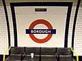 Borough Station, SE1 - geograph.org.uk - 828976.jpg 640 × 480; 92 KB
-
 Boundary stone in East Dale - geograph.org.uk - 702155.jpg 460 × 640; 158 KB
-
 Bramhope Puritan Chapel - geograph.org.uk - 701308.jpg 640 × 480; 60 KB
-
 Bransgore Avenue - geograph.org.uk - 701490.jpg 640 × 480; 49 KB
-
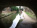
 Braunston Tunnel - geograph.org.uk - 701213.jpg 640 × 480; 103 KB
-
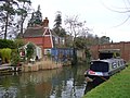
 Braunston-Grand Union Canal - geograph.org.uk - 701548.jpg 640 × 480; 72 KB
-
 Braunston-Grand Union Canal - geograph.org.uk - 702409.jpg 640 × 480; 92 KB
-
 Braunston-Grand Union Canal - geograph.org.uk - 704901.jpg 640 × 480; 90 KB
-
 Braunston-Grand Union Canal - geograph.org.uk - 704927.jpg 640 × 480; 66 KB
-
 Bridge carrying A68 over River Tweed - geograph.org.uk - 701297.jpg 640 × 480; 63 KB
-
 Bridge of Dochart - geograph.org.uk - 938794.jpg 640 × 480; 66 KB
-
 Bridge on Compton Street Ashbourne - geograph.org.uk - 703117.jpg 640 × 427; 268 KB
-
 Bridge over burn on the A839 - geograph.org.uk - 704605.jpg 640 × 480; 531 KB
-
 Bridge over the Hermitage - geograph.org.uk - 702073.jpg 640 × 480; 48 KB
-
 Bridleway - Tyersal Lane - geograph.org.uk - 701916.jpg 640 × 414; 41 KB
-
 Brimham Rocks (east side) - geograph.org.uk - 1640631.jpg 640 × 480; 70 KB
-
 Brimham Rocks (west side) - geograph.org.uk - 1640641.jpg 640 × 480; 67 KB
-
 Broad Lane - Cutler Heights Lane - geograph.org.uk - 701413.jpg 640 × 420; 32 KB
-
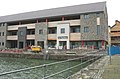
 Buildings on the Doc Fictoria site - geograph.org.uk - 703637.jpg 640 × 451; 53 KB
-
 Burberry Close - Shetcliffe Lane - geograph.org.uk - 701333.jpg 640 × 436; 44 KB
-
 Burnt grass patches - geograph.org.uk - 705508.jpg 640 × 479; 64 KB
-
 Bus shelter, postbox and telephone box - geograph.org.uk - 702075.jpg 640 × 480; 111 KB
-
 Bus stop in Purbrook Way - geograph.org.uk - 701573.jpg 640 × 480; 49 KB
-
-
 Bus Turning Circle - Bierley Lane - geograph.org.uk - 701266.jpg 640 × 442; 55 KB
-
 By the A 839 - geograph.org.uk - 704228.jpg 640 × 480; 459 KB
-
 By the A839 near Little Torboll - geograph.org.uk - 704216.jpg 640 × 480; 493 KB
-
 Caberfeigh Close - geograph.org.uk - 725934.jpg 640 × 480; 84 KB
-
 Cadbury Camp - geograph.org.uk - 701711.jpg 640 × 480; 57 KB
-
 Cadbury Camp - geograph.org.uk - 701723.jpg 480 × 640; 83 KB
-
 Caernarfon's Saturday Market - geograph.org.uk - 703235.jpg 640 × 465; 57 KB
-
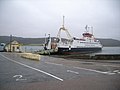
 CalMac Ferry at Rothesay Harbour - geograph.org.uk - 704723.jpg 640 × 480; 51 KB
-
 Canada Water - geograph.org.uk - 701595.jpg 640 × 480; 61 KB
-
 Canada Water Underground Station - geograph.org.uk - 701560.jpg 640 × 480; 53 KB
-
 Canada Water Underground Station - geograph.org.uk - 701568.jpg 640 × 480; 62 KB
-
 Canary Wharf Station - geograph.org.uk - 701614.jpg 640 × 480; 92 KB
-
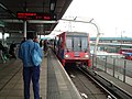
 Canning Town DLR platform - geograph.org.uk - 701675.jpg 640 × 480; 69 KB
-
 Cannon in grounds of Rothesay castle - geograph.org.uk - 704733.jpg 640 × 480; 92 KB
-

-
 Cardiff Bridge - geograph.org.uk - 708351.jpg 640 × 480; 81 KB
-
 Cardiff University Fun Run - geograph.org.uk - 708349.jpg 480 × 640; 106 KB
-
 Carreg Ti-Pw - geograph.org.uk - 704115.jpg 480 × 640; 52 KB
-
 Cartbridge, Send - geograph.org.uk - 702498.jpg 640 × 480; 103 KB
-
 Castell Deudraeth - panoramio.jpg 3,080 × 2,133; 2.63 MB
-
 Castlehill Point - geograph.org.uk - 1464000.jpg 640 × 480; 87 KB
-

-
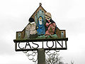 Caston village sign Norfolk England.jpg 640 × 480; 105 KB
-
 Cathedral Road Cardiff.jpg 640 × 480; 88 KB
-
 Cathedral Road, Cardiff - geograph.org.uk - 708356.jpg 640 × 480; 94 KB
-
 Cawood Church - geograph.org.uk - 701065.jpg 400 × 600; 91 KB
-
 Ceredigion coast path - geograph.org.uk - 704254.jpg 479 × 640; 49 KB
-
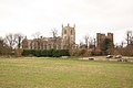
 Charney Manor - geograph.org.uk - 1096491.jpg 640 × 480; 190 KB
-
 Chatham Sorting Office - geograph.org.uk - 701908.jpg 640 × 480; 88 KB
-
 Chatham Telephone Exchange (1) - geograph.org.uk - 701909.jpg 640 × 480; 67 KB
-
 Chatham Telephone Exchange (2) - geograph.org.uk - 701910.jpg 640 × 480; 63 KB
-

-

-
 Church and Castle - geograph.org.uk - 702369.jpg 640 × 427; 58 KB
-
 Church at Burnt Yates - geograph.org.uk - 1640617.jpg 640 × 480; 100 KB
-
 Church near Huntley garden centre - geograph.org.uk - 701666.jpg 640 × 480; 105 KB
-
 Church of the Holy Cross - churchyard - geograph.org.uk - 702110.jpg 640 × 480; 138 KB
-
 Church of the Holy Cross - geograph.org.uk - 702108.jpg 640 × 480; 148 KB
-
 Church of the Holy Cross - geograph.org.uk - 702109.jpg 640 × 480; 114 KB
-

-
 Church of the Holy Cross - tower - geograph.org.uk - 702113.jpg 480 × 640; 130 KB
-
 Church rd, Longhope - geograph.org.uk - 701634.jpg 640 × 480; 55 KB
-
 Church Road - geograph.org.uk - 701976.jpg 480 × 640; 124 KB
-
 Church Road - geograph.org.uk - 701996.jpg 480 × 640; 93 KB
-
 ChurchofTheHolyCross.jpg 480 × 640; 97 KB
-
 Cliff face north of Carreg Ti-Pw - geograph.org.uk - 704168.jpg 479 × 640; 57 KB
-
 Clifftop field boundary - geograph.org.uk - 704209.jpg 479 × 640; 75 KB
-
 Clifftop gorse - geograph.org.uk - 705363.jpg 640 × 479; 53 KB
-
 Clifftop path - geograph.org.uk - 704280.jpg 479 × 640; 45 KB
-
 Clock tower - geograph.org.uk - 705323.jpg 426 × 640; 67 KB
-
 Coastal headland on the Cardigan Bay - geograph.org.uk - 705408.jpg 640 × 479; 43 KB
-

-
-
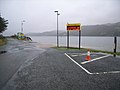 Colintraive ferry crossing - geograph.org.uk - 705021.jpg 640 × 480; 60 KB
-

-
 Colintraive ferry crossing - signpost - geograph.org.uk - 705031.jpg 640 × 480; 78 KB
-
 Colintraive ferry crossing - slipway - geograph.org.uk - 705030.jpg 640 × 480; 41 KB
-

-
 Colintraive telephone box - geograph.org.uk - 705055.jpg 640 × 480; 83 KB
-
 Colliers Arms Garden, Elland - geograph.org.uk - 701330.jpg 640 × 427; 87 KB
-
 Colts rugby match at Havant RFC - geograph.org.uk - 702043.jpg 640 × 480; 37 KB
-
 Common land at Stockheath - geograph.org.uk - 702034.jpg 640 × 480; 108 KB
-
 Communion Oven - geograph.org.uk - 702508.jpg 640 × 424; 72 KB
-
 Concrete hardstand in field beside road - geograph.org.uk - 702169.jpg 640 × 480; 134 KB
-
 Conifers in Hunsley Dale - geograph.org.uk - 702078.jpg 479 × 640; 179 KB
-
-

-

-
 Control tower at Tain Range - geograph.org.uk - 703805.jpg 640 × 480; 298 KB
-

-

-
 Country lane to Northacre - geograph.org.uk - 702031.jpg 640 × 480; 79 KB
-
 Country seat - geograph.org.uk - 704383.jpg 640 × 494; 168 KB
-
 Coventry Canal aqueduct over River Tame - geograph.org.uk - 703552.jpg 640 × 480; 179 KB
-
 Coventry Canal, Fazeley - geograph.org.uk - 713531.jpg 640 × 480; 187 KB
-
 Cover Drive sunset - geograph.org.uk - 701788.jpg 640 × 390; 63 KB
-
 Cubley church - geograph.org.uk - 703933.jpg 640 × 406; 223 KB
-
 Cubley church from the A515 - geograph.org.uk - 703928.jpg 466 × 640; 252 KB
-
 Curious sheep - geograph.org.uk - 703905.jpg 480 × 640; 85 KB
-
 Cwm Wyre - geograph.org.uk - 705688.jpg 479 × 640; 110 KB
-
 Cygnet Hospital - Bierley Lane - geograph.org.uk - 701241.jpg 640 × 441; 44 KB
-
 Denver Church and graveyard - geograph.org.uk - 723194.jpg 640 × 480; 147 KB
-
 Derelict Farm Buildings at Park Nook - geograph.org.uk - 702273.jpg 640 × 427; 66 KB
-

-
 Disused Mine, Park Nook - geograph.org.uk - 701453.jpg 640 × 427; 94 KB
-
 DLR train at Canning Town - geograph.org.uk - 701683.jpg 640 × 480; 76 KB
-
 Dog training in Dovedale - geograph.org.uk - 701827.jpg 640 × 427; 282 KB
-
 Double Dike, near Little Weighton - geograph.org.uk - 701441.jpg 640 × 455; 180 KB
-
 Dovedale - geograph.org.uk - 701833.jpg 427 × 640; 253 KB
-
 Drewton Tunnel airshaft - geograph.org.uk - 701852.jpg 640 × 434; 163 KB
-
 Earlston, Berwickshire - geograph.org.uk - 701287.jpg 640 × 480; 75 KB
-
 Eastern Avenue, Gants Hill - geograph.org.uk - 701420.jpg 640 × 480; 64 KB
-
 Eastern Avenue, Gants Hill - geograph.org.uk - 701425.jpg 640 × 480; 71 KB
-
 Edinburgh Christadelphian Church - geograph.org.uk - 705261.jpg 480 × 640; 87 KB
-
 Edinburgh House - geograph.org.uk - 702024.jpg 640 × 480; 96 KB
-
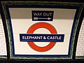 Elephant and Castle station, SE1 - geograph.org.uk - 829116.jpg 640 × 480; 83 KB
-
 Elland Lock - geograph.org.uk - 701351.jpg 640 × 427; 83 KB
-
 Elland Park Wood from Park Nook - geograph.org.uk - 702212.jpg 640 × 426; 63 KB
-
 Elsenham station - geograph.org.uk - 702285.jpg 2,048 × 1,536; 607 KB
-
 Emerging from gorse - geograph.org.uk - 705458.jpg 640 × 480; 72 KB
-
 End of the Line^ - Shetcliffe Lane - geograph.org.uk - 701280.jpg 640 × 422; 50 KB
-
 Entering the Lion's Den - geograph.org.uk - 704465.jpg 640 × 433; 142 KB
-
 Entrance to aqueduct - geograph.org.uk - 723510.jpg 480 × 640; 142 KB
-
 Entrance to Barnsdale Bar Quarry - geograph.org.uk - 701753.jpg 640 × 480; 59 KB
-
 Entrance to Park Wood Crematorium - geograph.org.uk - 701322.jpg 640 × 427; 87 KB
-
 Farm Yard at Park Nook - geograph.org.uk - 702270.jpg 640 × 427; 87 KB
-
 Farmer's Market, Petworth - geograph.org.uk - 712725.jpg 480 × 640; 66 KB
-
 Farmland from Marshland - geograph.org.uk - 704316.jpg 640 × 426; 171 KB
-
 Farmland near Eiden - geograph.org.uk - 704614.jpg 640 × 480; 441 KB
-
 Fazeley Junction - geograph.org.uk - 703609.jpg 544 × 640; 173 KB
-
 Feathered friends - geograph.org.uk - 701149.jpg 640 × 582; 111 KB
-
 Feeding Frenzy, Faulston Farm - geograph.org.uk - 702677.jpg 640 × 480; 92 KB
-

-
 FENCHURCH and MET Set HK.JPG 1,567 × 1,490; 708 KB
-
 FENCHURCH HK.JPG 2,027 × 1,478; 1.16 MB
-
 Fernando Torres. Super hero. El Niño - Flickr - Mat Jam.jpg 786 × 1,386; 324 KB
-
 Fields east of Barcloy Hill - geograph.org.uk - 1464064.jpg 640 × 480; 75 KB
-
 First and 77th Bridge, Coventry Canal - geograph.org.uk - 713298.jpg 640 × 480; 154 KB
-
 Firth Row - Bierley Lane - geograph.org.uk - 701255.jpg 640 × 418; 50 KB
-
 Fishing boat crest - geograph.org.uk - 714368.jpg 640 × 480; 34 KB
-
 Flats in Stockheath Lane - geograph.org.uk - 701750.jpg 640 × 480; 78 KB
-
 Flats in Stockheath Lane - geograph.org.uk - 702014.jpg 640 × 480; 97 KB


_-_geograph.org.uk_-_1640631.jpg)
_-_geograph.org.uk_-_1640641.jpg)


_-_geograph.org.uk_-_701909.jpg)
_-_geograph.org.uk_-_701910.jpg)


