Category:United Kingdom photographs taken on 2007-11-22
Jump to navigation
Jump to search
Countries of Europe: Austria · Belgium · Denmark · Finland · France‡ · Germany · Republic of Ireland · Italy · Netherlands‡ · Poland · Portugal‡ · Romania · Russia‡ · Slovakia · Spain‡ · Ukraine · United Kingdom
‡: partly located in Europe
‡: partly located in Europe
| ← | 22 November 2007 | → | ||
| ← | November 2007 | → | ||

United Kingdom photographs taken on 22 November 2007.
Image files should be categorized here automatically using {{taken on}} template. Direct categorisation is also possible, if automatic is impossible.
Subcategories
This category has the following 3 subcategories, out of 3 total.
Media in category "United Kingdom photographs taken on 2007-11-22"
The following 200 files are in this category, out of 359 total.
(previous page) (next page)-
 "Station Hotel", James Street, Omagh - geograph.org.uk - 617933.jpg 640 × 411; 38 KB
-
 326 bus, The Burroughs, Hendon - geograph.org.uk - 2214064.jpg 1,600 × 1,200; 737 KB
-
 A30 meets the A323 from the left - geograph.org.uk - 622363.jpg 640 × 480; 89 KB
-
 A30 meets the A323 from the right - geograph.org.uk - 622357.jpg 640 × 480; 81 KB
-
 A4136 leaves Staunton for Monmouth - geograph.org.uk - 617830.jpg 640 × 418; 135 KB
-
 A4136 passing through Staunton - geograph.org.uk - 617827.jpg 640 × 480; 134 KB
-
 Air Atlantique G-AMPY Douglas C47 Coventry (32591217704).jpg 1,759 × 1,100; 450 KB
-
 Air Atlantique G-AMPY Douglas C47 Coventry (33332469236).jpg 2,540 × 1,618; 1.14 MB
-
 Alexandra Crescent - geograph.org.uk - 617778.jpg 640 × 480; 78 KB
-
 All Saints Church, Staunton - geograph.org.uk - 617861.jpg 640 × 480; 148 KB
-
 All Saints Church, Staunton - geograph.org.uk - 617878.jpg 640 × 480; 107 KB
-
 All Saints' Church, Little Somborne - geograph.org.uk - 618136.jpg 640 × 480; 79 KB
-

-
 Ambleston1.jpg 640 × 480; 54 KB
-
 Apollo Cinema , Paignton - geograph.org.uk - 622554.jpg 640 × 480; 50 KB
-
 Appleby Manor Hotel - geograph.org.uk - 617795.jpg 640 × 480; 139 KB
-
 Appleby Swimming Pool - geograph.org.uk - 617785.jpg 640 × 480; 74 KB
-
 Araucaria araucana - geograph.org.uk - 617798.jpg 480 × 640; 103 KB
-

-
 Askam in Furness Station - geograph.org.uk - 767202.jpg 640 × 457; 52 KB
-

-
 Bann Boulevard, Portadown - geograph.org.uk - 618191.jpg 640 × 480; 71 KB
-
 Bann Meadows, Portadown - geograph.org.uk - 618189.jpg 640 × 480; 61 KB
-
 Battle Hill Woodland - geograph.org.uk - 617695.jpg 640 × 480; 305 KB
-
 Beech in the churchyard of St Anthony's - geograph.org.uk - 618103.jpg 427 × 640; 125 KB
-
 Binley Bottom, Hampshire - geograph.org.uk - 627481.jpg 640 × 427; 68 KB
-
 Binley, Hampshire - geograph.org.uk - 627484.jpg 640 × 427; 160 KB
-
 Binley, Hampshire - geograph.org.uk - 627485.jpg 640 × 427; 164 KB
-
 Binley, Hampshire - geograph.org.uk - 627486.jpg 640 × 427; 107 KB
-
 Birds of a feather etc - geograph.org.uk - 617996.jpg 640 × 338; 67 KB
-

-
 Boston House - geograph.org.uk - 617997.jpg 640 × 480; 81 KB
-
 Boston Spa bridge in 2007.jpg 640 × 480; 105 KB
-
 Boston Spa Library - geograph.org.uk - 617986.jpg 640 × 480; 114 KB
-
 Boundary Stone near Nun's Cross - geograph.org.uk - 617910.jpg 640 × 427; 48 KB
-
 Bournemouth, Horseshoe Common pond - geograph.org.uk - 617866.jpg 640 × 480; 133 KB
-
 Bournemouth, the synagogue - geograph.org.uk - 617874.jpg 640 × 480; 83 KB
-
 Bridleway across Foxtor Mires - geograph.org.uk - 1172042.jpg 640 × 427; 78 KB
-
 Brunswick Centre, Bloomsbury - geograph.org.uk - 618128.jpg 640 × 480; 68 KB
-
 Brunswick Centre, Bloomsbury - geograph.org.uk - 618130.jpg 640 × 480; 70 KB
-
 Burne-Jones' house - geograph.org.uk - 675202.jpg 426 × 640; 72 KB
-

-
 Cathedral of the Dormition - geograph.org.uk - 618240.jpg 640 × 426; 91 KB
-
 Central Garage, Boston Spa - geograph.org.uk - 618283.jpg 640 × 480; 85 KB
-
 Charing Cross Station - geograph.org.uk - 618018.jpg 480 × 640; 129 KB
-
 Chop Gate car park - geograph.org.uk - 1639430.jpg 640 × 480; 102 KB
-
 Church Road, Boston Spa - geograph.org.uk - 618266.jpg 640 × 480; 66 KB
-
 Churchyard, St. John Lee (2) - geograph.org.uk - 617844.jpg 640 × 480; 114 KB
-
 Churchyard, St. John Lee (3) - geograph.org.uk - 617847.jpg 640 × 480; 104 KB
-
 Churchyard, St. John Lee - geograph.org.uk - 617843.jpg 640 × 480; 115 KB
-
 Clifford village hall - geograph.org.uk - 618012.jpg 640 × 480; 85 KB
-
 Clinker's Tavern - geograph.org.uk - 617955.jpg 640 × 480; 80 KB
-
 Craven Passage, Charing Cross - geograph.org.uk - 618762.jpg 640 × 480; 124 KB
-
 Craven Street, Charing Cross - geograph.org.uk - 618745.jpg 640 × 480; 116 KB
-
 Criffel from Caerlaverock - geograph.org.uk - 621398.jpg 640 × 480; 151 KB
-
 Criffel from Caerlaverock - geograph.org.uk - 621759.jpg 640 × 480; 134 KB
-
 Crossways Shopping Centre, Paignton - geograph.org.uk - 618048.jpg 640 × 403; 58 KB
-
 Dead tractor - geograph.org.uk - 622351.jpg 640 × 480; 89 KB
-

-
 Descent from Battle Hill - geograph.org.uk - 617691.jpg 640 × 480; 163 KB
-
 Dogs on Preston Sands - geograph.org.uk - 617961.jpg 640 × 530; 96 KB
-

-
 Downhill to Brighouse - geograph.org.uk - 617978.jpg 640 × 480; 66 KB
-
 Dusk view from Snow Hill station - geograph.org.uk - 621519.jpg 425 × 640; 72 KB
-
 Early 'semis' in Boston Spa - geograph.org.uk - 617988.jpg 640 × 480; 96 KB
-
 Egger's (4) - geograph.org.uk - 617807.jpg 640 × 480; 69 KB
-
 Egger's (5) - geograph.org.uk - 617817.jpg 640 × 480; 96 KB
-
 Egger's (6) - geograph.org.uk - 617819.jpg 640 × 480; 52 KB
-
 Egger's (7) - geograph.org.uk - 617821.jpg 480 × 640; 66 KB
-
 Eglwys Treamlod - geograph.org.uk - 619751.jpg 640 × 480; 119 KB
-
 Electronics Shops on Tottenham Court Road - geograph.org.uk - 618127.jpg 640 × 480; 105 KB
-
 English Calvinistic Methodist Chapel - geograph.org.uk - 622347.jpg 480 × 640; 79 KB
-
 Entrance London Transport Museum.jpg 726 × 1,600; 178 KB
-
 Entrance to Battle Hill - geograph.org.uk - 617698.jpg 640 × 480; 216 KB
-
 Entrance to Funland November 2007.JPG 2,576 × 1,920; 2.13 MB
-

-
 Entrance to Temple Quarry - geograph.org.uk - 617984.jpg 640 × 480; 73 KB
-
 Fareham Magistrates Court - geograph.org.uk - 617971.jpg 640 × 480; 50 KB
-
 Fareham Methodist Church - geograph.org.uk - 617941.jpg 640 × 480; 66 KB
-
 Fareham Youth Centre - geograph.org.uk - 617979.jpg 640 × 480; 63 KB
-
 Farley House School, Lambeth Road - geograph.org.uk - 618764.jpg 640 × 480; 43 KB
-

-

-
 Fleet Road and Reading Road Junction - geograph.org.uk - 621176.jpg 640 × 480; 76 KB
-
 Footpath near Ambleston - geograph.org.uk - 619220.jpg 640 × 480; 97 KB
-
 Former bank, Palace Avenue, Paignton - geograph.org.uk - 622855.jpg 640 × 480; 94 KB
-
 Foundry Street, Llanidloes - geograph.org.uk - 622365.jpg 640 × 480; 55 KB
-
 Fox Tor - geograph.org.uk - 617897.jpg 640 × 427; 44 KB
-
 Games Workshop headquarters - geograph.org.uk - 618081.jpg 640 × 427; 71 KB
-

-

-
 Geograph meet at the Air Balloon - geograph.org.uk - 618184.jpg 640 × 426; 69 KB
-
 Georgian House, Newton Kyme. - geograph.org.uk - 618042.jpg 640 × 480; 87 KB
-
 Golden Jubilee Bridge - geograph.org.uk - 618073.jpg 640 × 480; 98 KB
-
 Golden Jubilee Bridge and London Eye - geograph.org.uk - 618109.jpg 480 × 638; 84 KB
-
 Granard Ltd G-LDFM Cessna 560XL Coventry (32754619383).jpg 1,688 × 1,023; 261 KB
-
 Grave of John Harries - geograph.org.uk - 619761.jpg 480 × 640; 88 KB
-
 Gravestones, Paignton - geograph.org.uk - 618075.jpg 480 × 640; 107 KB
-
 Graveyard and diseased tree - geograph.org.uk - 619754.jpg 640 × 480; 145 KB
-
 Great Western Arcade - geograph.org.uk - 618269.jpg 426 × 640; 85 KB
-
 Hartley Wintney Village Pond - geograph.org.uk - 621151.jpg 640 × 485; 133 KB
-
 Hartshead Moor Services.jpg 640 × 451; 69 KB
-
 Hayog Farm - geograph.org.uk - 619229.jpg 640 × 480; 114 KB
-
 Hermitage Doocot - geograph.org.uk - 619701.jpg 640 × 451; 151 KB
-
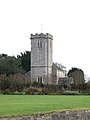
 Hexham Abbey above the rooftops - geograph.org.uk - 617788.jpg 640 × 480; 72 KB
-
 Hexham Fire Station - geograph.org.uk - 617790.jpg 640 × 338; 41 KB
-
 High Park Gasworks 770.jpg 480 × 640; 88 KB
-
 Higher Polsham Road - geograph.org.uk - 622899.jpg 640 × 480; 55 KB
-
 Holiday Inn hotel Clifton, Brighouse - geograph.org.uk - 617905.jpg 640 × 480; 68 KB
-
 Hollicombe Beach - geograph.org.uk - 617916.jpg 640 × 474; 97 KB
-
 Hollicombe Park - geograph.org.uk - 622506.jpg 640 × 480; 109 KB
-
 Hollicombe Park - geograph.org.uk - 622520.jpg 640 × 453; 104 KB
-
 Hollicombe Park - geograph.org.uk - 622533.jpg 640 × 480; 84 KB
-
 Hollicombe Park - geograph.org.uk - 622537.jpg 640 × 480; 81 KB
-
 Holy Trinity Car Park - geograph.org.uk - 617947.jpg 640 × 480; 57 KB
-
 Holy Trinity Church Centre - geograph.org.uk - 617949.jpg 640 × 480; 101 KB
-
 Hopper2.jpg 640 × 425; 145 KB
-

-
 Houses in Staunton village - geograph.org.uk - 617873.jpg 640 × 480; 152 KB
-
 How to tell the time^ - geograph.org.uk - 618277.jpg 640 × 426; 85 KB
-
 Hyde Road, Paignton - geograph.org.uk - 622589.jpg 640 × 406; 54 KB
-
 I was here first^ - geograph.org.uk - 618190.jpg 640 × 477; 50 KB
-
 Ice Rink outside The Forum - geograph.org.uk - 1495203.jpg 640 × 480; 136 KB
-

-
 Jet Options G-JETO Cessna 550 Coventry (33531718675).jpg 2,526 × 1,613; 553 KB
-
 John Harries's grave, detail - geograph.org.uk - 619763.jpg 640 × 509; 124 KB
-
 John Morgan Harries 1881-1952 - geograph.org.uk - 619766.jpg 640 × 480; 93 KB
-

-
 Kames Bay, Great Cumbrae Island - geograph.org.uk - 668767.jpg 640 × 480; 93 KB
-
 Killerton Close, Paignton - geograph.org.uk - 618058.jpg 640 × 323; 56 KB
-
 Kingdom Hall, Paignton - geograph.org.uk - 618067.jpg 640 × 480; 44 KB
-
 Kirkham House, Paignton - geograph.org.uk - 622635.jpg 640 × 492; 91 KB
-

-
 Landscape around Ambleston - geograph.org.uk - 620036.jpg 640 × 480; 73 KB
-

-
 Like a cormorant on a wire - geograph.org.uk - 617990.jpg 640 × 480; 28 KB
-

-

-
 London Transport Museum Entrance.jpg 1,218 × 1,600; 233 KB
-
 Longbridge, Llanidloes - geograph.org.uk - 622391.jpg 640 × 480; 99 KB
-
 Low Burswell - geograph.org.uk - 617776.jpg 640 × 480; 123 KB
-
 Lumpy growth on tree - geograph.org.uk - 619757.jpg 640 × 480; 127 KB
-
 Lych gate, St. John Lee - geograph.org.uk - 617841.jpg 640 × 480; 106 KB
-

-
 Marvell Close, Pound Hill, Crawley - geograph.org.uk - 626231.jpg 640 × 481; 73 KB
-
 Methodist Chapel, Boston Spa - geograph.org.uk - 617992.jpg 480 × 640; 107 KB
-
 Methodist chapel, Clifford. - geograph.org.uk - 618016.jpg 640 × 480; 74 KB
-
 Methodist Church, Monmouth - geograph.org.uk - 618244.jpg 469 × 640; 86 KB
-
 Methodist church, Paignton - geograph.org.uk - 622852.jpg 640 × 480; 65 KB
-
 Milepost in Boston Spa High Street. - geograph.org.uk - 618280.jpg 480 × 640; 100 KB
-
 Mist on Burstwick Drain, Hedon - geograph.org.uk - 617743.jpg 640 × 480; 78 KB
-
 Mosaic (1) - geograph.org.uk - 619722.jpg 640 × 480; 135 KB
-
 Mosaic (2) - geograph.org.uk - 619725.jpg 640 × 480; 135 KB
-
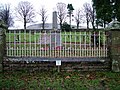 Murton War Memorial and Cemetery - geograph.org.uk - 617758.jpg 640 × 480; 141 KB
-
 My winter friends - geograph.org.uk - 622230.jpg 640 × 480; 36 KB
-
 Narrow Water near Warrenpoint - geograph.org.uk - 617912.jpg 640 × 428; 65 KB
-
 Narrow Water quarry near Newry - geograph.org.uk - 617922.jpg 640 × 428; 78 KB
-
 Newton Hall - geograph.org.uk - 618032.jpg 640 × 480; 81 KB
-
 Newton Hall Park - geograph.org.uk - 618036.jpg 640 × 480; 91 KB
-
 St Andrew's Church, Newton Kyme - geograph.org.uk - 618034.jpg 480 × 640; 56 KB
-
 Offices of Fareham Community Action - geograph.org.uk - 617974.jpg 640 × 480; 52 KB
-
 Old brewery, Paignton - geograph.org.uk - 618071.jpg 640 × 480; 59 KB
-
 Old Star Inn - geograph.org.uk - 618020.jpg 640 × 480; 67 KB
-
 Old stone barn near Acomb - geograph.org.uk - 617864.jpg 640 × 480; 88 KB
-
 Old-style stile - geograph.org.uk - 619223.jpg 640 × 480; 119 KB
-
 Paignton churchyard - geograph.org.uk - 622680.jpg 480 × 640; 143 KB
-
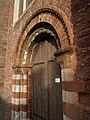 West door, Paignton church - geograph.org.uk - 618083.jpg 480 × 640; 96 KB
-
 Palace Avenue Gardens - geograph.org.uk - 622858.jpg 640 × 448; 80 KB
-
 Path to Ambleston - geograph.org.uk - 619217.jpg 640 × 480; 100 KB
-
 Patriotic flats in Trinity Street - geograph.org.uk - 617962.jpg 640 × 480; 76 KB
-
 Pillar, Convent Entrance, Omagh - geograph.org.uk - 618139.jpg 480 × 640; 113 KB
-
 Plymouth Ski Centre - geograph.org.uk - 618809.jpg 640 × 427; 100 KB
-
 Plynlimon House, Longbridge Street - geograph.org.uk - 622395.jpg 640 × 480; 84 KB
-
 Police Box, Blackford - geograph.org.uk - 619698.jpg 640 × 427; 134 KB
-
 Portadown Boat Club on the River Bann - geograph.org.uk - 618187.jpg 640 × 480; 64 KB
-
 Postbox, Binley, Hampshire - geograph.org.uk - 627487.jpg 427 × 640; 127 KB
-
 Preston Green from Hollicombe Head - geograph.org.uk - 622548.jpg 640 × 289; 39 KB
-
 Public footpath to Raisdale Road - geograph.org.uk - 1639455.jpg 640 × 480; 140 KB
-
 Quarry near Crich Stand - geograph.org.uk - 772296.jpg 640 × 480; 85 KB
-
 Railway Viaduct over Weaver Navigation Northwich 1.jpg 3,264 × 2,448; 2.67 MB
-
 Railway Viaduct over Weaver Navigation Northwich 2.jpg 3,264 × 2,448; 2.56 MB
-
 Reflection, Winner Street, Paignton - geograph.org.uk - 622841.jpg 640 × 543; 83 KB
-
 Remains of church cross, Staunton - geograph.org.uk - 617879.jpg 640 × 480; 183 KB
-
 Residents of High Ashgill - geograph.org.uk - 621449.jpg 480 × 640; 113 KB
-
 Restricted byway, Staunton - geograph.org.uk - 617867.jpg 640 × 467; 138 KB
-
 Rinaston, all that remains - geograph.org.uk - 619255.jpg 640 × 480; 140 KB
-
 River Eden at Appleby - geograph.org.uk - 617789.jpg 640 × 480; 135 KB
-

-
 Route of dismantled railway, Monmouth - geograph.org.uk - 618246.jpg 480 × 640; 200 KB
-
 Scout and Guide Hall, Boston Spa - geograph.org.uk - 618263.jpg 480 × 640; 90 KB
-

-
 Sewage incinerator Cooper Bridge - geograph.org.uk - 617981.jpg 640 × 384; 41 KB
-
 Shirley train at Snow Hill - geograph.org.uk - 618273.jpg 640 × 426; 51 KB
-
 Siop-yr-Oen - Lamb Shop - geograph.org.uk - 622346.jpg 480 × 640; 65 KB
-
 South door, St. John Lee - geograph.org.uk - 617846.jpg 480 × 640; 82 KB
-
 St Anthony churchyard - geograph.org.uk - 618093.jpg 640 × 427; 138 KB
-
 St Edward's RC Primary School - geograph.org.uk - 618267.jpg 640 × 480; 59 KB
-
 St Mary's CE Primary School - geograph.org.uk - 618003.jpg 640 × 480; 87 KB
-
 St Mary's Church, Hitchin - geograph.org.uk - 619117.jpg 640 × 480; 45 KB
-
 St Michael's Church, Winchester - geograph.org.uk - 618129.jpg 640 × 480; 64 KB


.jpg)
.jpg)


_-_geograph.org.uk_-_617844.jpg)
_-_geograph.org.uk_-_617847.jpg)


_-_geograph.org.uk_-_617807.jpg)
_-_geograph.org.uk_-_617817.jpg)
_-_geograph.org.uk_-_617819.jpg)
_-_geograph.org.uk_-_617821.jpg)


_near_Woolley_-_geograph.org.uk_-_617989.jpg)


.jpg)


.jpg)


_-_geograph.org.uk_-_642748.jpg)


_-_geograph.org.uk_-_619722.jpg)
_-_geograph.org.uk_-_619725.jpg)


