Category:United Kingdom photographs taken on 2003-09-06
Jump to navigation
Jump to search
Countries of Europe: Austria · Belgium · Czech Republic · Denmark · Finland · France‡ · Germany · Italy · Netherlands‡ · Portugal‡ · Russia‡ · Sweden · Switzerland · United Kingdom
‡: partly located in Europe
‡: partly located in Europe
| ← | 6 September 2003 | → | ||
| ← | September 2003 | → | ||

United Kingdom photographs taken on 6 September 2003.
Image files should be categorized here automatically using {{taken on}} template. Direct categorisation is also possible, if automatic is impossible.
Media in category "United Kingdom photographs taken on 2003-09-06"
The following 82 files are in this category, out of 82 total.
-
 Airbus A340-312, Air Jamaica JP147325.jpg 1,024 × 768; 193 KB
-
 Anstruther Harbour - geograph.org.uk - 714256.jpg 480 × 640; 59 KB
-
 Beesands Sea Defences - geograph.org.uk - 307158.jpg 640 × 427; 104 KB
-
 Blackcraig Hill, New Cumnock - geograph.org.uk - 536289.jpg 640 × 399; 90 KB
-
 Blind Beck Cafe - geograph.org.uk - 1472301.jpg 640 × 480; 101 KB
-
 Boeing 737-55S, CSA Czech Airlines JP147306.jpg 1,024 × 768; 229 KB
-
 Bolton Castle tower - geograph.org.uk - 1472852.jpg 480 × 640; 84 KB
-
 Boundarybrook.jpg 640 × 480; 188 KB
-

-
 Coastline east of Prawle Point - geograph.org.uk - 306865.jpg 640 × 428; 95 KB
-
 Coastline east of Prawle Point - geograph.org.uk - 306876.jpg 640 × 426; 87 KB
-
 Copley Viaduct from Greetland Moor - geograph.org.uk - 86713.jpg 480 × 640; 142 KB
-
 Double Rainbow - geograph.org.uk - 833231.jpg 600 × 450; 38 KB
-
 Dufftown Distillery rail sidings - geograph.org.uk - 258989.jpg 480 × 640; 90 KB
-
 Dufftown Station - geograph.org.uk - 258978.jpg 640 × 480; 134 KB
-
 Dufftown Station - geograph.org.uk - 258981.jpg 640 × 480; 79 KB
-
 Early morning at Cuttlehill - geograph.org.uk - 30434.jpg 640 × 480; 72 KB
-
 Embankment - panoramio (2).jpg 2,039 × 1,356; 733 KB
-
 Font in Inkberrow Church - geograph.org.uk - 43124.jpg 640 × 480; 73 KB
-
 Fort George Cannon on Battlements. - panoramio.jpg 2,048 × 1,536; 880 KB
-
 Fort George Church. - panoramio - tormentor4555.jpg 2,048 × 1,536; 881 KB
-
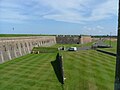 Fort George entrance & Battlements. - panoramio.jpg 2,048 × 1,536; 903 KB
-
 Fort George Moat. - panoramio - tormentor4555.jpg 2,048 × 1,536; 899 KB
-
 Fort George Moat. - panoramio.jpg 2,048 × 1,536; 882 KB
-
 Fort George moat. - panoramio.jpg 2,048 × 1,536; 904 KB
-
 Fort George Mortar. - panoramio.jpg 2,048 × 1,536; 876 KB
-
 Fort George mortar. - panoramio.jpg 2,048 × 1,536; 886 KB
-
 Fort George Visitors entrance. - panoramio.jpg 2,048 × 1,536; 865 KB
-
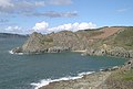 Gammon Head - geograph.org.uk - 31305.jpg 640 × 431; 91 KB
-
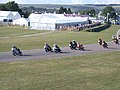 Goodwood Revival meeting - geograph.org.uk - 80664.jpg 640 × 480; 122 KB
-
 Greenknowe Tower - geograph.org.uk - 291078.jpg 427 × 640; 118 KB
-
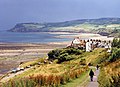
 Haverfordwest - geograph.org.uk - 242733.jpg 600 × 397; 61 KB
-
 Historic Racing at Goodwood - geograph.org.uk - 80668.jpg 640 × 480; 123 KB
-
 Horsted Keynes station - geograph.org.uk - 7926.jpg 640 × 480; 125 KB
-
 Huntingtower Castle - geograph.org.uk - 74228.jpg 640 × 480; 100 KB
-
 Inside Fort George. - panoramio - tormentor4555.jpg 2,048 × 1,536; 902 KB
-

-
 Loch Doire nam Mart with mist rising - geograph.org.uk - 709389.jpg 640 × 480; 65 KB
-
 Loch Sandig - geograph.org.uk - 732338.jpg 640 × 191; 27 KB
-
 Loch Smuaisebhal - geograph.org.uk - 732390.jpg 640 × 480; 62 KB
-
 Lodge Yard residences - geograph.org.uk - 1472810.jpg 640 × 480; 108 KB
-
 Moon rise over Loch Thonagro - geograph.org.uk - 732342.jpg 640 × 499; 53 KB
-
 North Breakwater, Peterhead - geograph.org.uk - 215770.jpg 640 × 480; 63 KB
-
 North end of the viaduct - geograph.org.uk - 1472287.jpg 640 × 480; 76 KB
-
 Nutwell Court - geograph.org.uk - 122942.jpg 640 × 480; 145 KB
-
 Nymans Gardens - geograph.org.uk - 29978.jpg 640 × 480; 171 KB
-

-
 Perfect Defence for the Times - geograph.org.uk - 492712.jpg 640 × 425; 63 KB
-
 Platform advert, Dufftown Station. - geograph.org.uk - 258985.jpg 640 × 480; 151 KB
-
 Porthkerry House - geograph.org.uk - 484228.jpg 640 × 480; 133 KB
-
 Prawle Point - geograph.org.uk - 31285.jpg 640 × 442; 79 KB
-

-

-
 Raised Beach - geograph.org.uk - 31292.jpg 640 × 423; 96 KB
-
 Salcombe from East Portlemouth - geograph.org.uk - 306807.jpg 640 × 425; 91 KB
-
 Salcombe Harbour Entrance - geograph.org.uk - 306821.jpg 640 × 428; 58 KB
-
 Seaside Road - geograph.org.uk - 234185.jpg 640 × 480; 68 KB
-
 Sheriff's Lench Manor - geograph.org.uk - 94654.jpg 480 × 640; 99 KB
-
 St Marys Hawridge 2.jpg 960 × 1,280; 1.15 MB
-
 St. Nicholas Church, Arne - geograph.org.uk - 48754.jpg 640 × 480; 138 KB
-
 Start Point and Lighthouse - geograph.org.uk - 307101.jpg 640 × 426; 70 KB
-
 Stone roof tiles - geograph.org.uk - 1472812.jpg 640 × 480; 105 KB
-
 Stormcloud over Robin Hood's Bay - geograph.org.uk - 611058.jpg 640 × 466; 103 KB
-
 The Chelsea Pub, Easton Bristol - geograph.org.uk - 5923.jpg 640 × 480; 69 KB
-
 The King's Arms - geograph.org.uk - 1472821.jpg 640 × 480; 81 KB
-
 The lower falls - geograph.org.uk - 1472829.jpg 640 × 480; 128 KB
-
 The Perfect Defensive Structure - geograph.org.uk - 492745.jpg 640 × 425; 58 KB
-
 The Perfect Defensive Structure - geograph.org.uk - 492752.jpg 425 × 640; 91 KB
-
 The Perfect Defensive Structure. - geograph.org.uk - 492729.jpg 425 × 640; 70 KB
-

-
 The Ruined Village of Hallsands - geograph.org.uk - 307150.jpg 542 × 640; 109 KB
-

-
-
 Weston Park, Weston-under-Lizard, Staffordshire TF11 8LE - geograph.org.uk - 1711714.jpg 1,600 × 1,200; 411 KB
-
 Woodbridge Tide Mill - geograph.org.uk - 18818.jpg 480 × 640; 102 KB
-
 Horse paddock - geograph.org.uk - 254567.jpg 640 × 480; 114 KB
-
 Loch of Lowes - geograph.org.uk - 353504.jpg 640 × 417; 77 KB
-
 Morven Lodge - geograph.org.uk - 114984.jpg 640 × 480; 175 KB
-
 North of Llanfihangel Nant Bran - geograph.org.uk - 66353.jpg 640 × 480; 147 KB
-
 North of Llanfihangel Nant Bran - geograph.org.uk - 66369.jpg 640 × 480; 118 KB
-

-
 View from Lary Hill - geograph.org.uk - 114990.jpg 640 × 480; 97 KB


.jpg)


_-_geograph.org.uk_-_254574.jpg)
