Category:UK general election maps of England
Jump to navigation
Jump to search
Subcategories
This category has only the following subcategory.
2
Media in category "UK general election maps of England"
The following 14 files are in this category, out of 14 total.
-
 2017 UK Election map England.svg 1,500 × 1,200; 6.29 MB
-
 Bristol UK general election 2017 map.svg 1,138 × 1,266; 597 KB
-
 Jun2017MPsEngland.png 1,142 × 707; 3.09 MB
-
 LondonParliamentaryConstituency2017Results.svg 427 × 337; 615 KB
-
 MerseysideParliamentaryConstituency2017Results.svg 301 × 311; 59 KB
-
 UK Green representation 2017.png 1,236 × 1,500; 533 KB
-
 United Kingdom General Election 2017 Results Map (East Midlands).svg 869 × 1,225; 609 KB
-
 United Kingdom General Election 2017 Results Map (East of England).svg 719 × 947; 794 KB
-
 United Kingdom General Election 2017 Results Map (North East England).svg 803 × 1,132; 172 KB
-
 United Kingdom General Election 2017 Results Map (North West England).svg 713 × 1,540; 956 KB
-
 United Kingdom General Election 2017 Results Map (South East England).svg 1,758 × 1,390; 1.05 MB
-
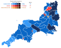 United Kingdom General Election 2017 Results Map (South West England).svg 1,277 × 1,016; 815 KB
-
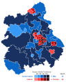 United Kingdom General Election 2017 Results Map (West Midlands).svg 1,089 × 1,353; 855 KB
-
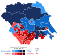 United Kingdom General Election 2017 Results Map (Yorkshire and the Humber).svg 1,089 × 1,055; 745 KB


.svg)
.svg)
.svg)
.svg)
.svg)
.svg)
.svg)
.svg)