Category:Tunshill
Jump to navigation
Jump to search
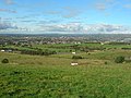
English: Tunshill is a hamlet at the northeastern edge of Milnrow, within the Metropolitan Borough of Rochdale, in Greater Manchester, England. It lies amongst the foothills of the Pennines, north-northeast of Oldham.
village in United Kingdom  | |||||
| Upload media | |||||
| Instance of | |||||
|---|---|---|---|---|---|
| Location | Rochdale, Greater Manchester, North West England, England | ||||
 | |||||
Media in category "Tunshill"
The following 49 files are in this category, out of 49 total.
-
 Ashfold Farm - geograph.org.uk - 1704269.jpg 1,024 × 768; 318 KB
-
 Bridge - geograph.org.uk - 450404.jpg 640 × 480; 140 KB
-
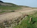
 Cobbled section of Tunshill Lane - geograph.org.uk - 3089176.jpg 2,048 × 1,536; 504 KB
-
 Cross-tracks on Tunshill Lane - geograph.org.uk - 2370137.jpg 2,000 × 1,402; 796 KB
-

-
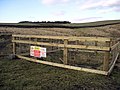
 Footpath and sheepfold - geograph.org.uk - 2370126.jpg 2,000 × 1,516; 1.05 MB
-
 Footpath off Tunshill Lane - geograph.org.uk - 2370174.jpg 2,000 × 1,500; 893 KB
-
 Heading towards the Longden End Brook Valley - geograph.org.uk - 3384239.jpg 1,800 × 1,200; 2.08 MB
-
 Junction on Tunshill Lane - geograph.org.uk - 2067976.jpg 3,872 × 2,466; 3.05 MB
-
 Legacy of mining activity above Tunshill - geograph.org.uk - 2067981.jpg 3,872 × 2,592; 2.29 MB
-
 Looking North from M62 - geograph.org.uk - 1393509.jpg 640 × 480; 55 KB
-
 M62 - geograph.org.uk - 1704262.jpg 1,024 × 768; 257 KB
-
 M62 - geograph.org.uk - 450408.jpg 640 × 480; 104 KB
-
 M62 - geograph.org.uk - 680986.jpg 640 × 480; 76 KB
-
 M62 Eastbound - geograph.org.uk - 1704239.jpg 1,024 × 768; 258 KB
-
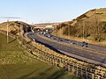
 M62 motorway at Tunshill - geograph.org.uk - 4498706.jpg 1,632 × 918; 441 KB
-
 M62 motorway from Tunshill.jpg 3,470 × 1,690; 1.28 MB
-
 Marker post at junction of Carr Lane and Tunshill Lane - geograph.org.uk - 3730599.jpg 1,600 × 1,200; 490 KB
-
 Mineshaft on Tunshill Lane - geograph.org.uk - 1732318.jpg 640 × 480; 107 KB
-
 Motorway Bridge - geograph.org.uk - 1704228.jpg 1,024 × 768; 297 KB
-
 Path Towards Tunshill - geograph.org.uk - 2526004.jpg 1,280 × 960; 581 KB
-
 Ruin - geograph.org.uk - 680980.jpg 640 × 480; 122 KB
-
 The King's Arms - geograph.org.uk - 680434.jpg 640 × 480; 70 KB
-
 The track up Rag Hole Clough - geograph.org.uk - 3730461.jpg 1,600 × 1,038; 374 KB
-
 Towards Dick Hill - geograph.org.uk - 1736096.jpg 640 × 480; 145 KB
-
 Tunshil.jpg 1,600 × 1,200; 524 KB
-
 Tunshill - geograph.org.uk - 2068000.jpg 3,872 × 2,592; 4.81 MB
-
 Tunshill Farm - geograph.org.uk - 3089180.jpg 2,048 × 1,536; 647 KB
-
 Tunshill Golf Club - geograph.org.uk - 1704217.jpg 1,024 × 768; 185 KB
-
 Tunshill Golf Course - geograph.org.uk - 1704201.jpg 1,024 × 768; 231 KB
-
 Tunshill Golf Course - geograph.org.uk - 1704208.jpg 1,024 × 768; 314 KB
-
 Tunshill House - geograph.org.uk - 1704273.jpg 1,024 × 768; 371 KB
-
 Tunshill House - geograph.org.uk - 680430.jpg 640 × 480; 107 KB
-
 Tunshill House, Tunshill - geograph.org.uk - 4498691.jpg 1,361 × 766; 573 KB
-
 Tunshill Lane - geograph.org.uk - 2370164.jpg 2,000 × 1,500; 866 KB
-
 Tunshill Lane - geograph.org.uk - 2580818.jpg 480 × 640; 156 KB
-
 Tunshill Lane - geograph.org.uk - 3146828.jpg 800 × 600; 135 KB
-
 Tunshill Lane - geograph.org.uk - 4367129.jpg 6,000 × 4,000; 4.82 MB
-
 Tunshill Lane - geograph.org.uk - 557713.jpg 640 × 474; 148 KB
-
 Tunshill Lane - geograph.org.uk - 680995.jpg 640 × 480; 114 KB
-
 Tunshill Lane approaching Dick Hill - geograph.org.uk - 3089160.jpg 2,048 × 1,536; 562 KB
-
 Tunshill Lane crossing M62 motorway - geograph.org.uk - 1820637.jpg 640 × 449; 82 KB
-
 Tunshill Lane-Carr Lane junction - geograph.org.uk - 3089170.jpg 2,048 × 1,536; 547 KB
-

-

-
 Tunshill, near Milnrow - geograph.org.uk - 578264.jpg 640 × 461; 125 KB
-
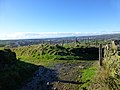
 View north from Tunshill Lane - geograph.org.uk - 3146985.jpg 800 × 600; 118 KB
-
-
 Westbound M62 - geograph.org.uk - 1704251.jpg 1,024 × 768; 285 KB


