Category:Tregaron (town)
Jump to navigation
Jump to search
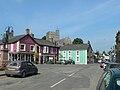
English: Tregaron is a small market town in the community of the same name, in central Ceredigion, Wales.
Subcategories
This category has the following 6 subcategories, out of 6 total.
C
- Capel Bwlchgwynt, Tregaron (2 F)
- Church of St Caron, Tregaron (39 F)
M
- Memorial Hall, Tregaron (7 F)
R
T
- Talbot Hotel, Tregaron (19 F)
Y
- Y Llew Coch, Tregaron (5 F)
Media in category "Tregaron (town)"
The following 65 files are in this category, out of 65 total.
-
 A forlorn day in Tregaron - geograph.org.uk - 3085042.jpg 4,288 × 2,848; 4.51 MB
-

-
 A view of Tregaron from Castle Hill NLW3361909.jpg 594 × 450; 34 KB
-
 Afon Brennig - geograph.org.uk - 5925335.jpg 3,264 × 2,448; 2.44 MB
-
 Afon Brennig, Tregaron - geograph.org.uk - 2657132.jpg 3,072 × 2,048; 3.9 MB
-
 Agricultural Area - geograph.org.uk - 42329.jpg 640 × 480; 103 KB
-

-
 Bank and pub - geograph.org.uk - 4387421.jpg 800 × 530; 428 KB
-
 Barclays Bank - geograph.org.uk - 4385987.jpg 800 × 530; 382 KB
-
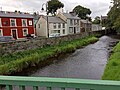
 Bridge over Afon Brennig - geograph.org.uk - 4386151.jpg 800 × 530; 375 KB
-
 Ceredigion Council Offices - geograph.org.uk - 4386035.jpg 800 × 530; 345 KB
-
 Chapel Road,Tregaron, Ceredigion - geograph.org.uk - 1436115.jpg 640 × 397; 121 KB
-
 Chapel Road,Tregaron, Ceredigion - geograph.org.uk - 1436118.jpg 640 × 467; 136 KB
-
 Chapel Street - geograph.org.uk - 4386161.jpg 800 × 530; 378 KB
-
 Cottage near Tregaron, Ceredigion - geograph.org.uk - 1439218.jpg 640 × 493; 138 KB
-
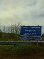
 Croeso i Dregaron - Welcome to Tregaron - geograph.org.uk - 6193332.jpg 1,024 × 768; 269 KB
-
 Dewi Road - geograph.org.uk - 4387391.jpg 800 × 530; 383 KB
-
 Dewi Road - geograph.org.uk - 4387411.jpg 800 × 530; 457 KB
-
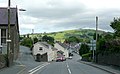
 Down the Station Road (A485) in Tregaron - geograph.org.uk - 3085123.jpg 4,288 × 2,848; 4.57 MB
-
 Downtown Tregaron 1 - geograph.org.uk - 3023187.jpg 1,024 × 577; 287 KB
-
 Garage and filling station - geograph.org.uk - 4387288.jpg 800 × 530; 386 KB
-
 J. Jenkin's Garage Tregaron - geograph.org.uk - 2657129.jpg 3,072 × 2,048; 1.1 MB
-
 Jenkins' Garage, Tregaron - geograph.org.uk - 210561.jpg 640 × 480; 82 KB
-
 Lloyds Bank in Tregaron - geograph.org.uk - 5041998.jpg 640 × 427; 71 KB
-
 Llwynonn - geograph.org.uk - 4387381.jpg 530 × 800; 412 KB
-
 Looking east at Church of St Caron, Tregaron, Ceredigion, Wales.jpg 640 × 416; 75 KB
-
 Market Square, Tregaron - geograph.org.uk - 4447936.jpg 979 × 734; 173 KB
-
 Market Square, Tregaron in 1987 - geograph.org.uk - 2308839.jpg 793 × 559; 109 KB
-
 Men's sunday school class, Tregaron NLW3363926.jpg 424 × 592; 41 KB
-
 Mynecbost Tregaron Signpost - geograph.org.uk - 1274066.jpg 480 × 640; 74 KB
-
 NatWest Bank - geograph.org.uk - 4386126.jpg 800 × 530; 432 KB
-
 New car park for Tregaron - geograph.org.uk - 2324701.jpg 640 × 480; 66 KB
-
 Old cottage and shop in Tregaron - geograph.org.uk - 2948964.jpg 640 × 480; 60 KB
-
 Ordnance Survey Benchmark - Tregaron Square - geograph.org.uk - 4217146.jpg 1,600 × 1,200; 501 KB
-
 Ordnance Survey Benchmark - Tregaron Square - geograph.org.uk - 4217150.jpg 1,600 × 1,200; 684 KB
-
 Ordnance Survey Benchmark - Tregaron Square NBM - geograph.org.uk - 4217138.jpg 1,600 × 1,200; 564 KB
-
 Oriel Jays Gallery.jpg 4,000 × 3,000; 3.7 MB
-
 Oriel Rhiannon.jpg 3,000 × 4,000; 2.34 MB
-

-

-
 Ras yr Iaith 2014 MyW - Shortcut.jpg 281 × 379; 118 KB
-
 Ras yr Iaith 2014 Tregaron.jpg 600 × 379; 216 KB
-
 River Brenig.jpg 3,000 × 4,000; 5.86 MB
-
 Road linking the B4343 to the A485 roads in Tregaron - geograph.org.uk - 5797876.jpg 4,000 × 3,000; 2.41 MB
-
 Road linking the B4343 to the A485 roads in Tregaron - geograph.org.uk - 5797883.jpg 4,000 × 3,000; 2.48 MB
-
 Road signs in Tregaron - geograph.org.uk - 2927235.jpg 3,008 × 2,000; 1.45 MB
-
 Station Road - geograph.org.uk - 4386143.jpg 800 × 530; 371 KB
-
 StCaron.jpg 2,592 × 1,944; 1.15 MB
-
 Street2218e.JPG 690 × 539; 74 KB
-
 Sunnyhill hotel in Tregaron - geograph.org.uk - 2927234.jpg 3,008 × 2,000; 1.16 MB
-
 Talbot Hotel in Market Square, Tregaron - geograph.org.uk - 5042002.jpg 5,184 × 3,456; 6.57 MB
-
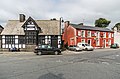
 The Square - geograph.org.uk - 4178594.jpg 800 × 530; 413 KB
-
 The Square - geograph.org.uk - 4386075.jpg 800 × 530; 347 KB
-
 The Square in Tregaron - geograph.org.uk - 3554585.jpg 640 × 480; 67 KB
-
 The square, Tregaron NLW3362319.jpg 597 × 455; 49 KB
-
 Towards The Square - geograph.org.uk - 4387426.jpg 800 × 530; 380 KB
-
 Tregaron Market Square, Ceredigion - geograph.org.uk - 1061646.jpg 640 × 441; 137 KB
-
 Tregaron prof.jpg 2,592 × 1,944; 878 KB
-
 Tregaron Square - geograph.org.uk - 6025925.jpg 2,304 × 1,728; 667 KB
-
 Tregaron town square - geograph.org.uk - 2324723.jpg 640 × 480; 75 KB
-
 Tregaron, Ceredigion (20443678318).jpg 3,888 × 2,592; 3.76 MB
-
 TregMainstreet.jpg 2,276 × 1,568; 442 KB
-
 Twm Sion Cati - geograph.org.uk - 6025919.jpg 1,728 × 2,304; 1.79 MB
-
 View to Tregaron from School museum - geograph.org.uk - 3123397.jpg 640 × 451; 79 KB
-
 Y Sgwar, Tregaron - geograph.org.uk - 6025888.jpg 2,302 × 1,724; 1.59 MB

_bungalow_on_the_banks_of_Afon_Brennig,_Tregaron_-_geograph.org.uk_-_886084.jpg)


_in_Tregaron_-_geograph.org.uk_-_3085123.jpg)


.jpg)


