Category:Transport maps of Kazakhstan
Jump to navigation
Jump to search
Countries of Europe: Albania · Andorra · Armenia‡ · Austria · Azerbaijan‡ · Belarus · Belgium · Bosnia and Herzegovina · Bulgaria · Croatia · Cyprus‡ · Czech Republic · Denmark · Estonia · Finland · France‡ · Georgia‡ · Germany · Greece · Hungary · Iceland · Republic of Ireland · Italy · Kazakhstan‡ · Latvia · Liechtenstein · Lithuania · Luxembourg · Malta · Moldova · Monaco · Montenegro · Netherlands‡ · North Macedonia · Norway · Poland · Portugal‡ · Romania · Russia‡ · San Marino · Serbia · Slovakia · Slovenia · Spain‡ · Sweden · Switzerland · Turkey‡ · Ukraine · United Kingdom · Vatican City
Specific status: Faroe Islands – Limited recognition: Kosovo
‡: partly located in Europe
Specific status: Faroe Islands – Limited recognition: Kosovo
‡: partly located in Europe
Media in category "Transport maps of Kazakhstan"
The following 7 files are in this category, out of 7 total.
-
 Kazakhstan Transportation.jpg 2,003 × 2,017; 1.52 MB
-
 Map of tram system in Almaty.svg 2,174 × 1,811; 82 KB
-
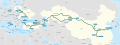 Middle Corridor Route.svg 512 × 191; 991 KB
-
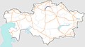 P-11 Road in Kazakhstan.jpg 800 × 446; 197 KB
-
 Tram line 4, Almaty.svg 2,174 × 1,811; 8 KB
-
 Tram line 6, Almaty.svg 2,174 × 1,811; 9 KB
-
 Транспортные коридоры в Средней Азии.jpg 800 × 452; 121 KB


