Category:Trails in Oregon
Jump to navigation
Jump to search
States of the United States: Alabama · Alaska · Arizona · Arkansas · California · Colorado · Connecticut · Delaware · Florida · Georgia · Hawaii · Idaho · Illinois · Indiana · Iowa · Kansas · Kentucky · Louisiana · Maine · Maryland · Massachusetts · Michigan · Minnesota · Mississippi · Missouri · Montana · Nebraska · Nevada · New Hampshire · New Jersey · New Mexico · New York · North Carolina · North Dakota · Ohio · Oklahoma · Oregon · Pennsylvania · Rhode Island · South Carolina · South Dakota · Tennessee · Texas · Utah · Vermont · Virginia · Washington · West Virginia · Wisconsin · Wyoming – Washington, D.C.
Puerto Rico
Puerto Rico
Subcategories
This category has the following 15 subcategories, out of 15 total.
+
- Maps of trails in Oregon (5 F)
C
E
- Eagle Creek Trail (12 F)
H
- Huntington Wagon Road (38 F)
K
- Kerby Peak Trail (22 F)
L
- Lava Butte Trail (2 F)
M
N
O
R
S
- Sterling Mine Ditch Trail (34 F)
Media in category "Trails in Oregon"
The following 109 files are in this category, out of 109 total.
-
 Along Hwy 101…near Devil's churn (7975460746).jpg 2,121 × 1,414; 3.22 MB
-
 Ankeny National Wildlife Refuge - path.JPG 1,536 × 2,048; 556 KB
-
 Beginning of walking trail at Molalla River State Park, Oregon.jpg 1,920 × 2,560; 2.57 MB
-
 Bench on South Beach Trail.jpg 3,008 × 2,000; 2.93 MB
-
 Blooms on Black Butte - panoramio.jpg 1,600 × 1,200; 894 KB
-
 Blue Basin pano JODA - Oregon.jpg 16,382 × 3,772; 17.92 MB
-
 Blueberry trail at Moore park.jpeg 1,936 × 2,592; 2.32 MB
-

-
 Boomscooter Trail at L L Stub Stewart State Park.jpg 5,472 × 3,648; 1.65 MB
-
 Bridge to nowhere.jpg 3,648 × 2,736; 3.41 MB
-
 Cape Lookout (2).jpg 3,008 × 2,000; 2.8 MB
-
 Cape Lookout.jpg 3,008 × 2,000; 2.42 MB
-
 Cape Perpetua, OR - trail at Devil's Churn 01 (19342337673).jpg 2,848 × 4,288; 6.17 MB
-
 Cape Perpetua, OR - trail at Devil's Churn 02 (19958125112).jpg 2,816 × 3,832; 5.16 MB
-
 Oregon Skyline Trail - Pacific Crest Trail system (IA CAT31341992).pdf 1,035 × 1,608, 32 pages; 2.35 MB
-
 Cathedral tree trail, Astoria, Oregon.jpg 3,120 × 4,160; 4.24 MB
-
 Coast trail at Boardman SP P4176a.jpeg 2,816 × 2,112; 1.31 MB
-
 Cooper Mountain Nature Park trail and Tualatin Valley.JPG 3,872 × 2,592; 3.9 MB
-
 Cornell Creek Park sidewalk - Hillsboro, Oregon.jpg 3,404 × 2,517; 2.83 MB
-
 Darlingtonia State Natural Site trail.jpg 3,120 × 4,160; 5.06 MB
-
 Ditch section 1 - China Ditch Oregon.jpg 3,000 × 3,525; 3.58 MB
-
 Ditch section 2 - China Ditch Oregon.jpg 3,000 × 4,000; 4.06 MB
-
 Ditch section 3 - China Ditch Oregon.jpg 3,000 × 4,000; 3.86 MB
-
 Ditch section 4 - China Ditch Oregon.jpg 3,000 × 4,000; 4.3 MB
-
 Ditch section 5 - China Ditch Oregon.jpg 3,000 × 4,000; 4.29 MB
-
 Ditch section 6 - China Ditch Oregon.jpg 3,000 × 4,000; 3.91 MB
-
 East Applegate Ridge Trail (40237273790).jpg 5,472 × 3,648; 2.65 MB
-
 Elk Rock Island (2920079570).jpg 3,888 × 2,592; 1.8 MB
-
 Fog on Spencer Butte, Oregon.JPG 4,608 × 3,456; 3.46 MB
-
 Forest park second growth bowed fallen alder P3910.jpeg 2,816 × 2,112; 2.4 MB
-
 Forest park wildwood trail in early summer P2860.jpeg 2,100 × 2,265; 1.86 MB
-
 Forest park wildwood trail lazy bend P3861.jpeg 2,438 × 1,829; 1.77 MB
-
 Forest trail, fern, hemlock.JPG 4,608 × 3,456; 3.39 MB
-
 Francis Street Park paths and trees - Hillsboro, Oregon.jpg 2,918 × 1,764; 1.43 MB
-
 Free Em road.jpg 1,181 × 795; 772 KB
-
 French Pete.JPG 1,600 × 1,200; 853 KB
-
 Frozen walk on Tipsoo trail (3022335090).jpg 3,264 × 2,448; 6.38 MB
-
 Garden Lake Park (Creswell, Oregon).jpg 4,375 × 2,917; 2.93 MB
-
 Hermiston Butte.jpg 3,992 × 2,992; 3.5 MB
-
 Hershberger Mountain Lookout path - Rogue River NF Oregon.JPG 3,000 × 4,000; 4.22 MB
-
 High Desert Museum, Oregon (2013) - 32.JPG 3,000 × 4,000; 4.64 MB
-
 Horseback riders in Wallowa primitive area (6468790547).jpg 1,536 × 2,000; 538 KB
-
 Hudson's Bay Company Granary & Clerk's House Site4 NRHP 91001574 Marion County, OR.jpg 1,344 × 1,008; 894 KB
-
 Ilex aquifolia along Westside Linear Trail.jpg 3,008 × 2,000; 2.91 MB
-
 Joda jd275.jpg 800 × 600; 524 KB
-
 Juniper Dunes 3 (7802730242).jpg 4,032 × 2,796; 8.27 MB
-
 Leaburg Canal Trail (7967344412).jpg 1,536 × 1,152; 702 KB
-
-
 Lesser Park trail - Portland Oregon.jpg 4,000 × 3,000; 4.95 MB
-
 Lighthouse trail, Heceta Head Scenic Viewpoint 966.jpg 2,000 × 3,000; 3.18 MB
-
 Linnton Trail, Portland, Oregon.JPG 2,112 × 2,816; 1.06 MB
-
 LIttle Three Creek Trail Annas (23665064642).jpg 4,608 × 2,592; 4.98 MB
-
 Lyle Hatfield Trail (Springfield, Oregon).jpg 4,608 × 3,072; 3.18 MB
-
 Maiden Peak trail.jpg 4,000 × 3,000; 2.53 MB
-
 Mary's Peak Parking Lot.jpg 3,008 × 2,000; 2.73 MB
-
 Maston and Juniper Trails (28381600216).jpg 4,272 × 2,848; 8.02 MB
-
 Maston and Juniper Trails (28381601886).jpg 3,688 × 2,344; 5.18 MB
-
 Maston and Juniper Trails (28381607676).jpg 4,272 × 2,848; 4.93 MB
-
 Maston and Juniper Trails (28381613466).jpg 4,272 × 2,848; 8.52 MB
-
 Maston and Juniper Trails (28381616766).jpg 4,272 × 2,848; 7.93 MB
-
 Maston and Juniper Trails (28381618586).jpg 4,080 × 2,688; 6.27 MB
-

-
 Meadow at Noble Woods Park - Hillsboro, Oregon.JPG 3,872 × 2,592; 3.99 MB
-
 Moore park back trail.jpeg 2,592 × 1,936; 2.47 MB
-
 Mossy rocks in rapids - Sweet Creek 860 01.jpg 6,000 × 4,000; 9.29 MB
-
 Mount June forest, Oregon.JPG 3,456 × 4,608; 6.1 MB
-
 Mt. Jefferson from Jefferson Park, OR.JPG 4,608 × 3,456; 3.3 MB
-
 North Spit of Coos Bay (34549850431).jpg 4,785 × 3,648; 8.55 MB
-
 North Umpqua Wild and Scenic River (16057653441).jpg 1,085 × 1,341; 2.33 MB
-
 Ocean near Cape Lookout.jpg 3,008 × 2,000; 2.96 MB
-
 Old Jeep Trail (11411029876).jpg 5,184 × 3,456; 8.17 MB
-

-
 Oregon Thrillium Trail Dh Riding (23508633).jpeg 980 × 654; 390 KB
-
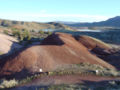
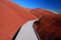 Painted Hills (Wheeler County, Oregon scenic images) (wheDA0017).jpg 488 × 324; 28 KB
-
 Painted Hills (Wheeler County, Oregon scenic images) (wheDA0125).jpg 324 × 488; 34 KB
-
 Painted Hills (Wheeler County, Oregon scenic images) (wheDA0131).jpg 324 × 488; 31 KB
-

-
 Peninsula Crossing Trail at Fessenden St..JPG 2,112 × 2,816; 1.17 MB
-

-

-
 Rail Trail 01550.JPG 2,560 × 1,920; 2.22 MB
-
 Reed Canyon, Portland, Oregon (2013) - 12.JPG 3,000 × 4,000; 4.74 MB
-
 Reed Canyon, Portland, Oregon (2013) - 13.JPG 3,000 × 4,000; 4.59 MB
-
 Rhody Garden bridge.JPG 2,448 × 3,264; 4.17 MB
-
 Rhody Garden Lake2.JPG 2,448 × 3,264; 4.19 MB
-
 Rhody Gardens Bridge.JPG 2,448 × 3,264; 4.02 MB
-
 Riverfront Park & Umatilla River.jpg 3,992 × 2,992; 2.92 MB
-
 Rock Creek Trail entrance Hillsboro Oregon.JPG 3,270 × 2,344; 3.04 MB
-
 Seal Rock and beach - Seal Rock SRS Oregon.jpg 4,032 × 3,024; 2.94 MB
-
 Silver Falls State Park - trail.jpg 2,304 × 1,728; 1.64 MB
-
 Siskiyou Trail.jpg 210 × 400; 114 KB
-
 Sitka Spruce grove - Cape Meares - Oregon USA.jpg 6,000 × 4,000; 25 MB
-
 South fork of Mckenzie River Trail, Cascade Forest, Oregon, 1922. - NARA - 299201.jpg 3,000 × 2,127; 1.43 MB
-
 South fork of Mckenzie River Trail, Cascade Forest, Oregon, 1922. - NARA - 299201.tif 3,000 × 2,127; 6.09 MB
-
 Southeast Portland, Oregon, July 2020 - 03.jpg 5,312 × 2,988; 6.81 MB
-
 Three Sisters Wilderness.JPG 3,264 × 2,001; 3.3 MB
-
 Trail - Sunset Beach SRS Oregon.jpg 3,000 × 4,000; 4.04 MB
-
 Trail from La Fajana, La Palma, to Barlovento, view to LP 1.jpg 3,618 × 2,713; 2 MB
-
 Trailhead - Sunset Beach SRS Oregon.jpg 4,000 × 3,000; 4.78 MB
-
 Tumalo Creek, Central Oregon (2013) - 15.JPG 3,000 × 4,000; 3.92 MB
-
 Tumalo Creek, Central Oregon (2013) - 16.JPG 3,000 × 4,000; 3.58 MB
-
 Turner Creek Park Hillsboro trail.JPG 3,872 × 2,592; 3.89 MB
-
 View from Mary's Peak (2).jpg 3,008 × 2,000; 2.43 MB
-
 View from Mary's Peak (3).jpg 3,008 × 2,000; 2.32 MB
-
 View from Mary's Peak.jpg 3,008 × 2,000; 2.71 MB
-
 View of walking trail in the forested part of Molalla River State Park, Oregon.jpg 1,920 × 2,560; 2.41 MB
-
 Wildwood Barlow Road segment - Oregon.jpg 3,901 × 2,320; 3.09 MB
-
 Wilsonville Memorial Park trail.JPG 3,872 × 2,592; 3.75 MB
-
 Wood River Wetland (32604664672).jpg 5,472 × 2,794; 14.65 MB
.jpg)


_(clacDA0069c).jpg)


.jpg)

.jpg)
.jpg)


.jpg)
.jpg)


.jpg)
.jpg)


_-_32.JPG)
.jpg)


.jpg)
.jpg)
_(malDA0075).jpg)


.jpg)
.jpg)


.jpg)
.jpg)
.jpg)
.jpg)
.jpg)
.jpg)
_(linnDA0051a).jpg)


.jpg)
.jpg)

.jpg)
.jpg)
.jpeg)
_(wheDA0017).jpg)
_(wheDA0125).jpg)
_(wheDA0131).jpg)
_(wheDA0015).jpg)

_(bakDA0073).jpg)
_(bakDA0074).jpg)

_-_12.JPG)
_-_13.JPG)


_-_15.JPG)
_-_16.JPG)

.jpg)
.jpg)


.jpg)