Category:Town hall of Paris 10e arrondissement
Jump to navigation
Jump to search
|
Paris 1 • 2 • 3 • 4 • 5 • 6 • 7 • 8 • 9 • 10 • 11 • 12 • 13 • 14 • 15 • 16 • 17 • 18 • 19 • 20 |
| Object location | | View all coordinates using: OpenStreetMap |
|---|
| town hall of Paris 10th arrondissement
|
|||
|---|---|---|---|
 |
|||
| Location | |||
| Coordinates | | ||
| Established | 1896 | ||
| Authority file |
| ||
district town hall in Paris, France    | |||||
| Upload media | |||||
| Instance of | |||||
|---|---|---|---|---|---|
| Location | 10th arrondissement of Paris, Paris, Grand Paris | ||||
| Located on street | |||||
| Architectural style | |||||
| Architect | |||||
| Commissioned by | |||||
| Heritage designation |
| ||||
| Significant event |
| ||||
| official website | |||||
 | |||||
Subcategories
This category has the following 3 subcategories, out of 3 total.
Pages in category "Town hall of Paris 10e arrondissement"
This category contains only the following page.
Media in category "Town hall of Paris 10e arrondissement"
The following 59 files are in this category, out of 59 total.
-
 Berryer, Pierre Antoine - 2.jpg 555 × 502; 76 KB
-

-
 1911 Britannica-Architecture-Mairie.png 305 × 476; 168 KB
-
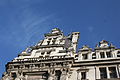
 Mairie 10e arrondissement Paris 1.jpg 8,805 × 7,237; 30.38 MB
-
 Mairie 10e arrondissement Paris 10.jpg 5,184 × 3,456; 7.18 MB
-
 Mairie 10e arrondissement Paris 11.jpg 5,184 × 3,456; 7.74 MB
-
 Mairie 10e arrondissement Paris 12.jpg 5,184 × 3,456; 6.78 MB
-
 Mairie 10e arrondissement Paris 13.jpg 6,427 × 7,095; 24.78 MB
-
 Mairie 10e arrondissement Paris 2.jpg 5,184 × 3,456; 6.81 MB
-
 Mairie 10e arrondissement Paris 3.jpg 9,565 × 5,682; 24.52 MB
-
 Mairie 10e arrondissement Paris 4.jpg 8,705 × 3,333; 27.94 MB
-
 Mairie 10e arrondissement Paris 5.jpg 5,184 × 3,456; 6.34 MB
-
 Mairie 10e arrondissement Paris 6.jpg 5,184 × 3,456; 7.58 MB
-
 Mairie 10e arrondissement Paris 7.jpg 5,184 × 3,456; 5.85 MB
-
 Mairie 10e arrondissement Paris 8.jpg 5,184 × 3,456; 6.26 MB
-
 Mairie 10e arrondissement Paris 9.jpg 3,456 × 5,184; 7.14 MB
-
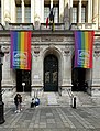 Mairie de Paris 10e avec les drapeaux de la LGBTQI+ Pride le lendemain.JPG 2,002 × 2,625; 4.43 MB
-
 Mairie du 10e arrondissement (Paris).jpg 640 × 480; 84 KB
-
 Mairie du 10e arrondissement de Paris - clocheton.jpg 2,304 × 3,456; 3.11 MB
-
 Mairie du 10e arrondissement de Paris.jpg 2,684 × 3,066; 1.59 MB
-
 Mairie du X ème arrondissement de Paris. Soutien à l'Ukraine.jpg 1,024 × 683; 268 KB
-
 Mairie du Xe.jpg 3,312 × 4,416; 1.91 MB
-
-
-
 P1210524 Paris X mairie du X rue Fg-st-Martin rwk.jpg 1,500 × 2,000; 1.24 MB
-
 P1210525 Paris X mairie du X rue Fg-St-Martin rwk.jpg 1,500 × 2,000; 1.41 MB
-
 P1210528 Paris X mairie du X rwk.jpg 1,478 × 2,100; 1.36 MB
-
 P1210529 Paris X mairie du X rwk.jpg 1,462 × 2,100; 1.4 MB
-
 P1210530 Paris X mairie du X rwk.jpg 2,000 × 1,741; 1.89 MB
-
 P1210532 Paris X mairie du X rwk.jpg 2,000 × 1,500; 1.47 MB
-
 Paris 10e Mairie 673.jpg 5,152 × 7,728; 27.14 MB
-
 Paris 10e Mairie 674.jpg 5,038 × 7,557; 21.71 MB
-
 Paris 10e Mairie 675.jpg 7,728 × 5,152; 28.9 MB
-
 Paris 10e Mairie 676.jpg 5,152 × 7,728; 29.03 MB
-
 Paris 10e Mairie 677.jpg 4,292 × 6,437; 19.48 MB
-
 Paris 10e Mairie 678.jpg 3,435 × 5,152; 12.69 MB
-
 Paris 10e Mairie 679.jpg 7,728 × 5,152; 28.7 MB
-
 Paris 10e Mairie 680.jpg 5,152 × 7,728; 24.93 MB
-
 Paris Mairie 10. Arrondissement 361.JPG 2,592 × 3,888; 7.82 MB
-
 Paris Mairie 10. Arrondissement 362.JPG 2,592 × 3,888; 7.51 MB
-
 Paris Mairie 10. Arrondissement 363.JPG 2,592 × 3,888; 7.78 MB
-
 Paris Mairie 10. Arrondissement 364.JPG 2,592 × 3,888; 7.52 MB
-
 Paris Mairie 10. Arrondissement 365.JPG 2,592 × 3,888; 7.95 MB
-
 Paris Mairie 10. Arrondissement 366.JPG 2,592 × 3,888; 7.77 MB
-
 Paris Mairie du 10e 1191.JPG 2,206 × 1,257; 2.56 MB
-
 Paris Mairie du 10e 176.JPG 3,888 × 2,592; 8.04 MB
-
 Paris Mairie du 10e 179.JPG 3,888 × 2,592; 8.05 MB
-
 Paris Mairie du 10e 184.JPG 3,333 × 2,571; 6.04 MB
-
 Paris Mairie du 10e 185.JPG 2,423 × 2,011; 3.61 MB
-
 Paris Mairie du 10e 186.JPG 2,592 × 3,888; 8.24 MB
-
 Paris Mairie du 10e 187.JPG 3,888 × 2,592; 8.65 MB
-
 Paris Mairie du 10e 188.JPG 2,592 × 3,888; 7.92 MB
-
 Paris Mairie du 10e 191.JPG 3,888 × 2,592; 8.21 MB
-
 Paris Mairie du 10e 192.JPG 3,888 × 2,592; 7.84 MB
-
 Paris Mairie du 10e 90.JPG 2,592 × 3,888; 8.23 MB
-
-

-
 Plaque de la rue du Château-d'Eau.jpg 4,416 × 3,312; 1.58 MB
-
 Town hall of Paris 10e arrondissement, 17 September 2019.jpg 3,024 × 3,024; 3.48 MB


.jpg)


(2).jpg)
(3).jpg)


