Category:Topographic maps of England
Jump to navigation
Jump to search
Subcategories
This category has the following 2 subcategories, out of 2 total.
S
- Topographic maps of Somerset (1 F)
Media in category "Topographic maps of England"
The following 90 files are in this category, out of 90 total.
-
 139 of 'Object Lessons in Geography for Standards I. II. & III' (11253054634).jpg 1,215 × 1,756; 439 KB
-

-
 Lange diercke sachsen europaeische landschaften london.jpg 1,250 × 932; 658 KB
-
 36 of 'About England- or, First lessons in English Geography' (11218677243).jpg 1,241 × 1,928; 697 KB
-
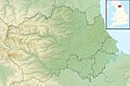
 Bedfordshire UK relief location map.jpg 2,006 × 2,269; 381 KB
-
 Berkshire UK relief location map.jpg 1,999 × 1,040; 238 KB
-
 Bridgy1.jpeg 417 × 378; 76 KB
-
 Bristol UK relief location map.jpg 2,007 × 2,233; 252 KB
-
 Buckinghamshire UK relief location map.jpg 2,005 × 2,374; 465 KB
-
 Cambridgeshire UK relief location map.jpg 1,998 × 2,251; 421 KB
-
 Cheshire UK relief location map.jpg 1,999 × 1,539; 292 KB
-
 City of Preston topography.png 831 × 941; 337 KB
-
 Cornwall UK mainland relief location map.jpg 2,004 × 1,946; 338 KB
-
 Cornwall UK relief location map.jpg 1,999 × 1,469; 227 KB
-
 Cotswolds AONB locator map.svg 1,648 × 2,000; 1.08 MB
-
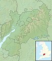
 County tops.jpg 1,932 × 2,345; 512 KB
-
 Craven Pass through Pennine Mountains UK topographic map.png 440 × 515; 147 KB
-
 Cumbria SRTM.png 1,317 × 1,537; 2.63 MB
-
 Cumbria UK relief location map.jpg 2,003 × 2,363; 700 KB
-
 Derbyshire UK relief location map.jpg 2,000 × 2,955; 730 KB
-
 Devon UK relief location map.jpg 2,009 × 1,846; 529 KB
-
 Dorset UK relief location map.jpg 1,999 × 1,389; 301 KB
-
 Durham UK relief location map.jpg 1,999 × 1,309; 319 KB
-
 East Riding of Yorkshire UK relief location map.jpg 1,999 × 1,551; 225 KB
-
 East Sussex UK relief location map.jpg 1,999 × 1,302; 248 KB
-
 England and Wales 1964 tops.png 1,410 × 1,743; 158 KB
-
 England relief location map.jpg 2,002 × 2,431; 730 KB
-
 English county tops map.svg 1,108 × 1,345; 305 KB
-
 Eskdale-drainage-area.png 1,434 × 923; 1.89 MB
-
 Essex UK relief location map.jpg 1,999 × 1,600; 346 KB
-
 Gloucestershire UK relief location map.jpg 2,010 × 2,339; 536 KB
-
 Gotischer Backstein um Nord- & südliche Ostsee.png 5,248 × 2,250; 11.33 MB
-
 Greater London UK relief location map.jpg 1,999 × 1,600; 338 KB
-
 Greater Manchester UK relief location map.jpg 1,999 × 1,393; 332 KB
-
 Hampshire UK relief location map.jpg 1,999 × 1,702; 407 KB
-
 Herefordshire UK relief location map.jpg 2,010 × 2,549; 594 KB
-
 Hering lon-sewer-det02 1882.jpg 1,103 × 779; 441 KB
-
 Hertfordshire UK relief location map.jpg 1,999 × 1,392; 289 KB
-
 Isle of Wight UK relief location map.jpg 1,999 × 1,218; 158 KB
-
 Kent UK relief location map.jpg 1,999 × 1,402; 301 KB
-
 Lancashire UK relief location map.jpg 1,998 × 2,338; 578 KB
-
 Leicestershire UK relief location map.jpg 1,999 × 1,574; 365 KB
-
 Lincolnshire UK relief location map.jpg 2,005 × 2,412; 448 KB
-
 Location relief and transport map Borough of Copeland.svg 1,044 × 1,346; 1.39 MB
-
 Location relief and transport map United Kingdom Allerdale.svg 1,015 × 1,345; 1.85 MB
-
 Location relief and transport map United Kingdom City of Carlisle.svg 1,252 × 1,346; 1.67 MB
-
 Location relief and transport map United Kingdom Eden.svg 1,425 × 1,303; 3.29 MB
-
 Location relief and transport map United Kingdom South Lakeland.svg 1,425 × 1,174; 4.2 MB
-
 Location relief map Borough of Copeland.svg 1,044 × 1,346; 651 KB
-
 Location relief map United Kingdom Allerdale.svg 1,015 × 1,345; 779 KB
-
 Location relief map United Kingdom City of Carlisle.svg 1,252 × 1,346; 626 KB
-
 Location relief map United Kingdom Eden.svg 1,425 × 1,303; 1.12 MB
-
 Location relief map United Kingdom Forest of Bowland.svg 946 × 924; 2.61 MB
-
 Location relief map United Kingdom South Lakeland.svg 1,425 × 1,174; 1.02 MB
-
 Merseyside UK relief location map.jpg 1,999 × 2,122; 278 KB
-
 N NE England SRTM.png 1,198 × 1,435; 2.08 MB
-
 Norfolk UK relief location map.jpg 1,999 × 1,242; 229 KB
-
 North Yorkshire UK relief location map.jpg 1,999 × 1,455; 466 KB
-
 Northamptonshire UK relief location map.jpg 2,011 × 2,304; 478 KB
-
 Northumberland UK relief location map.jpg 2,005 × 2,409; 585 KB
-
 Nottinghamshire UK relief location map.jpg 2,002 × 2,539; 456 KB
-
 Oxfordshire UK relief location map.jpg 2,003 × 2,357; 450 KB
-
 River Thames and surroudings 2-fr.svg 3,423 × 1,147; 4.27 MB
-
 River Thames and surroudings-en.svg 3,423 × 1,147; 2.88 MB
-
 River Thames and surroudings-fr.svg 3,423 × 1,147; 4.27 MB
-
 River Thames and surroudings-mk.svg 3,423 × 1,147; 3.47 MB
-
 Rutland UK relief location map.jpg 1,999 × 1,600; 248 KB
-
 ShepherdPhysical1926Northumberland.png 568 × 471; 367 KB
-
 Shropshire UK relief location map.jpg 2,004 × 2,285; 581 KB
-
 Somerset UK relief location map.jpg 2,019 × 1,275; 367 KB
-
 South Yorkshire UK relief location map.jpg 1,999 × 1,366; 310 KB
-
 Staffordshire UK relief location map.jpg 2,005 × 2,558; 604 KB
-
 Suffolk UK relief location map.jpg 1,999 × 1,299; 234 KB
-
 Surrey UK relief location map.jpg 1,999 × 1,514; 320 KB
-
 Topographic map of south-west England (labeled).png 535 × 360; 476 KB
-
 Topographic map of south-west England.png 535 × 360; 466 KB
-
 Topography of Lancashire.png 682 × 812; 235 KB
-
 Tyne and Wear UK relief location map.jpg 1,999 × 1,756; 263 KB
-
 Warwickshire UK relief location map.jpg 2,010 × 2,445; 503 KB
-
 West Midlands UK relief location map.jpg 1,999 × 1,366; 286 KB
-
 West Sussex UK relief location map.jpg 1,999 × 1,395; 283 KB
-
 West Yorkshire UK relief location map.jpg 1,999 × 1,455; 379 KB
-
 William Mecham Modern St. George and The Dragon 1888 Cornell CUL PJM 1100 01.jpg 4,299 × 6,250; 6.98 MB
-
 Wiltshire UK relief location map.jpg 2,005 × 2,444; 508 KB
-
 Wolds location.jpg 1,766 × 1,136; 191 KB
-
 Worcestershire UK relief location map.jpg 1,999 × 1,770; 390 KB
-
 WTC Andy Mabbett Topograph outside Herbert Art Gallery 1.jpeg 3,008 × 2,000; 2.67 MB
-
 WTC Andy Mabbett Topograph outside Herbert Art Gallery 2.jpeg 3,008 × 2,000; 3.11 MB
-
 WTC Andy Mabbett Topograph outside Herbert Art Gallery 3.jpeg 3,008 × 2,000; 3.21 MB
-
 コーンウォール半島の大地形.png 607 × 408; 969 KB
.jpg)


.jpg)


.png)


