Category:Swisstopo maps
Jump to navigation
Jump to search
English: Maps made by Swisstopo. For official sheets, the name of the map is preceded by a serial number. The number of digits in the number corresponds to the scale of the map (4 digits: 1:25'000; 3 digits: 1:50'000; 2 digits: 1:100'000; 1 digit: 200'000). This makes it easier to identify and select the desired map. The license can be identified with {{Attribution-Switzerland-mapdata}}.
Notes:
- Scale of maps should be identified with a subcategory of Category:Swisstopo maps by scale
- Cartography works and products can be identified with a subcategory of Category:Swisstopo maps by work
- Most recent map sheets (tiles) available at Wikimedia Commons can be found with Category:Swisstopo map sheets
- Map sheets (tiles) for which an newer ones is available at Wikimedia Commons can be found with Category:Swisstopo map sheets (superseded)
- If parts of map sheets (tiles) were cropped, they can be found in Category:Swisstopo maps, cropped
series of official Swiss maps | |||||
| Upload media | |||||
| Instance of |
| ||||
|---|---|---|---|---|---|
| Location |
| ||||
| Editor | |||||
| Replaces | |||||
| |||||
Subcategories
This category has the following 5 subcategories, out of 5 total.
*
S
Media in category "Swisstopo maps"
The following 11 files are in this category, out of 11 total.
-
 14000by9600white.svg 14,000 × 9,600; 109 bytes
-
 Chelin 1992.jpg 1,415 × 652; 222 KB
-
 Chelin 2021.jpg 1,415 × 652; 217 KB
-
 General Map of Switzerland.jpg 17,280 × 12,412; 66.78 MB
-
 Kleine Scheidegg WAB.jpg 2,860 × 1,588; 903 KB
-
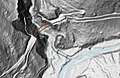
 LIDAR Winterthur 2696 1261.png 2,377 × 1,329; 1,001 KB
-
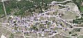
 Lugano Bay.jpg 3,140 × 2,093; 7.02 MB
-
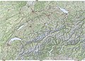
 National Map of Switzerland.jpg 15,400 × 9,600; 47.49 MB
-
 Punt Russein Geländerelief Swisstopo.jpg 1,166 × 762; 190 KB
-
 Swisstopo 8.jpg 800 × 800; 445 KB
-
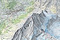 Swisstopo Eiger - Grindelwald.jpg 1,537 × 1,025; 783 KB


