Category:Sulzfluh
Jump to navigation
Jump to search
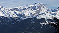
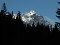
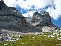
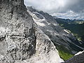
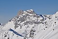
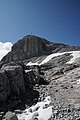
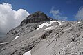
Deutsch: Die Sulzfluh gehört mit 2.817 Metern Höhe zu den zehn höchsten Alpengipfeln im Rätikon, Graubünden/Vorarlberg. Der Berg liegt direkt an der österreichisch-schweizerischen Grenze und besitzt neben dem Hauptgipfel noch den 2.812 Meter hohen Westgipfel.
| Object location | | View all coordinates using: OpenStreetMap |
|---|
mountain in the Rätikon at the border Vorarlberg / Grisons   | |||||
| Upload media | |||||
| Instance of | |||||
|---|---|---|---|---|---|
| Location |
| ||||
| Mountain range | |||||
| Topographic prominence |
| ||||
| Topographic isolation |
| ||||
| Elevation above sea level |
| ||||
| Parent peak | |||||
 | |||||
Subcategories
This category has the following 2 subcategories, out of 2 total.
S
- Sulzfluh, Plateau (20 F)
- Sulzfluh, Rachen (19 F)
Media in category "Sulzfluh"
The following 56 files are in this category, out of 56 total.
-
 7 Sulzfluh.jpg 4,608 × 2,592; 2.54 MB
-
 Abstieg Sulzfluh mit Blick nach Osten.jpg 6,000 × 4,000; 11.98 MB
-
 Alpenrösli-S.jpg 6,000 × 3,376; 4.74 MB
-
 Alpensteinböcke, Capra ibex auf der Sulzfluh 1.JPG 2,915 × 2,187; 3.83 MB
-
 Alpensteinböcke, Capra ibex auf der Sulzfluh 2.JPG 3,593 × 2,695; 4.22 MB
-
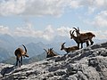 Alpensteinböcke, Capra ibex auf der Sulzfluh 3.JPG 3,482 × 2,612; 3.63 MB
-
 Alpensteinböcke, Capra ibex auf der Sulzfluh 4.JPG 4,288 × 2,848; 4.95 MB
-
 Alpensteinböcke, Capra ibex auf der Sulzfluh 5.JPG 3,661 × 2,746; 4.99 MB
-
 Alpensteinböcke, Capra ibex auf der Sulzfluh.JPG 4,288 × 2,848; 2.52 MB
-

-
 ETH-BIB-Sulzfluh, Partnunsee, Drusenfluh v. S. O. aus 3200 m-Inlandflüge-LBS MH01-003885.tif 6,306 × 4,444; 80.32 MB
-
 Gipfelkreuz Mittlerer Drusenturm Böhringer.jpg 4,868 × 3,516; 6.45 MB
-
 Großer Riß im Mittelgipfel, fällt wohl bald um.jpg 3,264 × 2,448; 1.83 MB
-
 Kleine Sulzfluh aus mittlerem Gauertal.jpg 4,608 × 3,456; 6.08 MB
-
 Rätikon.jpg 6,961 × 1,875; 2.69 MB
-
 Rätikonflühe von Schiers.jpg 2,272 × 1,704; 1.02 MB
-
 Schöner Buckel, Rachenauslauf und Sommerwegausstieg aus dem Rachen.jpg 3,264 × 2,448; 1.79 MB
-
 Skispuren im Rachen sowie Fußspuren.jpg 4,608 × 3,456; 1.48 MB
-
 Sulzfluh 1.JPG 3,072 × 2,304; 3.81 MB
-
 Sulzfluh 2.JPG 3,072 × 2,304; 3.86 MB
-
 Sulzfluh 3.JPG 3,072 × 2,304; 4.03 MB
-
 Sulzfluh 4.JPG 3,072 × 2,304; 3.28 MB
-
 Sulzfluh as seen from Schijenzan.jpg 4,032 × 3,024; 3.36 MB
-
 Sulzfluh CH.jpg 3,694 × 2,463; 1.82 MB
-
 Sulzfluh mit Rachen.jpg 1,360 × 890; 223 KB
-
 Sulzfluh Panorama 1.jpg 8,114 × 1,815; 11.01 MB
-
 Sulzfluh Panorama 2.jpg 8,304 × 1,904; 11.7 MB
-
 Sulzfluh Panorama 3.jpg 6,833 × 2,242; 9.86 MB
-
 Sulzfluh Panorama 360° Labeled.jpg 65,500 × 4,320; 134.41 MB
-
 Sulzfluh Panorama 360°.jpg 49,006 × 3,683; 76.58 MB
-
 Sulzfluh Panorama.jpg 49,152 × 3,581; 16.96 MB
-
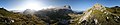
 Sulzfluh Plateau Panorama.jpg 9,325 × 1,844; 11.35 MB
-
 Sulzfluh Spherical Panorama 1.jpg 19,312 × 9,656; 94.4 MB
-
 Sulzfluh Spherical Panorama.jpg 10,240 × 5,120; 8.73 MB
-
 Sulzfluh von Bartholomaeberg.jpg 4,592 × 3,448; 4.07 MB
-
 Sulzfluh von Rellseck.jpg 4,320 × 2,880; 918 KB
-
 Sulzfluh-Gipfel a.jpg 3,072 × 2,304; 2.04 MB
-
 Sulzfluh-Gipfel b.jpg 3,072 × 2,304; 2.72 MB
-
 Sulzfluh-Weissplatte.jpg 4,377 × 2,998; 4.32 MB
-
 Sulzfluh2818m Kl Sulzfluh2708m.jpg 3,888 × 2,592; 1.7 MB
-
 Sulzfluhgipfel 01.JPG 4,288 × 2,848; 5.53 MB
-
 Sulzfluhgipfel 02.JPG 4,288 × 2,848; 3.27 MB
-
 Sulzfluhgipfel 03.JPG 4,288 × 2,848; 3.83 MB
-
 Sulzfluhgipfel 04.JPG 4,288 × 2,848; 1.97 MB
-
 Sulzfluhgipfel 05.JPG 4,288 × 2,848; 2.21 MB
-
 Sulzfluhgipfel 06.JPG 4,288 × 2,848; 2.35 MB
-
 Sulzfluhgipfel 07.JPG 4,288 × 2,848; 2.12 MB
-
 Sulzfluhgipfel 08.JPG 4,288 × 2,848; 2.42 MB
-
 Sulzfluhgipfel 09.JPG 4,288 × 2,848; 2.14 MB
-
 Sulzfluhgipfel 10.JPG 2,848 × 4,288; 6.03 MB
-
 Sulzfluhgipfel 11.JPG 2,848 × 4,288; 5.02 MB
-
 Sulzfluhgipfel 12.JPG 4,288 × 2,848; 2.51 MB
-
 Sulzfluhgipfel 13.JPG 2,848 × 4,288; 6.62 MB
-
 Sulzfluhgipfel 14.JPG 4,288 × 2,848; 3.35 MB
-
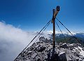
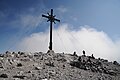
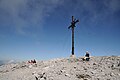
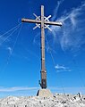 Summit cross on Sulzfluh.jpg 2,177 × 2,752; 789 KB
-
 Weißplatte Panorama 2.jpg 10,200 × 2,111; 17.68 MB


