Category:Streets in the City of London
Jump to navigation
Jump to search
Ceremonial counties of England: Bedfordshire · Berkshire · Buckinghamshire · Cambridgeshire · Cheshire · Cornwall · Cumbria · Derbyshire · Devon · Dorset · Durham · East Riding of Yorkshire · East Sussex · Essex · Gloucestershire · Greater London · Greater Manchester · Hampshire · Herefordshire · Hertfordshire · Isle of Wight · Kent · Lancashire · Leicestershire · Lincolnshire · Merseyside · Norfolk · North Yorkshire · Northamptonshire · Northumberland · Nottinghamshire · Oxfordshire · Rutland · Shropshire · Somerset · South Yorkshire · Staffordshire · Suffolk · Surrey · Tyne and Wear · Warwickshire · West Midlands · West Sussex · West Yorkshire · Wiltshire · Worcestershire
City-counties: Bristol · City of London
Former historic counties:
Other former counties:
City-counties: Bristol · City of London
Former historic counties:
Other former counties:

Wikimedia category | |||||
| Upload media | |||||
| Instance of | |||||
|---|---|---|---|---|---|
| Category combines topics | |||||
| |||||
Subcategories
This category has the following 200 subcategories, out of 270 total.
(previous page) (next page)- Street signs in the City of London (283 F)
A
- Aldermanbury Square (11 F)
- Amen Corner, City of London (4 F)
- Angel Court, London (16 F)
- Appold Street (14 F)
- Ave Maria Lane (5 F)
B
- Bartholomew Close (14 F)
- Bartlett's Buildings (5 F)
- Bearbinder Lane (1 F)
- Beech Street, London (31 F)
- Bennet's Hill, London (8 F)
- Bishop's Court, London EC4 (1 F)
- Bride Lane, London (5 F)
C
- Camomile Street (20 F)
- Carey Lane (2 F)
- Carmelite Street, London (10 F)
- Carter Court (6 F)
- Carthusian Street, London (13 F)
- Castle Court, Cheapside (2 F)
- Clement's Court (1 F)
- Copthall Avenue, London (19 F)
- Cousin Lane (10 F)
- Creed Lane (6 F)
- Crosswall (3 F)
- Cullum Street (London) (3 F)
D
- Dean Street, Holborn (2 F)
- Dorset Rise (8 F)
E
- Eldon Street (13 F)
F
- Feathers Court (1 F)
- Fenchurch Avenue (26 F)
- Finch Lane, London (9 F)
- Freeman's Court (1 F)
- Furnival Street, London (4 F)
G
- Goldsmith Street (1 F)
- Great St Thomas Apostle (9 F)
- Greystoke Place (2 F)
H
- Half Moon Court (1 F)
- Harrow Place (8 F)
- High Timber Street (10 F)
- Huggin Lane (1 F)
I
- Idol Lane (9 F)
- India Street, London (7 F)
J
K
- Kinghorn Street, London (2 F)
L
- Lambeth Hill (10 F)
- Limeburner Lane, London (5 F)
- Little Somerset Street, London (17 F)
- Lloyd's Avenue, London (8 F)
- Lombard Lane, London (4 F)
- Ludgate Square (8 F)
M
- Mansell Street, London E1 (17 F)
- Mansion House Place, London (8 F)
- Middle Street, London (3 F)
- Mitre Court (3 F)
- Mitre Street (24 F)
- Moor Lane (London) (16 F)
N
- Newcastle Close (1 F)
- Norton Folgate, London (9 F)
O
P
- Pemberton Row, London (11 F)
- Pepys Street (2 F)
- Petty Wales, London (3 F)
- Pilgrim Street, London (21 F)
- Plantation Lane, London (10 F)
- Playhouse Yard, London (7 F)
- Primrose Street, London (23 F)
Media in category "Streets in the City of London"
The following 200 files are in this category, out of 224 total.
(previous page) (next page)-
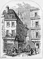
 ONL (1887) 1.216 - College of Physicians, Warwick Lane, 1868.jpg 1,924 × 2,195; 1.55 MB
-
 2009-03-18 Breams Buildings Fire.jpg 3,888 × 2,592; 2.44 MB
-
 A murky Steelyard Passage - geograph.org.uk - 881858.jpg 640 × 480; 54 KB
-

-
 Alderman's Walk - geograph.org.uk - 921579.jpg 480 × 640; 66 KB
-
 Ambrosden Avenue SW1 - geograph.org.uk - 3371100.jpg 480 × 640; 70 KB
-
 An afternoon stroll at Queenhithe - geograph.org.uk - 975787.jpg 480 × 640; 79 KB
-
 Angel Court - 1962 - geograph.org.uk - 1035301.jpg 522 × 640; 95 KB
-
 Archway in Crutched Friars - geograph.org.uk - 976198.jpg 640 × 480; 52 KB
-
 Archway to Austin Friars site of St Peter le Poer.JPG 3,264 × 2,448; 2.33 MB
-
 Autumn in London (4038245274).jpg 3,168 × 4,752; 4.84 MB
-
 Barbican - Main Exit - geograph.org.uk - 6215951.jpg 4,784 × 3,189; 4.46 MB
-
 Barbican Tandoori - geograph.org.uk - 2927924.jpg 640 × 430; 71 KB
-
 Barbican tower - geograph.org.uk - 5839442.jpg 480 × 640; 91 KB
-
 Barbican, A1 Aldersgate Street (1) - geograph.org.uk - 5902477.jpg 1,024 × 768; 162 KB
-
 Barbican, A1 Aldersgate Street (2) - geograph.org.uk - 5902491.jpg 1,024 × 768; 181 KB
-
 Barbican, B100 Beech Street - geograph.org.uk - 5902498.jpg 1,024 × 768; 148 KB
-

-
 Bastion House, London Wall - geograph.org.uk - 2590480.jpg 453 × 640; 183 KB
-
 Bastion, London Wall - geograph.org.uk - 4965003.jpg 1,136 × 1,000; 1,024 KB
-
 Bavarian Beerhouse, Cooper's Row - geograph.org.uk - 2769090.jpg 1,024 × 683; 168 KB
-
 Bear Alley - geograph.org.uk - 2508832.jpg 493 × 640; 160 KB
-
 Beavis Marks, A1211 - geograph.org.uk - 5349346.jpg 640 × 426; 65 KB
-
 Beech Gardens, Barbican - geograph.org.uk - 2281123.jpg 3,456 × 2,592; 2.64 MB
-
 Beech St Tunnel, The Barbican - geograph.org.uk - 2927901.jpg 640 × 430; 76 KB
-
 Beech Street EC2 and The Barbican - geograph.org.uk - 6150447.jpg 768 × 1,024; 178 KB
-
 Beehive Passage - geograph.org.uk - 3303890.jpg 3,648 × 2,736; 2.07 MB
-
 Behind St Botolph's - geograph.org.uk - 2818888.jpg 959 × 1,280; 256 KB
-
 Bell Inn Yard (28637988544).jpg 3,712 × 5,173; 9.32 MB
-

-

-
 Bernard Morgan House, Golden Lane - geograph.org.uk - 5568732.jpg 503 × 640; 203 KB
-

-
 Bevis Marks, A1211 - geograph.org.uk - 5404774.jpg 640 × 426; 48 KB
-
 Billiter Street, EC3 - geograph.org.uk - 6115542.jpg 768 × 1,024; 218 KB
-
 Bishopsgate (51628896488).jpg 2,448 × 2,448; 1.58 MB
-
 Bishopsgate Churchyard, London, EC2 - geograph.org.uk - 3406361.jpg 3,909 × 3,022; 2.36 MB
-
 Bishopsgate Churchyard, London, EC2 - geograph.org.uk - 3406604.jpg 3,427 × 3,008; 2.02 MB
-
 Bishopsgate, church hall - geograph.org.uk - 3133456.jpg 1,024 × 757; 159 KB
-
 Blackfriars Underpass - geograph.org.uk - 2237502.jpg 640 × 430; 144 KB
-
 Blackfriars underpass - geograph.org.uk - 2513213.jpg 640 × 425; 164 KB
-
 Blackfriars Underpass II, EC4 - geograph.org.uk - 2192898.jpg 3,504 × 2,336; 1.99 MB
-
 Blackfriars Underpass, EC4 - geograph.org.uk - 2191277.jpg 2,336 × 2,598; 1.02 MB
-
 Blacks at St Paul's Churchyard - geograph.org.uk - 4413401.jpg 768 × 788; 367 KB
-
 Blackwell House, Guildhall Yard - geograph.org.uk - 4173867.jpg 940 × 1,600; 366 KB
-
 Blake Tower, Fann Street - geograph.org.uk - 6153796.jpg 744 × 1,024; 325 KB
-
 Bollards, Swan Lane - geograph.org.uk - 2704811.jpg 640 × 430; 78 KB
-
 Booth Lane - geograph.org.uk - 2200690.jpg 1,500 × 1,000; 168 KB
-
 Boswell House, Hind Court - geograph.org.uk - 2236653.jpg 640 × 430; 181 KB
-
 Botolph Alley, City of London - geograph.org.uk - 5008421.jpg 899 × 1,600; 267 KB
-

-

-
 Bouverie Street, EC4 - geograph.org.uk - 5913094.jpg 768 × 1,024; 251 KB
-
 Bow Churchyard (19740733702).jpg 3,000 × 4,000; 2.2 MB
-
 Bow Churchyard, off Cheapside - geograph.org.uk - 2338917.jpg 1,280 × 960; 211 KB
-
 Bracken Wharf - geograph.org.uk - 3399857.jpg 426 × 640; 66 KB
-
 Brackley Street - geograph.org.uk - 1831590.jpg 495 × 640; 52 KB
-
 Braidwood Passage, EC1 - geograph.org.uk - 4142594.jpg 480 × 640; 49 KB
-
 Brandies or the Blackfriar Pub - geograph.org.uk - 5350542.jpg 1,503 × 2,000; 2.56 MB
-
 Bream's buildings - geograph.org.uk - 5839421.jpg 1,024 × 681; 137 KB
-
 Broad Street Avenue - geograph.org.uk - 3004093.jpg 640 × 480; 81 KB
-
 Broad Street House (51807134367).jpg 4,616 × 3,202; 3.42 MB
-
 Broad Street House (51808826945).jpg 4,616 × 3,202; 3 MB
-
 Broad Street House, Old Broad Street - geograph.org.uk - 2552513.jpg 640 × 504; 152 KB
-

-
 Broadgate Circle - geograph.org.uk - 3160285.jpg 960 × 1,280; 305 KB
-
 Broadgate Ice Rink - geograph.org.uk - 4817870.jpg 1,280 × 960; 232 KB
-
 Broken Wharf - Gardners Lane - geograph.org.uk - 2509224.jpg 800 × 600; 109 KB
-
 Broken Wharf - geograph.org.uk - 4301334.jpg 1,024 × 768; 145 KB
-
 Broken Wharf House - geograph.org.uk - 2708282.jpg 430 × 640; 64 KB
-
 BT building, Queen Victoria St - geograph.org.uk - 5590684.jpg 640 × 426; 67 KB
-
 BT Centre, St Martin Le Grand - geograph.org.uk - 2934431.jpg 430 × 640; 72 KB
-
 Bucklersbury Passage - geograph.org.uk - 2683857.jpg 3,018 × 2,300; 1.05 MB
-

-
 Building on Bisopsgate - geograph.org.uk - 5404792.jpg 425 × 640; 70 KB
-
 Building on Corner of Mincing Lane, London - geograph.org.uk - 4716147.jpg 688 × 1,050; 508 KB
-
 Buildings on Newbury Street - geograph.org.uk - 3647098.jpg 1,024 × 768; 211 KB
-
 Bulls Head Passage, EC3 - geograph.org.uk - 6114155.jpg 1,024 × 768; 263 KB
-
 Burgon Street - geograph.org.uk - 2858208.jpg 1,024 × 768; 172 KB
-
 Bury St off Beavis Marks - geograph.org.uk - 5349334.jpg 640 × 426; 75 KB
-
 Bury Street London looking towards Bevis Marks - geograph.org.uk - 3117155.jpg 1,024 × 768; 157 KB
-
 Castle Baynard Street - geograph.org.uk - 1811957.jpg 480 × 640; 50 KB
-
 Circular windows in Crutched Friars - geograph.org.uk - 976219.jpg 640 × 480; 84 KB
-
 City of London, London, UK - panoramio (26).jpg 2,048 × 1,536; 1.05 MB
-
 City of London, London, UK - panoramio (28).jpg 1,536 × 2,048; 943 KB
-
 City of London, London, United Kingdom (Unsplash EfIPZbnd46M).jpg 2,500 × 1,667; 3.04 MB
-

-
 Cobbled Street in the city of London - geograph.org.uk - 63858.jpg 480 × 640; 113 KB
-

-

-
 Crane on Dowgate Hill - geograph.org.uk - 1758119.jpg 480 × 640; 82 KB
-
 Cross Lane - geograph.org.uk - 965696.jpg 480 × 640; 88 KB
-

-
 Dead end in St Martin's Lane - geograph.org.uk - 1715556.jpg 480 × 640; 53 KB
-
 Dead end near The Monument - geograph.org.uk - 882847.jpg 480 × 640; 70 KB
-
 Doby Court - geograph.org.uk - 881769.jpg 640 × 480; 81 KB
-
 Dorset Buildings - geograph.org.uk - 764963.jpg 640 × 480; 62 KB
-
 East Harding Street - geograph.org.uk - 886780.jpg 640 × 480; 76 KB
-
 Eastern end of Laurence Pountney Lane - geograph.org.uk - 882975.jpg 480 × 640; 79 KB
-
 Entrance to Steelyard Passage - geograph.org.uk - 975844.jpg 480 × 640; 52 KB
-
 Fenchurch Buildings - geograph.org.uk - 976770.jpg 480 × 640; 65 KB
-
 Flickr - Duncan~ - The Shard from St Mary at Hill.jpg 1,966 × 3,312; 2.29 MB
-
 Friday Street City of London.JPG 3,264 × 2,448; 2.52 MB
-
 Goodmans Yard, London E1 - geograph.org.uk - 72973.jpg 640 × 425; 83 KB
-
 Gophir Lane - geograph.org.uk - 883042.jpg 480 × 640; 73 KB
-
 Great Trinity Lane - geograph.org.uk - 764187.jpg 640 × 480; 69 KB
-
 GrubStreet-London 300dpi.jpg 961 × 1,316; 1,013 KB
-
 Gutter Lane - geograph.org.uk - 767106.jpg 480 × 640; 81 KB
-

-
 High Rise, Tower area.jpg 2,304 × 3,072; 1.46 MB
-
 Hosier Lane - geograph.org.uk - 1021448.jpg 480 × 640; 65 KB
-
 Hotel in Pepys Street - geograph.org.uk - 976175.jpg 640 × 480; 83 KB
-
 Limeburner Lane - geograph.org.uk - 764907.jpg 640 × 480; 95 KB
-
 Lindsey Street, Smithfield - geograph.org.uk - 443556.jpg 640 × 480; 120 KB
-
 Lion Hill - geograph.org.uk - 764745.jpg 640 × 480; 81 KB
-
 London - Clothier Street - Gherkin.jpg 2,592 × 3,915; 9.38 MB
-
 London - panoramio (50).jpg 3,072 × 2,304; 1.24 MB
-
 London MMB 37 Fenchurch Buildings.jpg 1,600 × 2,400; 1.5 MB
-
 London MMB 38 Fenchurch Buildings.jpg 1,600 × 2,400; 1.57 MB
-
 London Nighttime Street View (30633970595).jpg 4,608 × 3,072; 4.19 MB
-
 London Old Swan Wharf geograph-3070301-by-Ben-Brooksbank.jpg 2,214 × 1,449; 1.12 MB
-
 Long Day in the city (Unsplash).jpg 4,666 × 3,495; 5.4 MB
-

-
 Looking along New Broad Street - geograph.org.uk - 921653.jpg 480 × 640; 74 KB
-

-
 Looking along St Clare Street - geograph.org.uk - 1007101.jpg 480 × 640; 62 KB
-
 Looking down Bartlett Court - geograph.org.uk - 766524.jpg 480 × 640; 72 KB
-

-
 Looking down Harrow Place - geograph.org.uk - 1015684.jpg 480 × 640; 49 KB
-

-
-

-
 Looking down Stoney Lane - geograph.org.uk - 1015669.jpg 480 × 640; 51 KB
-
 Looking down towards St Mary-at-Hill - geograph.org.uk - 642412.jpg 640 × 480; 65 KB
-
 Looking down Tower Street - geograph.org.uk - 642403.jpg 640 × 480; 65 KB
-

-

-

-

-

-

-

-

-
 Looking northwards up Godliman Street - geograph.org.uk - 894104.jpg 480 × 640; 69 KB
-

-

-

-

-

-

-

-

-

-
 Looking up Grocer's Hall Court - geograph.org.uk - 882796.jpg 480 × 640; 48 KB
-

-

-
 Looking westwards along Goodman's Yard - geograph.org.uk - 1008866.jpg 640 × 480; 193 KB
-
 Looking westwards along Pancras Lane - geograph.org.uk - 882481.jpg 480 × 640; 57 KB
-

-
 Martin Lane, London, EC4 - geograph.org.uk - 3402047.jpg 1,871 × 3,501; 1.15 MB
-
 Martin Lane, London.jpg 4,032 × 3,024; 3.45 MB
-
 Mid section of St Mary-at-Hill - geograph.org.uk - 1714126.jpg 480 × 640; 67 KB
-
 Mid section of Victoria Avenue - geograph.org.uk - 1021546.jpg 480 × 640; 55 KB
-
 Mid-section of Laurence Pountney Lane - geograph.org.uk - 883013.jpg 480 × 640; 72 KB
-
 Modern buildings in Cathedral Place - geograph.org.uk - 764655.jpg 640 × 480; 77 KB
-
 Monument Street, London EC4 - geograph.org.uk - 2337031.jpg 1,024 × 768; 353 KB
-
 New Broad Street, EC2 - geograph.org.uk - 1192807.jpg 640 × 426; 67 KB
-
 New Street, Shoreditch - geograph.org.uk - 1969022.jpg 480 × 640; 49 KB
-
 Newgate Street, London EC1 - geograph.org.uk - 1140815.jpg 640 × 435; 65 KB
-
 No way through at Muscovy Street - geograph.org.uk - 976112.jpg 640 × 480; 90 KB
-

-
 Nun Court - geograph.org.uk - 767155.jpg 480 × 640; 62 KB
-
 Old Billingsgate Walk - geograph.org.uk - 976041.jpg 640 × 480; 66 KB
-
 Old Mitre Court - geograph.org.uk - 680371.jpg 427 × 640; 144 KB
-
 Outwich Street in mid February - geograph.org.uk - 1834733.jpg 480 × 640; 85 KB
-
 Pedestrians in Milton Street - geograph.org.uk - 1831224.jpg 640 × 480; 72 KB
-
 Pepys Street - geograph.org.uk - 642325.jpg 640 × 480; 64 KB
-
 Pepys' beat - geograph.org.uk - 642329.jpg 640 × 480; 83 KB
-
 Plough Place - geograph.org.uk - 766513.jpg 640 × 480; 99 KB
-
 Police van in Pageantmaster Court - geograph.org.uk - 894193.jpg 640 × 480; 84 KB
-
 Portsoken Street - geograph.org.uk - 1015568.jpg 640 × 480; 73 KB
-
 Printers Inn Court - geograph.org.uk - 966869.jpg 480 × 640; 70 KB
-
 Rangoon Street - geograph.org.uk - 1004716.jpg 640 × 480; 65 KB
-
Road in London 2 2013-07-02.ogv 1 min 4 s, 720 × 1,280; 132.59 MB
-
 Road works in Copthall Close - geograph.org.uk - 1819308.jpg 480 × 640; 66 KB
-
 Roadworks in Great Swan Alley - geograph.org.uk - 1819778.jpg 480 × 640; 79 KB
-
 Roadworks in New Broad Street, EC2 - geograph.org.uk - 1102159.jpg 480 × 640; 97 KB
-
 Scaffolding in Northumberland Alley - geograph.org.uk - 976803.jpg 640 × 480; 86 KB
-
 Sceptre Court on Tower Hill - geograph.org.uk - 1008914.jpg 640 × 480; 75 KB
-

-
 Site of St Margaret Moses - geograph.org.uk - 764405.jpg 640 × 480; 75 KB
-
 Site of St Margaret Moses.JPG 3,264 × 2,448; 2.13 MB
-

-

-
 Southampton Buildings (off Holborn) - geograph.org.uk - 766849.jpg 640 × 480; 72 KB
-
 Southampton Buildings, WC2 - geograph.org.uk - 1271760.jpg 480 × 640; 82 KB
-
 Speed camera in Castle Baynard Street - geograph.org.uk - 894066.jpg 480 × 640; 70 KB
-
 St Botolph Street - geograph.org.uk - 1015631.jpg 480 × 640; 60 KB
-
 St Bride Street - geograph.org.uk - 764868.jpg 640 × 480; 117 KB
-
_1.216_-_College_of_Physicians,_Warwick_Lane,_1868.jpg)


.jpg)


_-_geograph.org.uk_-_5902477.jpg)
_-_geograph.org.uk_-_5902491.jpg)


.jpg)


.jpg)


.jpg)


.jpg)
.jpg)


.jpg)
.jpg)
.jpg)


.jpg)


.jpg)

.jpg)


_-_geograph.org.uk_-_766849.jpg)


