Category:Street junctions in the London Borough of Harrow
Jump to navigation
Jump to search

Media in category "Street junctions in the London Borough of Harrow"
The following 74 files are in this category, out of 74 total.
-
 Bacon Lane at the junction of The Chase - geograph.org.uk - 4743742.jpg 2,304 × 1,728; 841 KB
-
 Belmont Lane at the junction of Wemborough Road - geograph.org.uk - 4001827.jpg 2,304 × 1,728; 826 KB
-
 Beverley Gardens crosses Curzon Avenue - geograph.org.uk - 6284351.jpg 5,472 × 3,648; 2.97 MB
-
 Bransgrove Road at the junction of Merlin Crescent - geograph.org.uk - 4421365.jpg 2,304 × 1,728; 832 KB
-
 Brockhurst Corner, Harrow Weald - geograph.org.uk - 3177779.jpg 4,320 × 3,240; 4.38 MB
-
 Brooke Avenue at the junction of Northolt Road - geograph.org.uk - 4250117.jpg 2,304 × 1,728; 857 KB
-
 Brooke Avenue at the junction of South Hill Avenue - geograph.org.uk - 4250124.jpg 2,110 × 1,420; 856 KB
-
 Buckingham Road at the junction of Merlin Crescent - geograph.org.uk - 4421381.jpg 2,304 × 1,728; 852 KB
-
 Charlton Road at the junction of Kenmore Road - geograph.org.uk - 4773233.jpg 2,304 × 1,728; 900 KB
-

-
 Corner of Crowshott Avenue and Honeypot Lane, Stanmore - geograph.org.uk - 2241562.jpg 1,600 × 1,200; 751 KB
-
 Crossroads on Kenmore Road, Kenton - geograph.org.uk - 4773674.jpg 2,304 × 1,728; 934 KB
-
 Crowshott Avenue at the junction of Honeypot Lane - geograph.org.uk - 4740263.jpg 2,304 × 1,728; 866 KB
-
 Darcy Drive at the junction of Charlton Road - geograph.org.uk - 4773231.jpg 2,304 × 1,728; 836 KB
-

-
 Dusk on Honeypot lane, Canons Park - geograph.org.uk - 4658055.jpg 640 × 480; 62 KB
-
 Edgware, Mollison Way - geograph.org.uk - 92091.jpg 640 × 425; 73 KB
-
 Elliot Road at the junction of The Chase - geograph.org.uk - 4223267.jpg 2,258 × 1,664; 1.5 MB
-
 Elms Road at the junction of Uxbridge Road, Stanmore - geograph.org.uk - 3590077.jpg 1,600 × 1,200; 488 KB
-

-

-
 Gloucester Road at the junction of Cumberland Road - geograph.org.uk - 4223075.jpg 2,304 × 1,636; 1.05 MB
-
 Gloucester Road at the junction of Station Road - geograph.org.uk - 4223066.jpg 2,304 × 1,728; 821 KB
-
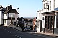
 Harrow on the Hill (1) - geograph.org.uk - 175017.jpg 640 × 480; 111 KB
-
 Harrow on the Hill, Middlesex - geograph.org.uk - 363642.jpg 640 × 489; 95 KB
-
 Harrow on the Hill, Middlesex - geograph.org.uk - 363680.jpg 640 × 473; 77 KB
-
 Harrow on the Hill, Middlesex - geograph.org.uk - 364697.jpg 640 × 427; 74 KB
-

-
 Hinkler Road at the junction of Paulhan Road - geograph.org.uk - 4773080.jpg 2,304 × 1,728; 858 KB
-
 Honeypot Lane at junction of Wigton Avenue - geograph.org.uk - 2272275.jpg 1,600 × 1,200; 596 KB
-
 Imperial Drive junction of Village Way - geograph.org.uk - 2280805.jpg 1,600 × 1,200; 648 KB
-
 Junction of Headstone Drive and Harrow View - geograph.org.uk - 3920442.jpg 1,600 × 1,020; 339 KB
-

-
-
 Junction of Malpas Drive and Eastcote Road - geograph.org.uk - 4856889.jpg 1,024 × 768; 119 KB
-

-
 Kenton Lane at Belmont Circle - geograph.org.uk - 4001824.jpg 2,304 × 1,728; 820 KB
-
 Kenton Library, Harrow, Middlesex - geograph.org.uk - 193880.jpg 640 × 474; 70 KB
-
 Kingshill Drive at the junction of Christchurch Avenue - geograph.org.uk - 5285180.jpg 3,264 × 2,448; 1.9 MB
-
 Lloyds Bank Corner, Stanmore - geograph.org.uk - 2441478.jpg 3,324 × 2,008; 758 KB
-

-
 Long Elmes, Harrow Weald - geograph.org.uk - 5961792.jpg 1,280 × 960; 452 KB
-
 Manor Park Crescent, Edgware - geograph.org.uk - 251473.jpg 480 × 266; 28 KB
-
 Merlin Crescent at the junction of St Davids Drive - geograph.org.uk - 4326614.jpg 2,186 × 1,556; 1,013 KB
-
 Mollison Way, Queensbury - geograph.org.uk - 1147756.jpg 640 × 480; 49 KB
-
 North Avenue at the junction of Blenheim Road - geograph.org.uk - 4201257.jpg 2,304 × 1,728; 654 KB
-
 Northolme Gardens at the junction of The Chase - geograph.org.uk - 4743738.jpg 2,256 × 1,664; 1.01 MB
-
 Oaktree Close at the junction of Belmont Lane - geograph.org.uk - 4001830.jpg 2,304 × 1,728; 830 KB
-
 Old Redding at junction of Brookshill, Harrow Weald - geograph.org.uk - 2272254.jpg 1,600 × 1,200; 428 KB
-
 Park View at the junction of Anselm Road - geograph.org.uk - 5737359.jpg 2,304 × 1,728; 1.74 MB
-
 Parkside Way at the junction of Pinner View - geograph.org.uk - 4201335.jpg 2,304 × 1,728; 665 KB
-
 Paulhan Road at the junction of Kenmore Road - geograph.org.uk - 4773405.jpg 2,304 × 1,728; 871 KB
-
 Pinner , Melrose Road junction with Kingsley Road - geograph.org.uk - 6327851.jpg 2,048 × 1,536; 823 KB
-
 Pinner - The Ridgeway from Rayners Lane - geograph.org.uk - 2881181.jpg 640 × 480; 163 KB
-
 Pinner Green - geograph.org.uk - 83700.jpg 640 × 480; 100 KB
-
 Pinner Methodist church - geograph.org.uk - 1283813.jpg 640 × 481; 77 KB
-
 Pinner Road at the junction of Southfield Park - geograph.org.uk - 3093613.jpg 1,600 × 1,200; 596 KB
-
 Pinner Road at the junction of The Gardens - geograph.org.uk - 4201294.jpg 2,304 × 1,728; 618 KB
-
 Roundabout at the end of Rayners Lane - geograph.org.uk - 3751126.jpg 2,304 × 1,728; 845 KB
-
 Roundabout in Wealdstone - geograph.org.uk - 2154696.jpg 640 × 480; 78 KB
-
 Roundabout on Crowshott Avenue, Stanmore - geograph.org.uk - 4001888.jpg 2,304 × 1,728; 810 KB
-
 Roundabout on Rayners Lane - geograph.org.uk - 4927330.jpg 4,608 × 3,456; 3.36 MB
-
 Roundabout on Streatfield Road, Kenton - geograph.org.uk - 4773043.jpg 2,304 × 1,728; 1.03 MB
-
 Roundabout on Streatfield Road, Kenton - geograph.org.uk - 5275643.jpg 2,304 × 1,728; 839 KB
-
 Roundabout on Uxbridge Road and Rowlands Avenue - geograph.org.uk - 3808131.jpg 2,304 × 1,728; 798 KB
-
 Roundabout on Uxbridge Road, Harrow Weald - geograph.org.uk - 3808155.jpg 2,304 × 1,728; 832 KB
-
 Sefton Avenue at the junction of Stanhope Avenue - geograph.org.uk - 3807620.jpg 2,304 × 1,728; 808 KB
-
 South Hill Avenue at the junction of Sudbury Hill - geograph.org.uk - 3722852.jpg 2,560 × 1,920; 1.09 MB
-
 St David's Drive at the junction of Merlin Crescent - geograph.org.uk - 3824315.jpg 2,254 × 1,660; 1.17 MB
-
 Stanmore Hill junction with The Broadway - geograph.org.uk - 2210873.jpg 1,600 × 1,200; 570 KB
-
 Stanmore, Bromefield - geograph.org.uk - 92426 (cropped).jpg 640 × 400; 84 KB
-
 Stanmore, Bromefield - geograph.org.uk - 92426.jpg 640 × 425; 88 KB
-
 Whitchurch Lane, junction with High Street, Edgware - geograph.org.uk - 2182077.jpg 4,320 × 3,240; 3.77 MB
-
 Windsor Road at the junction of Weald Lane - geograph.org.uk - 3808091.jpg 2,304 × 1,728; 836 KB


_-_geograph.org.uk_-_175017.jpg)


.jpg)


