Category:Stone, Buckinghamshire
Jump to navigation
Jump to search
village in Buckinghamshire, UK  | |||||
| Upload media | |||||
| Instance of | |||||
|---|---|---|---|---|---|
| Location | Stone with Bishopstone and Hartwell, Buckinghamshire, South East England, England | ||||
 | |||||
English: Stone is a village in Buckinghamshire, England. It is located southwest of the town of Aylesbury, on the A418 road that links Aylesbury to Thame. Stone with Bishopstone and Hartwell is a civil parish within Aylesbury Vale district and also incorporates the nearby settlements of Bishopstone and Hartwell.
Svenska: Stone är en by i Buckinghamshire, England. Den ligger sydväst om staden Aylesbury, längs vägen mellan Aylesbury och Thame. Stone with Bishopstone and Hartwell är en civil parish i distriktet Aylesbury Vale och omfattar även de närliggande byarna Bishopstone och Hartwell.
Subcategories
This category has the following 2 subcategories, out of 2 total.
Media in category "Stone, Buckinghamshire"
The following 22 files are in this category, out of 22 total.
-
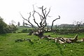 A fallen tree with Burn Hill behind - geograph.org.uk - 712908.jpg 640 × 425; 68 KB
-

-
 Fleet Marston Spinney - geograph.org.uk - 1624821.jpg 640 × 480; 65 KB
-
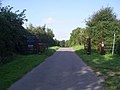
 Footpath heading to Fairford Leys - geograph.org.uk - 1624683.jpg 640 × 480; 118 KB
-
 Footpath over to Waddon hill farm - geograph.org.uk - 716081.jpg 640 × 425; 43 KB
-
 Houses, Eythrope Road - geograph.org.uk - 1285634.jpg 640 × 480; 115 KB
-
 Looking north from Whaddon Hill Farm - geograph.org.uk - 88223.jpg 640 × 480; 102 KB
-

-
 Milestone in Stone village - geograph.org.uk - 1592170.jpg 480 × 640; 107 KB
-
 Old wall near Stone House - geograph.org.uk - 247362.jpg 640 × 480; 117 KB
-
 Oxford Road (A418) - geograph.org.uk - 1186735.jpg 640 × 480; 70 KB
-
 Statue beside River Thame - geograph.org.uk - 1494765.jpg 480 × 640; 142 KB
-
 Closed chapel, Stone - geograph.org.uk - 247385.jpg 640 × 480; 93 KB
-
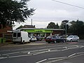 Stone Coop and Post Office - geograph.org.uk - 1608958.jpg 640 × 480; 73 KB
-
 Village Hall , Stone - geograph.org.uk - 1529271.jpg 640 × 480; 61 KB
-
 Stone SSSI.JPG 6,016 × 4,000; 9.8 MB
-
 Telephone Exchange, Stone, Bucks - geograph.org.uk - 967729.jpg 640 × 480; 91 KB
-
 The Rose and Crown pub, Stone - geograph.org.uk - 1529952.jpg 640 × 480; 62 KB
-
 Village Hall, Stone.jpg 3,008 × 2,000; 2.33 MB
-
 Village Pond, Stone - geograph.org.uk - 247526.jpg 640 × 480; 164 KB
-
 Boundary to the Waddesdon Estate - geograph.org.uk - 1495159.jpg 640 × 480; 76 KB
-
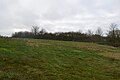
 Burn Hill tumulus - geograph.org.uk - 88228.jpg 640 × 480; 57 KB


_-_geograph.org.uk_-_1186735.jpg)


